 Canyoneering Poison Creek
Boise Idaho
Overview
|
Fri 57 | 45 |
Sat 60 | 42 |
Sun 62 | 43 |
Mon 61 | 43 |
Tue 64 | 41 |
| View Full Weather Details | ||||
|
Fri 57 | 45 |
Sat 60 | 42 |
Sun 62 | 43 |
Mon 61 | 43 |
Tue 64 | 41 |
| View Full Weather Details | ||||
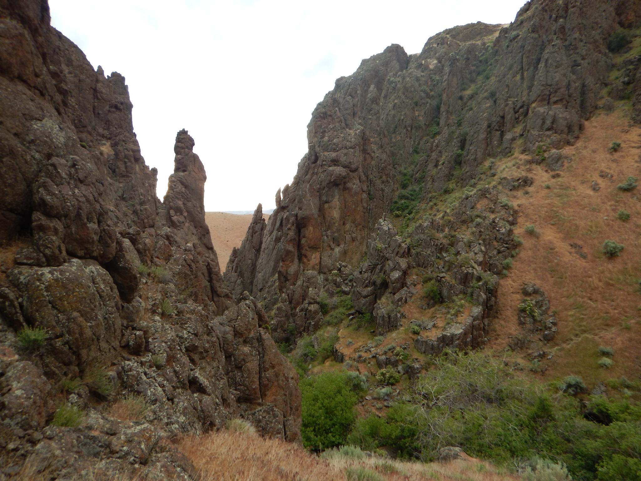
Heading down to the creek.
Short and sweet, this is a canyon that greatly impressed me. Though only a couple-of-hour affair, it makes a lovely jaunt if passing through the area and looking for a leg stretcher. The narrows are short, but quite pretty and with a nice dramatic second rappel. Not to be missed (in my opinion)!
The bad? Well, the canyon is home to an enormous amount of poison oak. If you are sensitive, skip this canyon. With a sharp eye and cautious foot work, we were able to avoid it. The seemingly no longer updated Canyoneering NorthWest site has details on the upper sections, but given the openness and likelihood of poison oak, I would recommend just this lower section.
There is decent primitive camping up the road from the trailhead, and generally the trailhead should be reachable by most any vehicle.
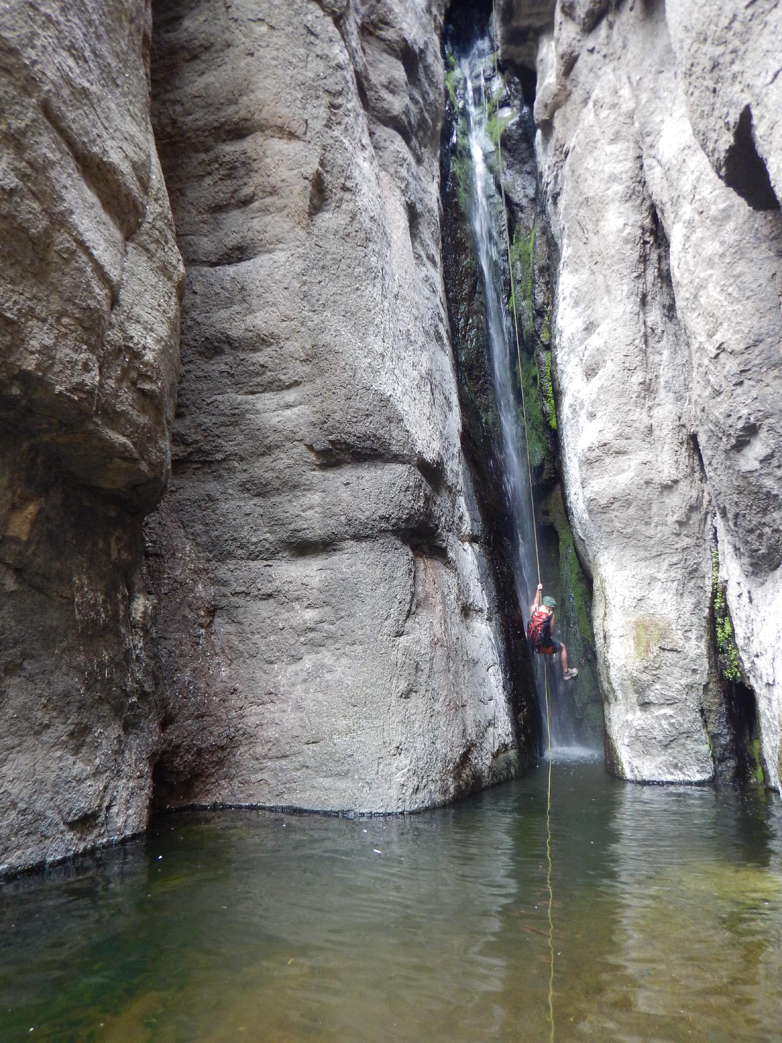
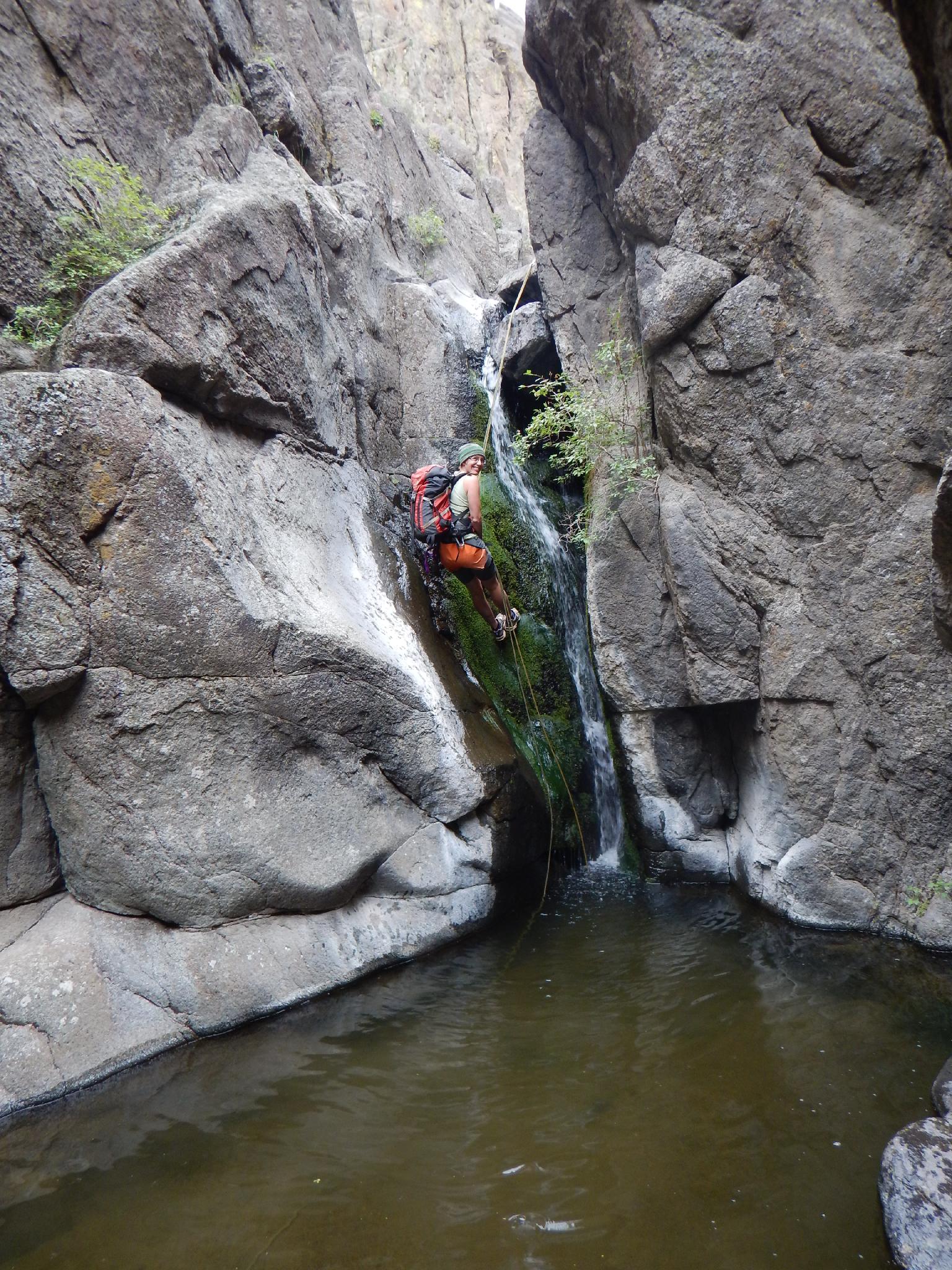
Rappelling the second drop in Poison Creek Canyon
First rappel in Poison Creek
Getting There
Reach the trailhead by first getting to Marsing, Idaho, just south west of Boise.
- Go west on ID 95 for 4.0 miles to the Cemetery where Cemetery Road takes off on the left.
- Go left on Cemetery road for 1 mile to Jump Creek Road.
- Go left on Jump Creek road for 3.1 miles to Poison Creek Road.
- Go right on Posion Creek Road for 2.6 miles, staying on the obvious main road and avoiding any side roads. En Route, the road becomes one lane and at about 1.4 miles, crosses very near a house. BLM has a right of way here to cross the land, but drive slow. Once through the property, the road climbs steeply. A very steep old jeep road that climbs the hill to the left at a bend marks the trailhead. Park off the road here. The Jeep road is the return trail.
Final Rappel in Poison Creek
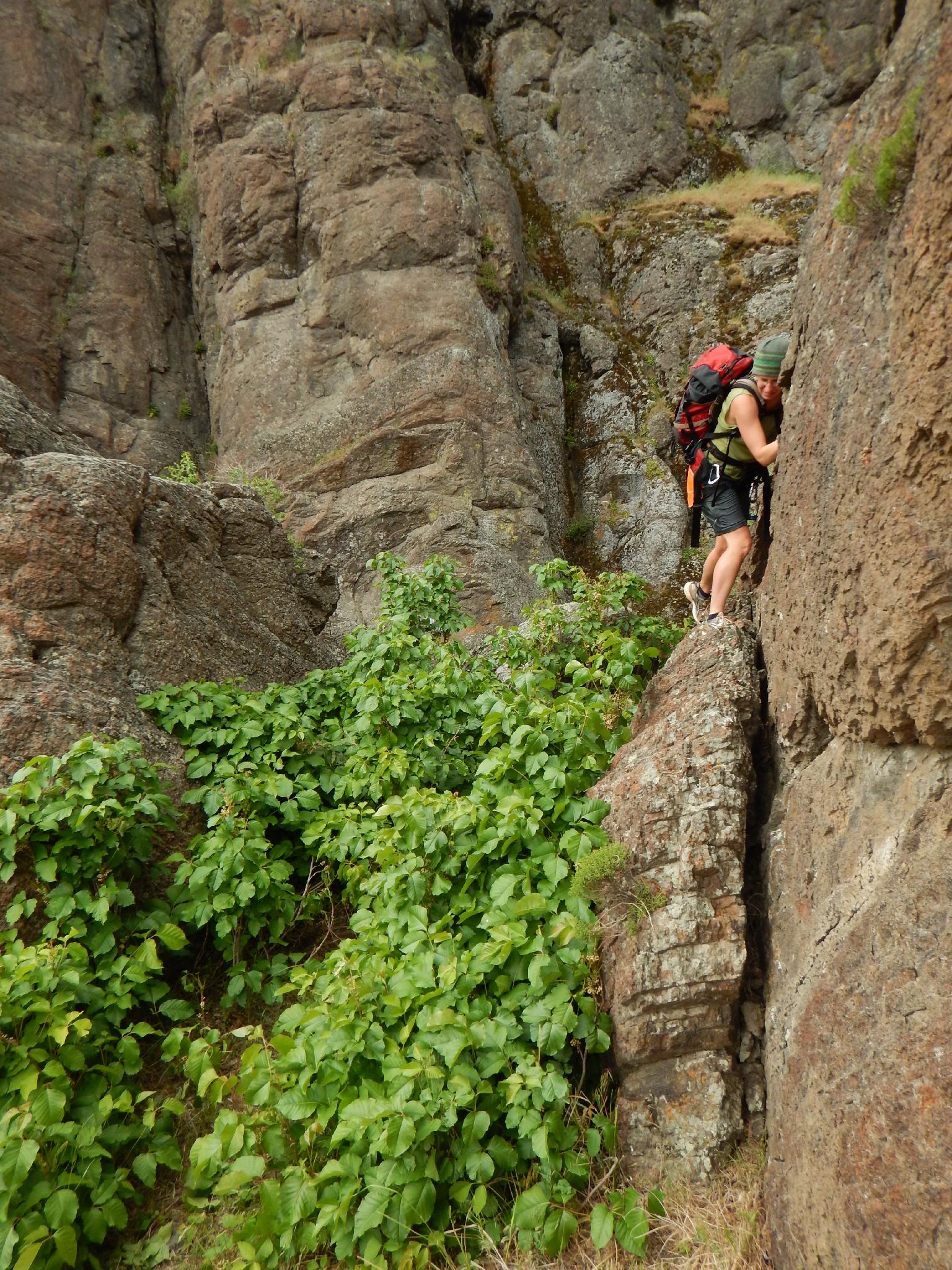
Diane Avoiding Poison Oak - Fun!
Route
Approach (30-40 minutes)
From the trailhead, work up the steep grassy hill to the southwest, watching out for snakes during hot times of the year. Once on top, go due south, crossing a side canyon, then quickly dropping steeply into the next side canyon. This is literally just a hundred feet or so after crossing the first more major side drainage.
Go down the side drainage as it quickly descends to Poison Creek.
Canyon
Once at the bottom of Poison Creek, cross it and find a minor social trail on the other side that bushwhacks down canyon. It is a bit brushy, but soon begins to relent just before the first rappel.
R1 - 7 m ( 23 ft. )
The first rappel is a lovely casual short drop down a falls. The pool at the bottom was belly deep on our trip. The second rappel is just down canyon where a sharp bend to the left is encountered.
R2 - 18 m ( 60 ft. )
A stunning drop into a likely deep pool, rappel 2 is the most beautiful section of the canyon and very photogenic. Fun!
R3 - 7 m ( 23 ft. )
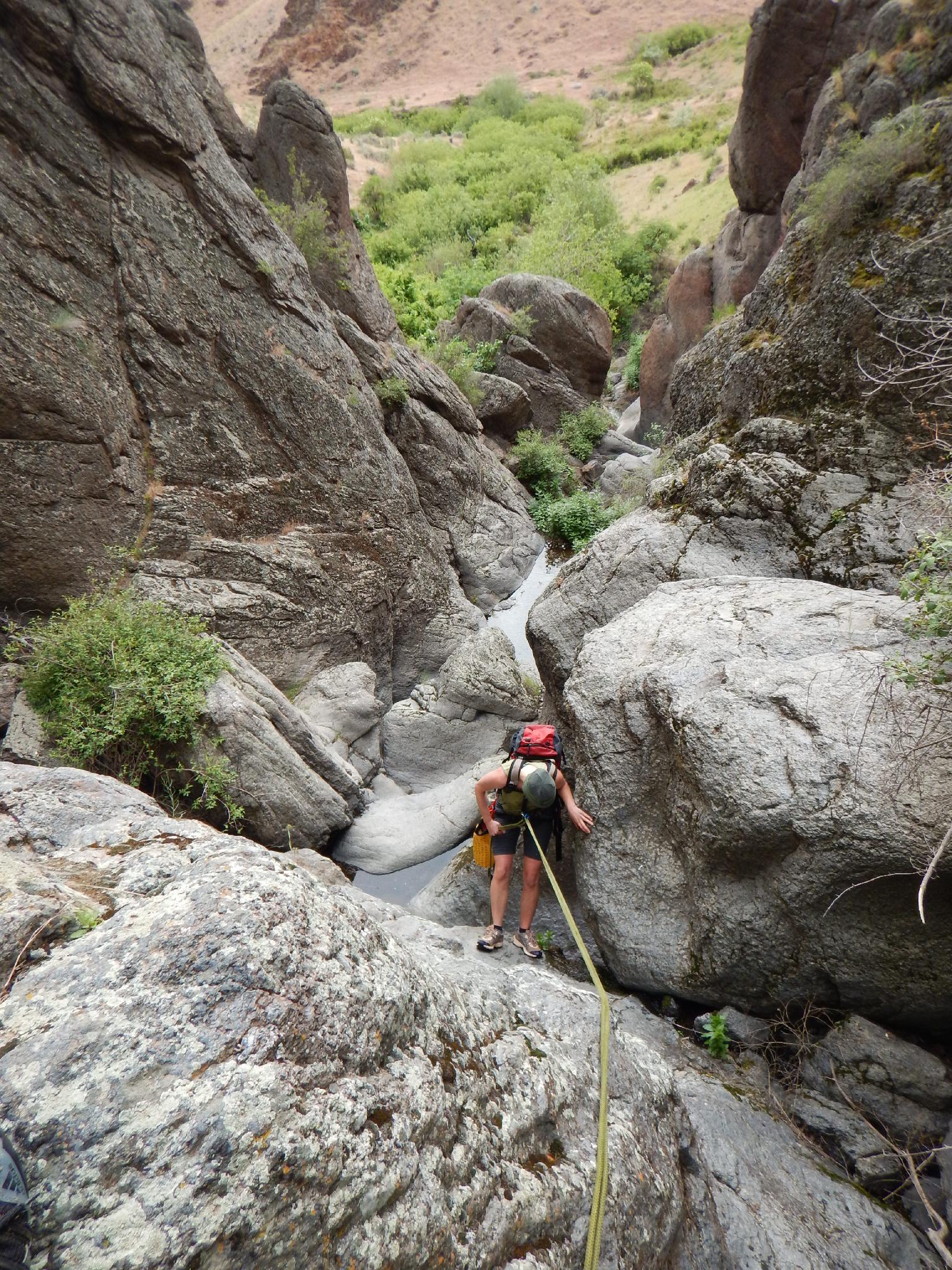
Just down from the second rappel is a jumble of boulders. Some are down climbing on the left, but a pinch as an anchor makes for an easy rappel here.
A little scrambling and the canyon quickly opens. Work out to the left when convenient and not TOO overgrown with poison oak.
Exit (15 minutes)
Once out of the stream bed, hike north a short distance to an old 4x4 road. Follow the road up the hill and back to the trailhead.
Photos
Maps

| Trailhead |
11T 503445mE 4815967mN N43° 29' 48" W116° 57' 27" |
| Rappel 1 |
11T 503763mE 4815149mN N43° 29' 21" W116° 57' 12" |
| Descent Gully |
11T 503487mE 4815221mN N43° 29' 24" W116° 57' 25" |