 Hiking Wolfberg Cracks and Wolfberg Arch
Cederberg South Africa
Overview
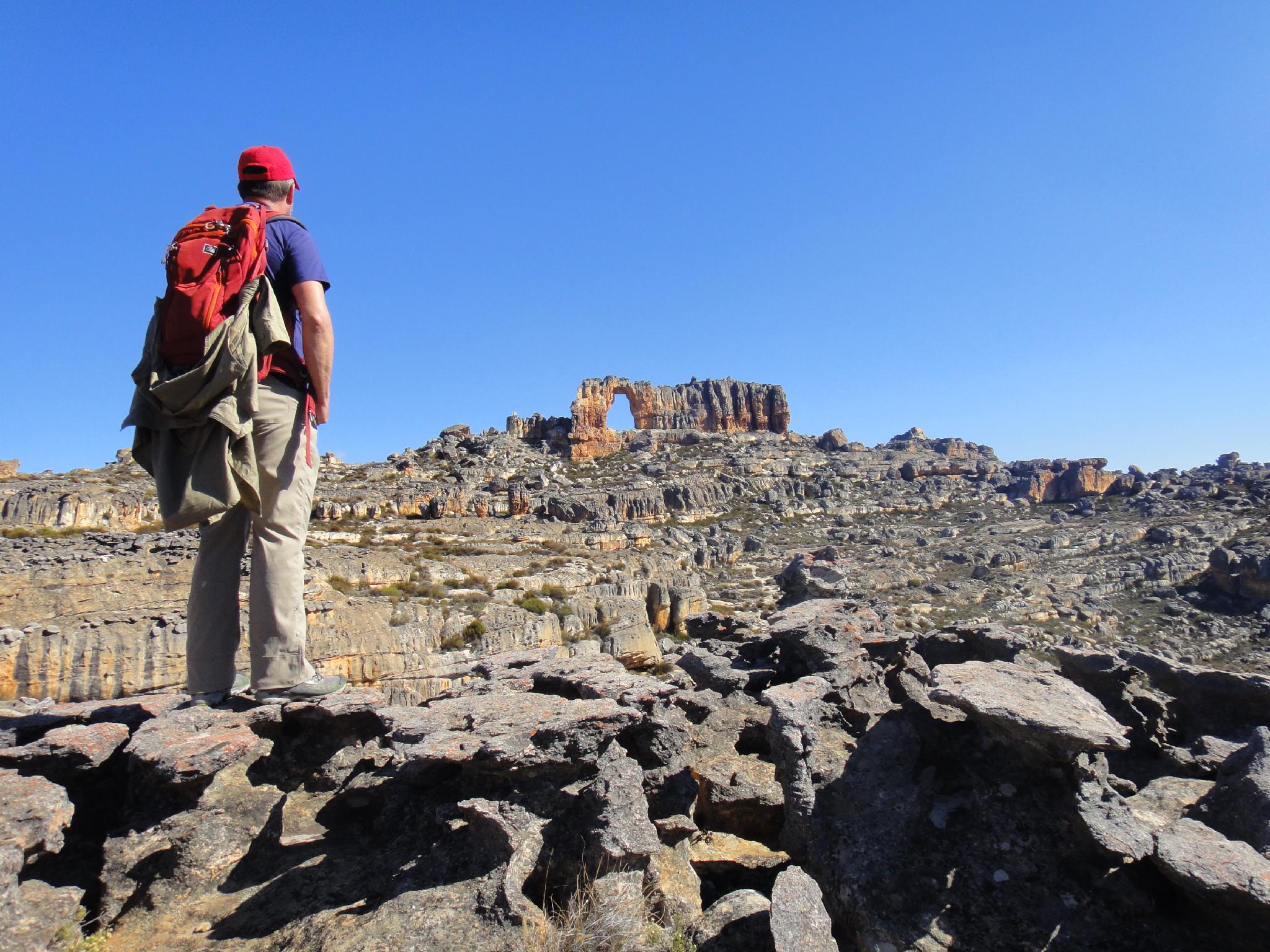
Wolfberg Arch in the distance. Nice easy hiking once up the cracks.
If there is one adventurous hike to do in the Cederberg Wilderness Area, this is it! Very popular, and for good reason, this is a hike with an adventurous feel and is a lot of fun. Many people just do the Wolfberg Cracks. I would recommend adding the additional miles to see Wolfberg Arch as well. Once up the cracks, the hiking along the top to the arch is easy and very stunning.
This is an amazing hike that is do-able most any time. The steep part of the hike is in the shade much of the day, making it approachable even in the heat of the summer though I would recommend an early start.
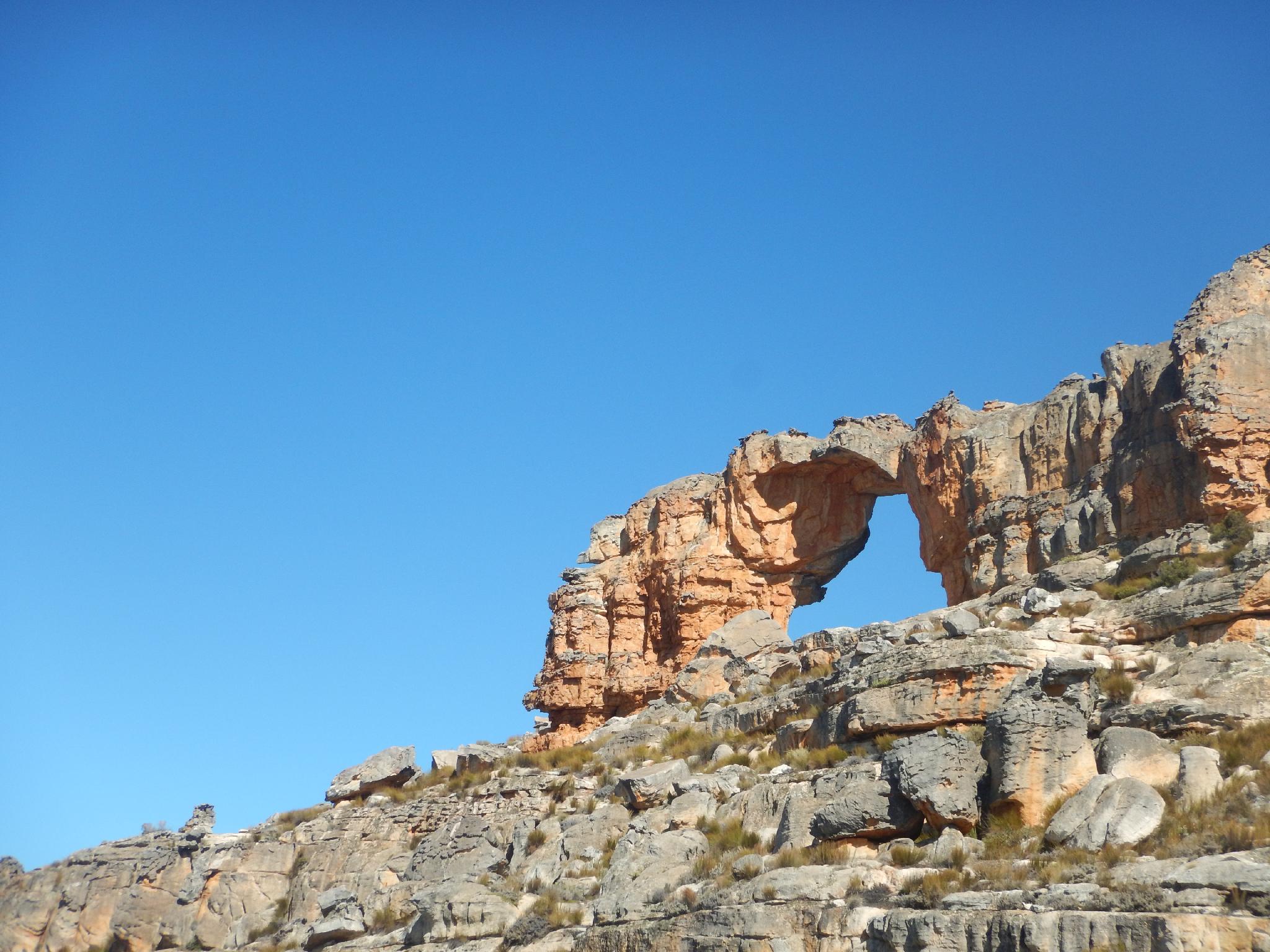
Wolfberg Arch
Getting There
The trail starts near the camping area at Dwarsrivier. From Clanwilliam go west to the N7 and travel south about 25 km. Turn left onto the road signed for Algeria and follow it about 18 km to the Algeria Campsite and Visitor Center.
From the Algeria Campsite, go south on the main road as it crosses the pass and descends to Dwarsrivier. The total distance from Algeria is about 26 km. You will need to stop at the store / reception center there to pick up a permit. In 2016, the reception center was open from 8AM to 5PM, with a 1-2PM lunch closure.
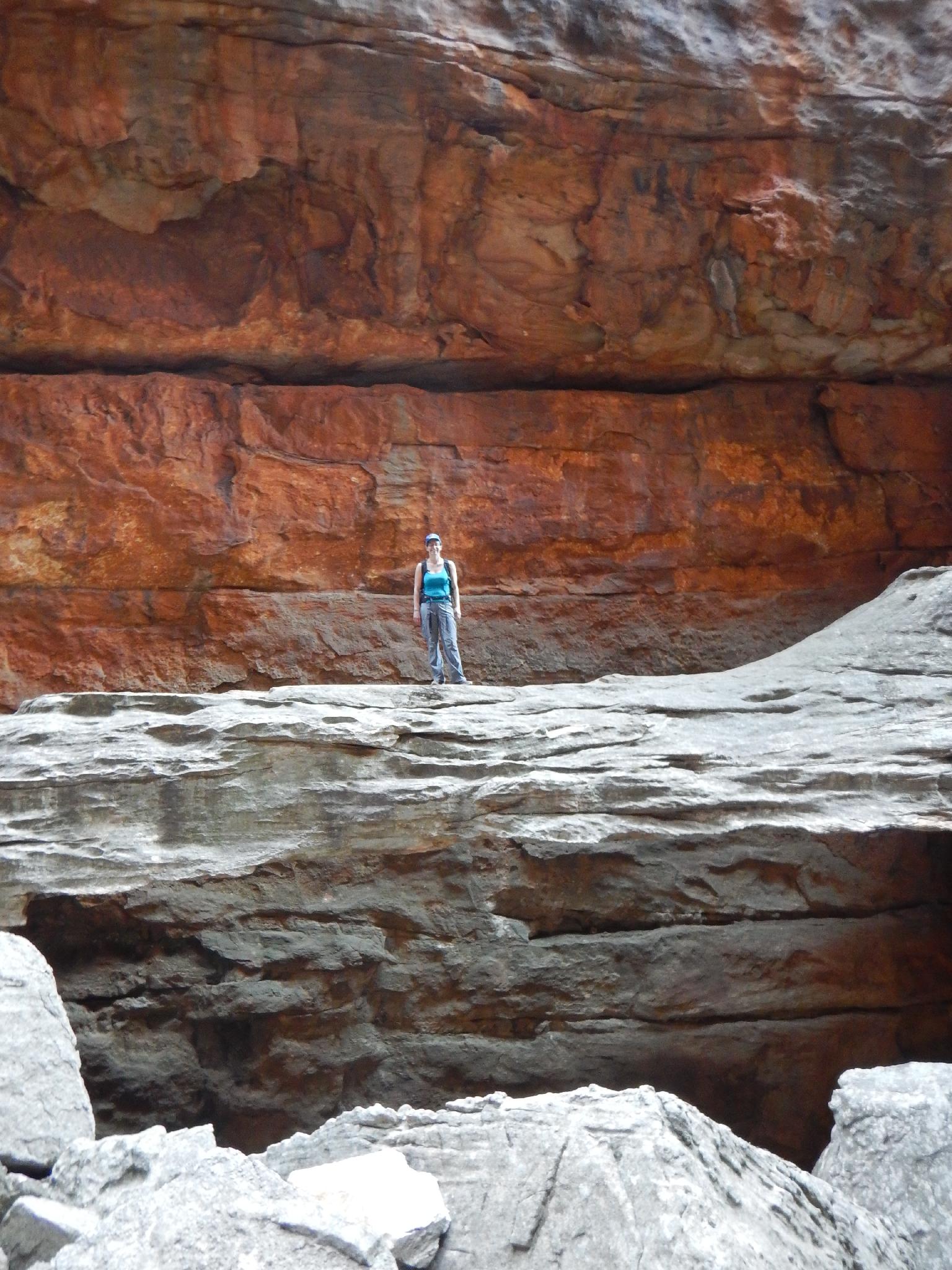
Diane on one of the arches in the Narrow Crack
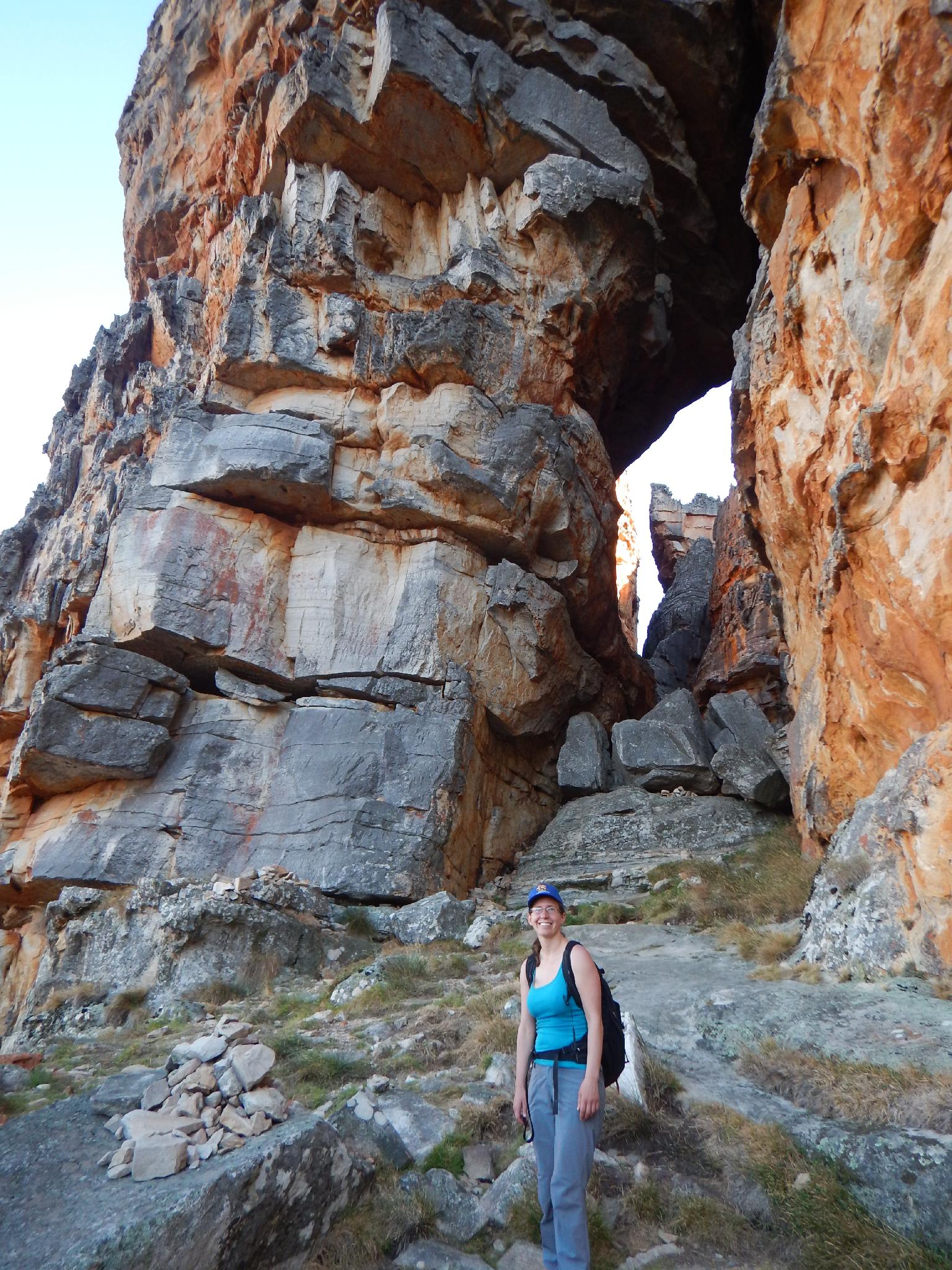
Diane just heading up to the arch before the dark narrow crack.
Route
To The Top (1.5-2.5 hours)
From the trailhead, follow the trail up and up and up. It meanders and zig-zags its way to the base of the cliff band that guards the summit. When the trail reaches the boulders and large rocks near the base of the cliffs, the route divides. The Narrow Crack is the recommended way up and involves fun scrambling and obstacles. If you are afraid of heights or obstacles, take the Wide route. The Wide route is straightforward hiking with a few small obstacles, but nothing difficult. I would recommend going up the Narrow and down the Wide.
The Narrow Crack
The narrow route is to the right of the more obvious wide route. The route starts by scrambling up and to the right under the large boulder blocking the path. This looks tricky (and is dark), but is class 4 and fairly straight forward when you find the feet.
Up above the first boulder, go right, contouring around a prow on a narrow ledge. Once around the prow, the trail becomes much more visible again as it cuts back and up left through an arch. Stunning!
Passing through the arch deposits you in a large flat area. The exit crack is straight across the boulder field and marked with an arrow. Squeeze in and through the crack, popping out into an amazing dark chamber. There are a couple of impressive arches visible in the chamber.
From the chamber, continue straight and to the left up and over a few boulders between the two big arches. Stay left and find the most difficult obstacle of the day, a short chimney up climb. There is a good hand high and right that makes this easier than it appears, but those unused to such moves may be happy to have some assistance
Above the chimney, a boulder blocks the path and must be crawled under. This has to be done ace up to be able to squirm out the other side! After the boulder it is a couple of minutes to the top where the crack opens. Continue a couple of more minutes to the trail junction on the edge of the large field area. If returning via the wide cracks, the route down is the crack just left of this junction.
The Wide Crack
From the bottom junction, the Wide is the obvious wide crack to the left. This requires a bit of boulder hopping to get into but is then very straightforward to the top. Once on top, continue a few minutes to a trail junction at the end of a large field area. This junction is at the top of the Narrow.
Wolfberg Arch
From the trail junction at the top of the Narrow/Wide at the end of the large field area, continue on the well-used trail. It is about 5 km to the arch, but after about 15-20 minutes, the arch comes into view in the distance. Even if not making the entire hike to the arch, it is worthwhile to walk to the first view of it.
The trail is easy to follow in most places. When in doubt, look for cairns. Just below the arch, an old wilderness sign marks a junction. The trail splits. Go left, and the trail meanders up to the arch. On return, you can circle back down to this junction.
Return the same way.
Photos
Maps

| Trailhead |
34H 337715mE 6404988mN S32° 28' 50" E19° 16' 23" |
| Bottom of Cracks |
34H 338050mE 6405793mN S32° 28' 24" E19° 16' 36" |
| Top of Narrow |
34H 337848mE 6406180mN S32° 28' 11" E19° 16' 28" |
| Top of Wide |
34H 337743mE 6406293mN S32° 28' 07" E19° 16' 24" |
| Arch View |
34H 337490mE 6407138mN S32° 27' 40" E19° 16' 15" |
| Wilderness Sign - Loop Junction |
34H 336285mE 6408779mN S32° 26' 46" E19° 15' 30" |