
 Capitol Gorge
Capitol Reef
Overview
|
Fri 66 | 48 |
Sat 61 | 42 |
Sun 68 | 40 |
Mon 77 | 42 |
Tue 82 | 48 |
| View Full Weather Details | ||||
|
Fri 66 | 48 |
Sat 61 | 42 |
Sun 68 | 40 |
Mon 77 | 42 |
Tue 82 | 48 |
| View Full Weather Details | ||||
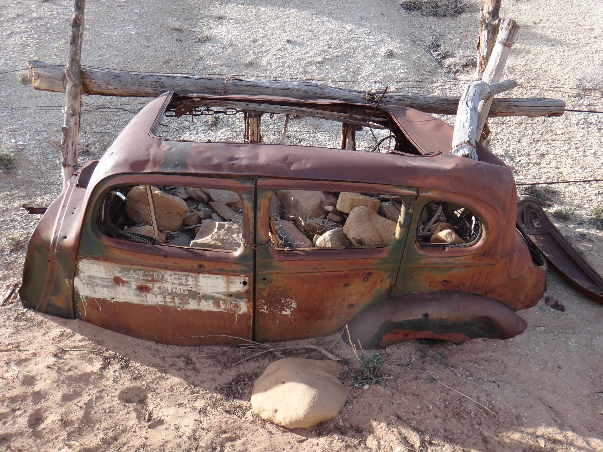
Old Car
Opened to wagon traffic in 1884 by hard working pioneers, Capitol Gorge has to be one of the better short hikes in Capitol Reef. The work needed to clear the passage for early wagons must have been daunting. Today the road is closed just before the narrows, with a good picnic area at the trailhead. Those not wishing to hike, may still want to make the drive to the trailhead. The side road from the scenic byway to the trailhead is dirt, but accessible to most vehicles, and quite scenic as it descends the upper part of the gorge.
Up for a short hike? A short 5-10 minutes down canyon from the trailhead visits a small petroglyph panel in a fairly nice narrows section. More motivated? Continuing into the canyon reveals an impressive Pioneer Register (30 minutes round trip). Still motivated? Next stop is the tanks, several large potholes used for water, as well as a small natural bridge. The tanks is the turn around point for most, but it is a nice amble to continue all the way through the gorge to the eastern park boundary.
Note: It should go without saying, but do NOT add to the pioneer register or deface the rock in any other location. It is against federal law, and the National Park Service is aggressive about finding and prosecuting vandals. It was surprising on my visit the number of carvings that had been done in the last couple of years.
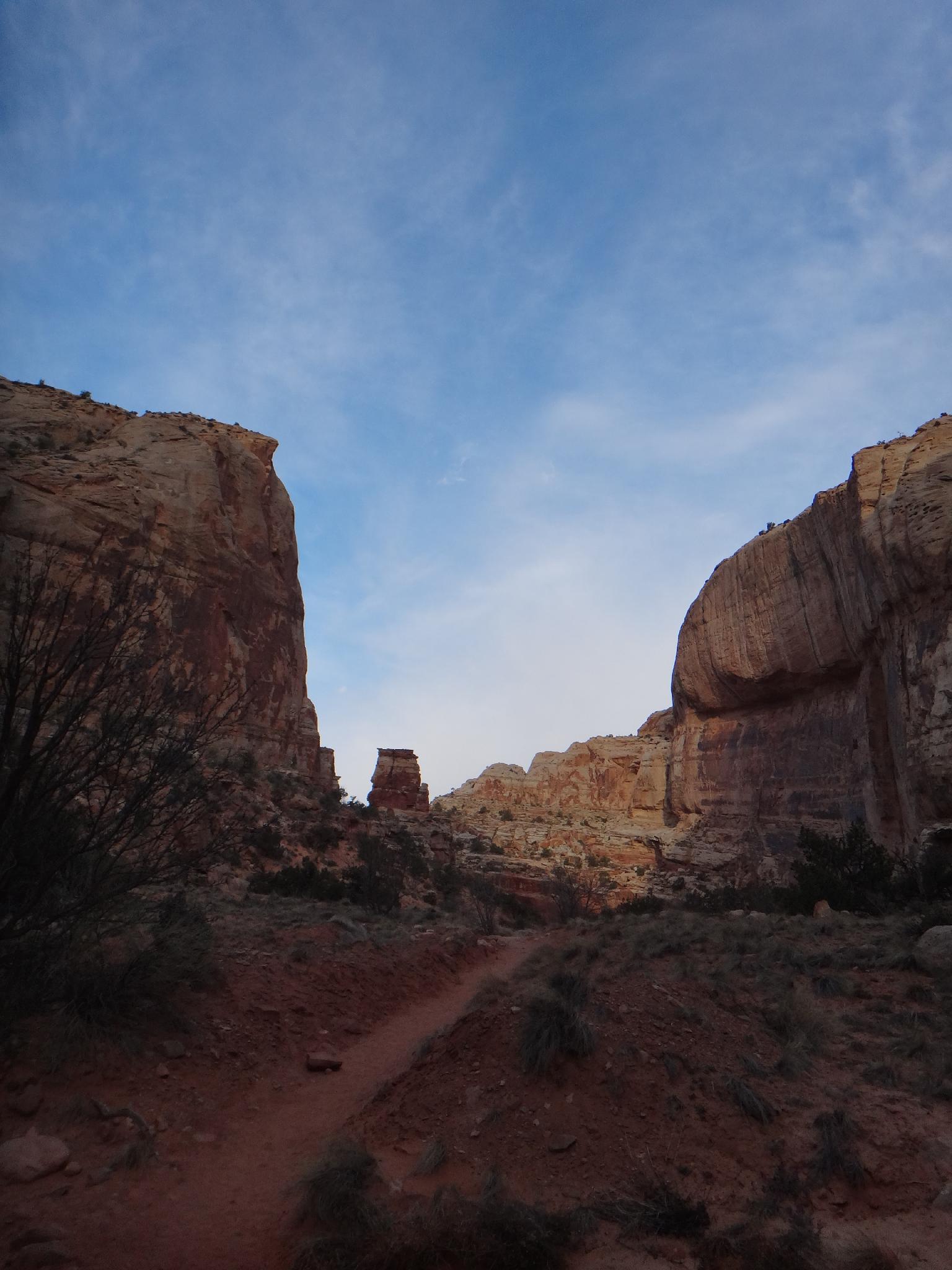
Dawn at Capitol Gorge
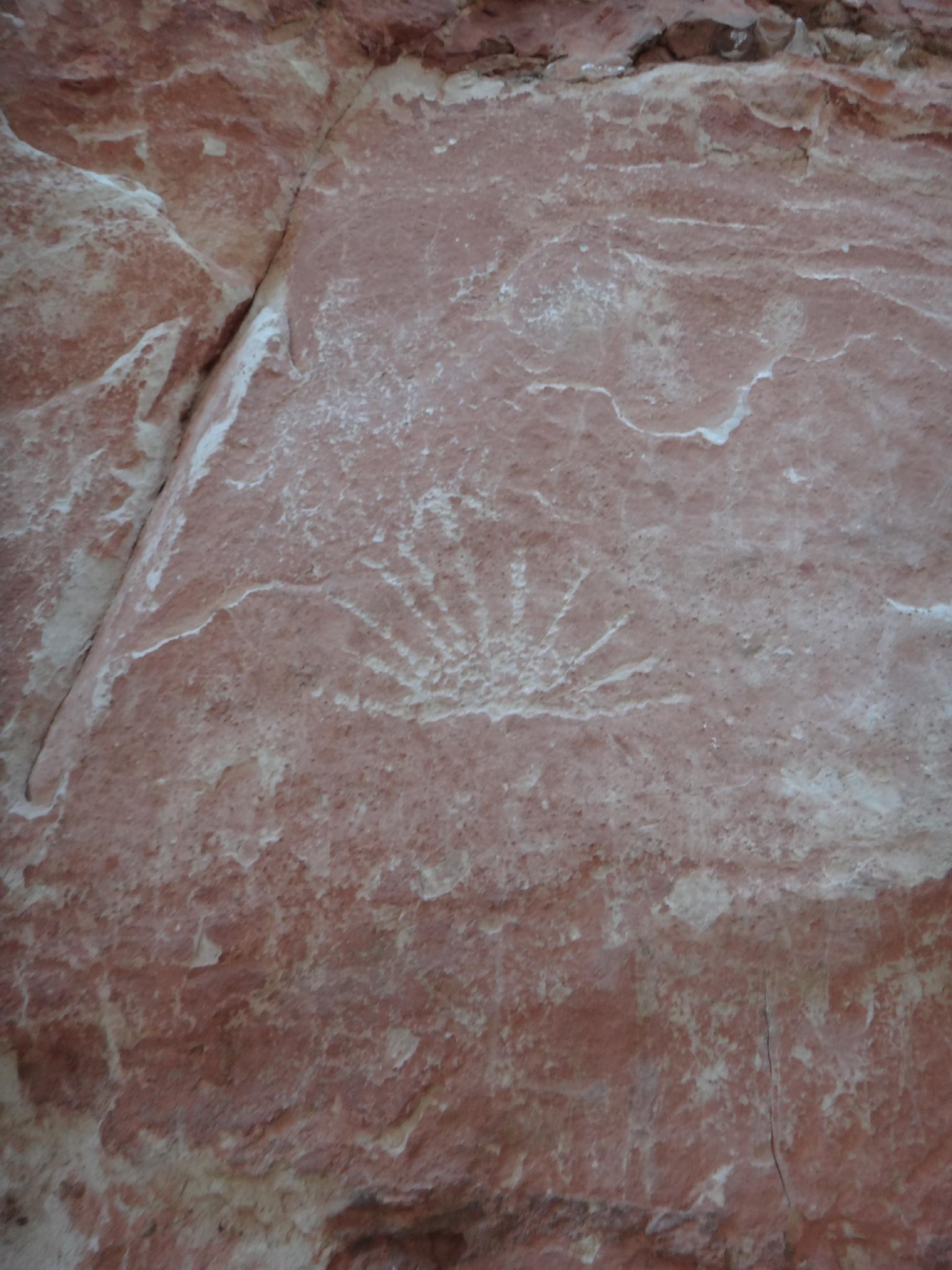
Petroglyph
Getting There
From the Capitol Reef Visitor Center, follow the Scenic Byway. At about 1.6 miles is the pay booth. At 7.9 miles, go left down the well signed Capitol Gorge road. There is a nice picnic area here.
Follow the Capitol Gorge dirt road about 2 miles to its end at the trailhead, and another nice picnic area. The trailhead starts on the east side, at the picnic area.
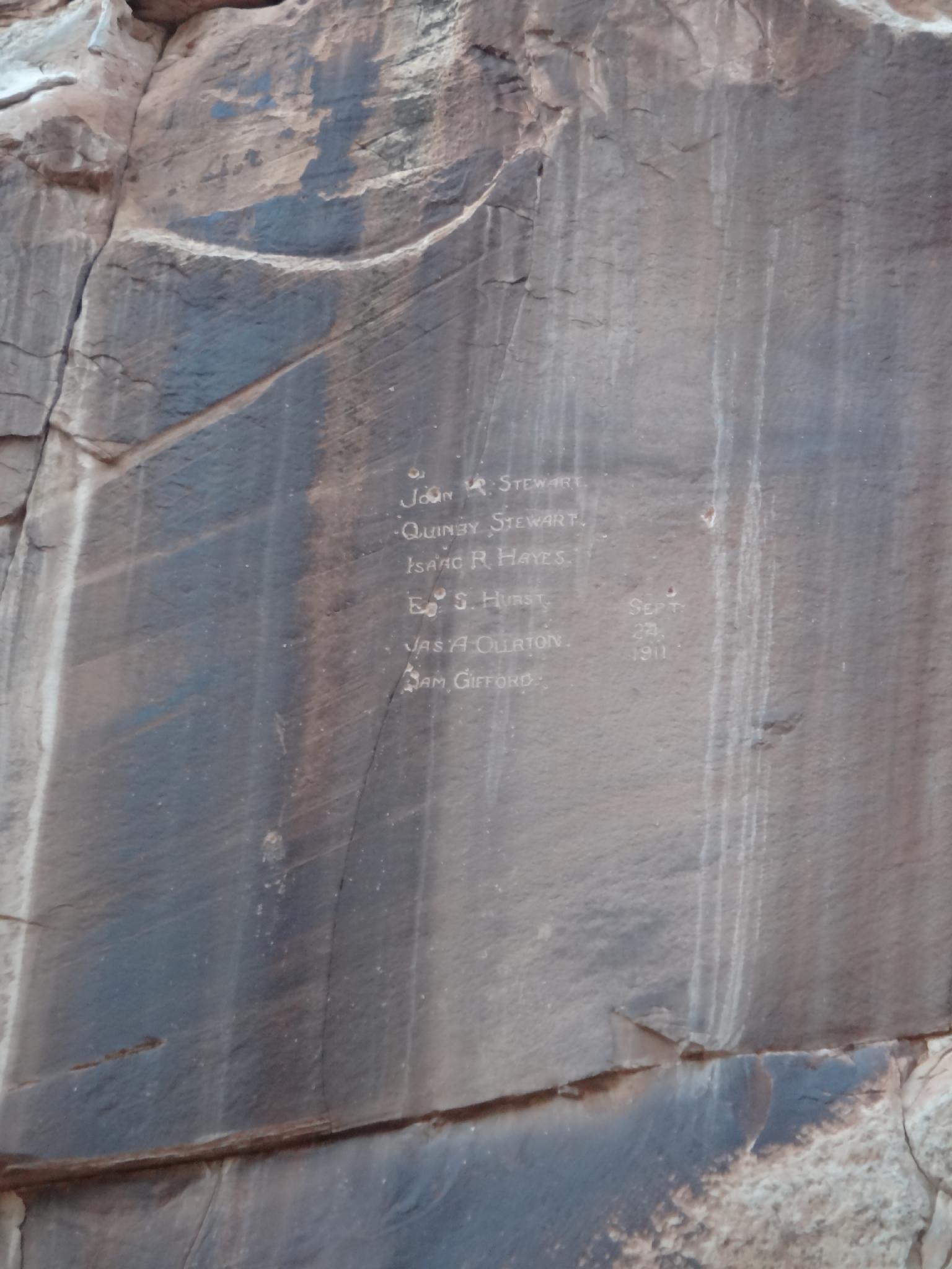
Names high above Capitol Gorge
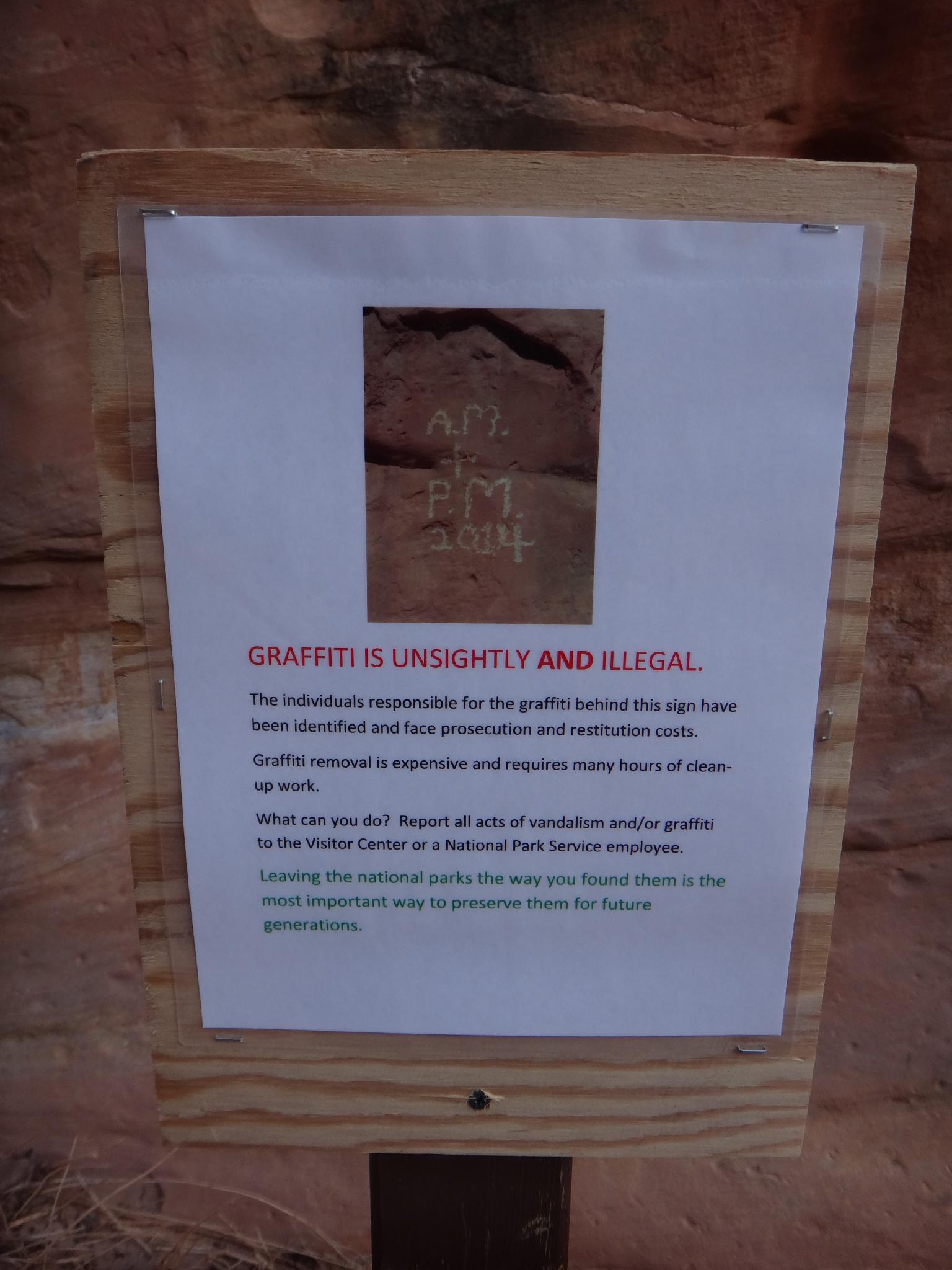
Graffiti
Route
Rock art and historic sites are fragile, non-renewable cultural resources that, once damaged, can never be replaced. To ensure they are protected, please:
- Avoid Touching the Petroglyphs: Look and observe, BUT DO NOT TOUCH!
- Stay on the Trails: Stay on the most used trails when visiting sites, and don't create new trails or trample vegetation.
- Photography and Sketching is Allowed: Do not introduce any foreign substance to enhance the carved and pecked images for photographic or drawing purposes. Altering, defacing, or damaging the petroglyphs is against the law -- even if the damage is unintentional.
- Pets: Keep pets on a leash and clean up after them.
- Artifacts: If you happen to come across sherds (broken pottery) or lithics (flakes of stone tools), leave them where you see them. Once they are moved or removed, a piece of the past is forever lost.
From the trailhead, go east down the canyon. In 5 or so minutes, a small petroglyph panel is on the left. Stay on the trail from the trailhead, not in the wash, or this can be easily missed. Pioneer signatures appear high on the right wall here as well.
Another 5-10 minutes down canyon a cairn marks the pioneer register on the left wall. Look up for it. Watching the rest of the scenery, I missed it on the way down the canyon, but saw it on the way back.
The canyon opens a bit now. Continue down 45 or so minutes from the trailhead to the side trail to the Tanks. This short side trail is worth the trip. It meanders up above Capitol Gorge a short distance, then goes up the canyon to an impressive set of potholes. (the biggest ones and a natural bridge are just to the left of the trail when it enters the small side canyon)
Most will return here. Continuing down Capitol Gorge from the Tanks junction, the canyon opens a bit. There is much graffiti along the walls in spots, and two old cement dams that have filled in with sand. Not long after the second one, the eastern boundary of the park is reached at a fence. An old car a minute past the fence on the right is an interesting look into the history of the area. Return the same way.
Photos
Maps

| Trailhead |
12S 485217mE 4229083mN N38° 12' 35" W111° 10' 08" |
| Petroglyphs |
12S 485426mE 4229107mN N38° 12' 35" W111° 09' 59" |
| Signatures |
12S 485921mE 4229289mN N38° 12' 41" W111° 09' 39" |
| Tanks |
12S 486219mE 4229552mN N38° 12' 50" W111° 09' 27" |
| Car |
12S 487932mE 4230559mN N38° 13' 23" W111° 08' 16" |