 Hiking Cottonwood Tanks
The Post
Overview
|
Wed 79 | 51 |
Thu 70 | 49 |
Fri 67 | 48 |
Sat 62 | 42 |
Sun 71 | 42 |
| View Full Weather Details | ||||
|
Wed 79 | 51 |
Thu 70 | 49 |
Fri 67 | 48 |
Sat 62 | 42 |
Sun 71 | 42 |
| View Full Weather Details | ||||

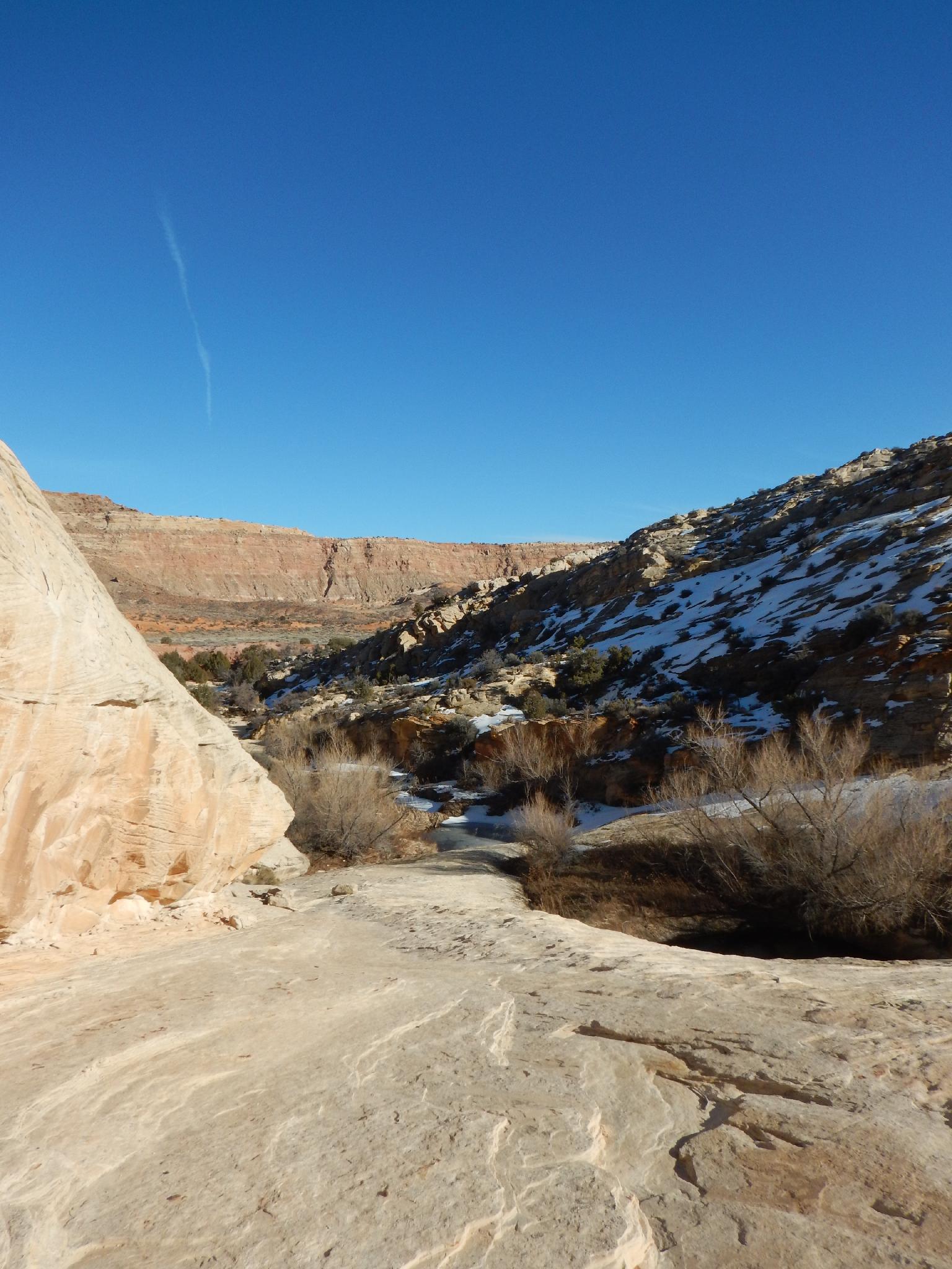
Views near the junction.
The Post area of Capitol Reef National Park is generally known for its long hikes, Halls Creek or Lower Muley Twist. These hikes are gorgeous and well worth doing, but long and require a fair bit of fitness.
Cottonwood Tanks starts from the Post and meanders down Halls Creek a mere 1.3 miles to visit Cottonwood Tanks proper. The short distance makes this a good leg stretching or family friendly hike in the area and gives a glimpse of the wonders of this part of the reef. The hike follows an old wagon road though it appears to be a mere hiking trail these days except in a few spots. It is easy to follow. The history, views, and length make this a recommended hike if passing through the area.
In 1879, a Mormon expedition made the Hole-In-The-Rock crossing on their way to settle southeastern Utah. One member of the expedition was Charles Hall. After the expedition Charles Hall created a ferry at Halls crossing (about 30 miles upstream from Hole-In-The-Rock) in 1882. The old wagon road that meanders down Halls Creek was constructed to support the ferry and allow settlers to cross the Colorado.
The ferry created a small settlement at the mouth of Halls Creek (under the waters of Lake Powell now), but the settlement and ferry were abandoned after only a couple of years. Charles Hall was also prominent in helping create other settlements, including Escalante and Parowan.

Cliffs that make up the east side of Halls Creek.
Getting There
Travel east out of Capitol Reef National Park on highway 24. Just past the park, 0.25 miles, is the well signed Notom road.
- Turn south onto Notom Road and reset your odometer. ( 12S 488763mE 4237262mN / N38° 17' 00" W111° 07' 43" )
- At 13.6 miles, is the Sandy Creek Junction. Stay right on the Notom road here. ( 12S 493913mE 4217290mN / N38° 06' 12" W111° 04' 10" )
- At 13.9 miles, is the second Sandy Creek Junction. Stay right on the Notom road here. ( 12S 494104mE 4216858mN / N38° 05' 58" W111° 04' 02" )
- 21.2 miles to the Cedar Mesa Campground on the right (west) side of the road. ( 12S 492760mE 4206611mN / N38° 00' 26" W111° 04' 57" )
- Burr Trail junction is at 32.5 miles. Stay straight, heading toward Bullfrog. ( 12S 498890mE 4189788mN / N37° 51' 20" W111° 00' 45" )
- 34.3 miles from highway 24, the Surprise Canyon trailhead is a small turn out on the right (west) side and is signed. ( 12S 500983mE 4187875mN / N37° 50' 18" W110° 59' 20" )
- 34.8 miles - Headquarters Canyon trailhead parking is on the left. The post side road is off on the right. This goes 0.5 miles to the Halls Creek/Lower Muley Twist/Cottonwood Tanks Trailhead. Follow it to its end. There is a pit toilet here, but no camping allowed. ( 12S 501614mE 4187295mN / N37° 49' 59" W110° 58' 54" )

Cottonwood Tanks on a winter day.
views from the tanks.
Route
From the trailhead, follow the trail a couple of minutes to the gate and fence. Go through the fence and continue south on the trail. Though easy to follow, keep an eye out when it crosses Halls Creek proper. A couple of these crossings can be easy to miss the trail leaving the other bank if you're not paying attention.
20-30 minutes from leaving the trailhead the side junction to Cottonwood Tanks is reached. It is signed. Follow the side trail a few minutes to the tanks proper.
It is easy to imagine early settlers and cowboys taking advantage of the large pools to rest, rehydrate, and refresh in this lonely part of the desert. Wandering up the north (right) side of the tanks, some old graffiti is faintly visible on the low cliff band. This is a riparian paradise with several very large pools.
Return the same way.
Photos
Maps

| Trailhead |
12S 501906mE 4186538mN N37° 49' 35" W110° 58' 42" |
| Junction |
12S 501920mE 4186410mN N37° 49' 30" W110° 58' 41" |
| Cottonwood Tank Jct. |
12S 502313mE 4184423mN N37° 48' 26" W110° 58' 25" |
| Graffiti |
12S 501980mE 4184601mN N37° 48' 32" W110° 58' 39" |