 Hiking Fremont Gorge Viewpoint
Capitol Reef
Overview
|
Sat 72 | 48 |
Sun 76 | 49 |
Mon 78 | 53 |
Tue 77 | 52 |
Wed 74 | 51 |
| View Full Weather Details | ||||
|
Sat 72 | 48 |
Sun 76 | 49 |
Mon 78 | 53 |
Tue 77 | 52 |
Wed 74 | 51 |
| View Full Weather Details | ||||

Views of Ferns Nipple and the Water Pocket Fold along the route.
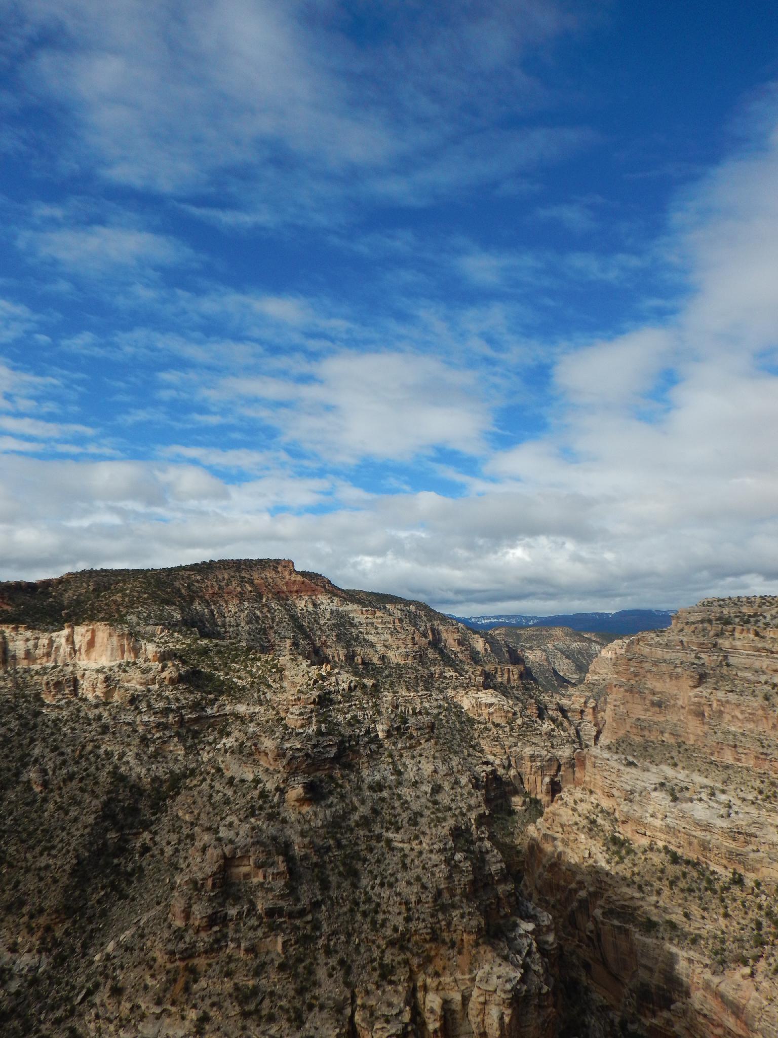
I kept putting off the Fremont Gorge Viewpoint hike, not expecting it to be particularly good. It surprised me! The hike is moderate to strenuous, with about a 1000' gain over 2.3 miles (one way), but offers nice views of the surprisingly deep and scenic Fremont River Gorge. From the top of the gorge near Grover or bottom of the gorge at the Visitor Center, one would not have any idea the depth and sheer walls the gorge creates as it cuts through the mesa.
The hike offers virtually no shade. This is a good one to do in the spring, fall, or winter. If visiting in the summer, start as early as possible and take plenty of water. Sunset would be a very photogenic time to visit.
Looking into the Fremont Gorge from the viewpoint.
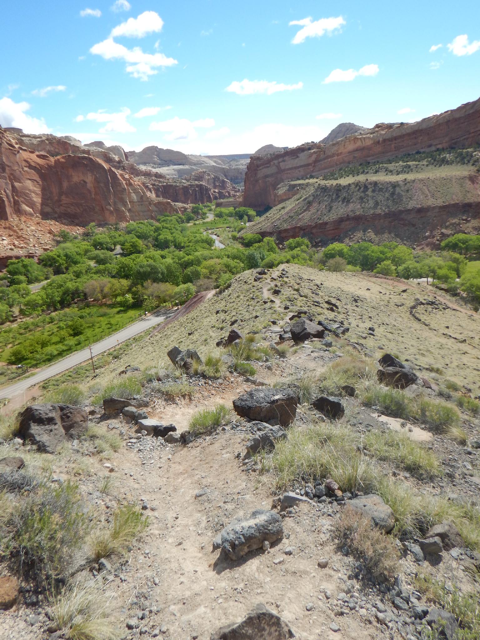
Heading down off the mesa to the trailhead.
Getting There
From the Capitol Reef National Park visitor center, take the scenic drive 0.6 miles to the old Blacksmith Shop display on the right side of the road. This is the trailhead, park in the parking area or at the picnic area just down the road.
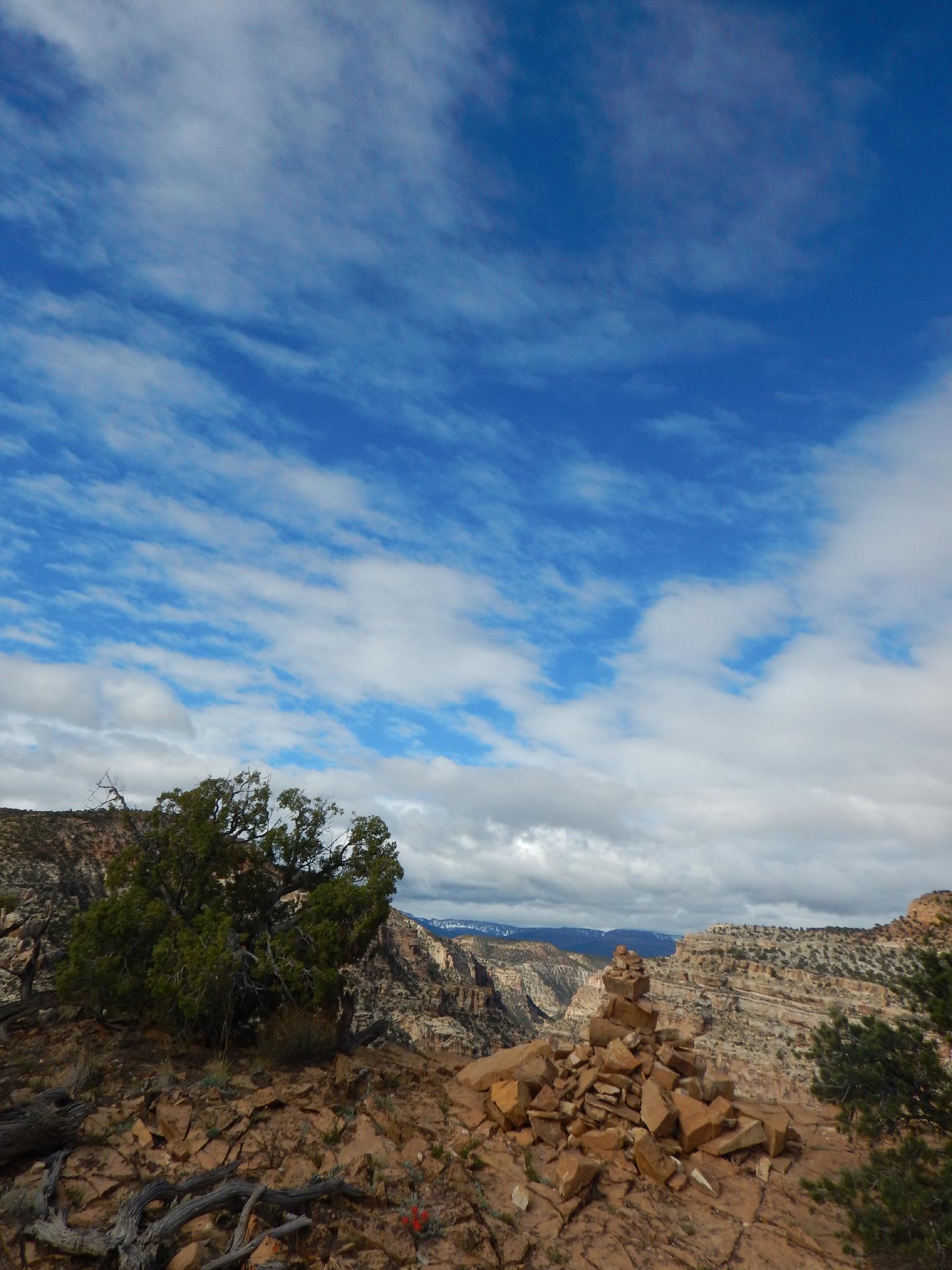
The scenic viewpoint cairn.
Route
From the Blacksmith Shop, follow the road is it climbs the hill. Just after rounding the bend, the trail leaves the road and climbs steeply up the volcanic boulder strewn slope to the top of the mesa. Big views of the Water Pocket Fold, Fuita, and Lower Fremont River are visible here.
The trail crosses the flat mesa, and begins its second and final ascent up to the viewpoint. The viewpoint is the end of the trail and looks steeply down into the Gorge. Boulder Mountain is visible to the south, and the Henry Mountains are off in the distance to the east. Ferns Nipple is also very visible to the slight south east.
Return the way you came.
Photos
Maps

| Trailhead |
12S 478222mE 4237619mN N38° 17' 11" W111° 14' 56" |
| Viewpoint |
12S 475546mE 4236467mN N38° 16' 33" W111° 16' 46" |