 Hiking Rock Canyon
Bicknell
Overview
|
Sun 70 | 38 |
Mon 71 | 42 |
Tue 70 | 43 |
Wed 68 | 42 |
Thu 63 | 40 |
| View Full Weather Details | ||||
|
Sun 70 | 38 |
Mon 71 | 42 |
Tue 70 | 43 |
Wed 68 | 42 |
Thu 63 | 40 |
| View Full Weather Details | ||||
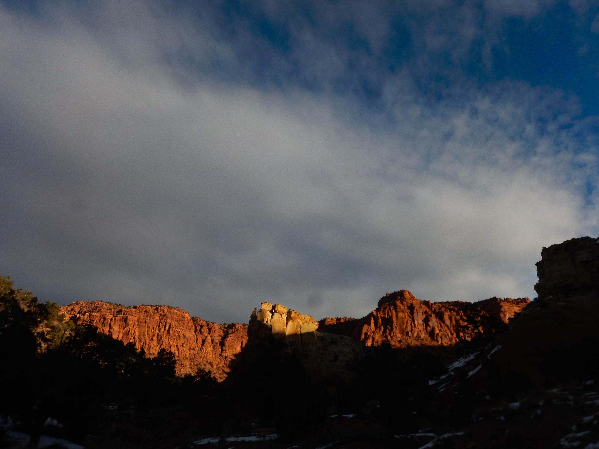
The headwall at the end of Red Canyon
Rock Canyon has to be one of the most used names in southern Utah. I can think of at least a half dozen "Rock Canyons" off the top of my head! This Rock Canyon, the Rock Canyon near Bicknell to be more specific, is a great dog-friendly outing if you are around Capitol Reef National Park And need somewhere outside the park to hike with your pooch.
With easy access just a few miles from highway 24, this hike nonetheless offers an outing that is surprisingly quiet and isolated feeling. Though not a 5-star outing given all of the hikes available in the National Park, this is a good place to get away from the crowds. The hike described wanders up to a spring, and returns in a casual 3-mile round trip outing, though many options are available wandering the different side canyons.
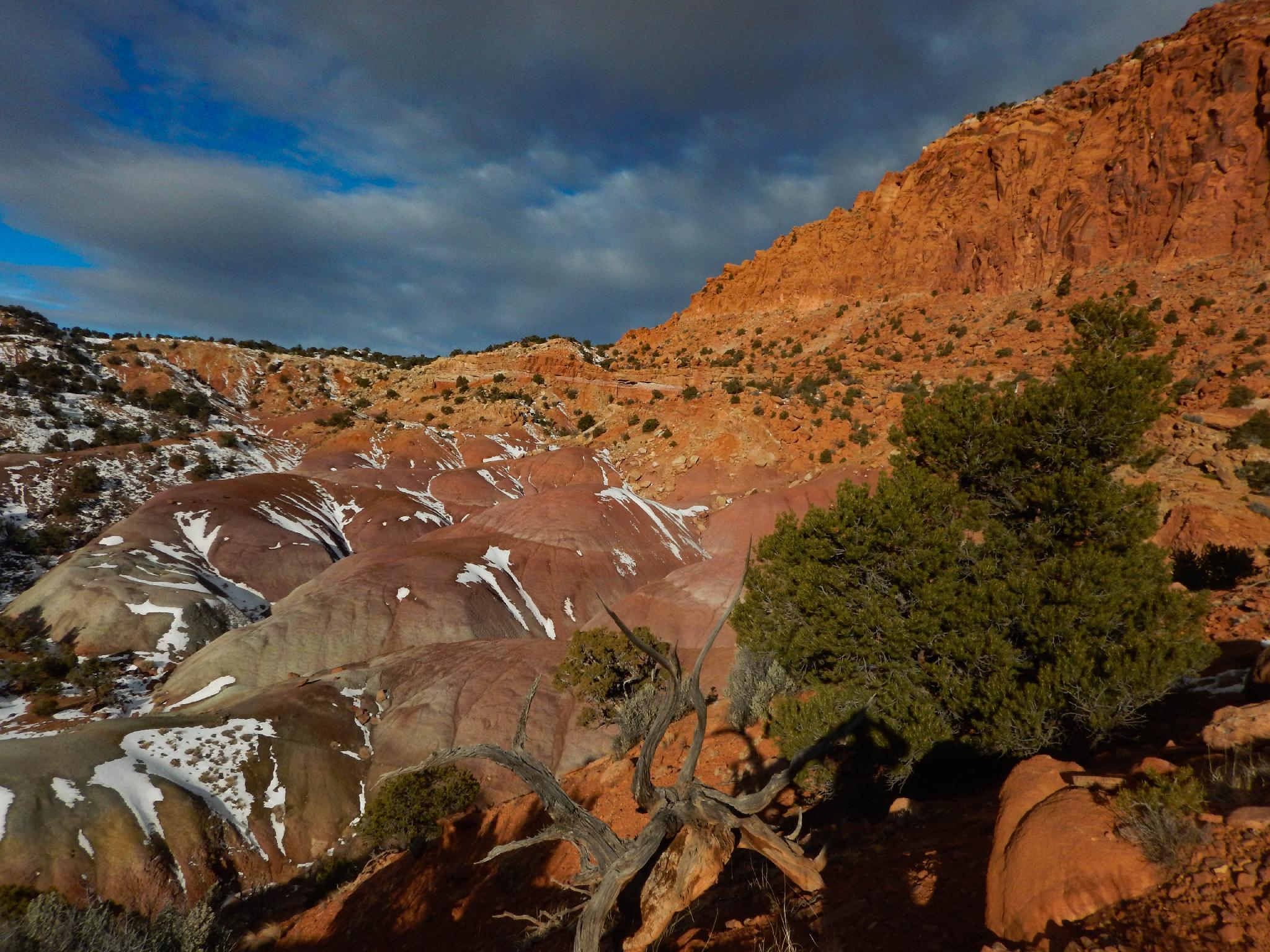
Colorful hills at the end of the hike.
Getting There
The trailhead is about 2.5 east of Bicknell on highway 24, or 6 miles west of Torrey. Either way, turn east at mile post 62.4 on highway 24, which is signed for the Gun Range.
At 0.2 miles is a junction, go right. At 0.4 miles, stay left, then a hard left. The road passes a power substation. At 0.8 miles is the gun range and trailhead.
Colorful hills at the end of the hike.
Route
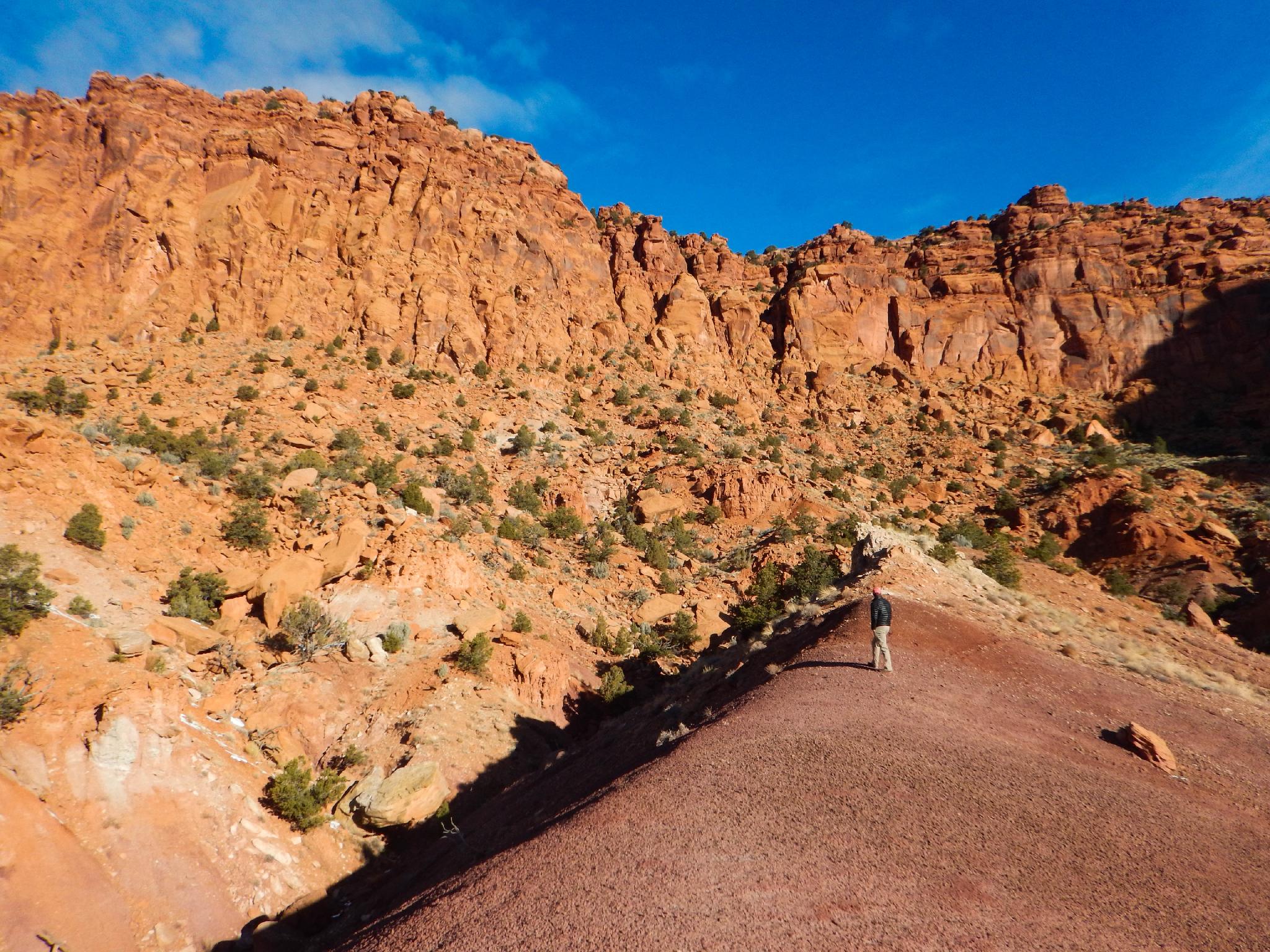
From the trailhead, either follow the road or the wash proper as it heads north up Rock Canyon. The road dwindles out in a few minutes, and the bottom of the wash offers easy hiking. The canyon is colorful and surprisingly deep, with the distant Wingate cliffs looming to the north.
As the wash meanders upstream, a major junction is reached. Go left here. The wash narrows a bit and becomes a little more vegetated. 10 minutes or so past the junction, a grassy junction is reached. A spring flows here, coming in on the right. Follow the right fork another 10 minutes or so through a brushy section to the headwall cliff and spring. En route, a section of colorful Moenkopi hills is on the left. Wandering up to the ridge on the left makes for good views of the contrasting Moenkopi hills and Wingate cliffs.
Photos
Maps

| Trailhead |
12S 454899mE 4241269mN N38° 19' 06" W111° 30' 57" |
| Junction - Go left. |
12S 455294mE 4242312mN N38° 19' 40" W111° 30' 41" |