 Roadside Attraction Sand Creek Petrified Wood
Torrey
Overview
|
Fri 66 | 44 |
Sat 65 | 43 |
Sun 69 | 43 |
Mon 70 | 46 |
Tue 71 | 45 |
| View Full Weather Details | ||||
|
Fri 66 | 44 |
Sat 65 | 43 |
Sun 69 | 43 |
Mon 70 | 46 |
Tue 71 | 45 |
| View Full Weather Details | ||||
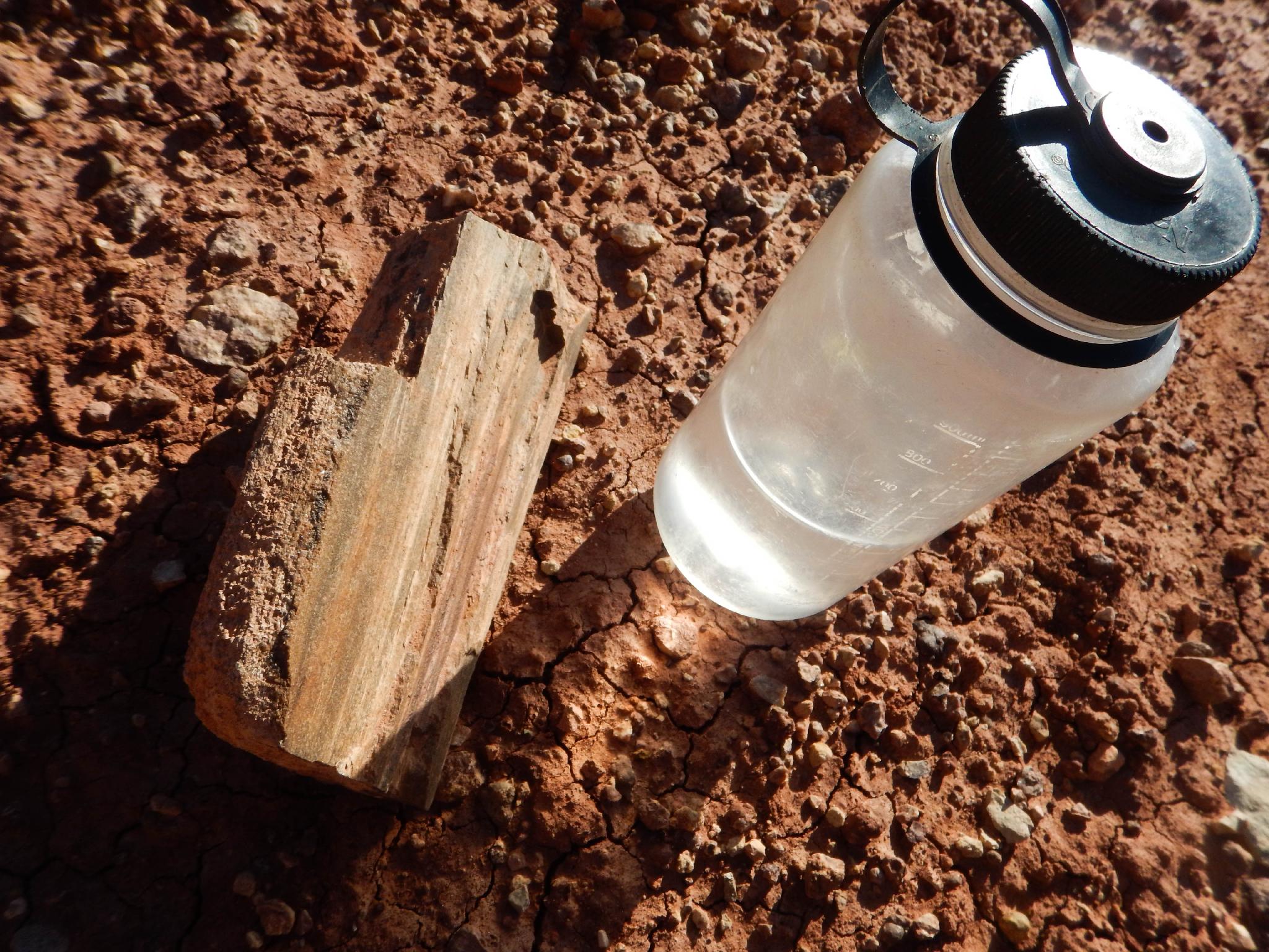
An example found next to the road.
As a kid, I was enjoyed picking up rocks to add to my meager and unimpressive (by geological standards) collection. Some things you never outgrow I suppose. I no longer collect rocks but do enjoy seeing interesting geology in the wild. Sand Creek, and really the whole area around Torrey, is a great area to see Petrified Wood in its geological setting. Kids and those with a geology interest will love spending an hour or more wandering under the sandstone cliff in Sand Creek looking at the various petrified wood. There are some fairly large and impressive specimens if you hunt around a bit.
I have heard that petrified wood may contain small amounts of uranium and perhaps should not be used as a necklace or carried around in your pocket, though I haven’t found anything definitive to support this.

A large mostly buried branch or trunk.
Getting There
On the west side of the town of Torrey, turn north onto Sand Creek road. This is well signed. Reset your odometer as you turn onto Sand Creek Road off of highway 24. (The main road through Torrey)
- 0.75 miles - Junction, go left onto the dirt road. ( 12S 462190mE 4240290mN / N38° 18' 36" W111° 25' 57" )
- 1.5 miles - North / South Route Jct just after crossing Sand Creek. Go right. ( 12S 461321mE 4241240mN / N38° 19' 06" W111° 26' 33" )
- 2.3 miles - Junction. Go left toward Sand Creek. ( 12S 461481mE 4242320mN / N38° 19' 41" W111° 26' 26" )
- 2.5 miles - Side road. Turn right. This side road heads toward the cliffs. ( 12S 461237mE 4242402mN / N38° 19' 44" W111° 26' 37" )
- 2.8 ish miles - Park anywhere. ( 12S 460830mE 4242699mN / N38° 19' 54" W111° 26' 53" )
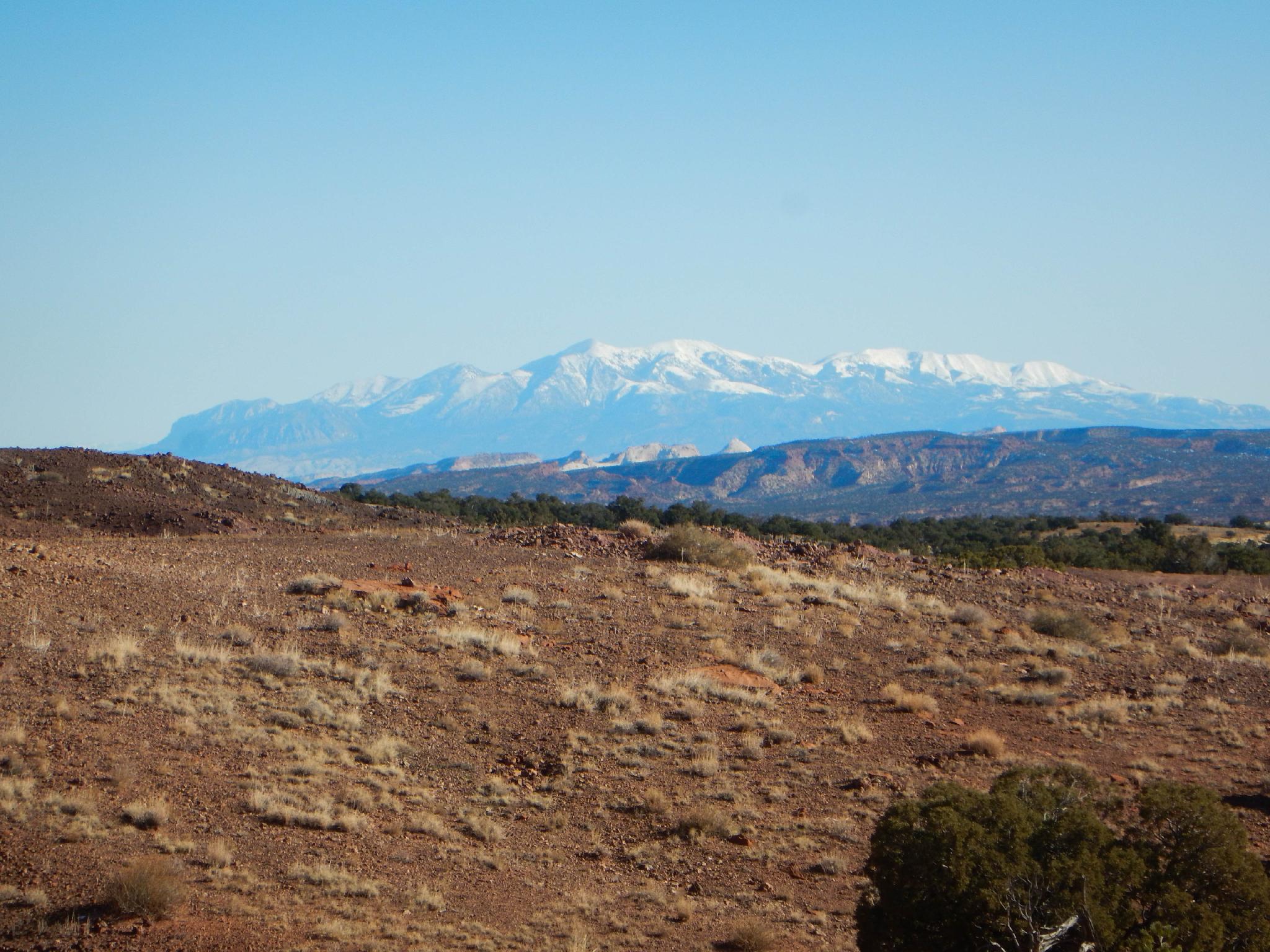
Views of the Henry Mountains and Capitol Reef in the distance.
Route
From the parking area, let the wandering begin! No specifics are shown on the map, but small pieces litter the area next to the road. Wandering away from the road often leads to bigger specimens. We found up to about 6-inch diameter cross sections in a couple of places.
Photos
Maps

| Trailhead |
12S 460829mE 4242699mN N38° 19' 54" W111° 26' 53" |