 Hiking Sundance Trail
Dark Canyon
Overview
|
Sat 76 | 51 |
Sun 80 | 51 |
Mon 83 | 57 |
Tue 82 | 54 |
Wed 79 | 55 |
| View Full Weather Details | ||||
|
Sat 76 | 51 |
Sun 80 | 51 |
Mon 83 | 57 |
Tue 82 | 54 |
Wed 79 | 55 |
| View Full Weather Details | ||||
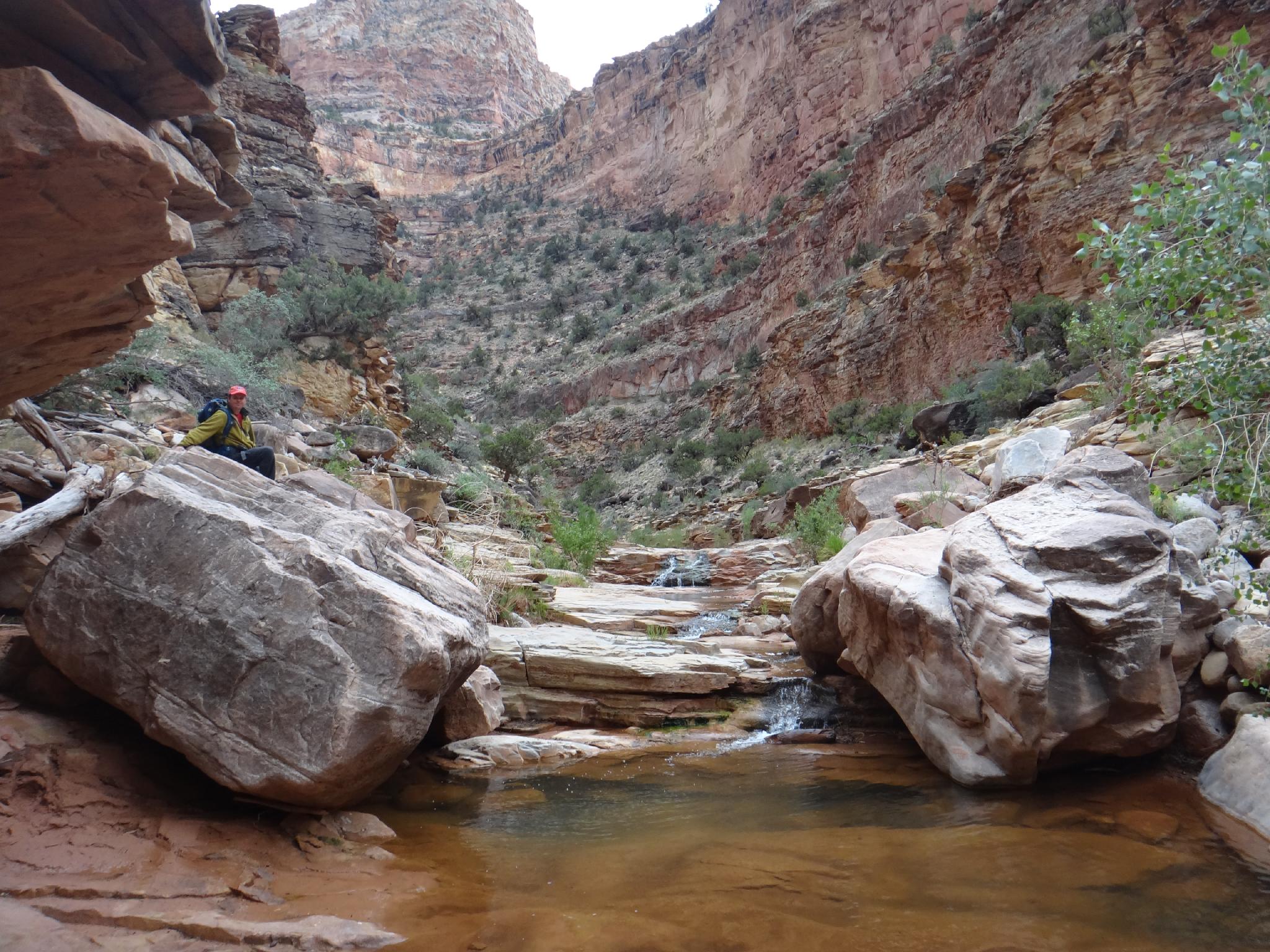
Dark Canyon just above Young Canyon
Dark Canyon is one of the crown jewels of Southern Utah. Starting high in the alpine area of Elk Ridge at about 9000' in elevation, it descends all the way to elevation 3700' where it reaches the Colorado River. Lake Powell used to inundate the lower part of the canyon, but it has receded leaving sand banked walls and sun-baked former mud flats in the very lower reaches.
Visiting Dark Canyon is often done either by visiting the upper, more alpine area, or the lower more desert area. A full traverse from the top to the bottom is a 5+-day affair and requires a long car shuttle. This trip visits the lower half that is a stunning mix of towering sandstone walls, crystal clear pools, waterfalls, and big views.
The approach is about 3.5 miles with a loss of about 1500' to the canyon floor. Though this COULD be done in a day, it would be foolish to get to the good stuff just in time to turn around and make the return. Most groups take 3 days though that is a bit hurried. Four days seems like a good length to visit, and is what is described here. If doing it in 3 days, one of the day hikes can be cut out of this trip, though the full 4 days is recommended.
The area is rugged, and takes a bit of work to visit, but is well worth it. Spring and Fall are recommended though winters could be pleasant if you don't mind the long nights and cold temperatures. Summers are brutally hot, and several groups have recounted tales involving hordes of biting insects by June. Ideal times to visit are likely late April until late May, and September/October.
Note: The exit requires a substantial elevation gain up a steep talus slope. In hotter times of the year, plan to exit early in the morning or later in the evening when temps are more manageable for the climb out. The talus slope would not be fun in the heat of the day.
Lower Dark Canyon on the way to the river.
Getting There
The trailhead can generally be reached by most vehicles, but there are a few rough spots. The last 1.2 miles requires high clearance, but can be walked if needed.
The dirt road to the trailhead starts off of highway 95 between mile posts 48 and 49, which is 48 miles south of Hanksville. Two side roads go off here, but coalesce just off the highway.
- Left off highway onto Dirt Road ( 12S 556969mE 4192555mN / N37° 52' 43" W110° 21' 08" )
- 4.1 miles - Left ( 12S 561517mE 4190037mN / N37° 51' 21" W110° 18' 03" )
- 4.3 miles - Stay straight on #2081 ( 12S 561783mE 4189716mN / N37° 51' 10" W110° 17' 52" )
- 6.5 miles - Left on road #2641 ( 12S 564198mE 4187305mN / N37° 49' 51" W110° 16' 14" )
- 7.2 Miles - Left ( 12S 565345mE 4187463mN / N37° 49' 56" W110° 15' 27" )
- 9.4 Miles - Left ( 12S 567594mE 4187321mN / N37° 49' 51" W110° 13' 55" )
- 12.1 miles - Left on #2821 (Signed for Sundance Trailhead) ( 12S 570072mE 4187872mN / N37° 50' 08" W110° 12' 13" )
- 13.3 miles - Trailhead ( 12S 571139mE 4189214mN / N37° 50' 51" W110° 11' 29" )
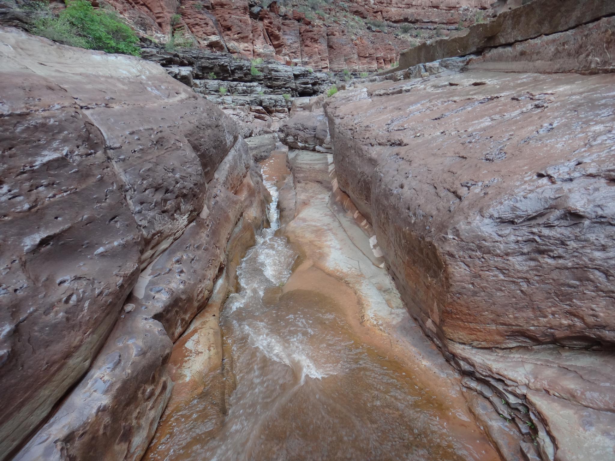
Dark Canyon, sandy after a small flood.
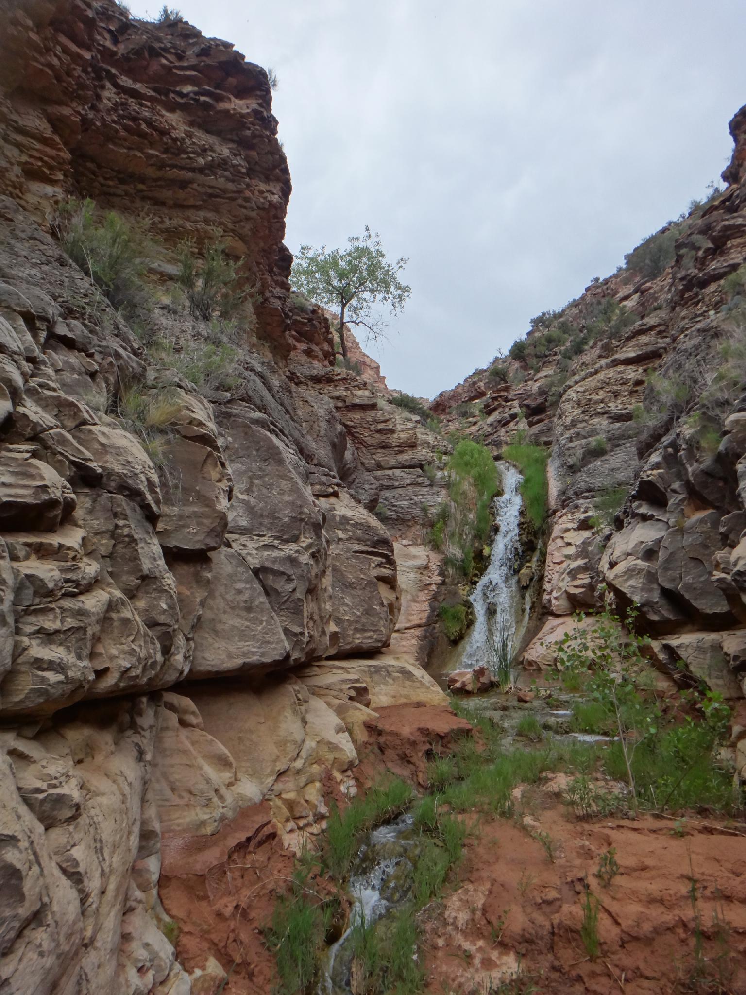
Waterfall at the mouth of Youngs Canyon - Dark Canyon
Route
Day 1 - To Dark Canyon (about 4 miles to the canyon, 6 to the optional camp)
From the trailhead, follow the old jeep road as it drops and meanders north then west offering a preview into Dark Canyon from above. After about 30-40 minutes, a marked trail junction is reached. Leave the old jeep road and follow the trail north, and then east to a point overlooking Dark Canyon. As you cross the mesa, there are many social trails. All lead to generally the same place. Stay on the most used ones to minimize impacts.
From the point, the trail descends the obvious large talus slope about a 1000 feet to the canyon floor. Again, there are many cairned use trails, stay on the most used. Once on the canyon floor, it is a short 5-10 minutes down to the confluence of the side canyon and Dark Canyon and stream. This area is becoming overused by campers. Try not to camp directly in the area, there are many good campsites up and down Dark a short distance.
Optional: If planning on day hiking up Dark Canyon on Day 2, it is worthwhile to hike up Dark a couple of miles and setup camp. As you head up Dark, crisscross the stream countless times. Several small narrows sections have trails on either side for easiest passage. The camp marked on the map is a good stopping point. Just above this the narrows require a bit more route finding to get around, and it is easier with lighter day packs.
Day 2 - Day Hike to Youngs (10 miles)
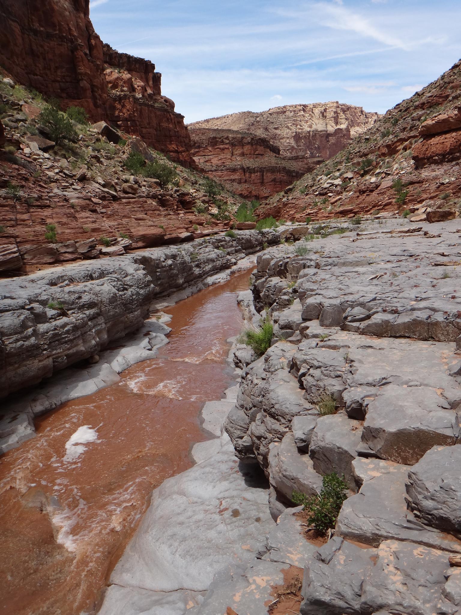
From the upper camp, as you head up canyon, a narrows section requires getting wet, or climbing out on the left or right a bit back from the narrows. This marks the rhythm for the rest of the hike, small, shallow narrows sections that are passable on side trails on the left or right interspersed with open walking sections. Going up, stay on the side trails, because several sections have impassable falls in them. Coming back, it is nice to stay in the water except for the few narrows that have falls.
Youngs in about 5 miles from the upper camp and about 3-4 hours one way. Several seeps emerge on the right wall as you near Youngs. It is difficult to miss Youngs Canyon, there is a 10 m ( 33 ft. ) waterfall near its mouth and the area has a bit of a sulfur smell. Continue up Dark Canyon past Youngs about 2 minutes to find an amazing pool and rock art on the right. This marks a good turn around spot for most. Above the large pool, the canyon begins to change and starts becoming drier.
Day 3 - Day Hike to the River (7 miles from Sundance Trail Junction)
Day 3 you may want to move camp back down canyon to an area closer to where the Sundance Trail comes in, shortening day 3 and 4. From the Sundance Trail down to the Colorado River is about 7 miles round trip. Just down from the Sundance Trail junction, Lean To canyon comes in on the right. There is good camping here, but it is also heavily used.
About 5-10 minutes down from Lean To the first small waterfall is encountered. Pass it on a trail on the left, and then crossing back over to the right (looking down canyon) at cairns before the canyon begins dropping again. There is a little class 4 move here to get on the bench above the narrows, but once out, a good social trail continues down the canyon. Follow the social trail quite some distance to a cairned gulley that re-enters Dark.
Continuing down, another falls is encounter 10-15 minutes down the canyon. A social trail exists on either side avoiding the falls along the rim. The right side seems a better trail. Follow the social trail 5-10 minutes until it descends back to the canyon floor. Where it descends marks the high water mark of Lake Powell and is evidenced by the large sand deposits and dead tamarisk at the high water level.
The canyon changes character here, with high sandy walls and dried mud flats. It is worth the 20-30 minute walk down to the confluence with the Colorado River. The last section can be backed up and require wading or traversing the sand bank on the left to get to the true confluence, a stunning spot. Return the same way.
Photos
Maps


| Trailhead |
12S 571162mE 4189226mN N37° 50' 52" W110° 11' 28" |
| Trail Junction |
12S 569718mE 4190399mN N37° 51' 30" W110° 12' 27" |
| Sundance Top |
12S 571125mE 4190861mN N37° 51' 45" W110° 11' 29" |
| Camp |
12S 574184mE 4188785mN N37° 50' 37" W110° 09' 25" |
| Rock Art |
12S 580168mE 4188734mN N37° 50' 33" W110° 05' 20" |
| Lean To |
12S 571941mE 4190836mN N37° 51' 44" W110° 10' 56" |
| River |
12S 569907mE 4194555mN N37° 53' 45" W110° 12' 18" |