 Hiking Davis Gulch
Hole In The Rock Road
Overview
|
Thu 72 | 52 |
Fri 71 | 53 |
Sat 64 | 46 |
Sun 72 | 44 |
Mon 79 | 48 |
| View Full Weather Details | ||||
|
Thu 72 | 52 |
Fri 71 | 53 |
Sat 64 | 46 |
Sun 72 | 44 |
Mon 79 | 48 |
| View Full Weather Details | ||||
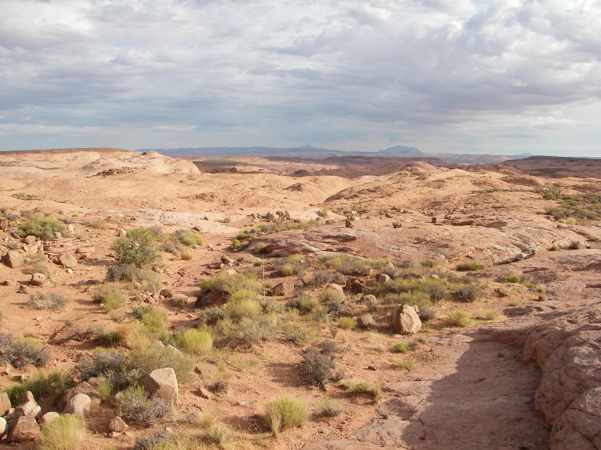
Views from the trailhead
Davis Gulch offers the non-technical canyoneer a technical canyoneering experience, and is one not to be missed by the experienced desert hiker. Technical canyoneers will probably find the slot section short and not as dramatic as many other technical slot canyons, but the exit hike is very worthwhile. The full route exits below Bement Arch, one of the showcase arches in the area. Keep an eye out, many believe Davis Gulch to be the last area Everett Ruess was visiting.
Are you a climber? Looking for a short, sporty evening route? Davis Gulch fits the bill. Just after the slot section, a moki step exit on the left (west) side offers those with the skills an elegant short route back to the car. The Moqui exit is NOT RECOMMENDED for non-climbers. Though relatively easy, a fall could easily have fatal consequences. I would rate it at 5.6 or 5.7, no gear possible, and a bit sandy and insecure in spots.
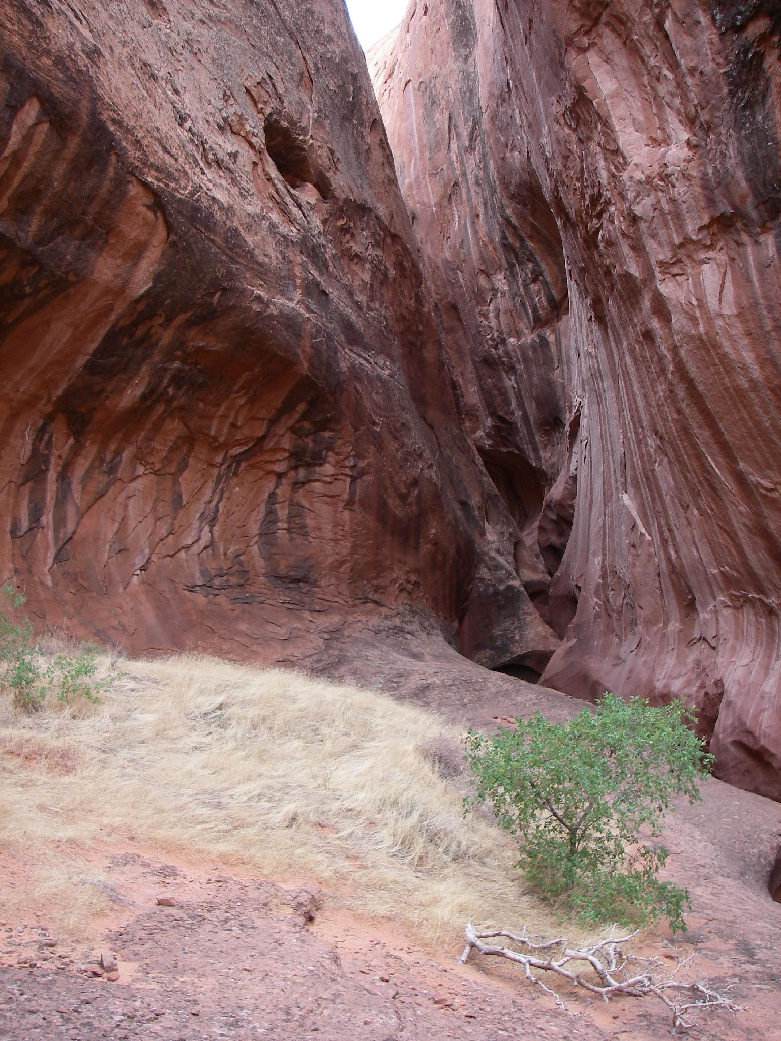
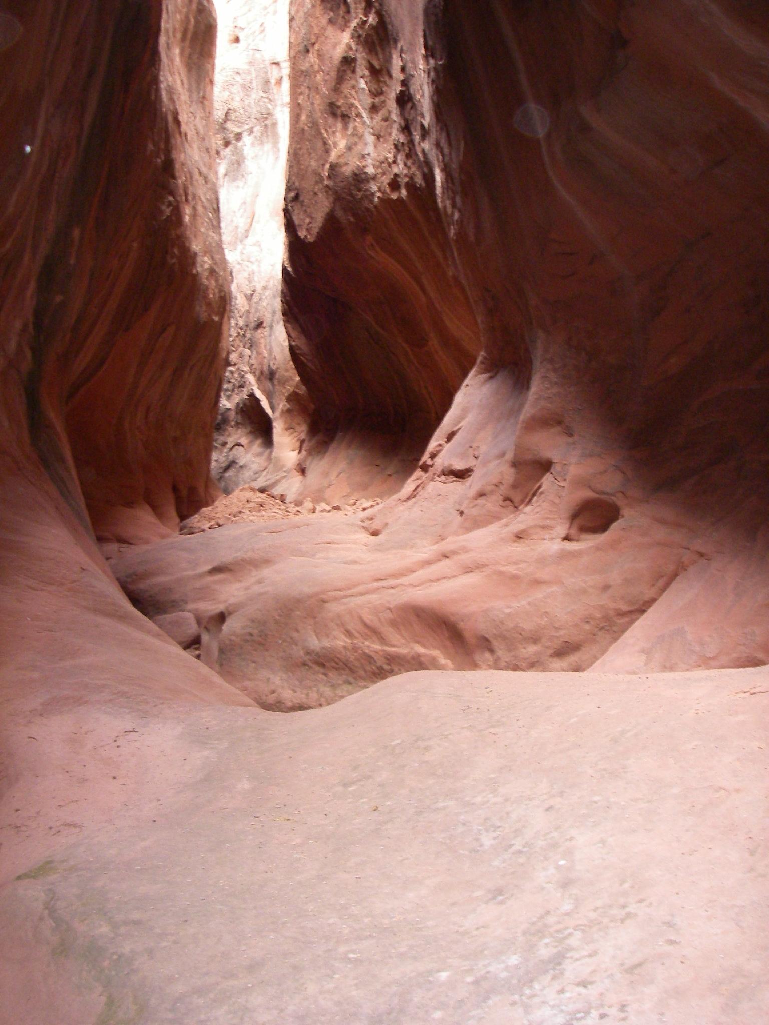
Davis Gulch Slot
The lovely upper section of Davis Gulch
Getting There
Head east out of the town of Escalante about 5 miles on highway 12 until the well signed Hole in the Rock road on the south side of highway 12. Reset the odometer as you turn onto this road.
- Mile 0 - Hole-In-The-Rock Road Turnoff ( 12S 453167mE 4175716mN / N37° 43' 39" W111° 31' 53" )
- 8.0 miles - Parking area after a cattle guard. This is the Zebra/Tunnel trailhead. ( 12S 460681mE 4165896mN / N37° 38' 22" W111° 26' 44" )
- 12.3 miles - Devil's Garden turn off on the right. The trailhead is about 1/4 of a mile down this road. No camping, but a pit toilet. ( 12S 463808mE 4160175mN / N37° 35' 17" W111° 24' 36" )
- 16.6 miles - Egypt road on the left. This access the Egypt and Neon trailheads ( 12S 468045mE 4154960mN / N37° 32' 28" W111° 21' 42" )
- 24.8 miles - Upper Dry Fork Trailhead on the right (south). This has a large parking area and pit toilet. ( 12S 478657mE 4148035mN / N37° 28' 44" W111° 14' 29" )
- 26.1 miles - Dry Fork Trailhead Road on the left (north). The trailhead is at the end of the road in about a mile. ( 12S 480198mE 4146661mN / N37° 27' 60" W111° 13' 26" )
- 30.9 miles - Red Well side road on the left. Follow this 1 mile to its end for the Red Well Trailhead. ( 12S 485669mE 4141593mN / N37° 25' 16" W111° 09' 43" )
- 33.1 miles - Chimney Rock side road on the left (north). ( 12S 487309mE 4138502mN / N37° 23' 36" W111° 08' 36" )
- 34 miles - Hurricane Wash Trailhead on the left. ( 12S 488275mE 4137666mN / N37° 23' 08" W111° 07' 57" )
- 36.3 miles - Fortymile Ridge side road on the left. This road goes to the Stock Tank and Fortymile Ridge trailheads commonly used for Coyote Gulch. This is also the road to Sunset Arch. ( 12S 489827mE 4135057mN / N37° 21' 44" W111° 06' 54" )
- 36.9 miles - Dance Hall Rock on the left. ( 12S 490766mE 4134519mN / N37° 21' 26" W111° 06' 15" )
- 40.8 miles - Sooner Rocks. Good primitive camping in the area. ( 12S 494749mE 4131425mN / N37° 19' 46" W111° 03' 33" )
- 51.6 miles - Davis Gulch trailhead just after crossing Davis Gulch. ( 12S 502303mE 4122852mN / N37° 15' 08" W110° 58' 26" )
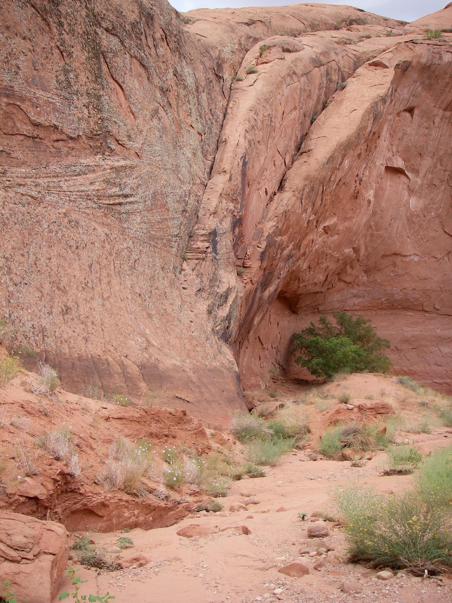
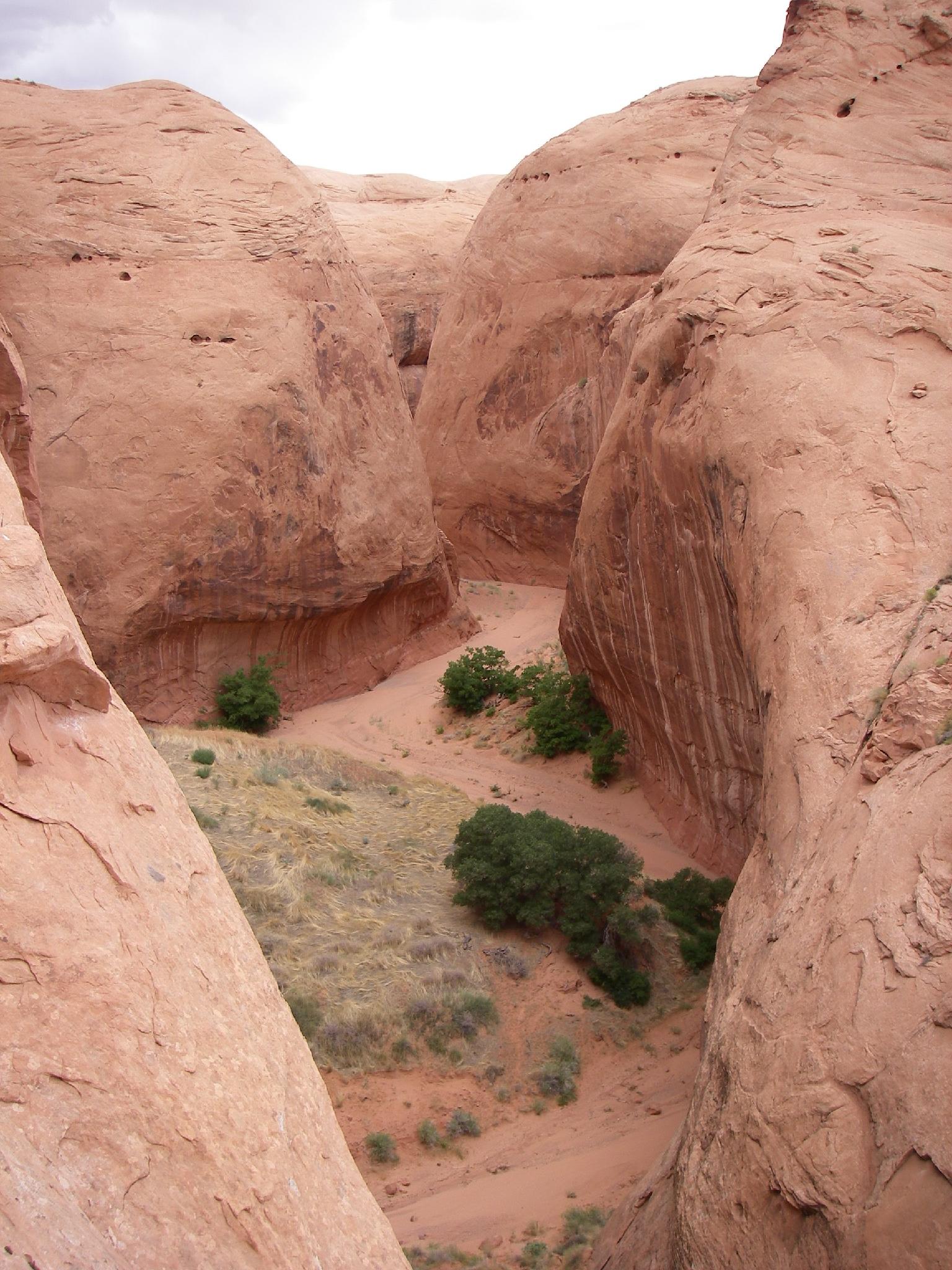
The Moki exit (Visible in the middle of the picture)
View from the rim.
Route
Canyon Section (4-5 hours)
Let the fun begin! From the trailhead, follow the wash north as it begins cutting into sandstone. This first section has some down climbs, but is straightforward. It soon opens offering and escape. If the top section seemed hard, take the exit. The final section of slot is the hardest.
The final section of slot drop and narrows quickly. Some may need to use the rope as a handline in 2-3 spots, but a little teamwork will prevail. Experienced canyoneers will likely find these drops easy downclimbs.
The slot ends abruptly, and the canyon opens. The Moki step exit is easily visible on the left just after the narrows. Experts only! All others, continue the stroll down the canyon. The going is easy but brushy the farther down you get, with big undercuts and towering walls.
Bement Arch is the next landmark, and stunning. It is best photographed from the upstream side. It marks about the 1/2 point of the canyon. Stay on the developing hikers trail for easiest passage through the brush down the canyon. An old fence on the north wall marks the exit, not far above the high water mark of Lake Powell.
Exit (1.5-2 hours)
From the fence, follow an old cattle trail and cairns to the rim. One on top, an emerging trail here heads south-west away from Davis Gulch to avoid the many small drainages that drain into it. If you lose the trail, just head south/southwest toward Fifty Mile Point and intersect the road, then follow the road east to the trailhead.
Photos
Maps

| Exit |
12S 504356mE 4128185mN N37° 18' 01" W110° 57' 03" |
| Bement Arch |
12S 503095mE 4126384mN N37° 17' 03" W110° 57' 54" |
| Easy Exit |
12S 502465mE 4123370mN N37° 15' 25" W110° 58' 20" |
| Canyon |
12S 502315mE 4122995mN N37° 15' 13" W110° 58' 26" |
| Trailhead |
12S 502304mE 4122853mN N37° 15' 08" W110° 58' 26" |
| Moki Exit |
12S 502463mE 4124616mN N37° 16' 05" W110° 58' 20" |