 Hiking Moab Dump Panels
Moab
Overview
|
Thu 73 | 55 |
Fri 70 | 50 |
Sat 61 | 45 |
Sun 67 | 42 |
Mon 76 | 44 |
| View Full Weather Details | ||||
|
Thu 73 | 55 |
Fri 70 | 50 |
Sat 61 | 45 |
Sun 67 | 42 |
Mon 76 | 44 |
| View Full Weather Details | ||||
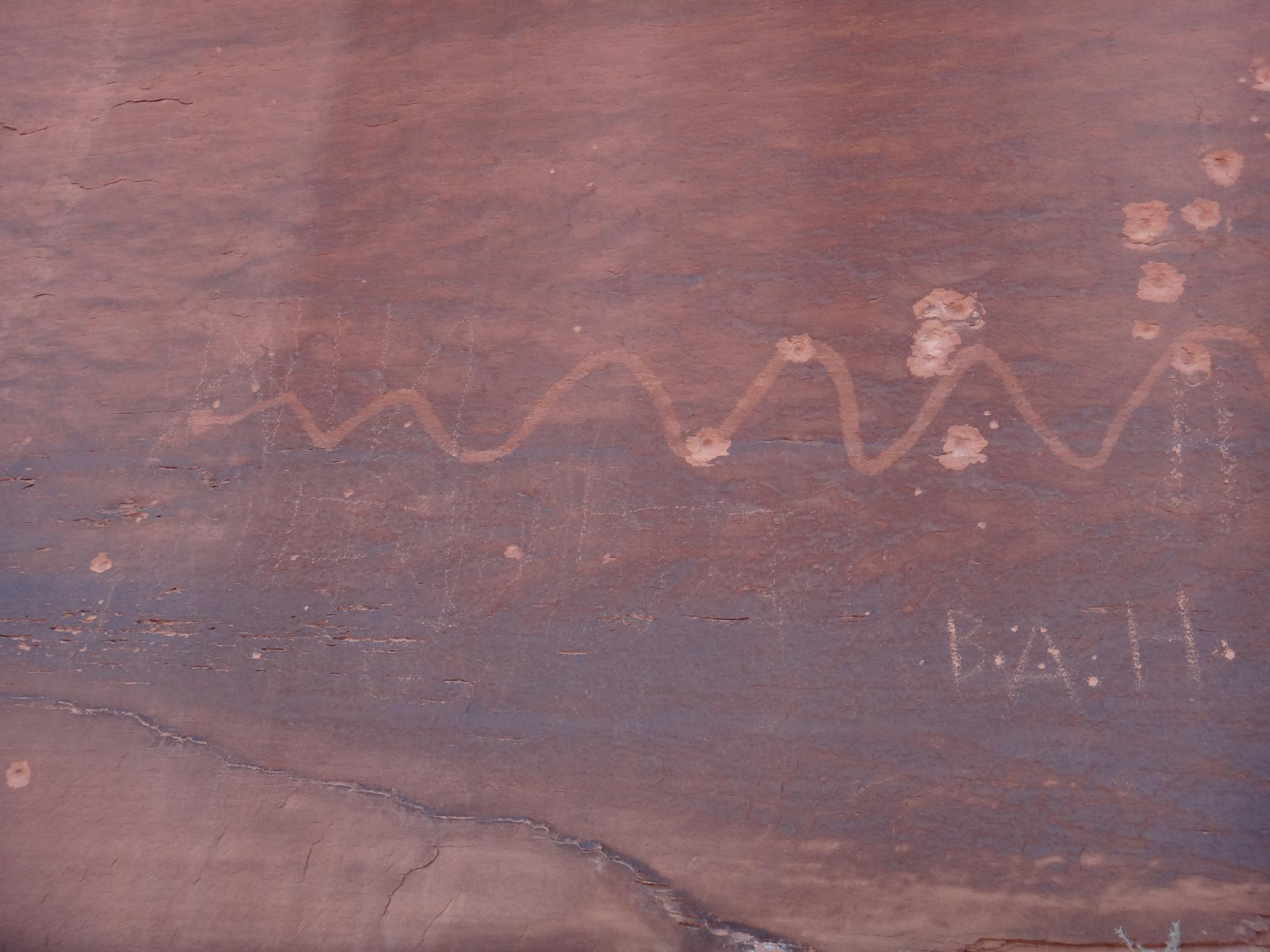
First panel
In 1986, the Moab Chamber of Commerce held a contest to find the most scenic dump in America. When it was all said and done, the contest ended in a tie between Moab, Utah and Kodiak, Alaska having the most scenic dump. So, it is a must see, and the reason it is on the site, right?!?
Not being a connoisseur of city dumps, I am not qualified to say whether the dump proper is worth visiting or not. I can say, however, that the cliff band just outside of the dump is well worth a short hike and visit to see fairly good petroglyph panels and views of the city. The dump is included in the views, so don't worry, if city dumps are your thing, you can at least get a distant peak at Moab's.
The hike is easy, and suitable for most. It gets mid-day through evening sun, so makes a good afternoon outing in cooler times and morning outing in hot seasons.
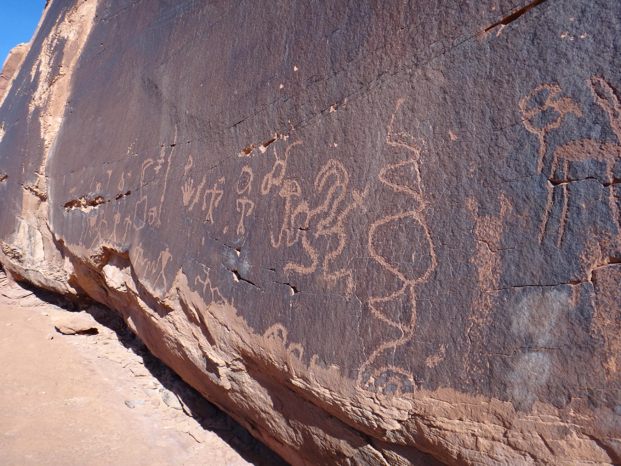
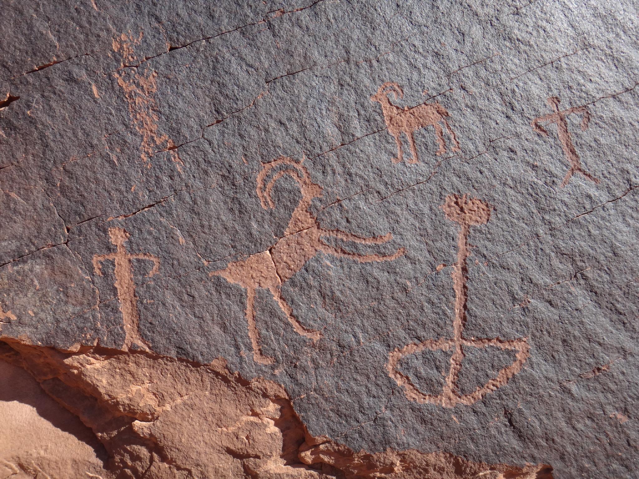
Best Panel
Getting There
The trailhead is reached from the same road that heads to Sand Flat. From downtown Moab:
- Go east on Center Street to 400 East.
- Turn right on 400 East and follow it to Mill Creek Drive and turn left onto Mill Creek Drive. (This is signed Slick Rock Bike and Sand Flat Recreation Area.)
- Follow Mill Creek Road for 1.8 miles. It becomes Sand Flat road after 0.5 miles and begins climbing. It passes the recycle center, then the dump. Finally, just before a curve where the road begins climbing a sandstone cliff, pullout on the right at a small pull-out and route closed to vehicles sign.
Pictographs
Route
Rock art and historic sites are fragile, non-renewable cultural resources that, once damaged, can never be replaced. To ensure they are protected, please:
- Avoid Touching the Petroglyphs: Look and observe, BUT DO NOT TOUCH!
- Stay on the Trails: Stay on the most used trails when visiting sites, and don't create new trails or trample vegetation.
- Photography and Sketching is Allowed: Do not introduce any foreign substance to enhance the carved and pecked images for photographic or drawing purposes. Altering, defacing, or damaging the petroglyphs is against the law -- even if the damage is unintentional.
- Pets: Keep pets on a leash and clean up after them.
- Artifacts: If you happen to come across sherds (broken pottery) or lithics (flakes of stone tools), leave them where you see them. Once they are moved or removed, a piece of the past is forever lost.
From the trailhead, follow the old closed road as it heads south. It soon crosses a deep sandy wash and gets close to the cliff where the first panel is. Follow the social trail a short distance to the cliff. Though it is tempting to stay on the road, there is much more to be seen staying close to the cliff face. Follow it, visiting several panels.
The old road veers away from the cliff, stay along the cliff band. A smaller cliff band is below the main cliff band just past this point. Either scramble up this (easy, but an exposed class 4 move right at the top) or go past it, until it is easy to get back up to the main cliff band and walk back along the cliff. The best two panels are here, with a few smaller figures. Photographing them, however, requires some moderate scrambling or a good zoom lens.
Continuing south from the good panels along the cliff band, an overlook of Mill Creek marks the end of the hike, return the way you came along the cliff, or follow the old road back.
Photos
Maps

| Trailhead |
12S 628270mE 4270714mN N38° 34' 32" W109° 31' 39" |
| Panel |
12S 628766mE 4270421mN N38° 34' 23" W109° 31' 19" |
| Panel |
12S 628827mE 4270352mN N38° 34' 20" W109° 31' 16" |
| Good Panel |
12S 629285mE 4270035mN N38° 34' 10" W109° 30' 57" |
| Best Panel |
12S 629307mE 4270024mN N38° 34' 09" W109° 30' 57" |
| Small Panel |
12S 629377mE 4269987mN N38° 34' 08" W109° 30' 54" |