
 Onion Creek
Fisher Towers
Overview
|
Fri 74 | 50 |
Sat 73 | 50 |
Sun 76 | 49 |
Mon 78 | 53 |
Tue 78 | 52 |
| View Full Weather Details | ||||
|
Fri 74 | 50 |
Sat 73 | 50 |
Sun 76 | 49 |
Mon 78 | 53 |
Tue 78 | 52 |
| View Full Weather Details | ||||
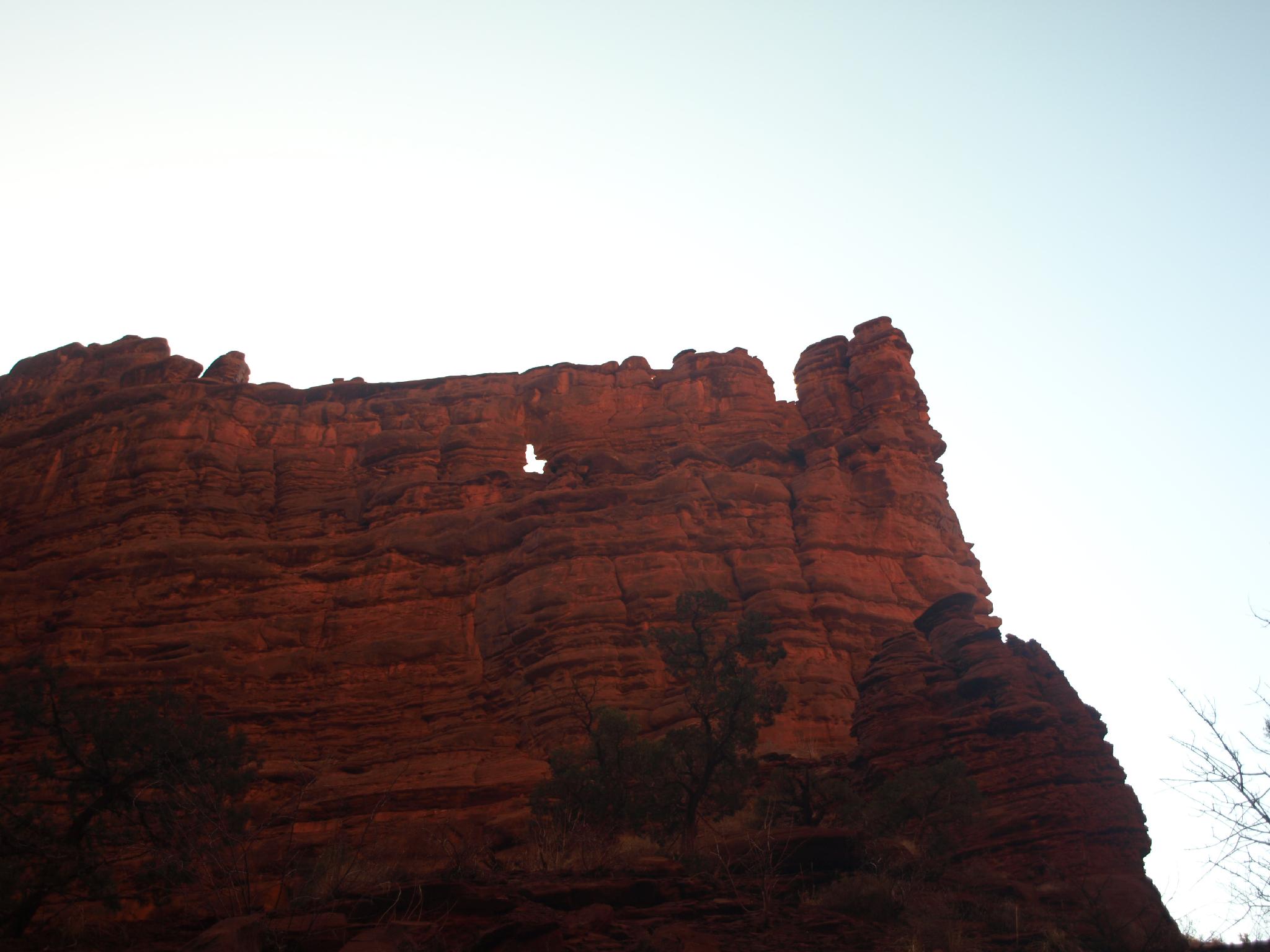
Arch up the north fork
With a name like Onion Creek, this has to be an amazing canyon, right?!?! Well, not as bad as the name may suggest, this is not a canyoneering adventure I am very likely to recommend. The route meanders from Onion Creek up one of several drainages to the edges of Fisher Towers, then either returns the same way or via a different canyon. A few minor obstacles are encountered en route.
The route is not very technical, and most of it can be visited without technical gear, making it a good beginner trip or one for non-technical hikers. Onion Creek is pretty, as is the bench at the edge of Fisher Towers, however I would recommend the other canyons in Moab before this one as a canyoneering trip. Hikers will be best served exploring around Fisher Towers proper before visiting Onion Creek.
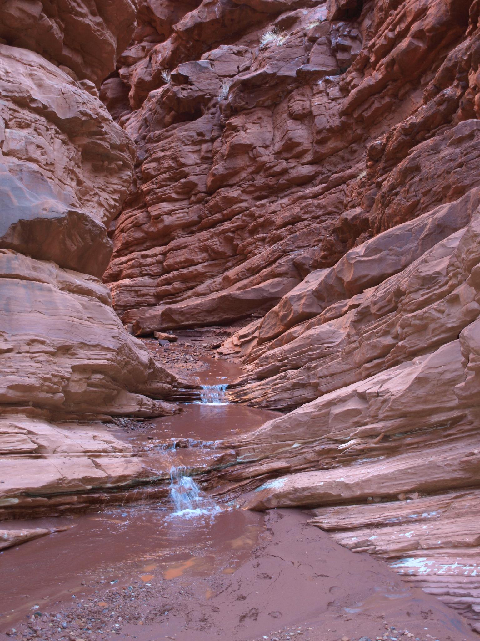
Narrows in the hike.
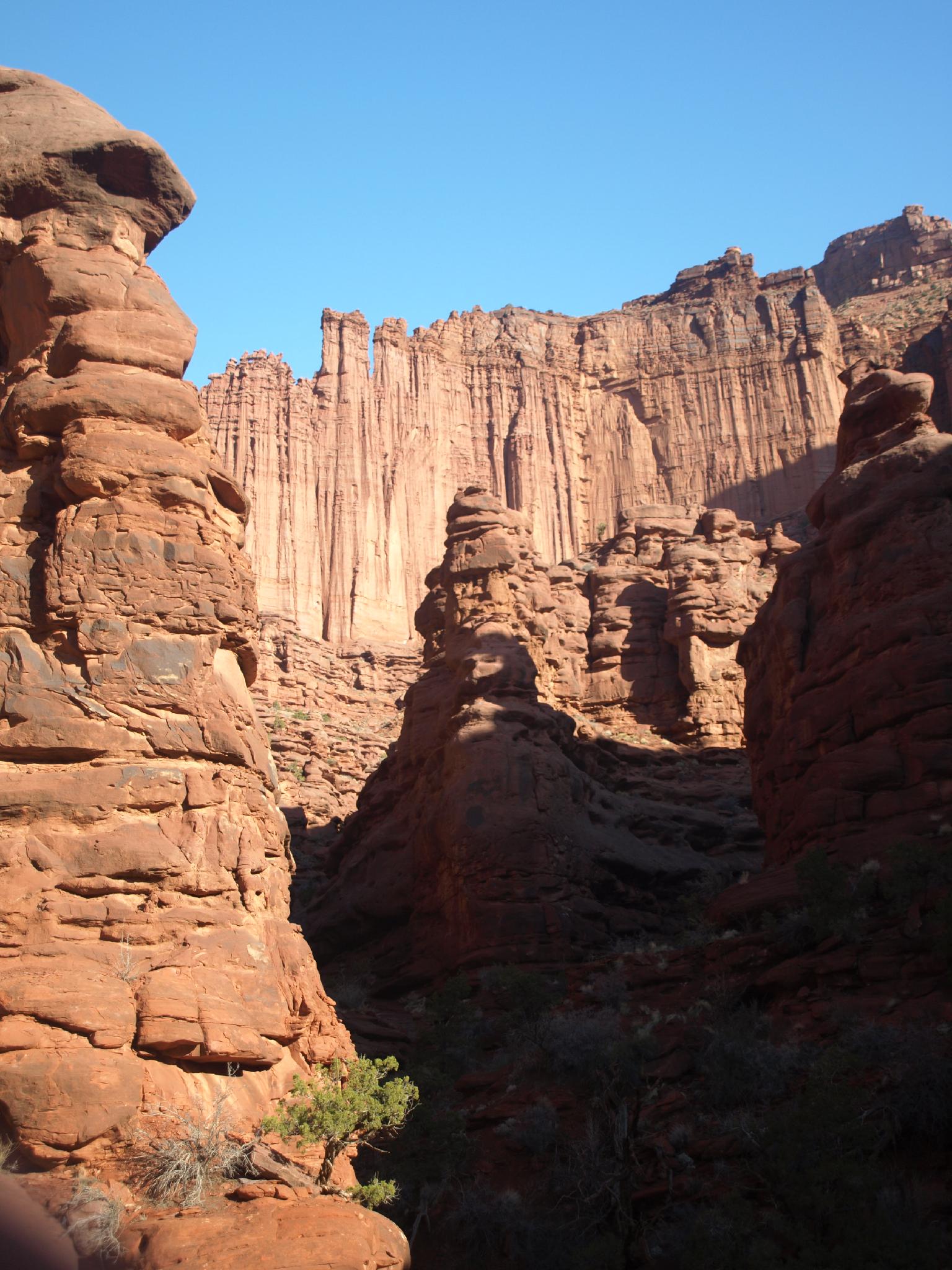
Views heading up the North Fork
Getting There
Go north out of Moab on Highway 191 to Highway 128. This is about 2 miles north of Moab, just before crossing the Colorado River. Go about 20 miles on Highway 128 to just past mile post 20, where the signed Onion Creek Road goes off on the right.
Follow the Onion Creek Road as it crosses the creek several times. 3.9 miles from the highway, after going through some narrows, a small pullout on the right is the trailhead. There are a few campsites on the way in, however they are often full in busy seasons.
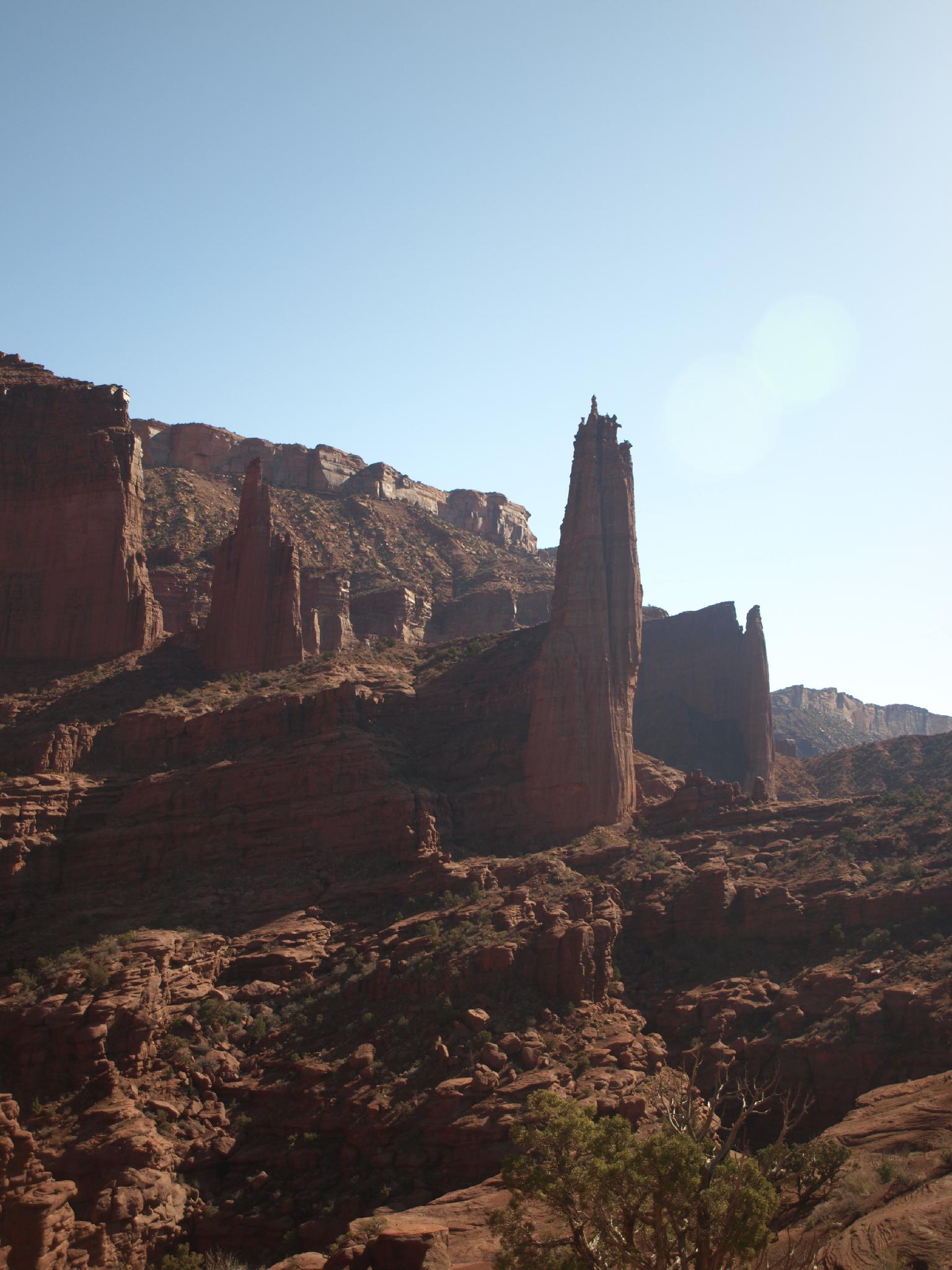
Views from the bench lands above the North Fork/Middle Forks
Route
To The North Fork (20-30 minutes)
From the trailhead, head up the obvious and major drainage coming in from north. The canyon is open and fairly wide. Wander up it for about 20-30 minutes to the junction with the north fork.
The North Fork allows fairly easy passage to the bench lands above. A few small obstacles present themselves, but as the canyon opens, there are many exits on both the right and left. If exiting on the left, you can join up with the Fisher Towers trail not far to the west.
To the Middle/East Junction (20-30 Minutes)
To Reach the Middle/East forks, continue right, up the main drainage for another 20-30 minutes. You can't make it far up the Middle Fork before being stopped at a dryfall.
East Fork (30+ minutes)
Up the East Fork from the Middle/East junction is the best section in my opinion. The canyon is deep, and quite pretty. Not far up the East Fork is a low angle slab that is generally seeping and slippery. This is an approach/descent route for climbers accessing several of the Fisher Towers above the canyon, and you are likely to find a fixed rope in place. This is a good place to turn around, but if you make it up the dryfall, a more difficult boulder blocks the way up canyon shortly.
Return the same way.
Once in the Middle Fork, go down canyon to the one rappel at a dryfall just before the confluence with the East Fork.
Photos
Maps

| Trailhead |
12S 647496mE 4285562mN N38° 42' 23" W109° 18' 13" |
| North Fork |
12S 648321mE 4285983mN N38° 42' 36" W109° 17' 39" |
| Middle-East Junction |
12S 648888mE 4286499mN N38° 42' 53" W109° 17' 15" |