 Canyoneering Lost Angel Canyon
Angel Point
Overview
|
Thu 73 | 49 |
Fri 67 | 47 |
Sat 63 | 42 |
Sun 70 | 41 |
Mon 78 | 42 |
| View Full Weather Details | ||||
|
Thu 73 | 49 |
Fri 67 | 47 |
Sat 63 | 42 |
Sun 70 | 41 |
Mon 78 | 42 |
| View Full Weather Details | ||||
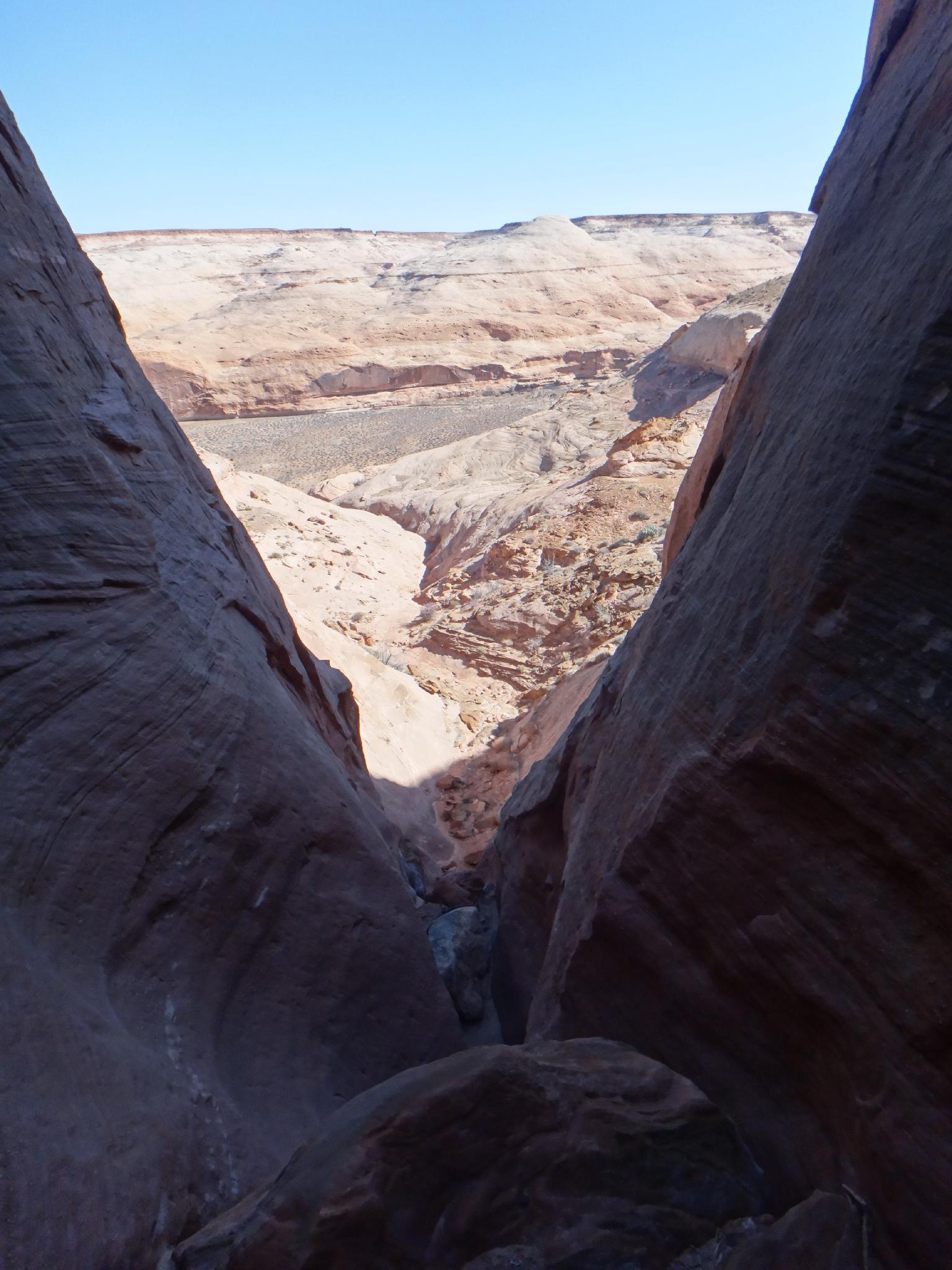
Final shallow section
Of the two neighboring canyons, Lost Angel and Fallen Angel, I would have to pick Lost Angel as my favorite. Short, open, and with very little water holding capacity, this makes a great cooler season adventure. We did it right after heavy rains and snows and still kept our feet dry. The canyon has a half dozen rappels, most with straightforward anchors, but good anchor skills are still recommended. Reaching the head of the canyon is the trickiest part, bring a GPS or good navigation skills. You'll spend far more time on the approach and exit than in the actual slot, making this a poor choice for people looking for an action packed canyon day. The canyon showed very few signs of descent, and is likely not visited very often.
Note: It is tempting to think it would be shorter/easier to approach and exit the canyon from Lower Sand Slide, which is just up stream from the canyon. Don't be tempted! Diane and I took that option and ended up breaking through ice, and trudging through thigh deep quick sand crossing the Dirty Devil a couple of times. Makes a great story, but probably not an experience I would likely recommend.
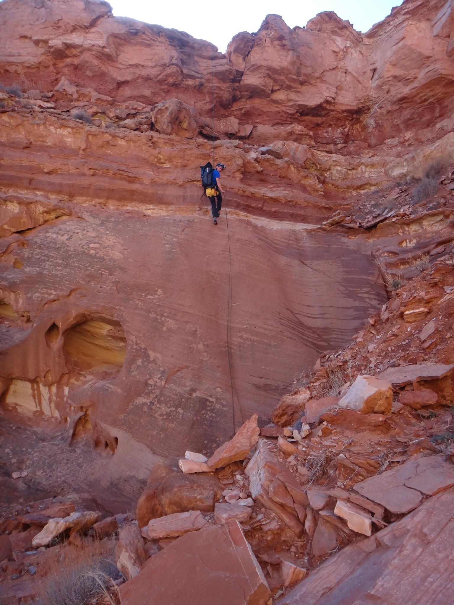
First Rappel in Lost Angel Canyon
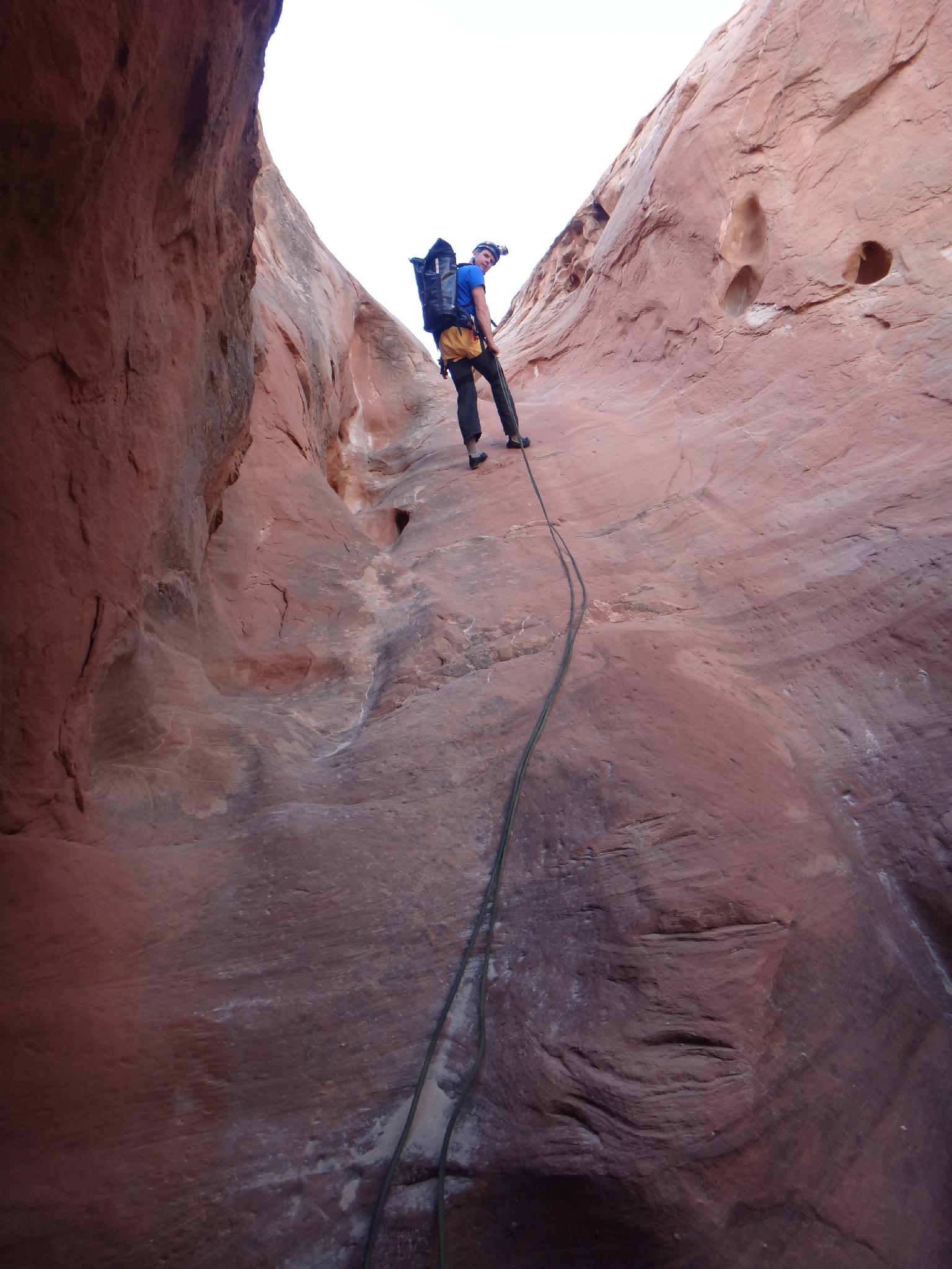
Third Rappel in Lost Angel Canyon
Getting There
Go south out of Hanksville on Highway 95 toward Hite for 10 miles. Just after mile marker 10, on the left (east) side of the road is a dirt road signed Angel Point. Stay on the main road unless directions indicate otherwise.
- Reset your odometer as you leave the highway. ( 12S 530825mE 4232063mN / N38° 14' 10" W110° 38' 52" )
- 1.7 miles - Stay Left ( 12S 533182mE 4232015mN / N38° 14' 08" W110° 37' 15" )
- 2.5 miles - Left ( 12S 534105mE 4232786mN / N38° 14' 33" W110° 36' 37" )
- 3.4 miles - Left ( 12S 535181mE 4233830mN / N38° 15' 06" W110° 35' 52" )
- 8.5 miles - Signed Angel Point Road, stay left on the main road ( 12S 539084mE 4240141mN / N38° 18' 31" W110° 33' 11" )
- 8.8 miles - Right on a smaller side road (First road after Angel Point Road) ( 12S 539212mE 4240666mN / N38° 18' 48" W110° 33' 05" )
- 9.1 miles - Small camping area on the left. This is the trailhead. The road beyond is very faded. ( 12S 539588mE 4241078mN / N38° 19' 01" W110° 32' 50" )
Opening toward the Dirty Devil.
Diane pondering the choices she made to end up thigh deep in the ice cold Dirty Devil.
Route
Approach (20-30 minutes)
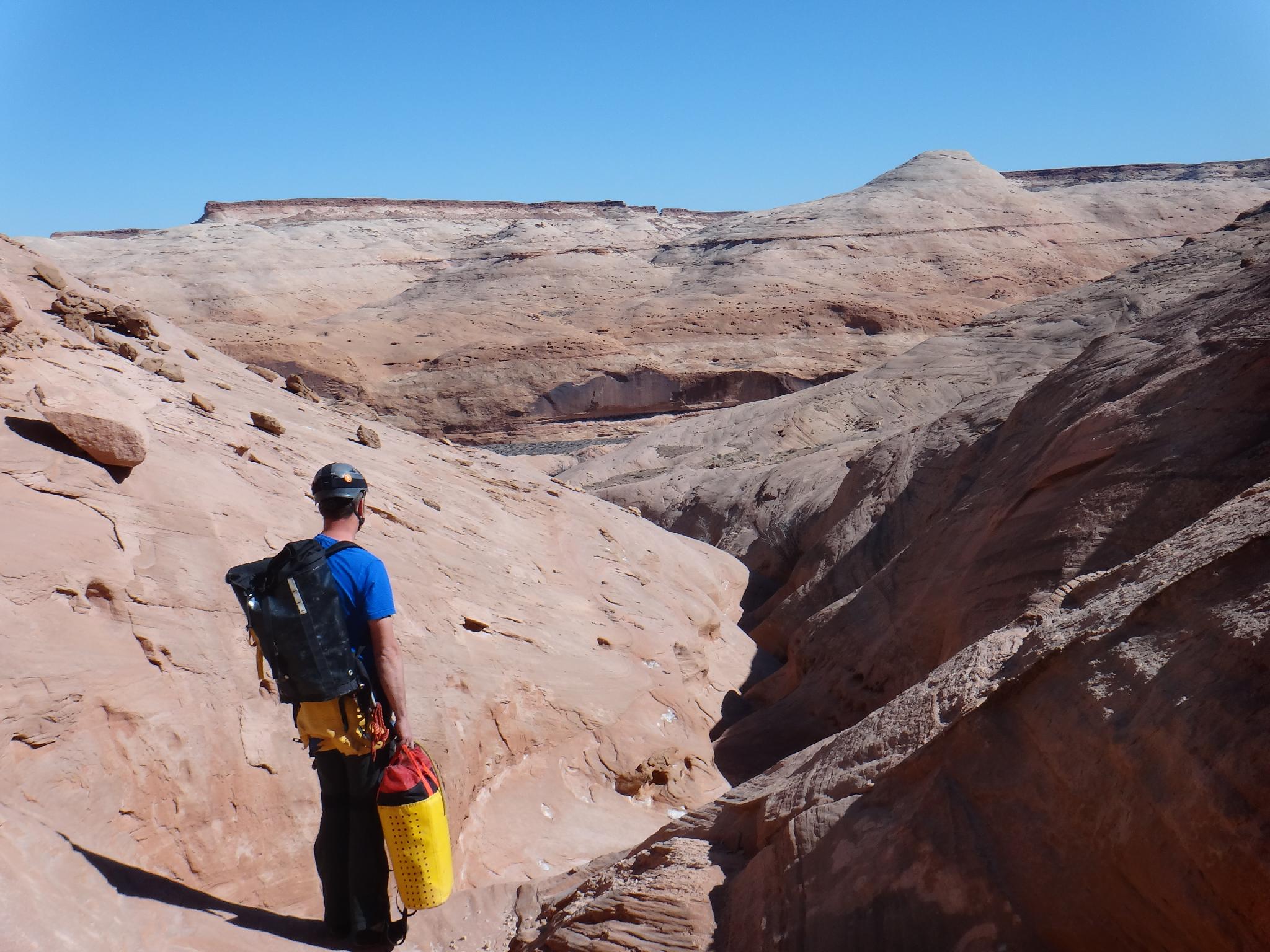
From the trailhead, follow the well worn trail down to Angel Cove Slot. From the bottom of Angel Cove, head due north up to the sage brush plains. You may encounter an old road here. Continue north, passing the upper reaches of Fallen Angel Canyon and staying on the sage brush flats until a wash clearly heads north. Drop into the wash and head down canyon.
It is easy going to where the wash cuts into sandstone at the head of the canyon proper.
Canyon
Rappel 1 - The canyon starts with a 23 m ( 76 ft. ) rappel. Most are using a tree for this rappel, evaluate it closely.
Rappel 2 - 1 minute down canyon is a second, short 6 m ( 20 ft. ) drop that can be down climbed or rappelled.
Rappel 3 - 3 minutes further down canyon, the canyon slots up a bit and drops about 10 m ( 33 ft. ).
Rappel 4 - 1 minute down canyon from the 10 m ( 33 ft. ) drop is a 2 stage 22 m ( 73 ft. ) rappel. Be sure to rappel both stages before pulling the ropes, and make sure to check the pull. The canyon opens here.
Rappel 5 - A short (6 m ( 20 ft. )) drop is encountered immediately that can be rappelled or down climbed on the left (looking down canyon) by the slab climbing skilled.
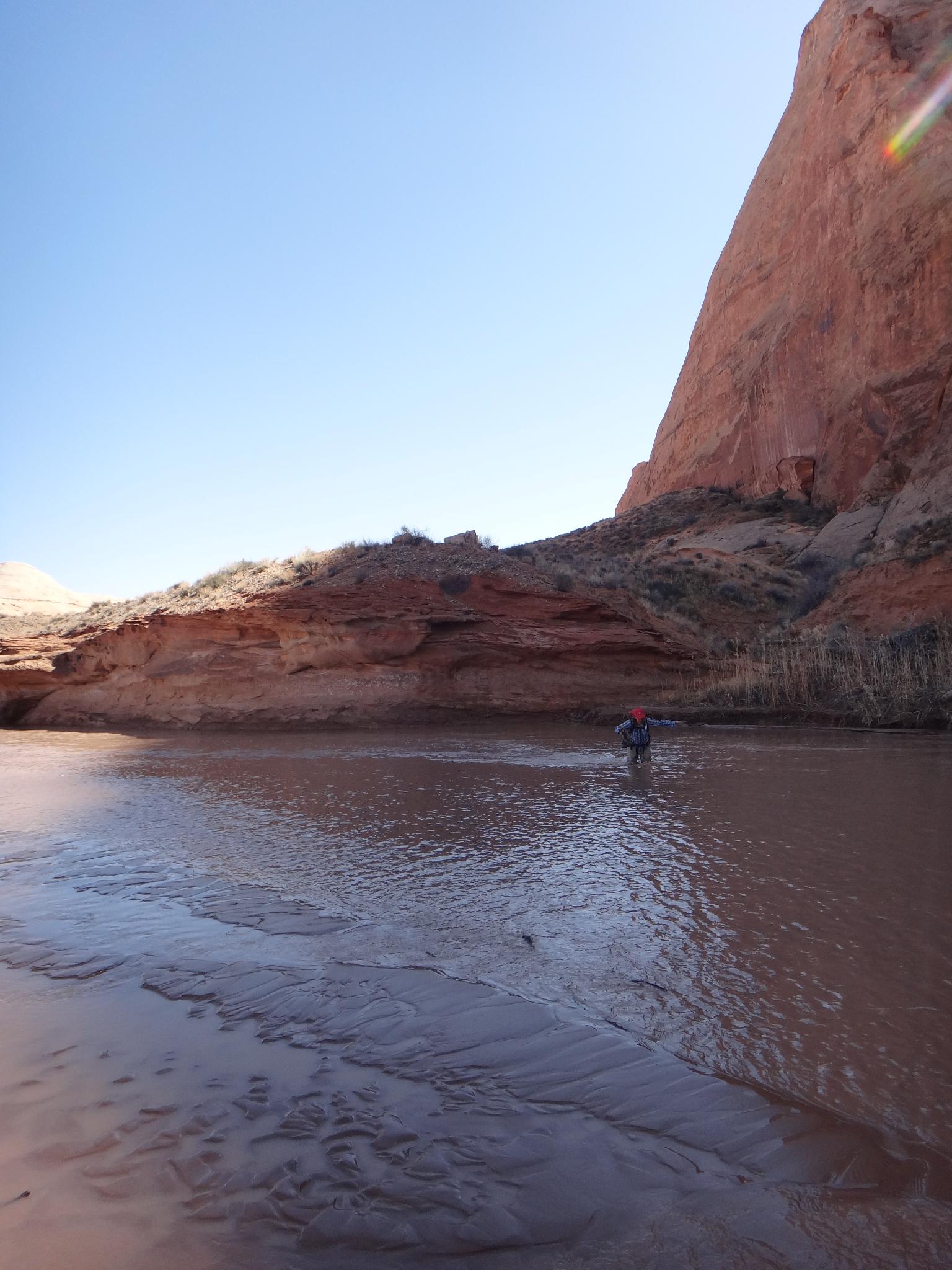
Ah, the canyon has one final short, shallow section. Keep an eye out on the right skyline as you near the final rappel for an arch. It is hard to photograph.
Rappel 6 - The final rappel into the Dirty Devil seems to generally be done as a 60 m ( 197 ft. ) rappel from the top of the final couple of potholes, though you could also build a deadman in one of the lower potholes to shorten the rappel. Regardless, make sure there is a good pull before the last man comes down, this drop can create a lot of friction if the ropes aren't setup correctly. Walk down canyon from the drop to make the pull easier and minimize grooves.
Exit
From the bottom of the final rappel, it is a short walk down to the Dirty Devil River. Follow the Dirt Devil down stream, passing Fallen Angel Canyon shortly where it comes in on the right. Follow an emerging trail downstream. It stays near the cliff base. As you pass under the tallest cliff (this has been B.A.S.E. jumped), look for a pictograph and petroglyph panel. The pictograph panel is first, and on the downstream side of the cliff in an arch type feature near the ground. The petroglyph panel is just past this on the same wall.
Continuing on, you may spot another small petroglyph panel just after Angel Slot comes in on the right. This is an important land mark, the exit route leaves the Dirty Devil just after Angel Cove Slot. Go downstream a short distance (5 minutes) until you can climb out on the right up a level and to a small wash.
The trail splits. The easiest path (left fork) is to go up the wash, to where it is possible to climb out on the right up the first section of slickrock. (Class 3 with a move or two or 4-). The right fork climbs a small slab (easy fifth class) up a level directly, then traverses south to rejoin the wash at its head where the steep slickrock begins.
Up the first section of slickrock, notice the large overhang on the skyline. The goal is to get to the base of it. The easiest way is to traverse right to the ridge, then follow the slickrock ridge line up. There is a 4th class move or two to get onto the ridge, then it is class 3 if you find the path of least resistance. Once below the large overhang/cave, traverse right 1-2 minutes until you can find a way up the slickrock. The final red cliff band is 2 m ( 7 ft. ) tall, and is easier than it looks to surmount. (Class 4)
Once on the mesa, follow the rim of the south fork to its head, then go north / northwest back to the trailhead.
Photos
Maps

| Trailhead |
12S 539591mE 4241070mN N38° 19' 01" W110° 32' 50" |
| Rappel 1 - Lost Angel |
12S 539932mE 4242320mN N38° 19' 41" W110° 32' 35" |
| Panels |
12S 540463mE 4241283mN N38° 19' 08" W110° 32' 14" |
| Petroglyph |
12S 540709mE 4241126mN N38° 19' 02" W110° 32' 04" |
| Exit |
12S 540380mE 4240938mN N38° 18' 56" W110° 32' 17" |