 Hiking Ding and Dang Canyons
San Rafael Swell
Overview
|
Sat 73 | 49 |
Sun 77 | 49 |
Mon 79 | 53 |
Tue 78 | 52 |
Wed 75 | 52 |
| View Full Weather Details | ||||
|
Sat 73 | 49 |
Sun 77 | 49 |
Mon 79 | 53 |
Tue 78 | 52 |
Wed 75 | 52 |
| View Full Weather Details | ||||
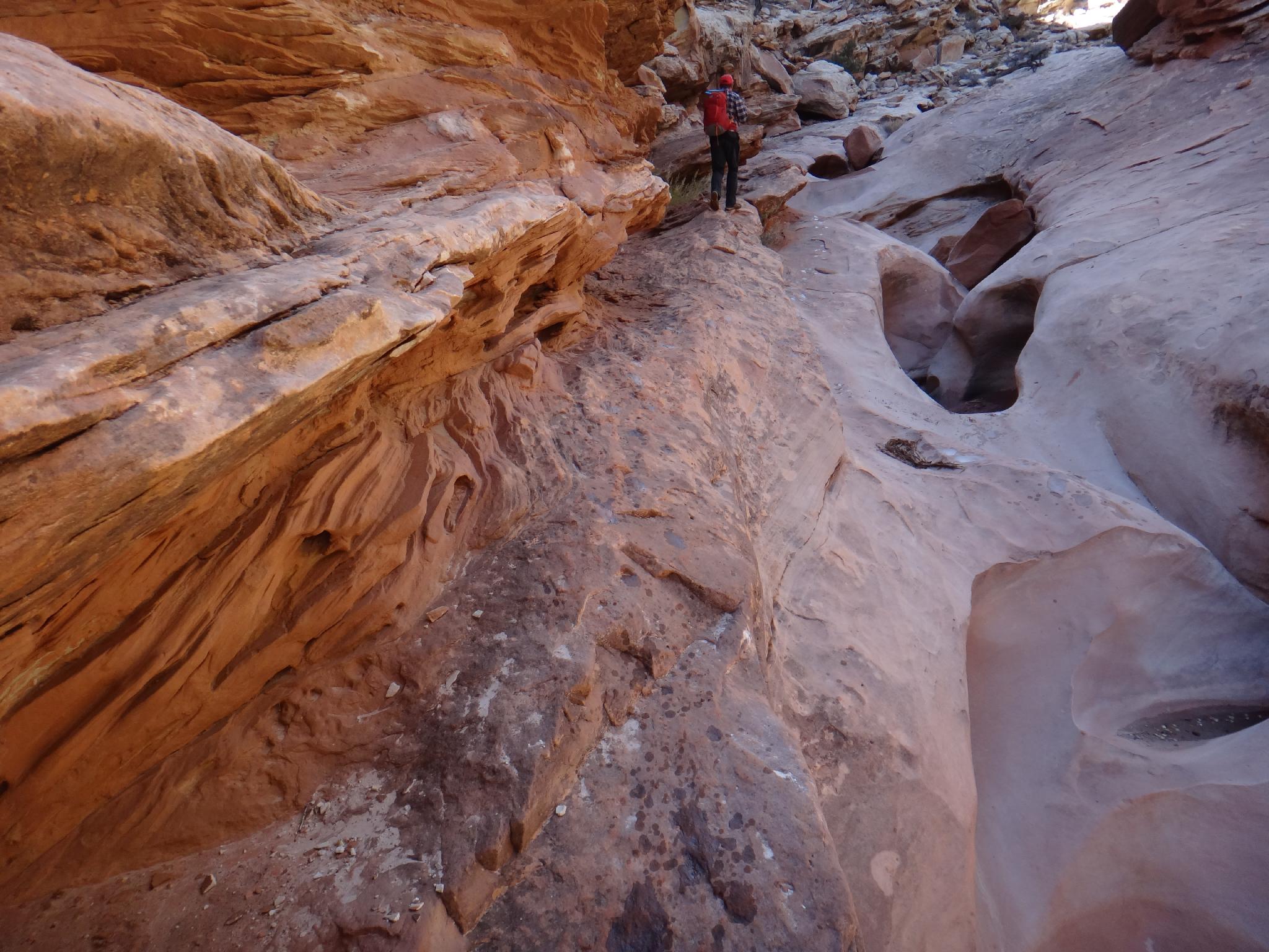
Diane working up Ding
Ding and Dang canyons, neighbors to the extremely popular Bell and Little Wild Horse canyons are less traveled, but still a great hike with beautiful scenery. Ascending Ding is an easy romp while descending Dang provides a few obstacles and a little bit of spice. If in the area, this is a hike not to miss. Although possible to bring dogs along for the Ding portion of the hike, getting them down Dang can be more difficult. Don't attempt Dang with dogs unless you have a harness for them and the knowledge of how to lower them down the many drops safely.
Ding Canyon
Dang Canyon
Getting There
Reach the trailhead by going west from Green River Utah on I-70 to the junction with highway 24 that goes to Hanksville. Go toward Hanksville for about 25 miles to Mile Post 135.
- A paved road goes off to the west signed Goblin Valley. ( 12S 537737mE 4275878mN / N38° 37' 50" W110° 33' 59" )
- Follow this paved road 5.1 miles to a junction. Go south (left) on the signed road toward Goblin Valley, resetting your odometer. ( 12S 530077mE 4278354mN / N38° 39' 12" W110° 39' 16" )
- Just before Goblin Valley, 6.0 miles, another junction occurs. Go right here, resetting your odometer once again. ( 12S 525266mE 4270703mN / N38° 35' 04" W110° 42' 36" )
- Follow the road 5.3 miles to the signed Little Wild Horse trailhead, it is now paved all the way to the trailhead. ( 12S 517180mE 4270494mN / N38° 34' 58" W110° 48' 10" )
- Continue past the Little Wild Horse trailhead another 1.2 miles on the now dirt road to where the road makes a left. This is the trailhead. ( 12S 515466mE 4269810mN / N38° 34' 36" W110° 49' 21" )
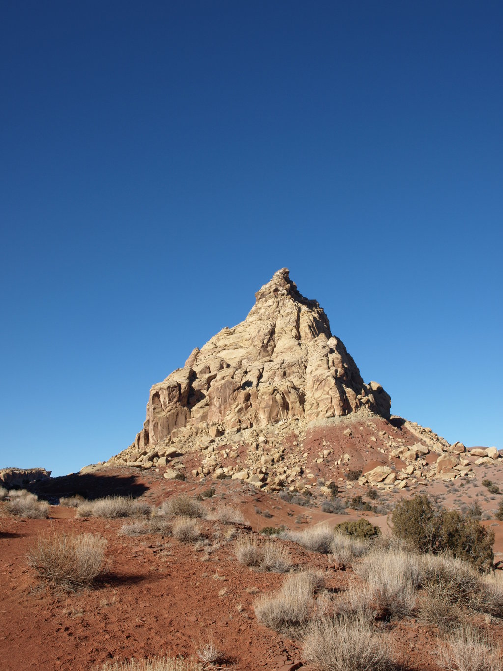
Ding Dang Dome
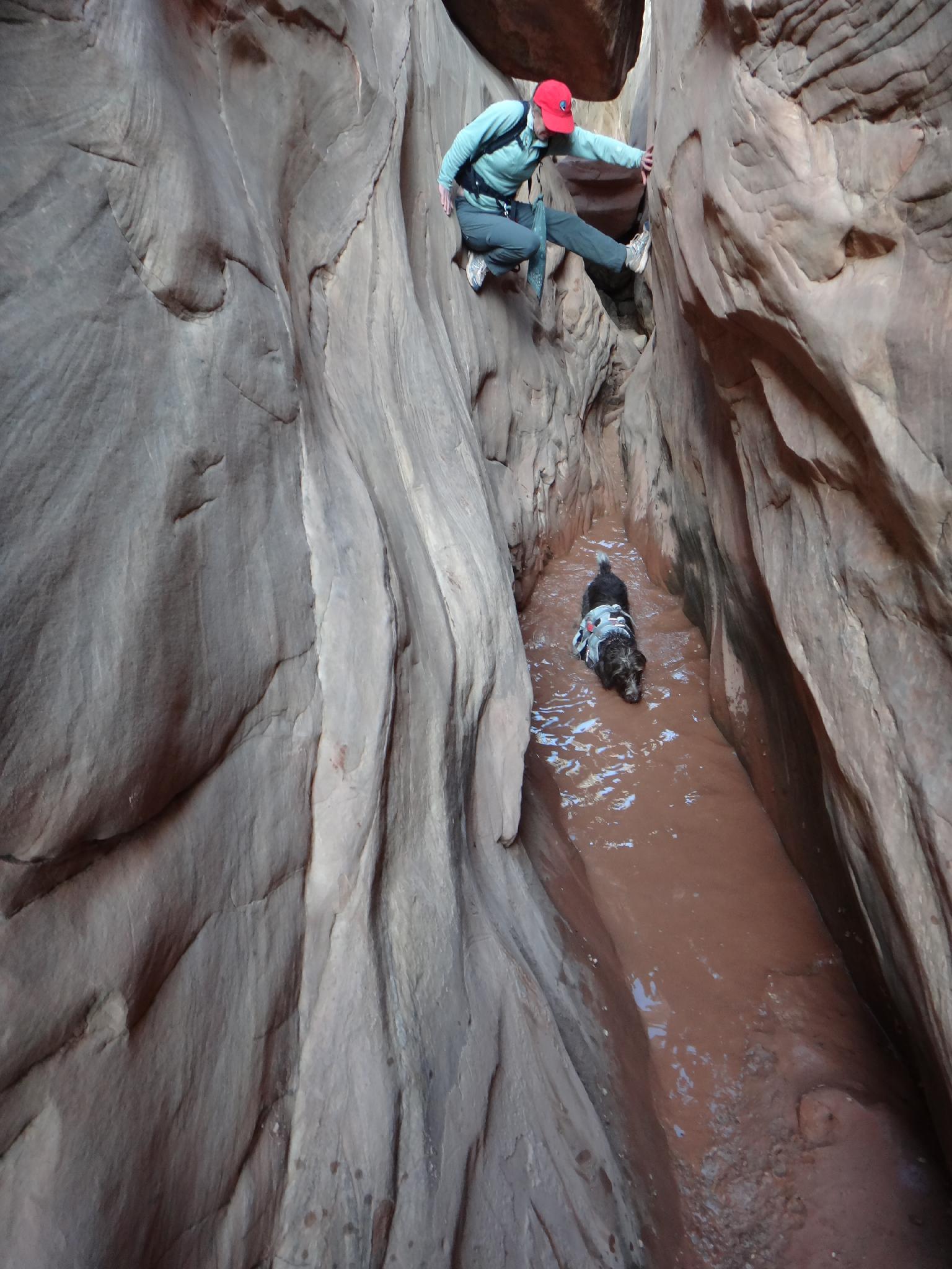
Wonderdog not affraid to get wet. Diane... maybe a little.
Route
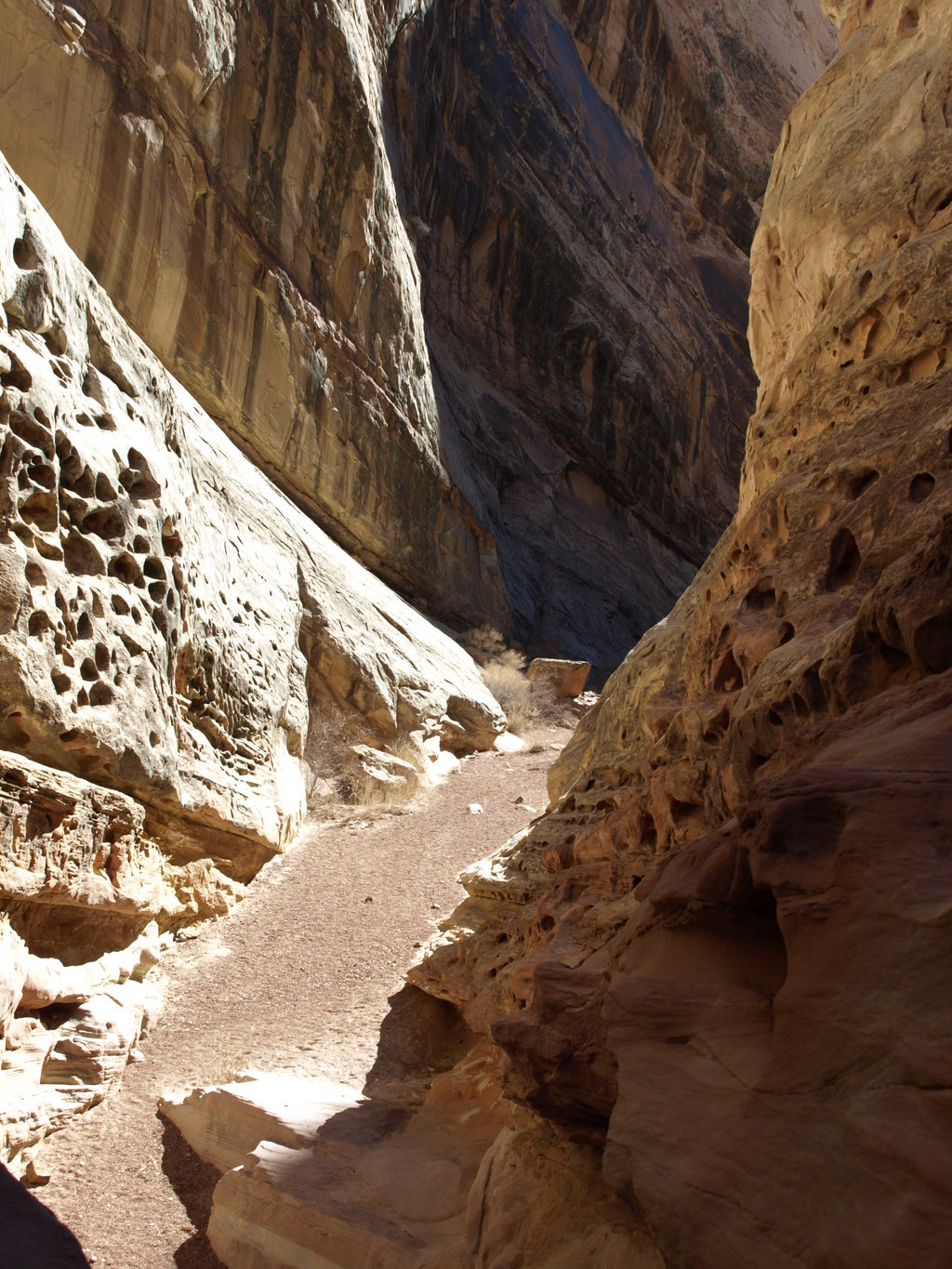
From the trailhead, follow the prominent wash. After about 20-30 minutes, it divides at a craggy point in equal portions. Go right, up Ding. In 5 minutes from the divide, there is a slickrock slab that marks the start of Ding as it cuts through the reef. Ascend the slab, and follow the canyon as it meanders through the reef. The narrow section is short and followed by a long section of small potholes and dryfalls. Most of the dryfalls are bypassed on the right, and none should be difficult (more than class 3).
Soon the canyon opens dramatically as it exits the back of the reef, and Ding Dang Dome is prominently visible. Follow an emerging trail to an old mining road on the left, between the reef and Ding Dang Dome. This drops you into the top of Dang Canyon. (10 minutes between Ding and Dang)
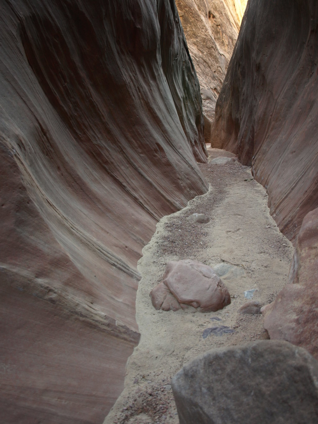
Head down Dang Canyon. A few small challenges present themselves early on, but none are difficult. As the canyon deepens and narrows, however, you will reach a dryfall that can be passed on the right using ledges (somewhat exposed). If needed, a bolt exists to tie a handline to in order the descend the dryfall directly. This is not as difficult as it looks, due to some ledges.
Just below the dryfall the canyon slots up and begins its final journey through the reef. Several chockstones in this section provide small challenges. The most difficult of these is about 2.5 m tall. A little teamwork will easily defeat it. Some rate these obstacles as hard as 5.7 in climbing terms, but none are anywhere near that difficult. A team of two or three with a short rope should be able to defeat these easily. The canyon quickly opens, and you will find yourself back in a wide wash. Follow this wash left as it meanders it's way back to the mouth of Ding Canyon in 15 minutes or so. From there, retrace your steps along the wash back to your car.
Photos
Maps

| Trailhead |
12S 515465mE 4269810mN N38° 34' 36" W110° 49' 21" |
| D-D Junction |
12S 514306mE 4270206mN N38° 34' 49" W110° 50' 09" |
| Ding Top |
12S 513577mE 4272110mN N38° 35' 51" W110° 50' 39" |
| Dang Top |
12S 512848mE 4271972mN N38° 35' 46" W110° 51' 09" |
| Ding Dang Dome |
12S 512896mE 4272280mN N38° 35' 56" W110° 51' 07" |