 Roadside Attraction Dutchman Arch - Locomotive Point
San Rafael Swell
Overview
|
Sat 65 | 44 |
Sun 69 | 44 |
Mon 70 | 49 |
Tue 69 | 46 |
Wed 68 | 47 |
| View Full Weather Details | ||||
|
Sat 65 | 44 |
Sun 69 | 44 |
Mon 70 | 49 |
Tue 69 | 46 |
Wed 68 | 47 |
| View Full Weather Details | ||||
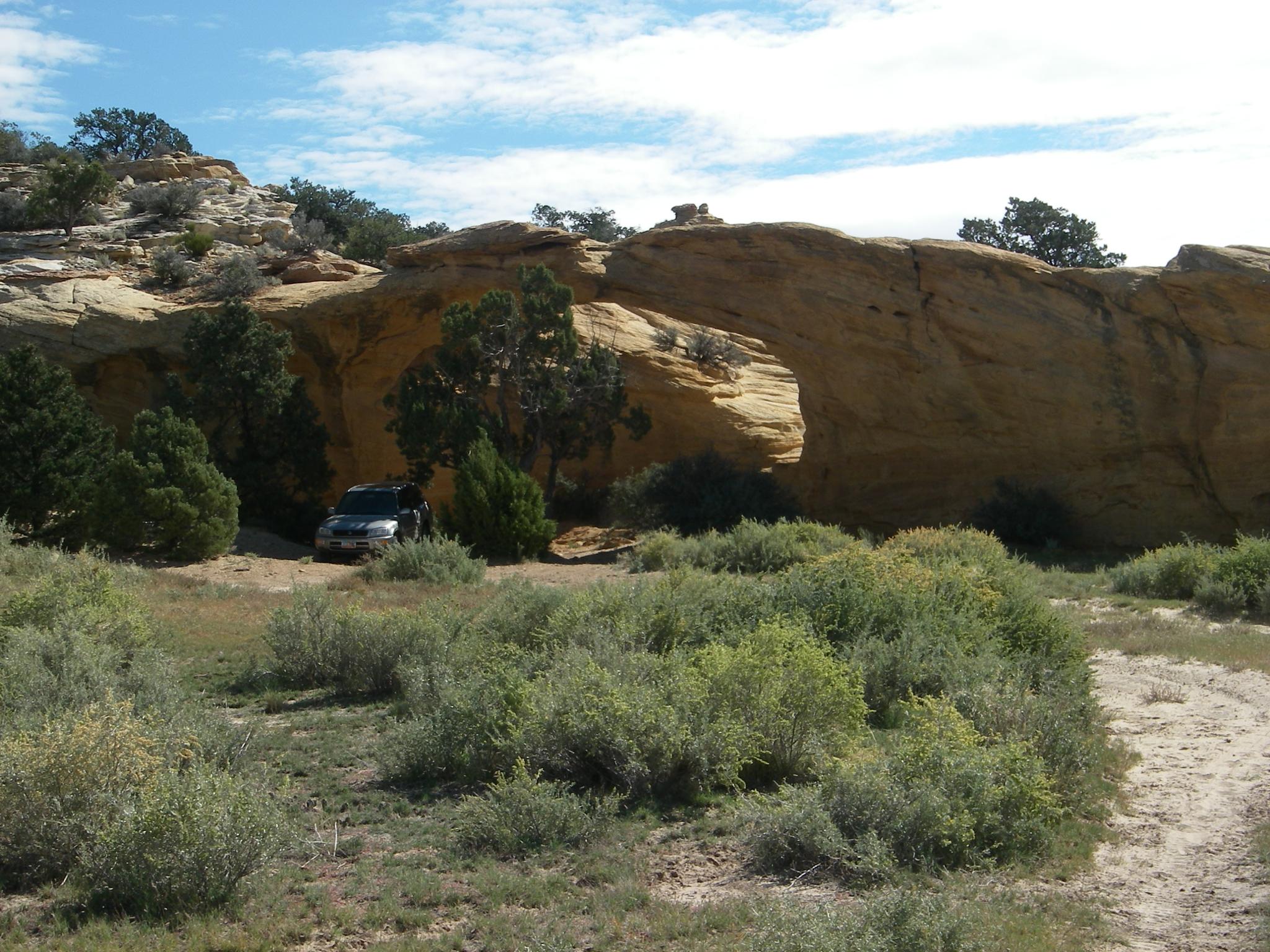
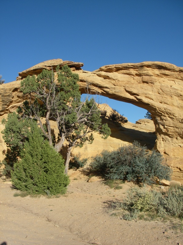
Dutchman Arch
Dutchman Arch is a small arch visible from I-70. It is easy to visit, and fun for kids.
Locomotive Point has a small, but very dark and defined pictograph panel. Due to their close proximities to I-70 and each other, this makes a great side trip while passing by.
Dutchman Arch
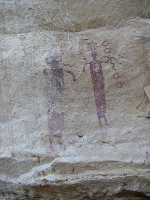
Locomotive Point Pictograph Panel 2
Getting There
Take exit 131 from I-70 (about 30 miles west of Green River). Go south off the freeway.
- Reset your odometer on the south side of the freeway. ( 12S 529655mE 4303563mN / N38° 52' 50" W110° 39' 29" )
- 3.8 miles from the freeway you will find a signed junction for Head of Sinbad. Go right at this junction toward Head of Sinbad. ( 12S 525540mE 4299475mN / N38° 50' 37" W110° 42' 20" )
- 1.0 miles past this junction a road comes in on the left, stay right. ( 12S 524095mE 4298719mN / N38° 50' 13" W110° 43' 21" )
- Stay on this main road for 3.4 more miles (4.4 from the first junction) to a signed junction to Dutchman Arch. ( 12S 519546mE 4301513mN / N38° 51' 44" W110° 46' 29" )
- Go right, crossing under the freeway in 0.5 miles. ( 12S 519168mE 4302140mN / N38° 52' 04" W110° 46' 45" )
- After crossing under the freeway, the area is a maze of roads. Below is the easiest way to get to each place.
- Dutchmans Arch
- After the freeway the road branches into several forks, you should go left on road #641, following the fence a short distance then turning north. 0.2 miles from the highway is a junction, go left and Dutchman Arch will be on your right in 0.5 miles. ( 12S 518799mE 4302532mN / N38° 52' 17" W110° 46' 60" )
- Locomotive Point
- After the freeway, go right, on road #644. 0.2 miles from the freeway, go right. ( 12S 519074mE 4302640mN / N38° 52' 21" W110° 46' 48" )
- 0.7 miles from the freeway, go left directly toward the cliff. ( 12S 519777mE 4303013mN / N38° 52' 33" W110° 46' 19" )
- The panel is at the end of this road, 1.1 miles total from the freeway, and is easy to locate behind a log fence. ( 12S 519851mE 4303547mN / N38° 52' 50" W110° 46' 16" )
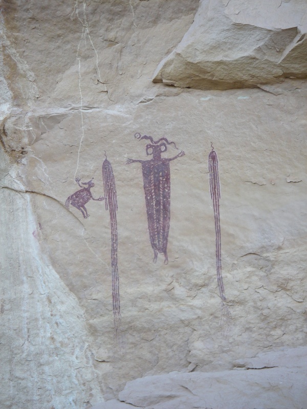
Locomotive Point Pictograph Panel
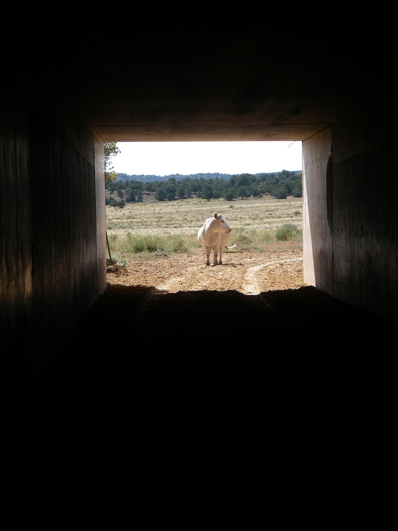
Traffic under the freeway!
Route
Rock art and historic sites are fragile, non-renewable cultural resources that, once damaged, can never be replaced. To ensure they are protected, please:
- Avoid Touching the Petroglyphs: Look and observe, BUT DO NOT TOUCH!
- Stay on the Trails: Stay on the most used trails when visiting sites, and don't create new trails or trample vegetation.
- Photography and Sketching is Allowed: Do not introduce any foreign substance to enhance the carved and pecked images for photographic or drawing purposes. Altering, defacing, or damaging the petroglyphs is against the law -- even if the damage is unintentional.
- Pets: Keep pets on a leash and clean up after them.
- Artifacts: If you happen to come across sherds (broken pottery) or lithics (flakes of stone tools), leave them where you see them. Once they are moved or removed, a piece of the past is forever lost.
Dutchman Arch
The arch is clearly visible right next to the road. You can drive right up to it.
Locomotive Point Panel
The panel is clearly marked as a fenced area. Enjoy the panels, they are impressive.
Photos
Maps

| Freeway Underpass |
12S 519148mE 4302190mN N38° 52' 06" W110° 46' 45" |
| Duchmans Arch |
12S 518406mE 4302632mN N38° 52' 20" W110° 47' 16" |
| Petroglyphs |
12S 519850mE 4303547mN N38° 52' 50" W110° 46' 16" |