 Hiking Salt Wash
Western Swell
Overview
|
Sat 71 | 43 |
Sun 76 | 42 |
Mon 76 | 47 |
Tue 76 | 47 |
Wed 75 | 47 |
| View Full Weather Details | ||||
|
Sat 71 | 43 |
Sun 76 | 42 |
Mon 76 | 47 |
Tue 76 | 47 |
Wed 75 | 47 |
| View Full Weather Details | ||||
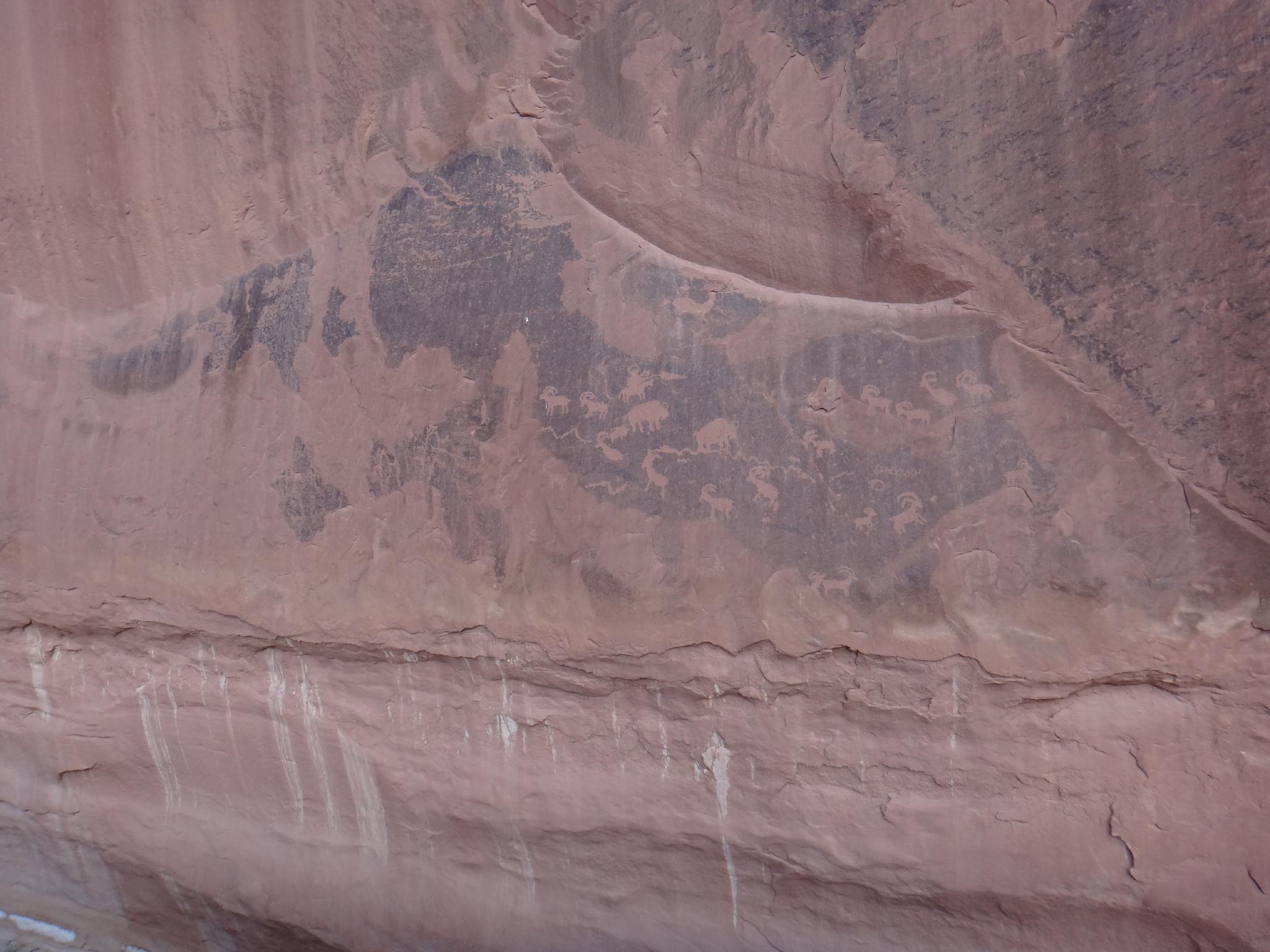
Panel near the Rincon
Tucked on the western edge of the San Rafael Swell, Salt Wash offers easy access with big views, deep canyons, and many petroglyphs to visit along the way. Given all there is to see and do, I am surprised this is as seldom visited as it is, and highly recommend it. The area seems to see a fair bit of horse traffic, but very little foot traffic.
A full out-and-back from the trailhead to the San Rafael River makes for a nice moderate/long dayhike. The best parts, however, are early on in the hike, so shorter out-and-back options are available for the less ambitious. Visiting just the first panel or two would make a great family friendly hike. Salt Wash has perennial water, making this a good dog friendly hike. Beware, bugs can be an issue in the spring.
There is decent primitive camping at the trailhead. For bigger views, continue about 0.5 miles past the trailhead for a few small sites right on the rim of Salt Wash that offer great views and ok primitive camping.
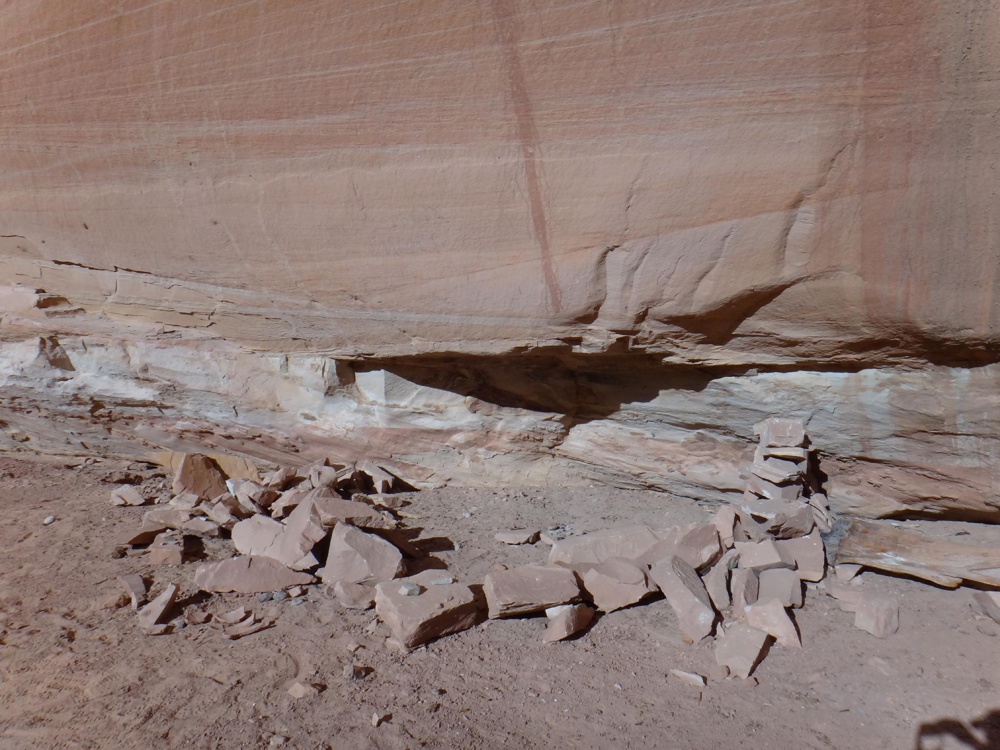
Ruin under the overhang.
Getting There
From Ferron, UT, head east on 100 S (Molen Road). This is across the road from the Millsite Recreation Sign. Reset your odometer as you turn off main street and onto 100 S.
- 3.0 - 4 way junction. Go right, toward Dutch Flat Desert.
- 3.3 - Road turns to dirt.
- 4.3 - Stay straight on main road through 4 way junction. The road begins heading east.
- 5.6 - Stay straight (don't take the lesser right)
- 15.1 - Junction with a kiosk and large parking area.
Reset your odometer here as you go LEFT (north). The road gets rougher from here. - 1.6 - Junction, go right.
- 4.0 - Road passes near a fence.
- 4.4 - Cattle guard
- 4.7 - Log fence.
- 5.3 - Second log fence, this is the trailhead with decent primitive camping at the trailhead.
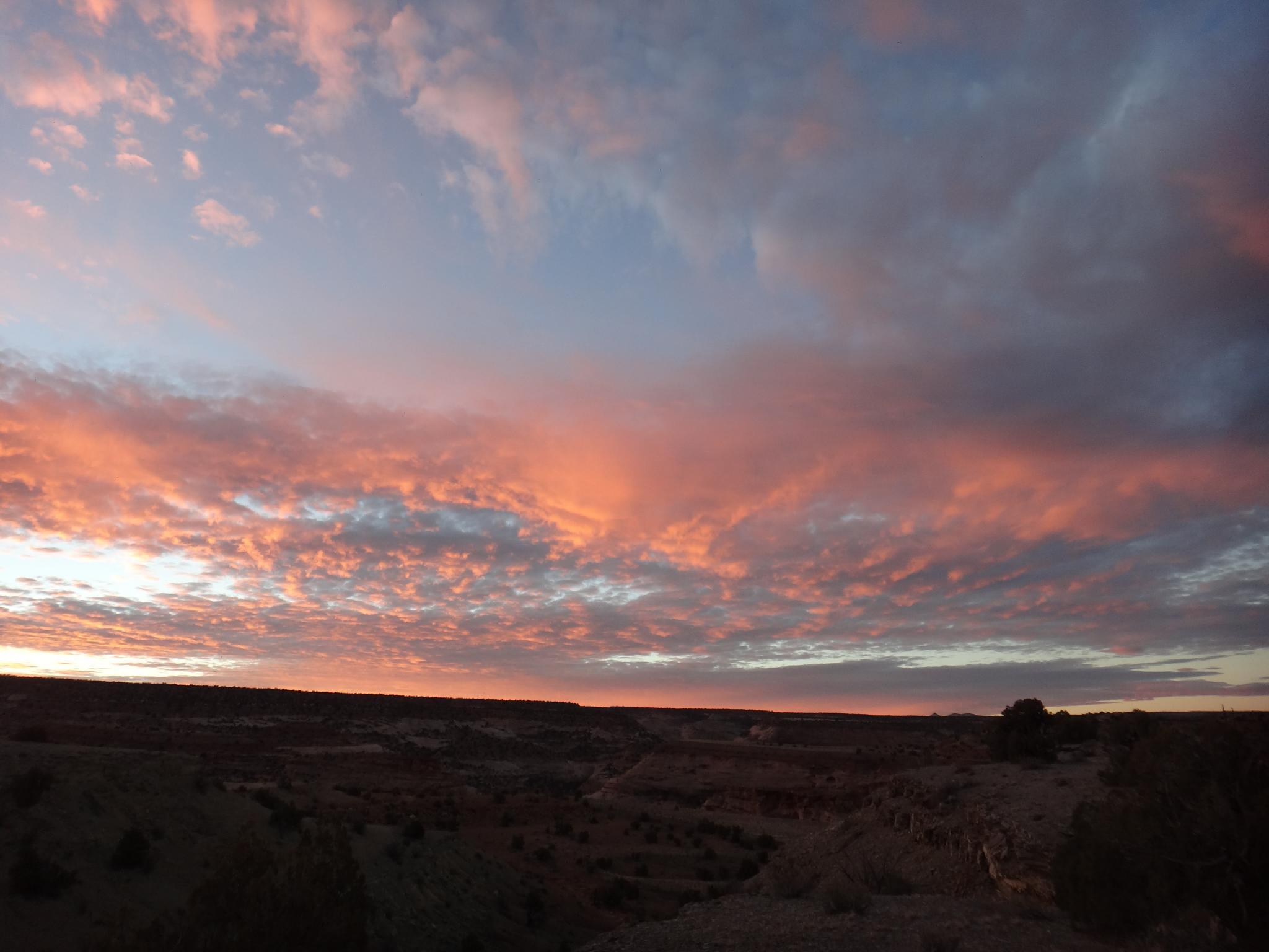
Sunrise over Salt Wash
Route
Rock art and historic sites are fragile, non-renewable cultural resources that, once damaged, can never be replaced. To ensure they are protected, please:
- Avoid Touching the Petroglyphs: Look and observe, BUT DO NOT TOUCH!
- Stay on the Trails: Stay on the most used trails when visiting sites, and don't create new trails or trample vegetation.
- Photography and Sketching is Allowed: Do not introduce any foreign substance to enhance the carved and pecked images for photographic or drawing purposes. Altering, defacing, or damaging the petroglyphs is against the law -- even if the damage is unintentional.
- Pets: Keep pets on a leash and clean up after them.
- Artifacts: If you happen to come across sherds (broken pottery) or lithics (flakes of stone tools), leave them where you see them. Once they are moved or removed, a piece of the past is forever lost.
From the log fence, follow the old road down toward Salt Wash. It enters a wash. Follow the wash, but keep an eye out for where it leaves the wash as the wash makes a right hand turn. If you go to far, you will reach a dryfall into Salt Wash, retrace back a couple of minutes. Two minutes after the road leaves the wash, it ends at an old camping area. Look for a cairn on the point that marks the trail down to Salt Wash. It reaches Salt Wash exactly across from Saddle Horse Canyon.
Hike down Salt Wash. Keep an eye out on the left where the canyon makes a bend to the right and the slickrock cliff comes to the wash bank. There area a couple of good petroglyph panels on the west side. They are visible from Salt Wash, but also worth the short side trip to view them close up.
Continuing down Salt Wash, the canyon makes a left and bend and a large rincon comes into view on the left side of the wash. There is a very good panel on the cliff wall north of the rincon (downstream side). Follow Salt Wash until past the rincon, then hike across the flat plain to the north wall. A wash separates the plain from the panel. This panel is fairly new because it depicts a rider on a horse. It is also the only panel I have seen that has a buffalo in it.
From the rincon, down Salt Wash a few minute is a fence. There is a petroglyph on the west wall just past the fence, though it looked suspiciously fake to me. About a mile down from the rincon is another panel on the left wall.
Continuing down, a seep on the left is a good land mark. Around the next bend is a overhang on the left with a sandy bench a bit above the bottom of Salt Wash. There appears to be a crude structure here, as well as a petroglyph on the left wall a few minutes down from the overhang. This marks the last petroglyphs I found, from here it is just a lovely amble to the San Rafael River. If you did the Sids Mountain hike, the next side canyon on the right is the overlook from the bottom that hike visits.
Return the same way.
Photos
Maps

| Trailhead |
12S 512532mE 4324166mN N39° 03' 59" W110° 51' 18" |
| Trail |
12S 513109mE 4323535mN N39° 03' 39" W110° 50' 55" |
| Panel |
12S 513200mE 4323889mN N39° 03' 50" W110° 50' 51" |
| Panel |
12S 513174mE 4324574mN N39° 04' 13" W110° 50' 52" |
| Panel |
12S 513303mE 4324563mN N39° 04' 12" W110° 50' 46" |
| Fence |
12S 515550mE 4326041mN N39° 05' 00" W110° 49' 13" |
| Pet |
12S 514647mE 4325186mN N39° 04' 32" W110° 49' 50" |
| Ruin |
12S 514537mE 4325151mN N39° 04' 31" W110° 49' 55" |
| Pet |
12S 514403mE 4324713mN N39° 04' 17" W110° 50' 01" |
| Pet |
12S 513671mE 4324751mN N39° 04' 18" W110° 50' 31" |
| River |
12S 516292mE 4326469mN N39° 05' 14" W110° 48' 42" |