 Hiking Sids Mountain
Western Swell
Overview
|
Fri 71 | 44 |
Sat 71 | 45 |
Sun 76 | 44 |
Mon 75 | 47 |
Tue 76 | 46 |
| View Full Weather Details | ||||
|
Fri 71 | 44 |
Sat 71 | 45 |
Sun 76 | 44 |
Mon 75 | 47 |
Tue 76 | 46 |
| View Full Weather Details | ||||
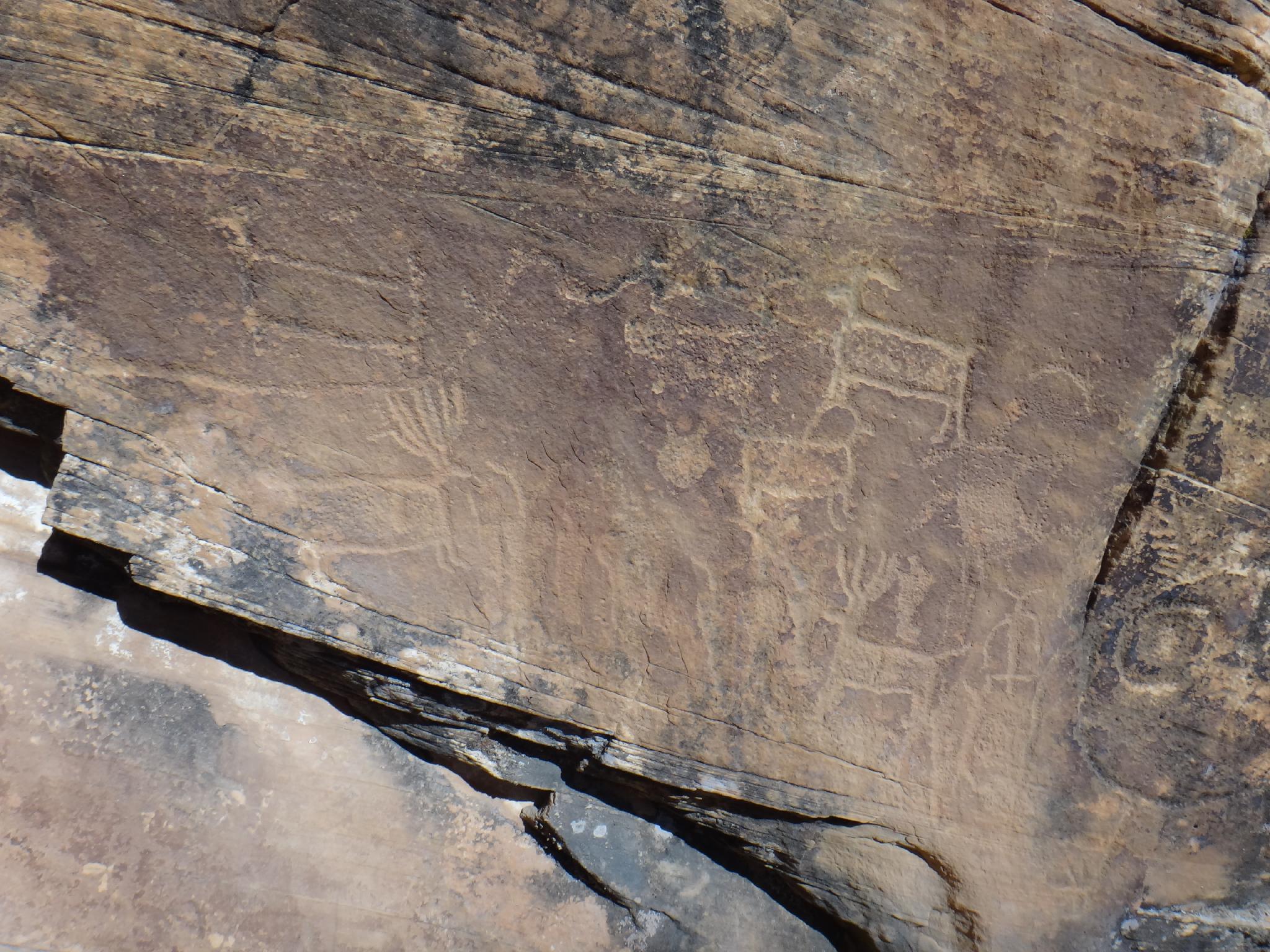
Petroglyphs near Sids Mountain
Sids Mountain is a magical place. The hike starts on an old horse trail, crosses Salt Wash, and winds its way up to an old homestead nestled among the domes of Sids Mountain. The cabin, built by the Kofford's in the 1930's as a homestead is still in fairly good shape and fascinating to visit. Those looking for a moderate day will call this the stopping point and return the same way. Doing this as an out and back hike makes for an excellent day hike and is highly recommended. (about 12 miles round trip)
Still have energy? There is much more to see while in the area, from the Kofford cabin, it is a short hike to Swazy point, the highest point on Sids mountain which offers big views of the area. From here, a loop hike can be made back to the trailhead, passing many petrgolyphs along the way. The full loop hike is about 16 miles, and only recommended for very strong hikers prepared for a long day. Backpacking is an option, though water will likely only be available after recent rains, and at a little over half way through the hike. I would recommend carrying all water needed in case the potholes have dried up.
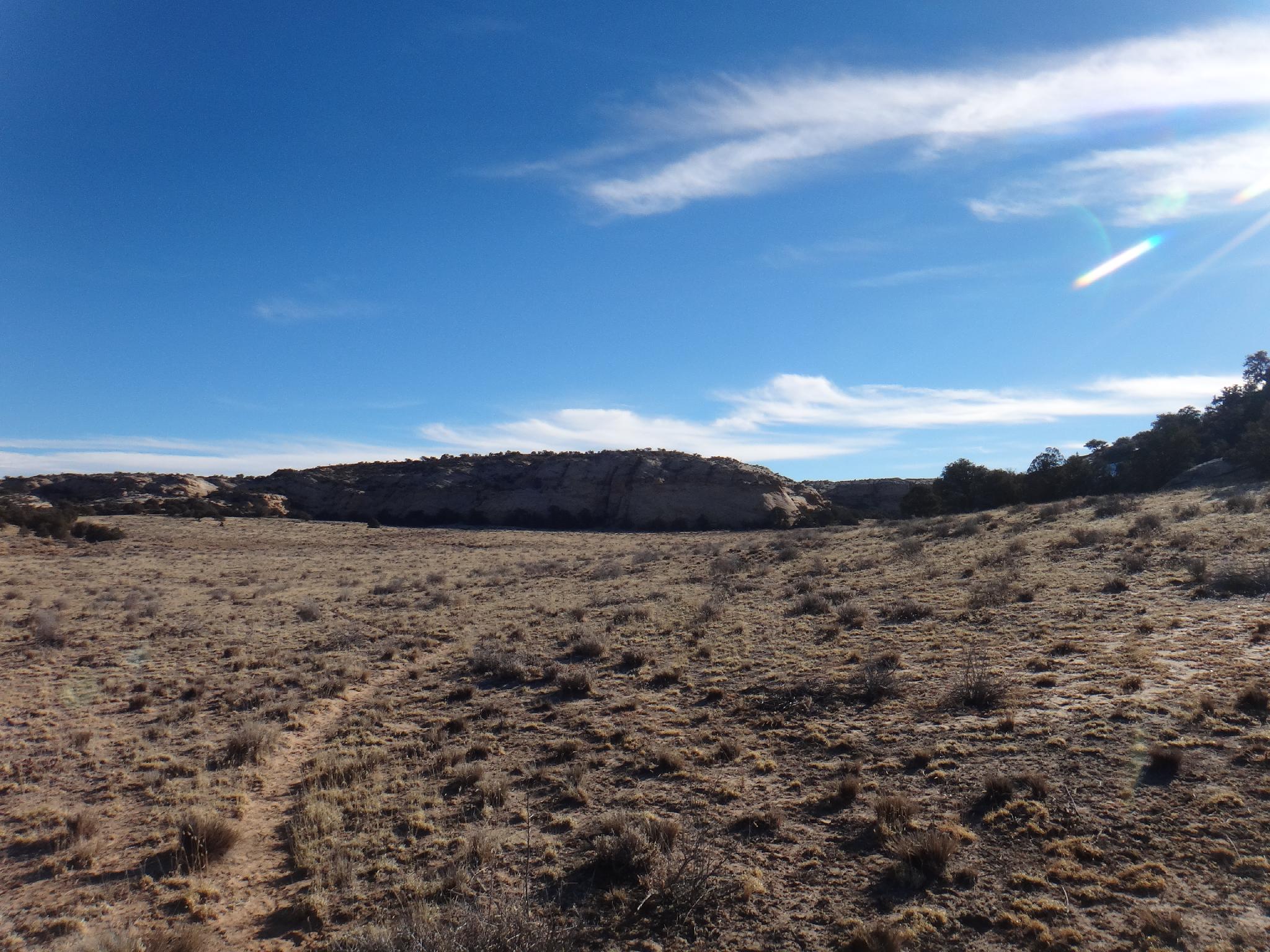
The distance of the hike make this area seldom visited. Although civilization is visible in the far distance, the area has a great remote feel to it. The isolation the homesteaders faced seems a bit daunting, but what a beautiful area to homestead.
The trail as it nears the cabin on Sids Mountain
Getting There
From Ferron, UT, head east on 100 S (Molen Road). This is across the road from the Millsite Recreation Sign. Reset your odometer as you turn off main street and onto 100 S.
- 3.0 - 4 way junction. Go right, toward Dutch Flat Desert.
- 3.3 - Road turns to dirt.
- 4.3 - Stay straight on main road through 4 way junction. The road begins heading east.
- 5.6 - Stay straight (don't take the lesser right)
- 15.1 - Junction with a kiosk and large parking area.
Reset your odometer here as you go LEFT (north). The road gets rougher from here. - 1.6 - Junction, go right.
- 4.0 - Road passes near a fence.
- 4.4 - Cattle guard
- 4.7 - Log fence.
- 5.3 - Second log fence, this is the trailhead with decent primitive camping at the trailhead.
Views into Saddle Horse Canyon from near the old horse trail
Route
Rock art and historic sites are fragile, non-renewable cultural resources that, once damaged, can never be replaced. To ensure they are protected, please:
- Avoid Touching the Petroglyphs: Look and observe, BUT DO NOT TOUCH!
- Stay on the Trails: Stay on the most used trails when visiting sites, and don't create new trails or trample vegetation.
- Photography and Sketching is Allowed: Do not introduce any foreign substance to enhance the carved and pecked images for photographic or drawing purposes. Altering, defacing, or damaging the petroglyphs is against the law -- even if the damage is unintentional.
- Pets: Keep pets on a leash and clean up after them.
- Artifacts: If you happen to come across sherds (broken pottery) or lithics (flakes of stone tools), leave them where you see them. Once they are moved or removed, a piece of the past is forever lost.
From the log fence, follow the old road down toward Salt Wash. It enters a wash. Follow the wash, but keep an eye out for where it leaves the wash as the wash makes a right hand turn. If you go to far, you will reach a dryfall into Salt Wash, retrace back a couple of minutes. Two minutes after the road leaves the wash, it ends at an old camping area. Look for a cairn on the point that marks the trail down to Salt Wash. It reaches Salt Wash exactly across from Saddle Horse Canyon.
Hike down Salt Wash. Keep an eye out on the left where the canyon makes a bend to the right and the slickrock cliff comes to the wash bank. There area a couple of good petroglyph panels on the west side. They are visible from Salt Wash, but also worth the short side trip to view them close up. From the panels, continue down Salt Wash to where it makes a left hand turn with a point of rocks on the left. The old horse trail leaves the wash here. Follow one of the many trails that leave the wash on the east (right) side, they coalese once out of Salt Wash.
Follow the old horse trail up and out of Salt Wash. It is a bit braided in spots and easy to loose the main path, but a little scouting and it always re-appears. About 50 feet from the top the trail divides, with left countouring down and right going directly up. Go right, to the top.
From the top, the trail is quite faint for a minute. Going due east and heading up the cedar hill should re-find the trail. Follow it as it gradually ascends up to Sids Mountain. An old fence is passed as you near Sids Mountain. From the fence, the trail meanders into the valley that is the old homestead. Cross the valley and stay near the largest domes to visit the cabin.
If your looking for a shorter day, return the same way from the cabin.
Long Route
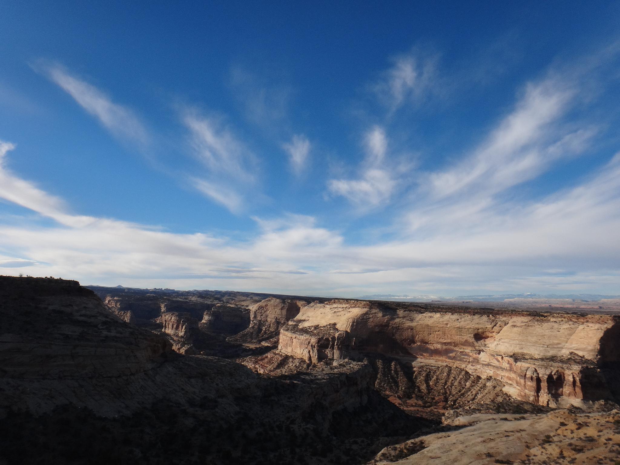
Those looking for the full route will return a different way. From the cabin, follow an old trail east as it crosses a shallow drainage. Swazy Point is the high point to north east, and a nice diversion to visit. From its vantage point, you can see the La Sals near Moab, Thousand Lake Mountain to the south west, and most of the northern Swell. If not visiting the highpoint (or after visiting the highpoint), head down the shallow drainage.
Keep an eye out on the left at the first place varnished cliff walls come down to the edge of the drainge. There are many petroglyph panels along this cliff band. Below these panels the drainage begins to deepen with a few potholes that may hold water after recent rains (if water is needed). Follow the drainage down, alternating between the canyon bottom and old horse trails depending on what is most convenient. A few minor dryfalls and obstacles are encountered, but are easily bypassably on old trails.
From the panels, it is about 1.5 hours to the end of the canyon where it drop into Salt Wash at an impressive dryfall. Just up from the dryfall, on the west side, are a couple of small caves. One of these has evidence of early peoples visiting or living in them.
Work up from the cave to the south rim of the drainage you have been coming down. Meander south and west along the rim of Salt Wash back to re-join the original horse trail. There is an old trail to follow for much of this, but if you loose it, stay along the rim of Salt Wash, countoring around a few small side drainages. Follow the original horse trail back to the trailhead.
Photos
Maps


| Trailhead |
12S 512531mE 4324148mN N39° 03' 59" W110° 51' 19" |
| Trail |
12S 513104mE 4323534mN N39° 03' 39" W110° 50' 55" |
| Panels |
12S 513202mE 4323886mN N39° 03' 50" W110° 50' 51" |
| Horse Trail |
12S 513874mE 4323976mN N39° 03' 53" W110° 50' 23" |
| Top |
12S 514296mE 4324044mN N39° 03' 55" W110° 50' 05" |
| Fence |
12S 516246mE 4321920mN N39° 02' 46" W110° 48' 44" |
| Cabin |
12S 517813mE 4321024mN N39° 02' 17" W110° 47' 39" |
| Swazy |
12S 519190mE 4321350mN N39° 02' 28" W110° 46' 42" |
| Panel |
12S 517686mE 4322059mN N39° 02' 51" W110° 47' 44" |
| Panel |
12S 518012mE 4321946mN N39° 02' 47" W110° 47' 31" |
| Panel |
12S 518182mE 4321884mN N39° 02' 45" W110° 47' 24" |
| Overlook |
12S 515291mE 4324889mN N39° 04' 23" W110° 49' 24" |