 Climbing S. Ridge of Mount Superior
Little Cottonwood Canyon
Overview
|
Sat 46 | 30 |
Sun 52 | 32 |
Mon 47 | 32 |
Tue 52 | 33 |
Wed 53 | 36 |
| View Full Weather Details | ||||
|
Sat 46 | 30 |
Sun 52 | 32 |
Mon 47 | 32 |
Tue 52 | 33 |
Wed 53 | 36 |
| View Full Weather Details | ||||
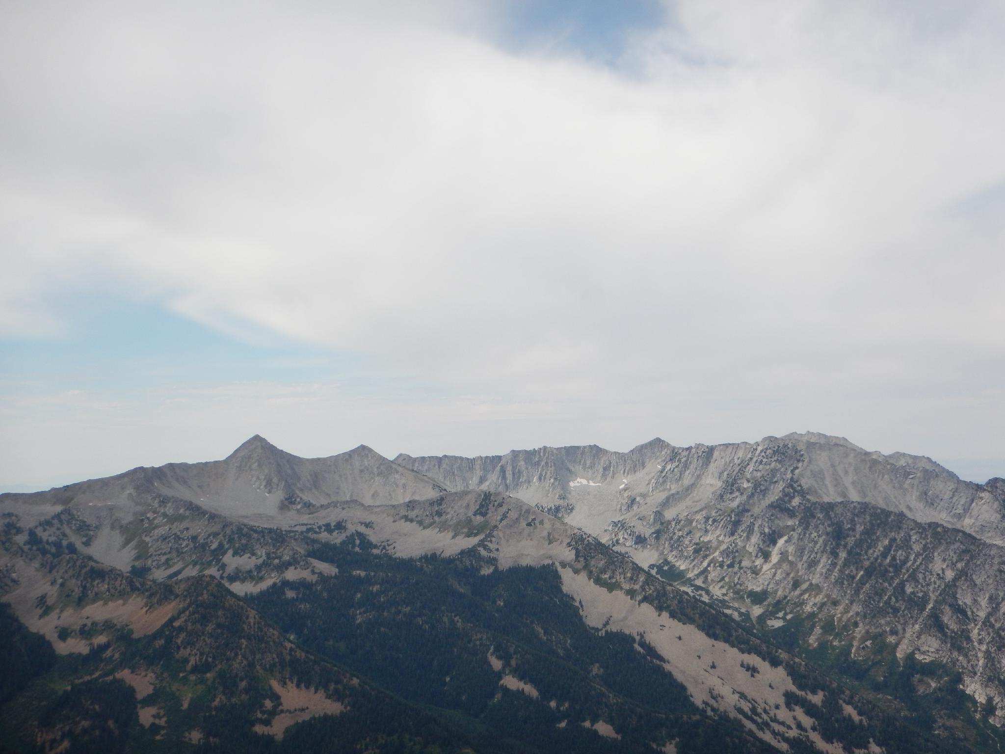
Views of the Pfieferhorn from the top.
This is one of the classic ridge scrambles in the Wasatch. At over 2600 feet of gain, it is a long scramble on mostly easy ground with a lot of exposure and big views. For experienced climbers, this is often done without gear. Those that are less experienced should bring a rope and bit of gear. Generally 50' of climbing rope and a set of nuts would be adequate to protect the few more difficult spots. I've done the route twice (2002, 2015), and both times my partner and I felt very comfortable without a rope. In both instances we were all climbers and comfortable at moderate grades.
In September of 2002, a hiker (Daniel Rector) fell to his death on this route. Not matter your experience level, take this route seriously. There are many places where if a rock pulled off, a misstep was taken, bees attacked, or any number of common mishaps occurred a fatal fall could happen.
Once on top, a short side trip offers a second summit of the day, Monte Cristo, then the standard Mount Superior hiking trail is followed back down to Cardiff Pass and onward to Alta.
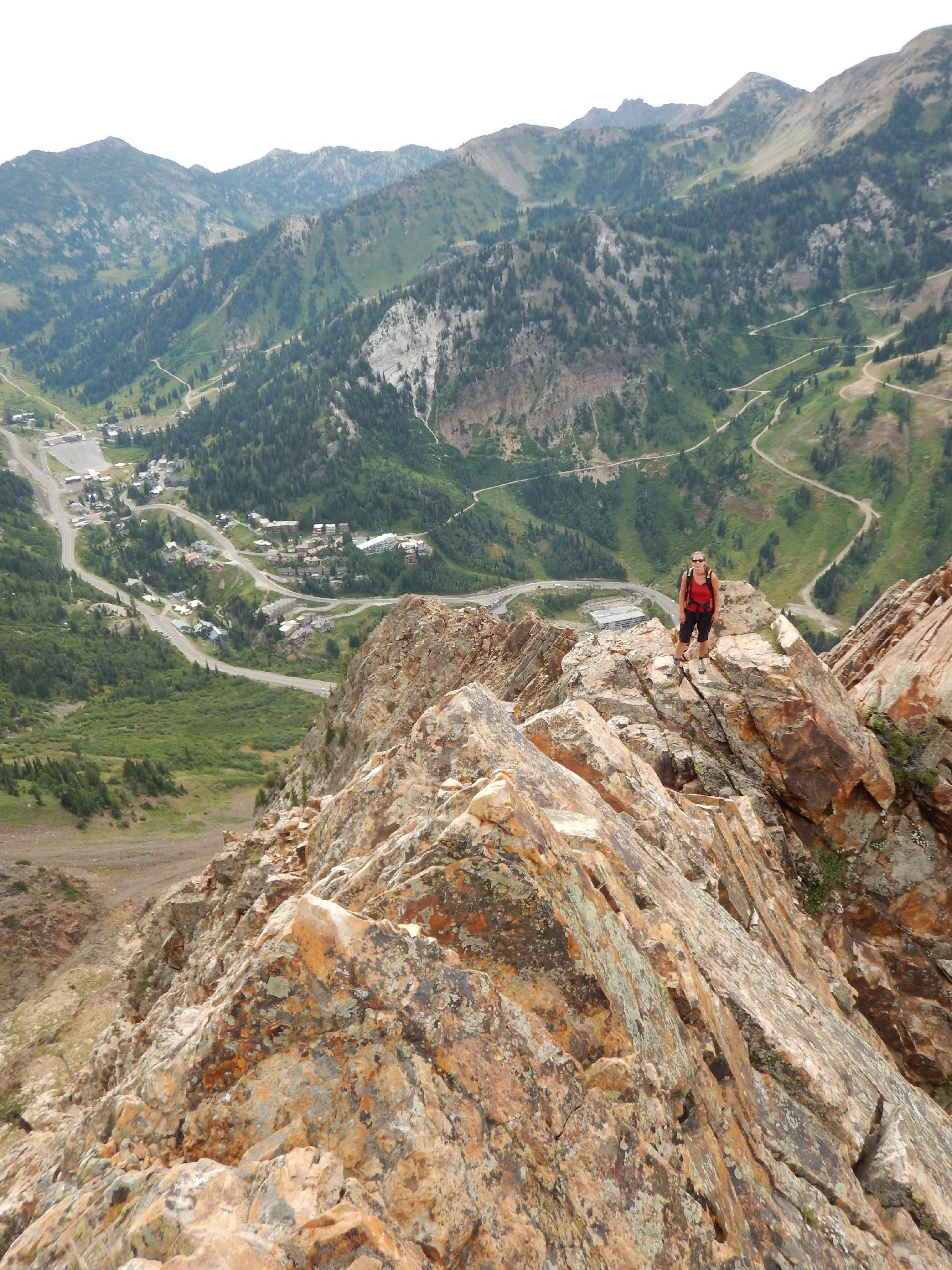
Crossing the first rock ridge above the saddle.
Working across the fun ridge.
Getting There
Little Cottonwood Canyon is on the east side of the Salt Lake City Valley. Get there by following I-215 to the east, taking exit 6 off the interstate and heading east toward the mountains.
Follow 6200 South which becomes Wasatch Blvd for 1.8 miles to the stop light and signs for Big Cottonwood Canyon. Continue south (straight) through the light an additional 2.3 miles to a junction and light. Stay left here, reaching the mouth of Little Cottonwood Canyon in an additional 1.6 miles.
From the mouth of Little Cottonwood, travel up the canyon 7.1 miles to an old dirt road that leaves the highway on the north (left) side. This is the trailhead. If you have two cars, you can leave the second car at 8.1 miles, where the Police station and town office are to save 0.9 miles of hiking on the way down.
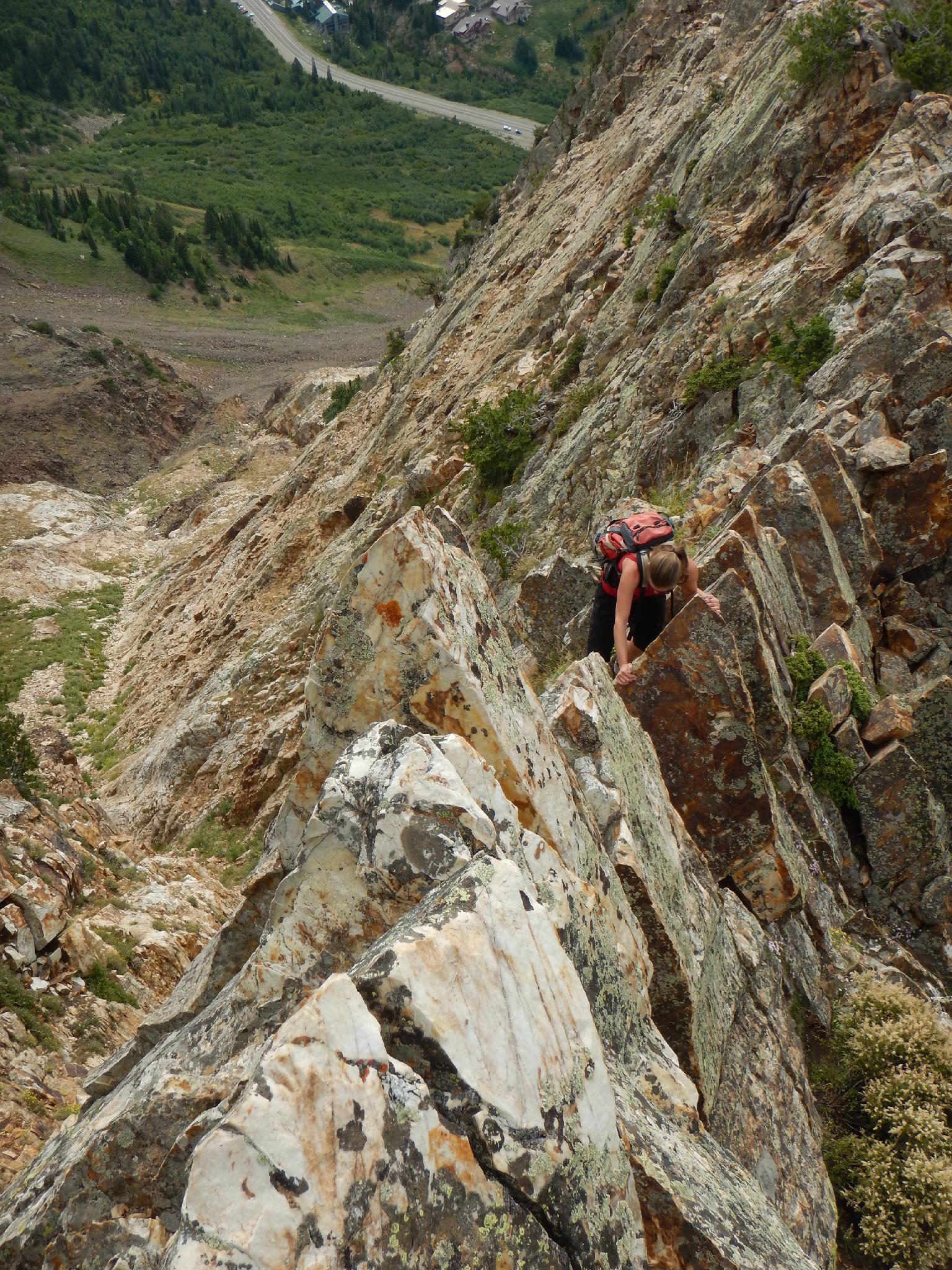
Looking at the upper ridge.
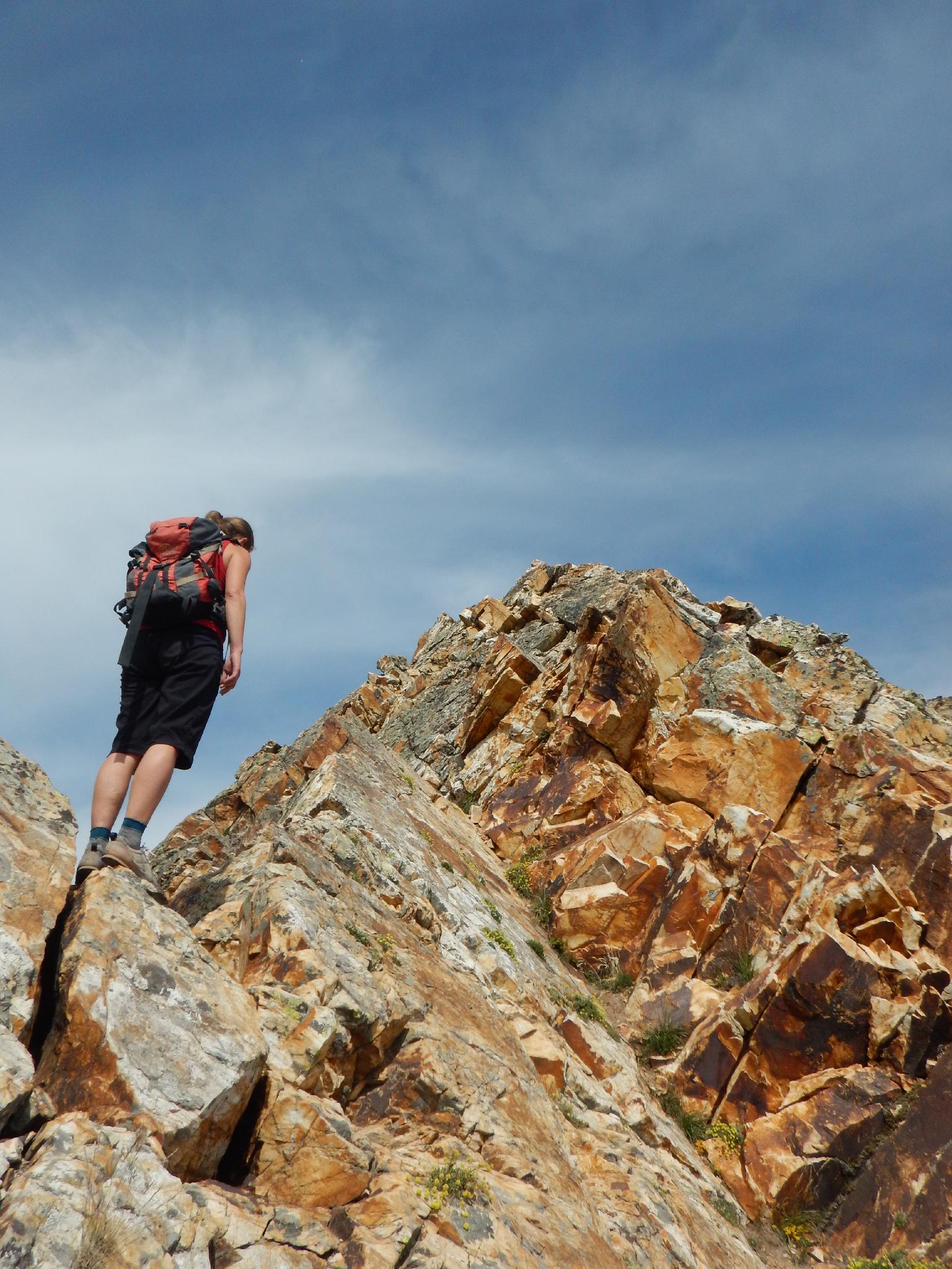
Diane contemplating the next moves up the ridge.
Route
Route (2-3 hours / 1 mile / 2655' of gain)
From the trailhead, walk the old road one minute to a flat area. A dirt trail goes off on the right, with a small talus path going off on the right as well just past it. Take the talus path and work up toward the ridge of Mount Superior. The social trail ascends the talus and reaches a white rock band that marks the start of the route.
Scramble up, heading to the upper pipe visible from the trailhead and from the route once up the white rock band. A good social trail works up to the pipe and a platform beyond.
Here the route becomes easy to follow. Either work up the ridge proper, or social trails on the sides of the ridge that avoid some of the difficulties. After the first stretch, a saddle is reached and a very fun knife edged ridge is crossed and ascended. (Can be bypassed on the left on a social trail.) Above the first section of climbing, it is a boulder walk up to the next saddle where the more impressive higher ridge comes into view.
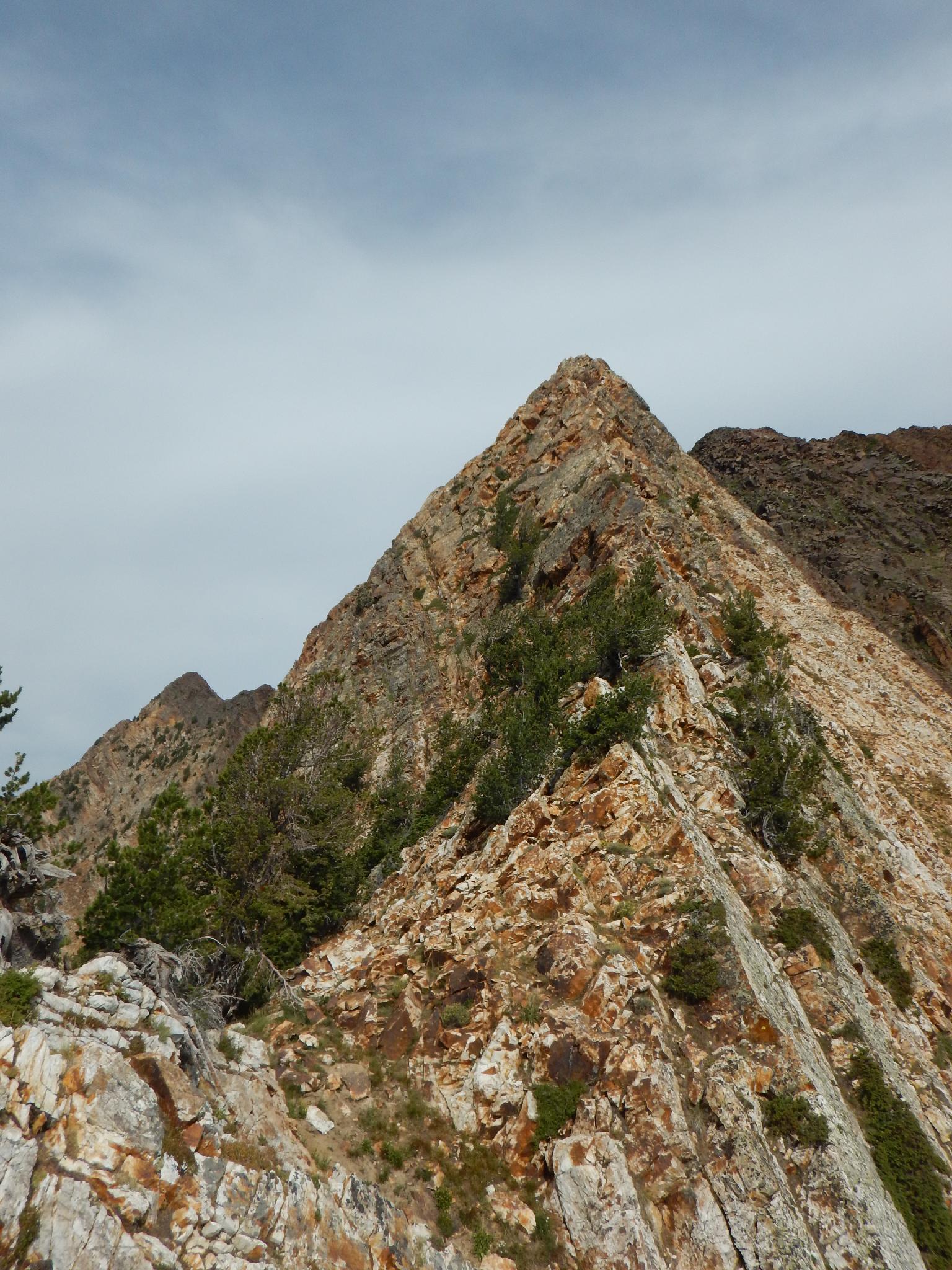
Head up the ridge. Staying on the ridge proper seemed the most fun to us. There is one spot that may be 5.4 or so, but this section is short. If it seems hard, look around. Above the ridge, the rock changes from Quartzite to the darker and more broken up Basalt layer.Continue hiking up the social trails to the top of Mount Superior.
Monte Cristo Side Trip (30 minutes / 0.5 miles round trip)
Continue west on the ridge 0.25 miles to the summit of Monte Cristo if time and energy allow. The views are great from Monte Cristo, and this side trip is recommended.
Descent (2-3 hours / 2.5 miles)
Follow the social trail east as it descends steeply down along the ridge. There are many sections of loose scree and steep spots. Follow the trail about 2 miles to just before a small shed on the ridge before Cardiff Pass. Here the trail branches. Go right (on the south side of the small peak with the small building on it). As the trail traverses just below the ridgeline, take a side trail on the left and then climb steeply for a minute. Cross the ridge, then follow an easy traverse to Cardiff Pass.
From Cardiff Pass, follow the most used trail down. It branches a few times, but the side trails re-merge near the bottom. The trail turns into an old road, then intersects with a private road. Go right, and follow the private dirt road down hill a few minutes to the Police station and highway coming up Little Cottonwood Canyon.
The trailhead is 0.9 miles down the highway.
Photos
Maps

| Trailhead |
12T 444745mE 4493067mN N40° 35' 12" W111° 39' 11" |
| Talus Trail |
12T 444676mE 4493053mN N40° 35' 11" W111° 39' 14" |
| Base |
12T 444362mE 4493150mN N40° 35' 14" W111° 39' 27" |
| Saddle |
12T 443885mE 4493191mN N40° 35' 15" W111° 39' 47" |
| Mount Superior |
12T 443543mE 4493695mN N40° 35' 32" W111° 40' 02" |
| Monte Cristo |
12T 443198mE 4493614mN N40° 35' 29" W111° 40' 17" |
| Cardiff Pass |
12T 444881mE 4494124mN N40° 35' 46" W111° 39' 05" |
| Exit Trailhead |
12T 446044mE 4493455mN N40° 35' 25" W111° 38' 15" |