 Hiking Terraces to Elbow Fork
Millcreek Canyon
Overview
|
Sat 59 | 36 |
Sun 65 | 41 |
Mon 57 | 39 |
Tue 64 | 38 |
Wed 65 | 45 |
| View Full Weather Details | ||||
|
Sat 59 | 36 |
Sun 65 | 41 |
Mon 57 | 39 |
Tue 64 | 38 |
Wed 65 | 45 |
| View Full Weather Details | ||||
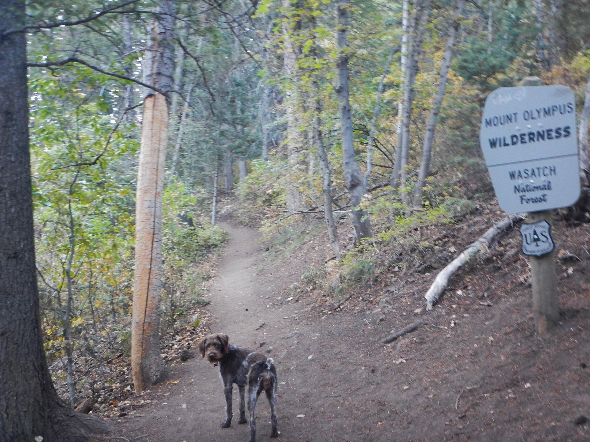
Wonderdog heading into the wilderness
On the list of hikes to do in Millcreek Canyon, I would put this one fairly low, though it does make a good off the beaten path excursion. Starting at Terraces Picnic Area, the hike meanders up to a ridge that offers a few distant views of Baker Pass, Mount Raymond, and Gobblers Knob before re-entering the woods and meandering down to Elbow Fork.
Though not a highly recommended outing, it is nice that you can make the hike into a 6 mile loop by returning on the pipeline trail.
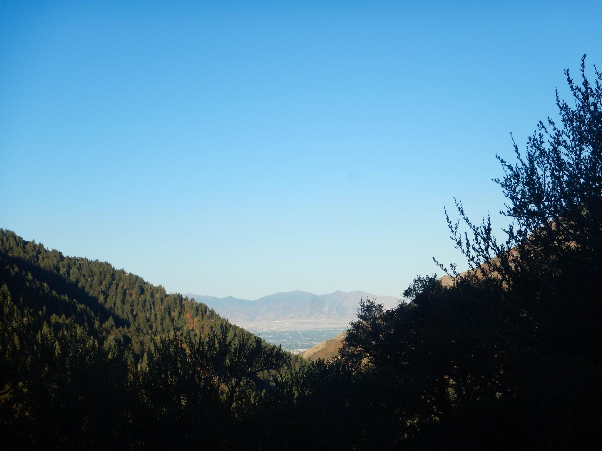
Salt Lake Valley in the distance from the Terraces Trail.
Getting There
Millcreek Canyon is on the east side of the Salt Lake Valley, just south of I-80 and Parleys Canyon. To get there, take I-215 South from I-80 and take exit 4 off of I-215 and go left (east) on 3900 South.
Turn left on Wasatch Blvd just after crossing under the highway, then the next right on Millcreek Canyon Road.
0.7 miles from the junction of Wasatch Blvd and Millcreek Canyon Road is the entrance to Millcreek Canyon and the pay booth.
Mileage below is from the pay booth.
0.7 miles - Pipeline Trailhead on the left (north).
2.4 miles - Church Fork Trailhead on the left (north).
2.5 miles - Desolation on the right (south).
3.4 miles - Porter Fork on the right (south).
3.5 miles - Burch Hollow Trailhead (north).
3.7 miles - Terraces Picnic Area / Trailhead (south). Start trailhead.
3.8 miles - Winter Gate Closure
5.4 miles - Elbow Fork Trailhead (Mount Aire). Exit trailhead is you have two vehicles.
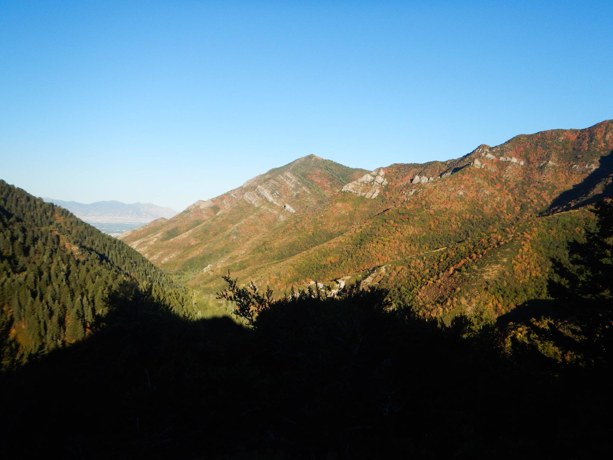
Fall colors starting to show up on the north side of the canyon. (early September)
Route
Terraces to Elbow Fork (2.6 miles / 1-1.5 hours)
From the Terraces Picnic Area Trailhead follow the trail a short distance to a fork. Go left here, toward Elbow Fork. The trail is casual for a while before beginning a bit of a climb to the ridge. An open area at the ridge makes a great break spot and the best views of the hike. Mount Raymond and Baker Pass are visible to the south. Raymond is the peak with the rock cliffs on its right side.
The trail re-enters the forest. A side trail here goes off on the right and (presumably) down to Bowman Fork. If you happen to see it, stay left. The trail soon begins its steep descent down to Elbow Fork with intermittent views of Mount Aire to the north through the trees.
Optional Loop down Pipeline (2.9 miles / 1 hour)
If you don't have two cars or just want to make a loop out of the hike, cross the road and join the Pipeline Trail just down the canyon at the Elbow Fork Trailhead. The Pipeline Trail has a few ups and downs but is generally fast and easy walking. It is very popular with bikers, so keep an eye out if you have a dog.
The Pipeline Trail traverses past the Burch Hollow junction (stay left), crosses Burch Hollow, and then begins a switchback descent back down to the road. Go left at the major junction just above the road to get back to the Burch Hollow Trailhead.
To Terraces Trailhead (0.5 miles / 10 minutes)
If you left a vehicle at Terraces Picnic Area, it is about 0.2 miles up the road to the Terraces Picnic Area junction, then another 0.3 miles up to the trailhead parking.
Photos
Maps

| Trailhead - Terraces |
12T 439499mE 4505383mN N40° 41' 50" W111° 42' 58" |
| Trailhead - Burch Hollow |
12T 439070mE 4505642mN N40° 41' 58" W111° 43' 16" |
| Trailhead - Elbow Fork |
12T 441730mE 4506378mN N40° 42' 23" W111° 41' 23" |
| Jct. - Left |
12T 439499mE 4505401mN N40° 41' 50" W111° 42' 58" |
| Minor Junction - Left |
12T 441252mE 4505274mN N40° 41' 47" W111° 41' 43" |
| Pipeline Jct - Left |
12T 438810mE 4505654mN N40° 41' 58" W111° 43' 27" |