 Canyoneering Russell Gulch
Zion West Side
Overview
|
Sat 74 | 44 |
Sun 76 | 46 |
Mon 76 | 46 |
Tue 75 | 46 |
Wed 72 | 44 |
| View Full Weather Details | ||||
|
Sat 74 | 44 |
Sun 76 | 46 |
Mon 76 | 46 |
Tue 75 | 46 |
Wed 72 | 44 |
| View Full Weather Details | ||||
First rappel in Russell Gulch
Just starting down Russelll Gulch
Russell Gulch is generally used as an alternate entry to the The Subway (From the Top) . When doing the Subway from the top, the usual approach trail crosses the top of Russell Gulch but does not descend it. This route leaves the Subway approach trail, descends Russell Gulch, and meets up with the Subway trail right where it enters the Left Fork.
So, what is it like? Russell Gulch is not a fantastic canyon, with mostly open, low angle slopes and quite a bit of vegetation. The four rappels en route add a little spice and beauty, as they happen at the few short interesting sections. I would highly recommend this as an alternate start to the Subway if you have done the Subway before. If you haven't done the Subway before, stick with the standard approach trail. Taking Russell Gulch adds 1.5 or 2 hours to a normal Subway day, and is not recommended for first-time Subway-ers.
I would not recommend doing Russell Gulch on its own, without continuing through the Subway.
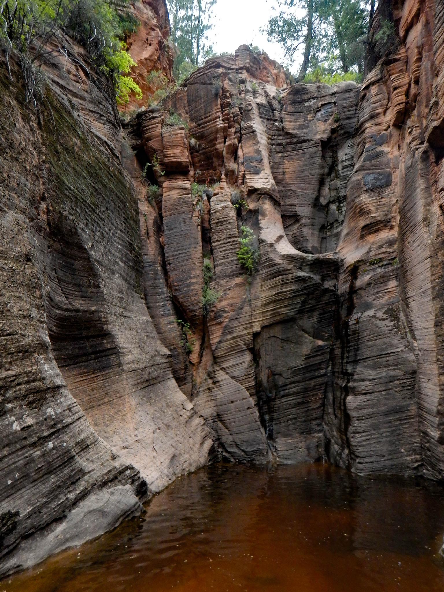
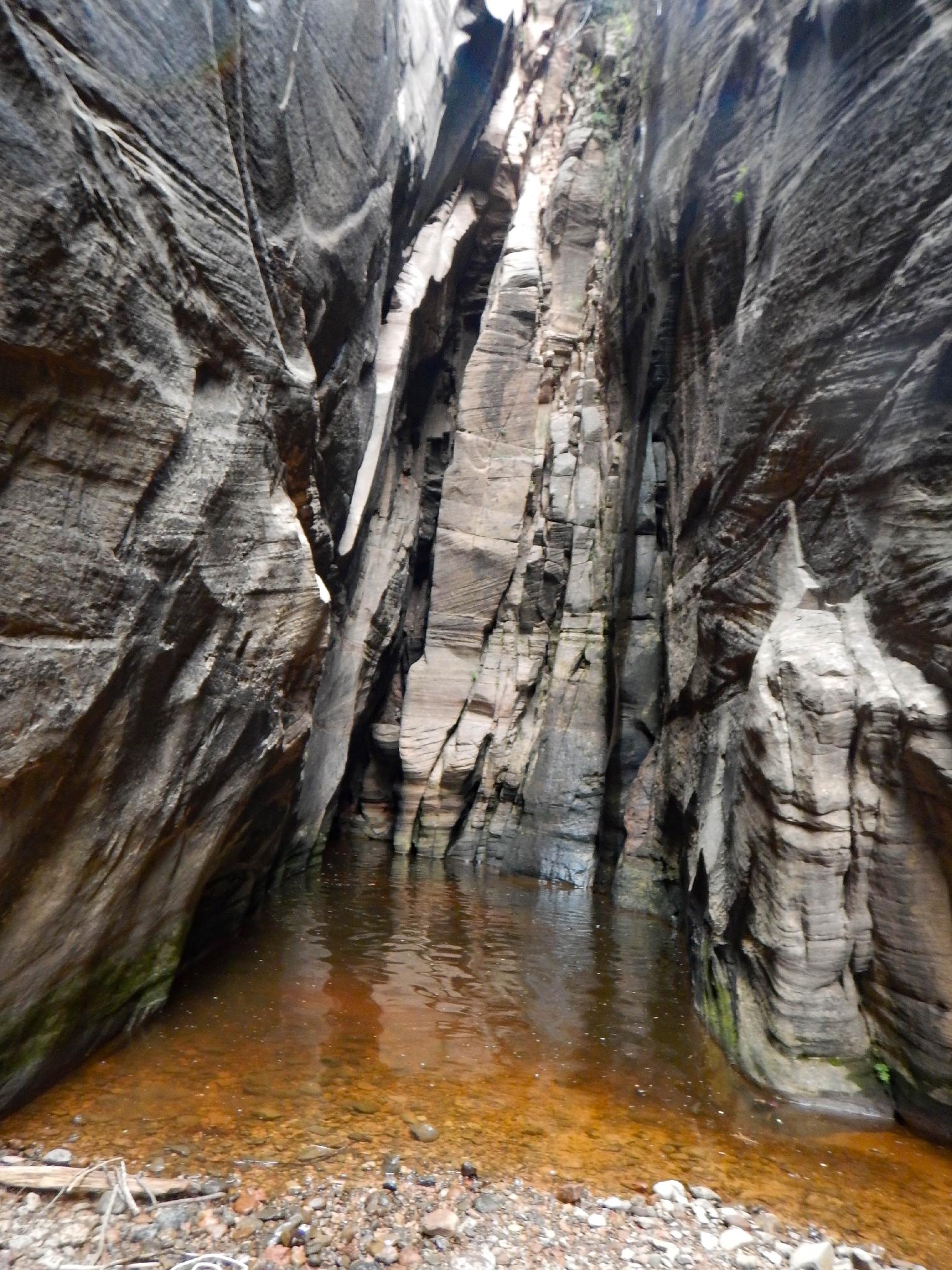
Scenery in Russell Gulch
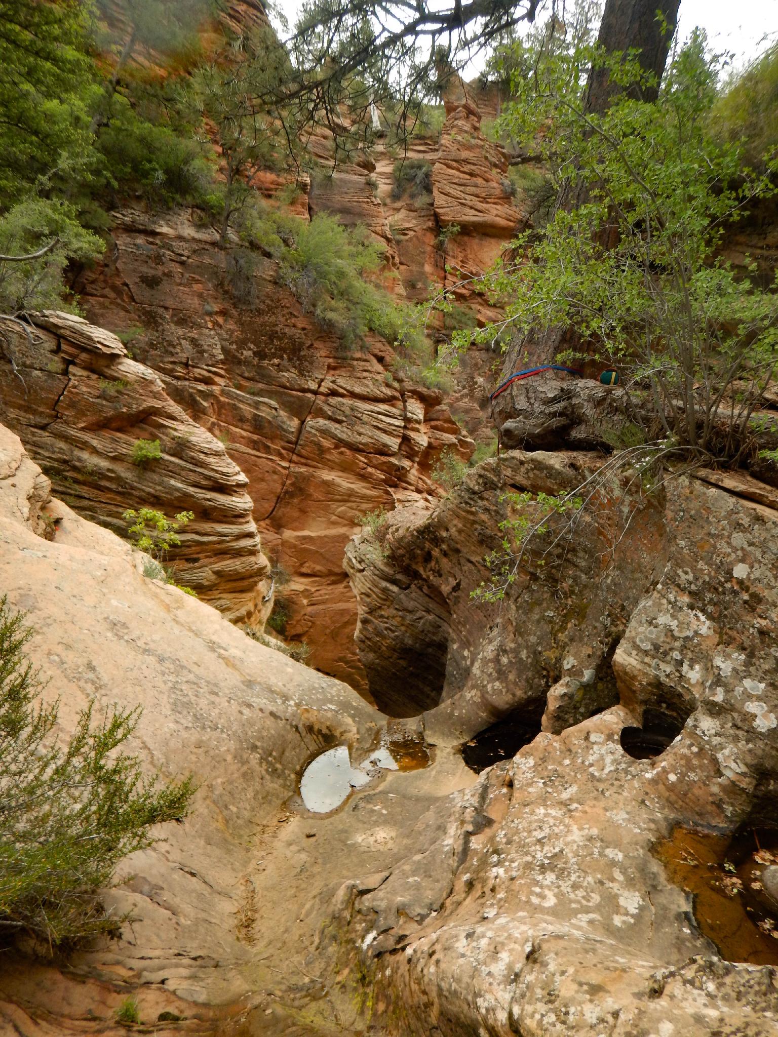
About to the third rappel (tree on the right)
Getting There
From the Zion Visitor center, head west on UT-9 for about 12 miles until you reach the town of Virgin. The Kolob Reservoir Road goes off on the right as you enter town. Follow the Kolob Reservoir for 12.9 miles to the Wildcat Trailhead on the right. It is right on a curve, and has a pit toilet. Be sure not to park on any vegetation, as I have seen cars ticketed for this.
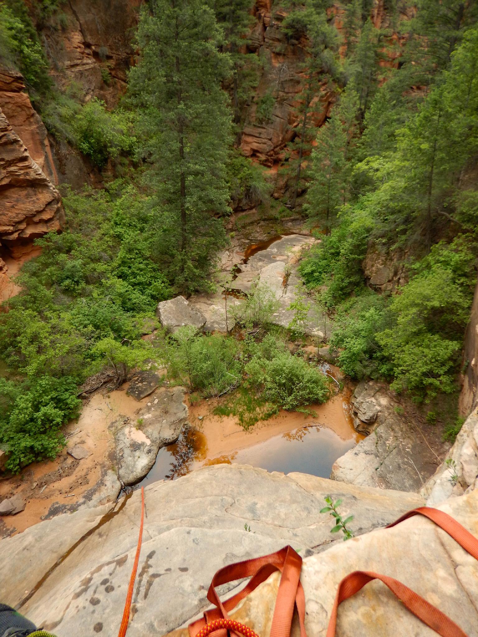
Looking down the final rappel in Russell Gulch
Bottom of second rappel in Russell Gulch
Route
Approach (1-1.25 hours)
Follow the Wildcat trail about 15-20 minutes to its junction with Northgate Peaks. Go right on the Northgate Peaks trail for several minutes until the signed junction with the Subway trail going off on the left.
Follow the Subway trail, and cairns, along the slickrock on the right for 5 minutes or so until it drops off slickrock and onto dirt. The trail is now easy to follow as it makes its way down to and crosses Russell Gulch. This is the obvious low point before the trail climbs slickrock to the pass ahead. If returning via the Subway trail, you will be returning over the pass ahead.
Canyon (2 hours)
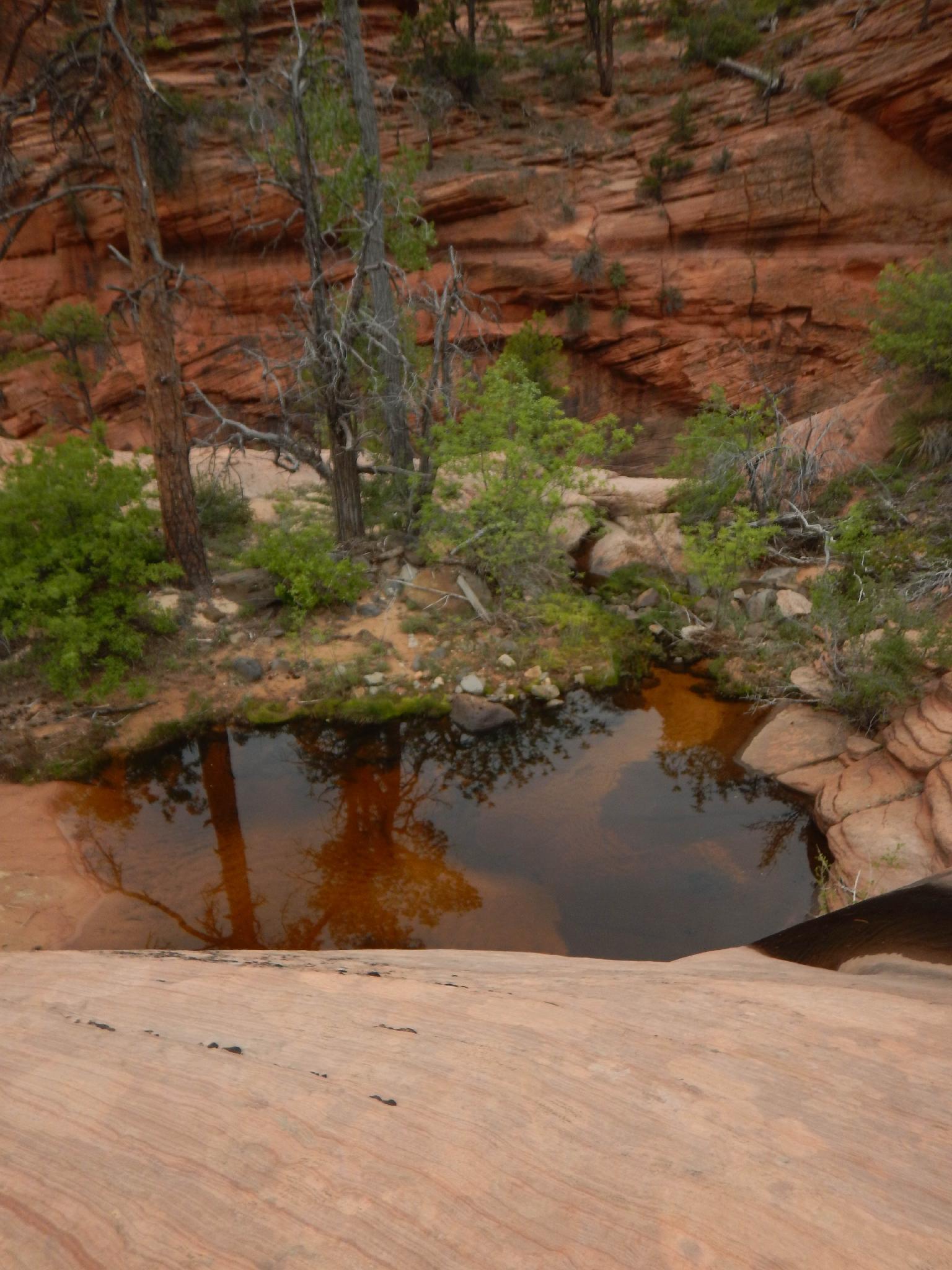
From where the trail crosses Russell Gulch, head down Russell Gulch. The first drop is easy to bypass on the right. Continuing down, most of the water is easy to bypass with strategic rock hopping. The first rappel is just down from the first unavoidable pool. Suit up before the pool is wearing wetsuit.
R1 - 23 m ( 76 ft. ) The first rappel drops to a pothole midway down that is easy to hop across, then further down to a likely waist deep pool.
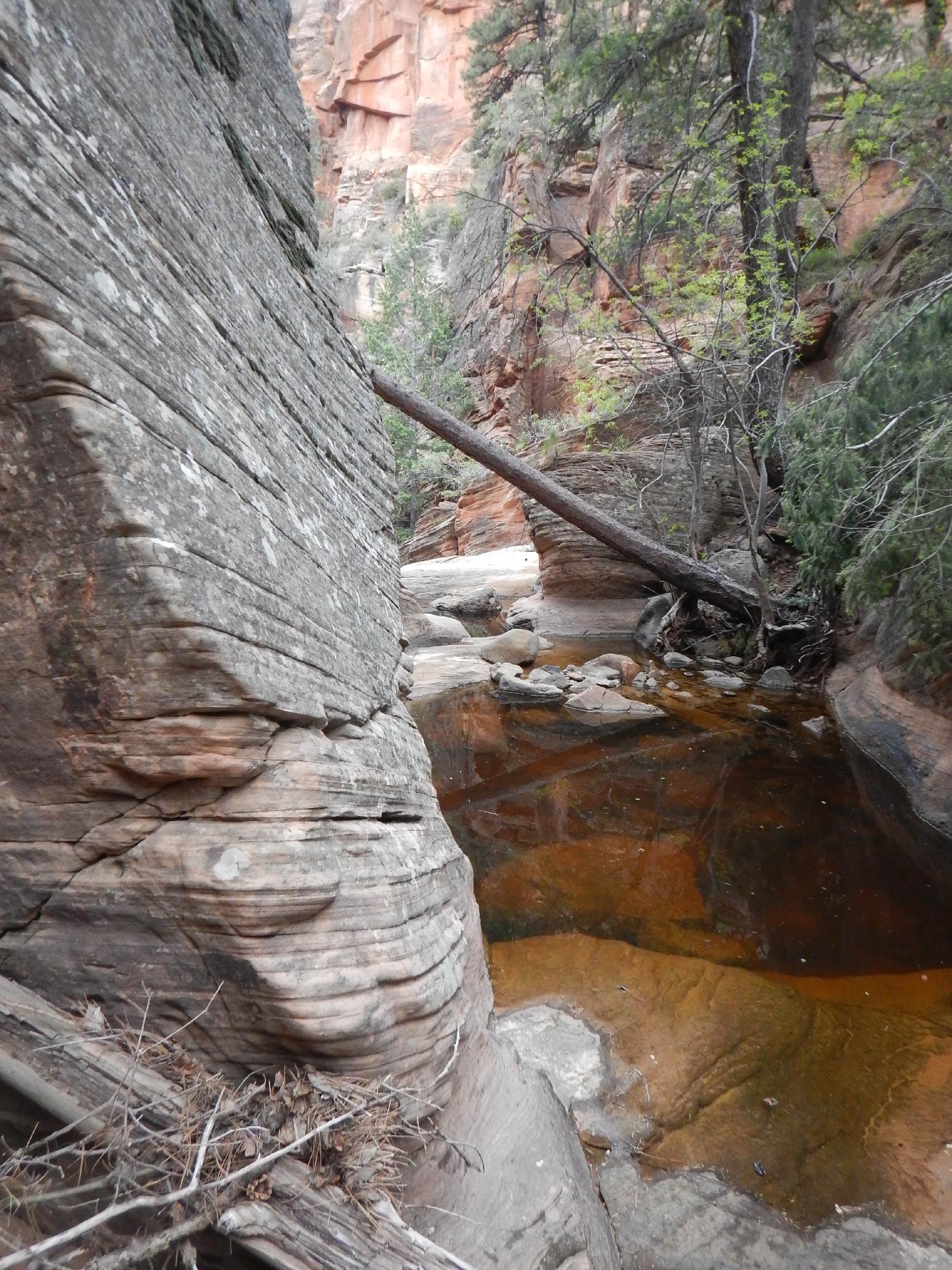
From the first rappel, it is easy walking with a side drainage coming in on the left where the walls are low-angle. Stay right in the main drainage and reach the second rappel shortly.
R2 - 30 m ( 99 ft. ) The second rappel is the biggest in the canyon, and about 30 m to a pool that is possibly a bit deeper than waist deep, but likely not a swimmer.
R3 - 7 m ( 23 ft. ) Not far below rappel 2 are the final two rappels that come in rapid succession. Rappel 3 is generally done off a large tree on the right down 7 m to a ledge and bolted anchor for the final rappel.
R4 - 20 m ( 66 ft. ) Down to the edge of a pool. Be sure the webbing is extended appropriately for an easy pull.
Just down from rappel 4 is a final drop. This can be rappelled, but there is no need. The Subway approach trail is on the left here (looking down canyon). Follow a social trail steeply up to join the Subway trail just before this drop.
Exit (1.5-2 hours)
If continuing down the Subway, go down the Subway trail to the bottom of Left Fork and head down the canyon.
If exiting back to the Wildcat Trailhead, go up the Subway social trail. In less than a minute it cuts right through a crack. Once you find this, the trail is generally easy to follow as it winds its way up. When a large slickrock area is reached, you can see the pass ahead that you saw from Russell Gulch. Climb to the pass and down the other side to meet up with the approach route. Return using the trail you came in on from the top of Russell Gulch.
Photos
Maps

| Trailhead |
12S 316116mE 4134600mN N37° 20' 24" W113° 04' 33" |
| Northgate Junction - Right |
12S 317544mE 4134591mN N37° 20' 24" W113° 03' 35" |
| Subway Junction - Left |
12S 317569mE 4134478mN N37° 20' 21" W113° 03' 34" |
| Russell Gulch |
12S 318830mE 4133441mN N37° 19' 48" W113° 02' 42" |
| Rappel 1 |
12S 318862mE 4132905mN N37° 19' 31" W113° 02' 40" |
| Side Drainage |
12S 319016mE 4132600mN N37° 19' 21" W113° 02' 33" |
| Final Rappel |
12S 319124mE 4132251mN N37° 19' 10" W113° 02' 29" |
| Left to Subway Trail |
12S 319162mE 4132164mN N37° 19' 07" W113° 02' 27" |