 Canyoneering Cove Canyon
Cedar Mesa
Overview
|
Wed 76 | 51 |
Thu 67 | 49 |
Fri 65 | 47 |
Sat 59 | 42 |
Sun 67 | 42 |
| View Full Weather Details | ||||
|
Wed 76 | 51 |
Thu 67 | 49 |
Fri 65 | 47 |
Sat 59 | 42 |
Sun 67 | 42 |
| View Full Weather Details | ||||
Cove Canyon - Cedar Mesa
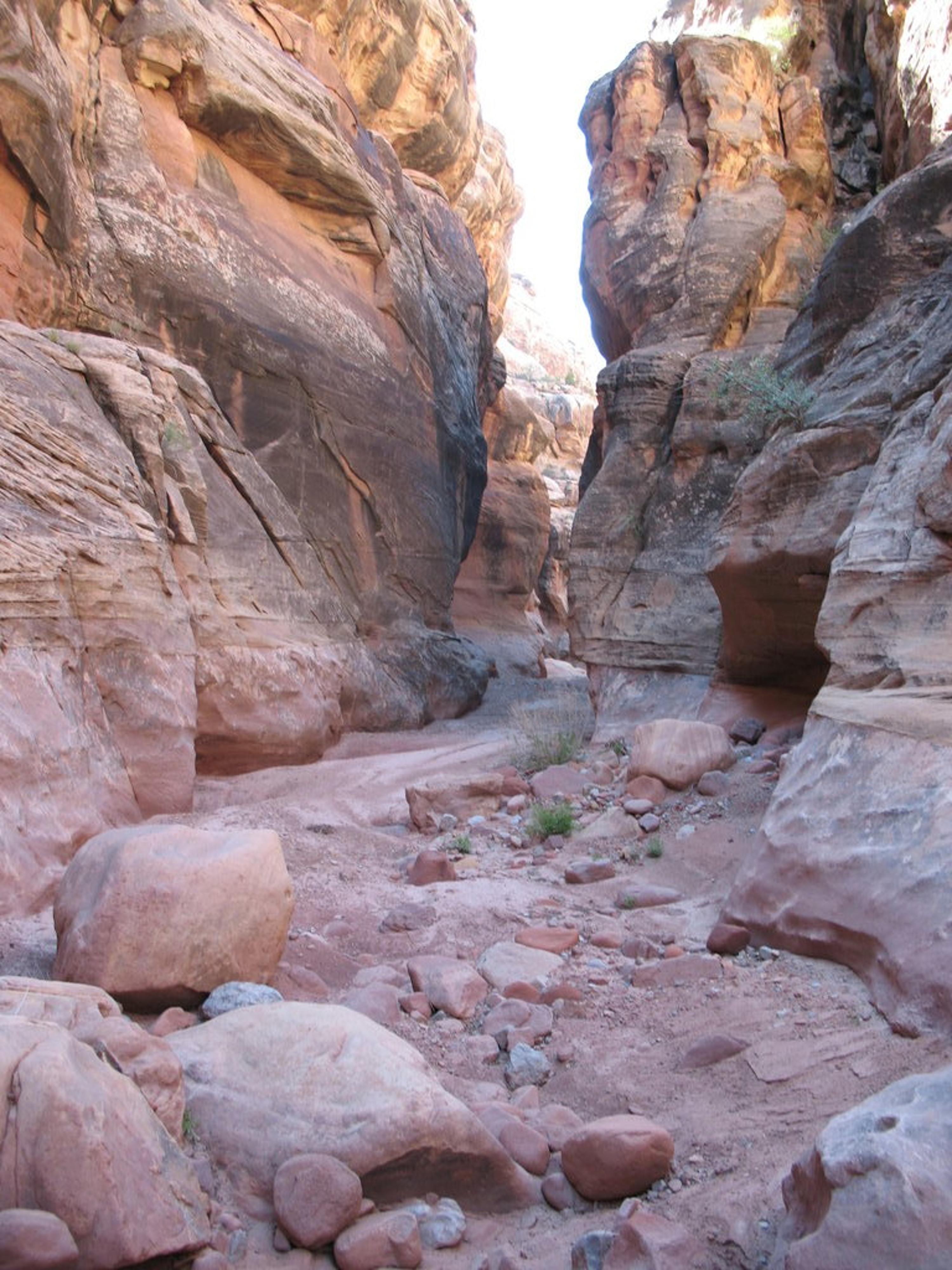
Cove Canyon easy walking - Cedar Mesa
Cove Canyon, although not a destination, is a nice stop to stretch your legs if you in the area. The non-technical portion of the hike provides a lovely ramble down a beautiful canyon as it deepens on its way to the Colorado River. The technical section, requiring ascending, is recommended for those that are proficient in ascending and looking to get some practice in.
This makes a good addition to a visit to The Block or Clearwater Canyon.
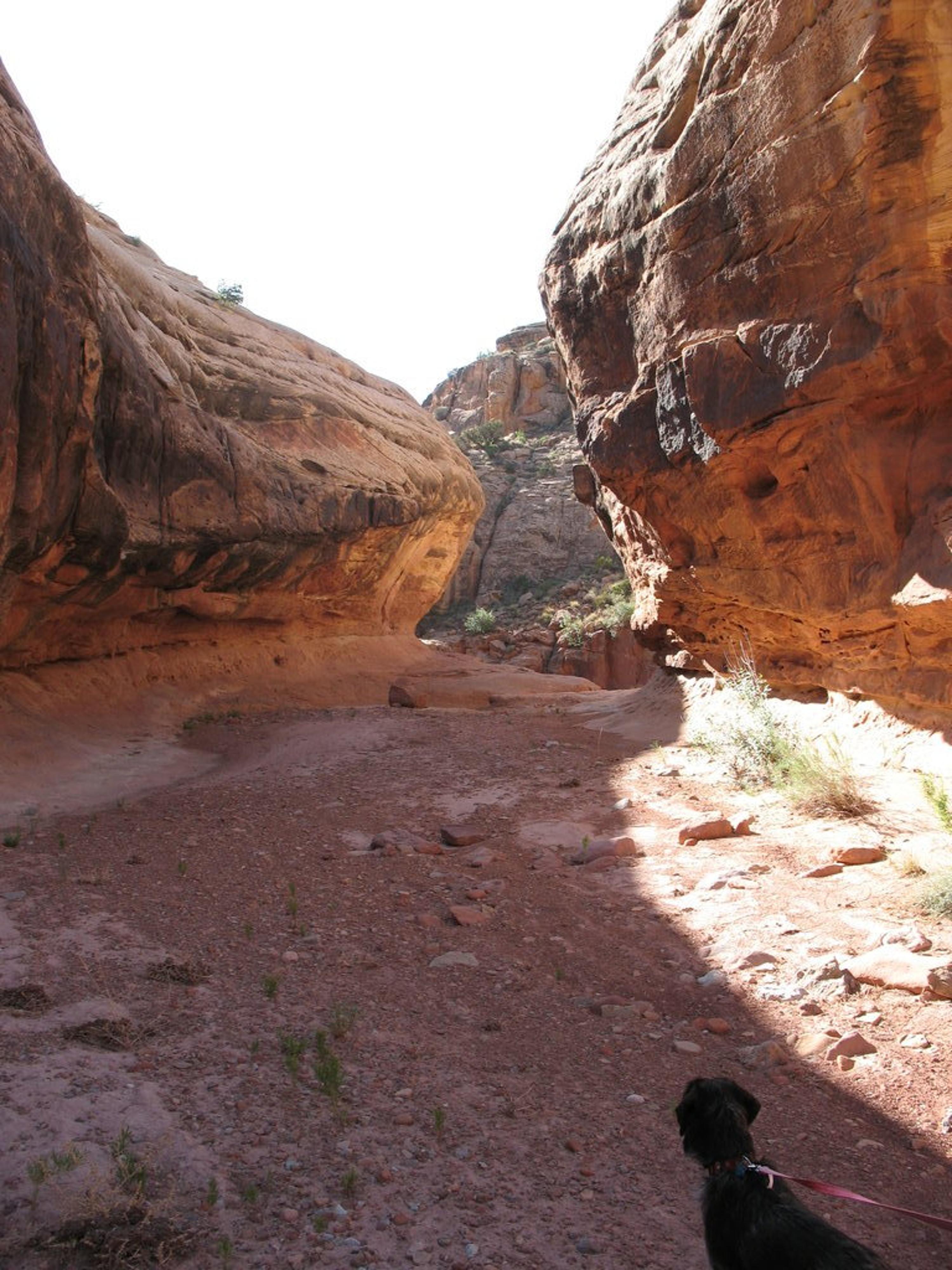
Starting to narrow in Cove Canyon
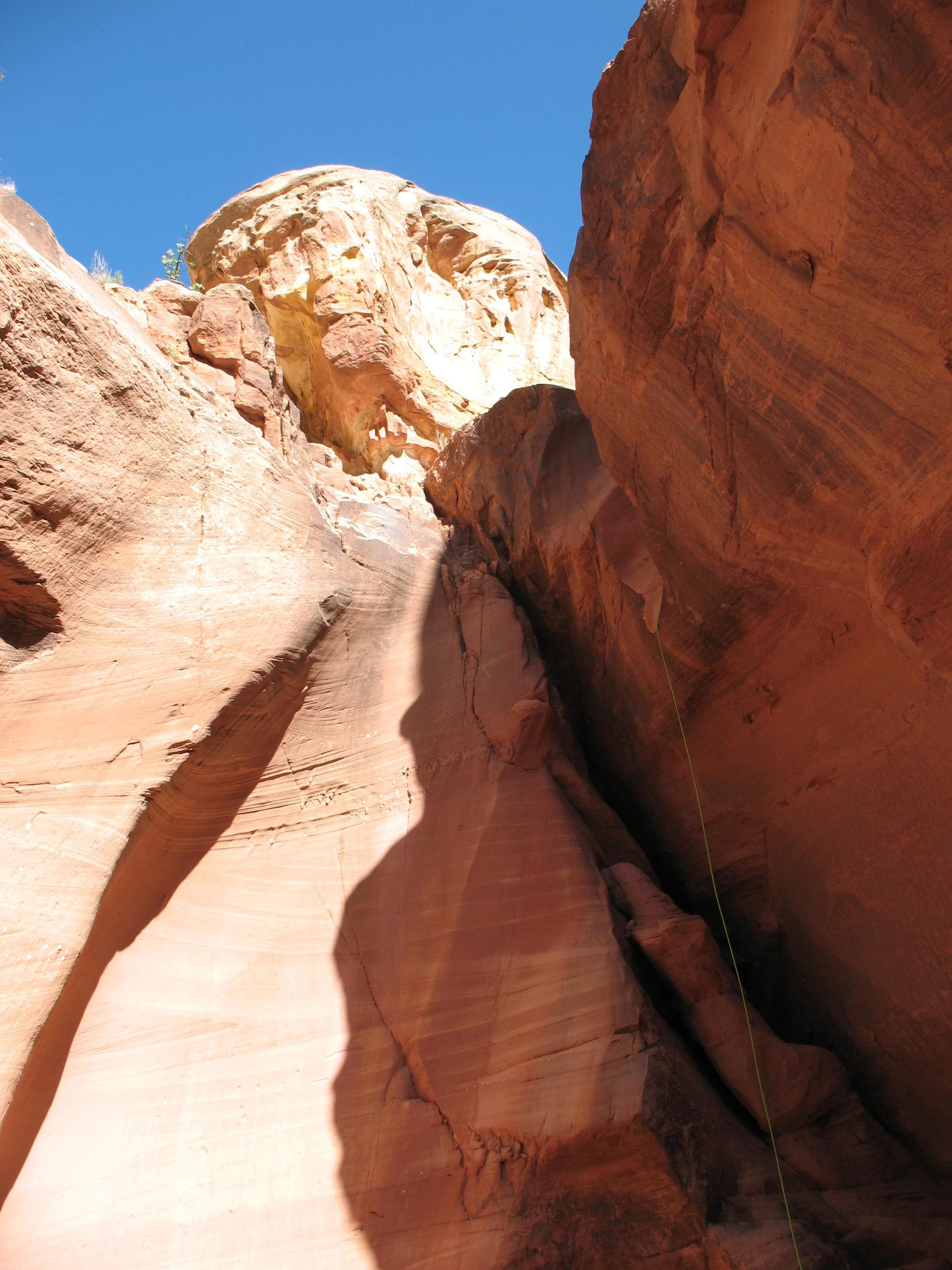
One of the drops in Cove
Getting There
Travel south out of Hanksville on Highway 95 about 45 miles to between mile posts 45 and 46. There is a dirt road on the east side of the highway here, just before the bridge over the Colorado River. Take this road.
- Reset your odometer as you turn off onto the side road. Stay on the main road, avoiding the many side roads along the way. ( 12S 554607mE 4195028mN / N37° 54' 04" W110° 22' 44" )
- At 19.6, just before the road crosses Cove Canyon, there is a junction. The road to this point should be passable by all vehicles if carefully driven. This junction is the trailhead. ( 12S 566089mE 4202078mN / N37° 57' 50" W110° 14' 51" )
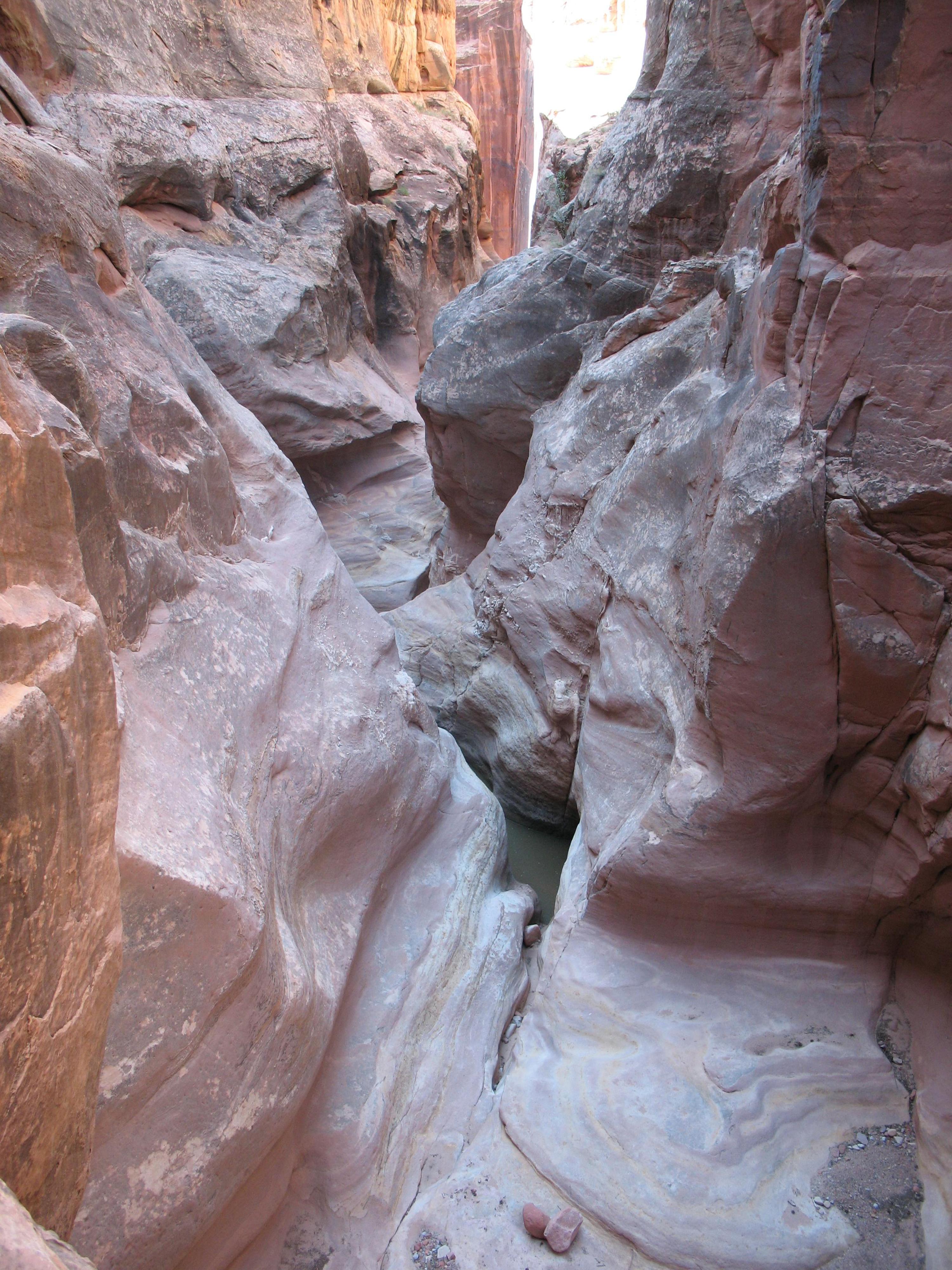
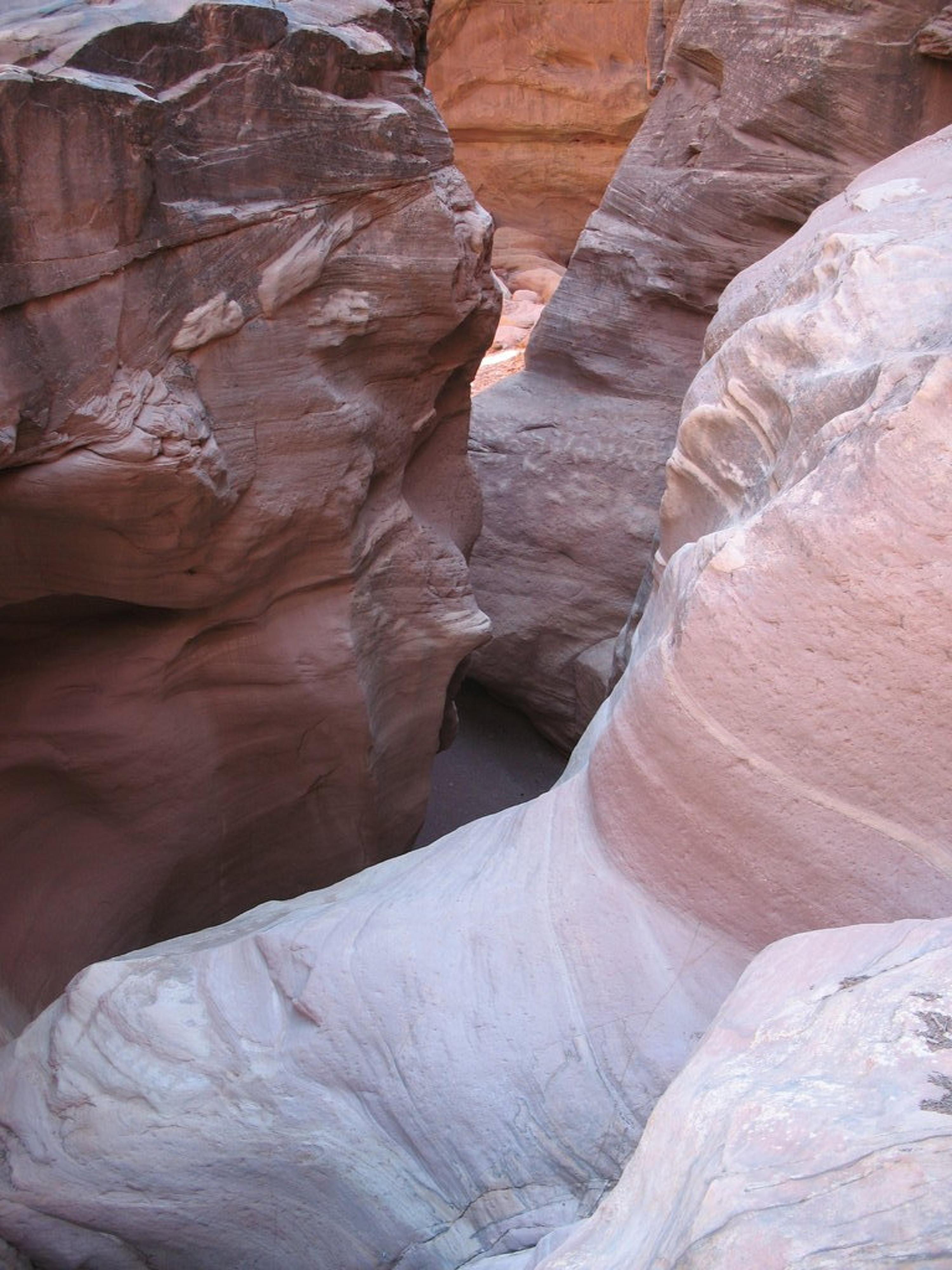
Lovely narrows and pool in Cove Canyon
Route
From the trailhead, walk down into Cove Canyon and head down the canyon. The canyon is wide and shallow at this point with many large overhangs and shallow caves along the way. Follow the canyon down as it begins deepening and cutting into the sandstone. It slowly deepens, with easy walking. 30-45 minutes from the trailhead, a small downclimb is encountered. The downclimb is followed by another small drop that is easily passable on the left. Canyon walls are beginning to rise and narrow as the canyon rounds a bend and prepares for its first big drop. Those out for a hike will want to turn back at this drop. (60 minutes from the trailhead.)
If continuing down, be sure to have ascenders and be proficient in using them. The first rappel is about 15 m ( 50 ft. ) with the anchor being a large boulder back from the edge. The last part of this rappel is free hanging, meaning you will have to pass a lip when ascending.
2 minutes below the first rappel is the second rappel. A 30 m ( 99 ft. ) rope can be used here to anchor off one of the large boulders back from the edge. The rappel is low angle with several ledges along the way, before depositing you in a (likely) deep pool. The canyon is deepening quickly and this point and becoming more narrow and beautiful.
5 minutes down from the second rappel is another drop. This drop is about 15 m ( 50 ft. ) - 20 m ( 66 ft. ) as well, but you will need a 60 m ( 197 ft. ) rope (or long length of webbing) as the only anchor possibilities are back from the edge some distance. Below this drop there are several pools, and another drop just down canyon.
Unfortunately at this point I was out of rope, so had to ascend. If continuing, it appeared you could go a bit further, but it would require more ropes. (likely a 60 m ( 197 ft. )).
Re-ascend the fix ropes you left.
Photos
Maps

| Trailhead |
12S 566041mE 4201879mN N37° 57' 44" W110° 14' 53" |
| First Rap |
12S 567473mE 4200520mN N37° 56' 59" W110° 13' 55" |