 Hiking Mount Peale
San Juan County Highpoint
Overview
|
Fri 44 | 32 |
Sat 43 | 30 |
Sun 46 | 29 |
Mon 48 | 33 |
Tue 49 | 33 |
| View Full Weather Details | ||||
SEASON: Summer, Fall
GEAR: Standard Hiking Gear / Moderate Navigation Skills
WATER: None.
NOTES: The approach gully can hold snow well into the summer. If hiking in early summer, plan on crampons, ice axes, and the skills needed to use them. Late summer or fall is best for those without steep snow experience.
|
Fri 44 | 32 |
Sat 43 | 30 |
Sun 46 | 29 |
Mon 48 | 33 |
Tue 49 | 33 |
| View Full Weather Details | ||||
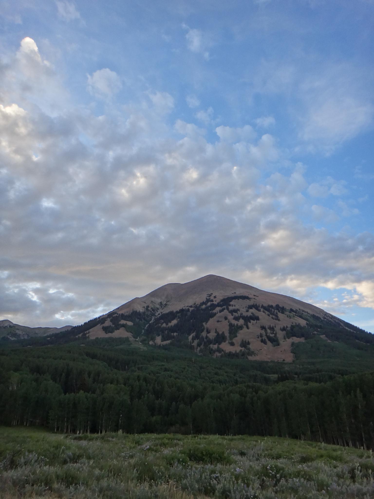
Mount Peale from a campsite on the south side.
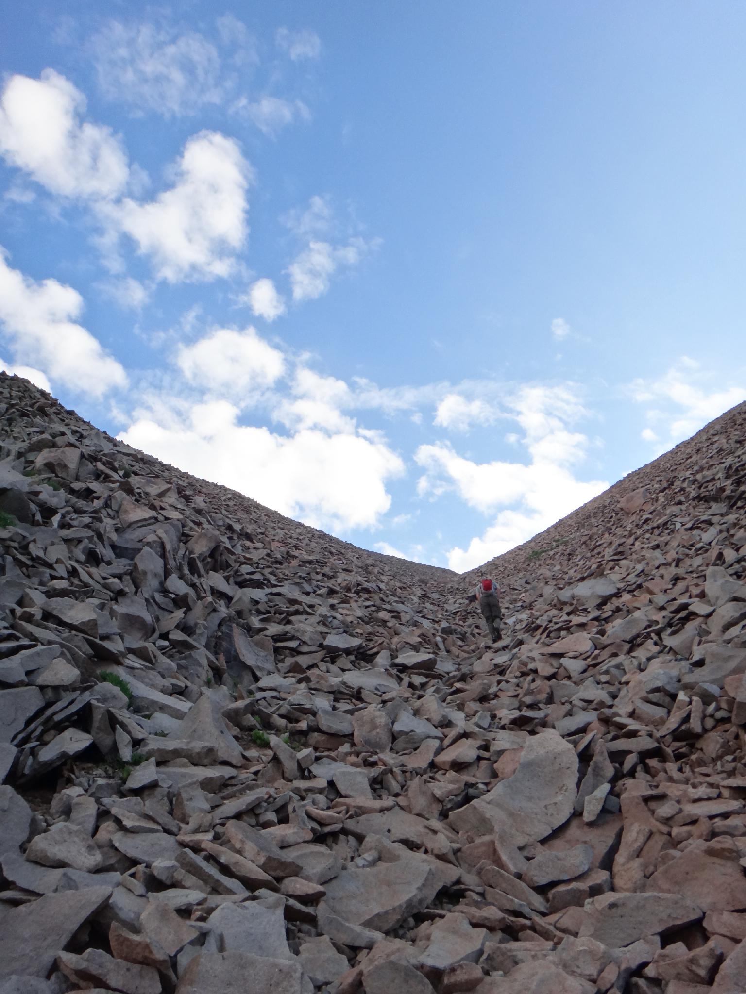
The GULLY!
Ever notice the striking pyramid looking peak to the south from Moab? The one that looks like the highpoint of the La Sals? Turns out that is NOT the highpoint, that is Mt. Tukuhnikivatz. Mt. Peale, the highpoint of the range and of San Juan county is behind Tukuhnikivatz, and a mere 250' higher. From most vantage points, Tukuhnikivatz looks taller, and to be fair, is likely the more striking of the two peaks.
Visiting the La Sal mountains is in contrast to the desert county near Moab. On even the hottest days in Moab, the La Sal mountains can be pleasant to down right chilly. The mountains were likely named by early Spanish visitors who, in the oppressive heat of the desert around Moab, assumed the white tops of the mountains must be made of salt (la sal). Surely snow couldn't exist in such heat?!?!?
As always with peaks, beware of afternoon thunderstorms.
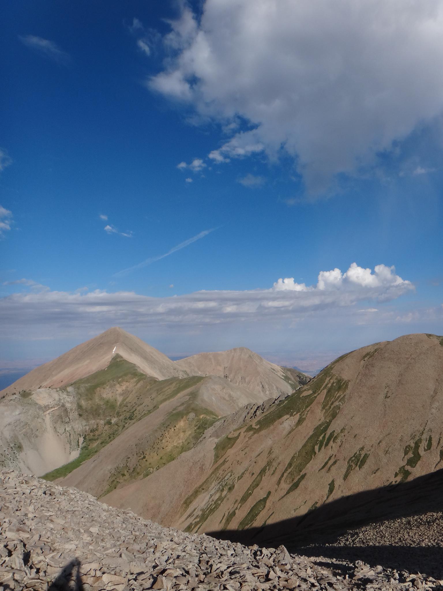
View of Mount Tukuhnikivatz from the ridge.
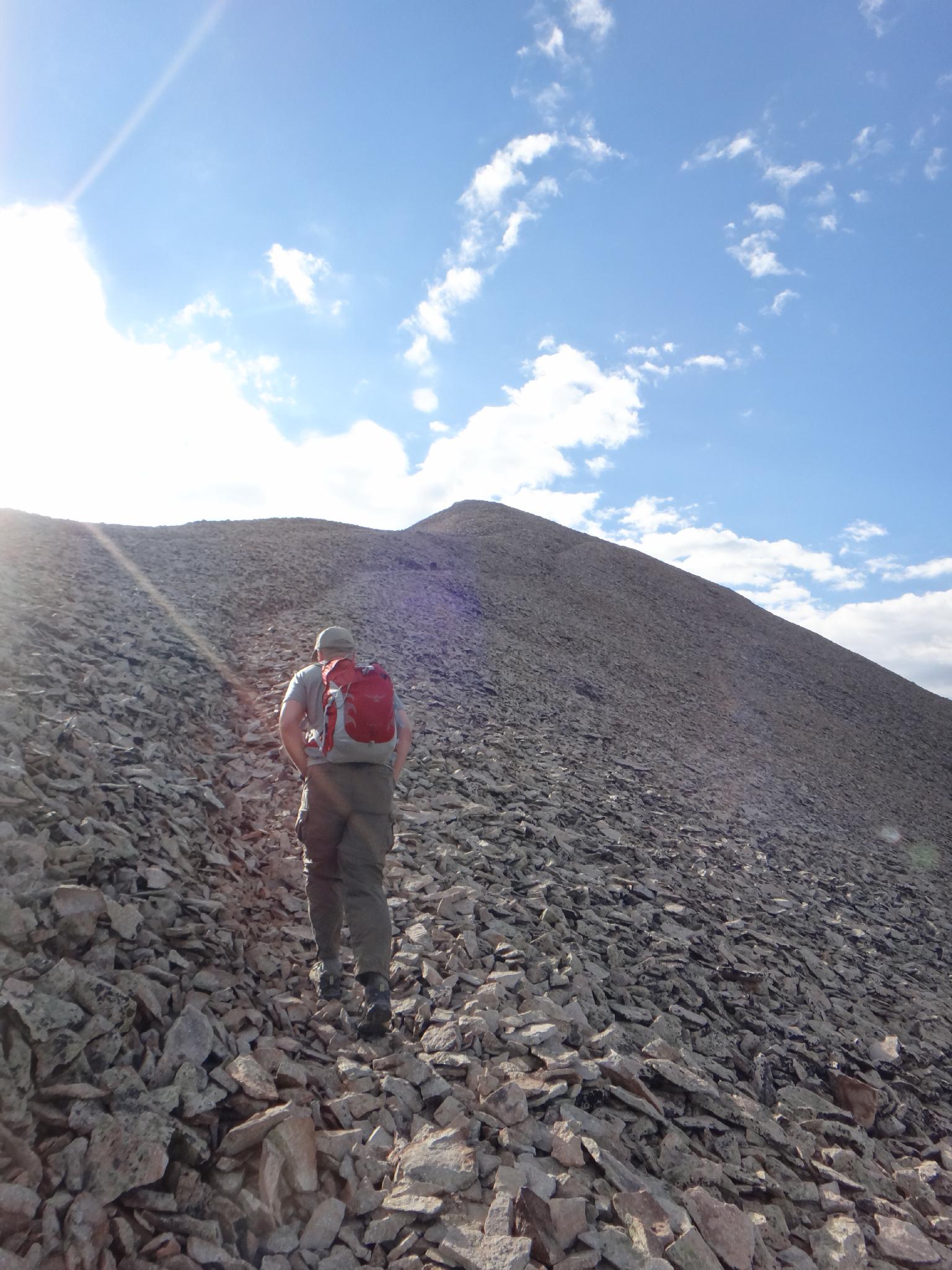
Charging up the last section
Getting There
The trailhead is at La Sal Pass. This can be reached from the north, but requires a high clearance 4wd vehicle, from the south most any vehicle should be able to reach the trailhead.
From Moab:
From Moab:
- Drive south on highway 191 about 22 miles to La Sal Junction.
- Go left, toward, and passing through La Sal to mile 12.7, where a dirt road goes off on the left signed La Sal Pass.
- 1.9 miles from the paved highway, go left toward La Sal Pass
- 7.4 miles from the last junction the road crests the pass with a large parking area on the right and several good camping sights on the left.
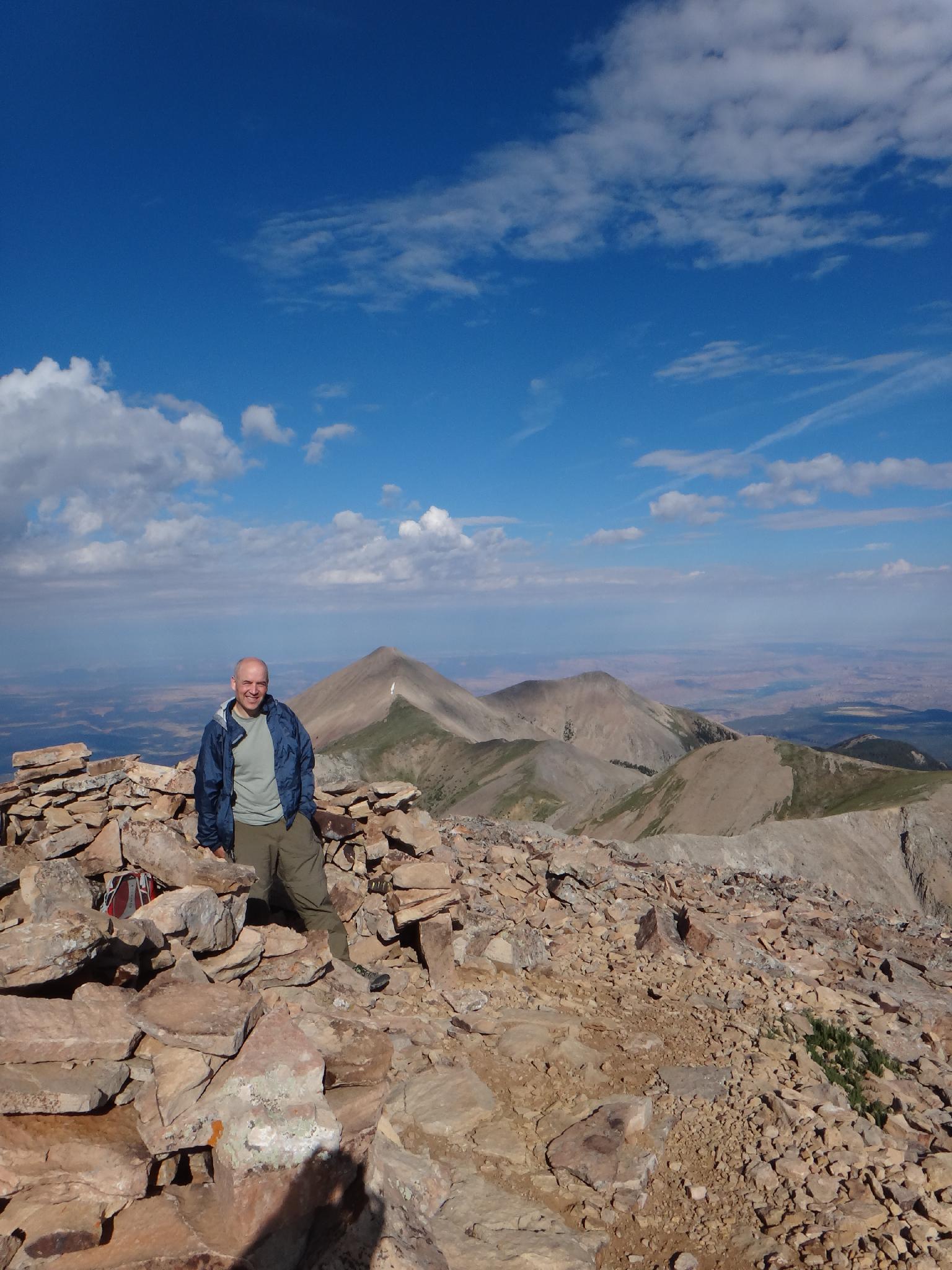
Tom on the summit
Route
Summit: 3877 m ( 12720 ft. )
Trailhead: 3079 m ( 10102 ft. )
La Sal Pass
Head north, crossing the meadow, and wooded areas to reach the obvious gully visible from the trailhead. It is easiest, after the first wooded section, to descend to the east to reach the 4x4 road. This looses a little elevation, but not much. Follow the 4x4 road the the 4x4 trailhead.
4x4 Trailhead
Follow the use trail on the east side of the drainage as it climbs through the trees. Shortly, it reaches the gully proper and the hike steepens and becomes rocky. Follow the gully upward. About 1/2 way to the ridge, a well worn use trail climbs steeply up the right slope. Though steep, this is the recommended route. An alternative is to follow the gully proper to the ridge.
Once on the ridge, follow it east as it passes a small summit and climbs to the true summit. There are several social trails here at lower levels. Stay on the most used higher trail. The lower trails tend to fade and/or are harder than the minor elevation gain and loss of the main upper trail.
The summit offers astounding views of the desert around Moab and other La Sal peaks. Return the same way.
Photos
Maps
Route /
5.11 miles /
Elevation Range 10,134 - 12,716 ft.
Printable Maps:


| Trailhead |
12S 652617mE 4253750mN N38° 25' 08" W109° 15' 06" |
| 4wd Trailhead |
12S 653334mE 4255272mN N38° 25' 57" W109° 14' 36" |
| Summit |
12S 654546mE 4255946mN N38° 26' 18" W109° 13' 45" |