 Roadside Attraction Muley Point
Cedar Mesa
Overview
|
Thu 67 | 41 |
Fri 71 | 47 |
Sat 71 | 48 |
Sun 78 | 49 |
Mon 82 | 54 |
| View Full Weather Details | ||||
|
Thu 67 | 41 |
Fri 71 | 47 |
Sat 71 | 48 |
Sun 78 | 49 |
Mon 82 | 54 |
| View Full Weather Details | ||||

Muley Point Looking into the San Juan River
Muley Point has to be one of the premiere overlooks in Utah. At the precipitous southern edge of Cedar Mesa, near the top of the Moqui Dugway, it towers above the Goosenecks of the San Juan, with incredible views in all directions. The area has several primitive campsites, and can fill up on busy weekends during the summer. Muley Point is a very highly recommended stop if in the area, and one of the best primitive campsites in Utah for outstanding views. The road is usually accessible year around to any vehicle.

Muley Point - Looking off toward Bluff
Getting There
Muley Point is reached from the top of the Moqui Dugway. This is an impressively steep stretch of road on UT-261 linking the Mexican Hat area with Highway 95 to the north.
From the North
If coming from the north, travel on Highway 95 east, about 12 miles east of Natural Bridges. (93 miles from Hanksville) Take UT-261 south here for about 23 miles to just before it drops of the mesa down the Moqui Dugway.
From the South
Travel east out of Mexican Hat about 4 miles to the junction with UT-261. Follow UT-261 about 9.6 miles to just after it has reached the top of the Moqui Dugway.
Both Routes
Follow the well graded dirt road at the top of the dugway west, and then south about 5 miles to it's end.
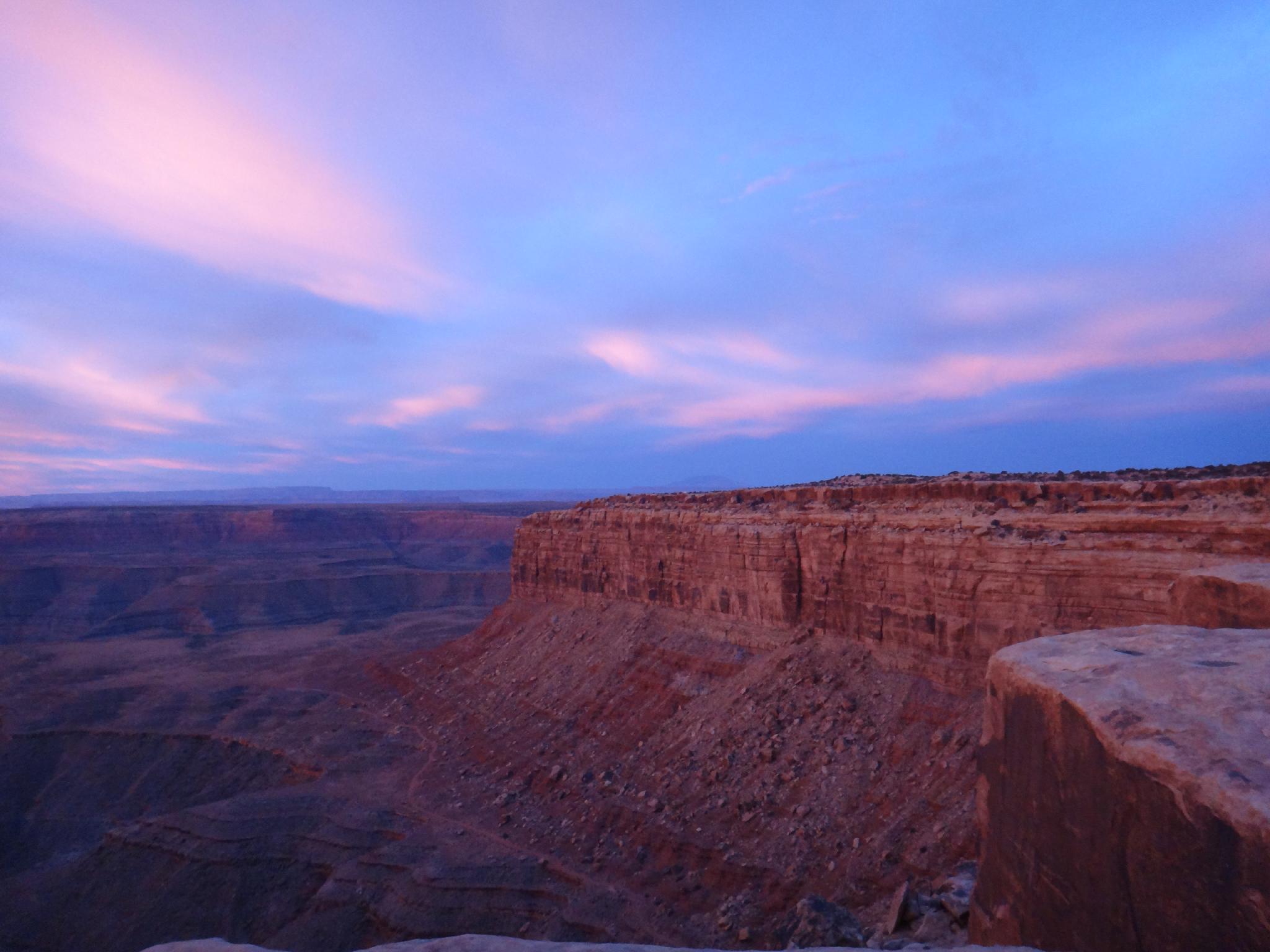
Sunrise at Muley Point
Route
From Muley Point, here are a few of the sights:
- South - On a clear day, you can see the towers of Monument Valley off in the distance.
- South/West - The large mountain to the southwest is Navajo Mountain, above Lake Powell. Navajo Mountain is a prominent landmark that is visible from many areas of South Eastern Utah.
- North/West - The mountains in the distance are the Little Rockies and Henry Mountains near Hanksville
- North - The Bears Ears can often be made out in the distance.
- Looking down below Muley Point is the obvious San Juan River, in the deep canyon coming out of the Goosenecks
Photos
Maps
| Muley Point Turnoff |
12S 593696mE 4126192mN N37° 16' 39" W109° 56' 35" |
| Muley Point |
12S 589329mE 4121225mN N37° 13' 60" W109° 59' 35" |