
 Pine Spring Ruin
Cedar Mesa
Overview
|
Sat 51 | 36 |
Sun 58 | 37 |
Mon 65 | 39 |
Tue 70 | 44 |
Wed 71 | 47 |
| View Full Weather Details | ||||
|
Sat 51 | 36 |
Sun 58 | 37 |
Mon 65 | 39 |
Tue 70 | 44 |
Wed 71 | 47 |
| View Full Weather Details | ||||
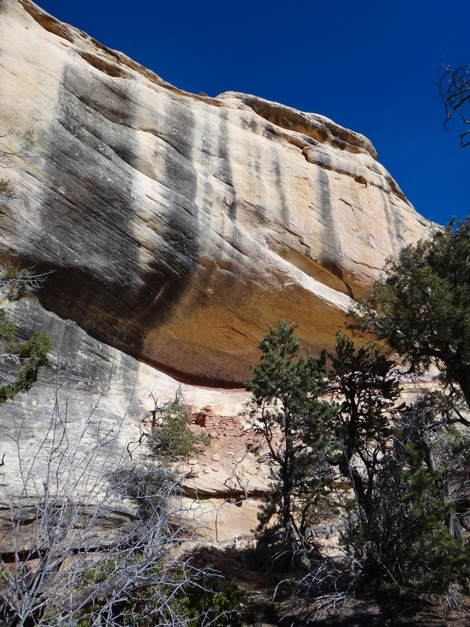
Pine Spring Ruin on Cedar Mesa
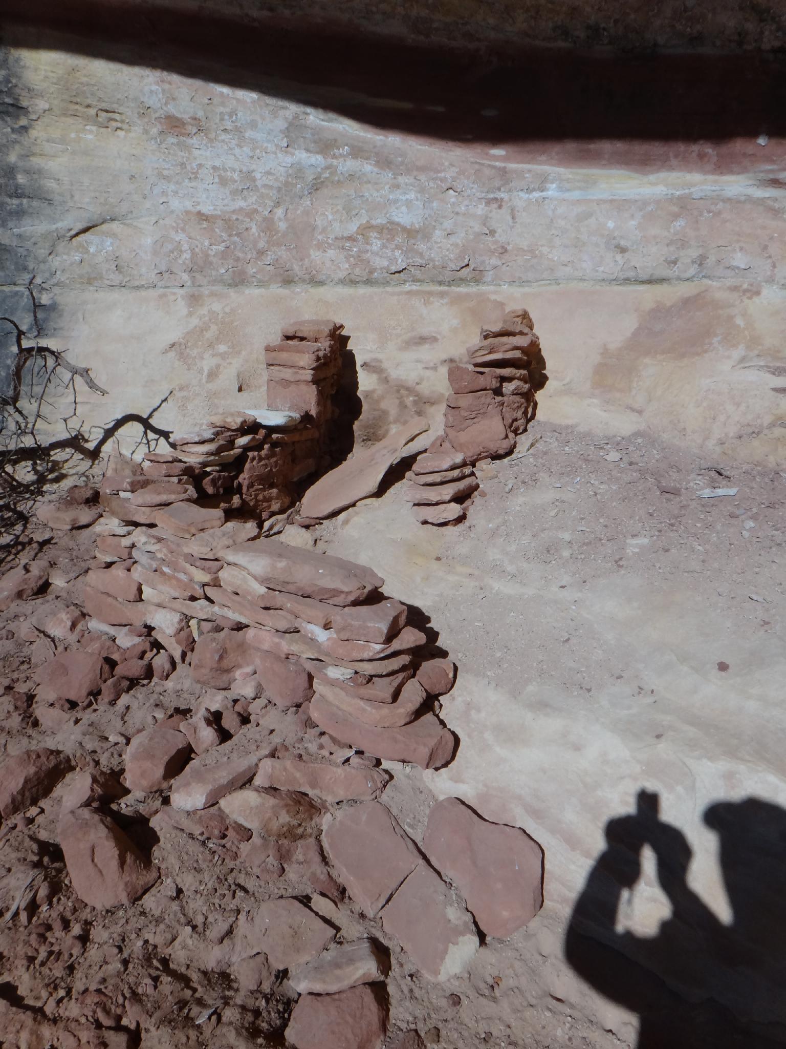
Pine Spring Ruin
It is rare that I am disappointed by a hike. This one, however, is the exception. Given a good spring, south facing cliff walls, and the many other ruins nearby, I expected Pine Spring to have a few ruins, panels, or both. One small ruin that is in poor shape is visible not far off the road, however a morning of wandering around the rest of Pine Spring canyon didn't turn up any other signs of the ancients.
This is a good hike if your looking for a short leg stretcher. The scenery is good, however the ruins are not. On the plus side, there are several good primitive camp sites along the road.
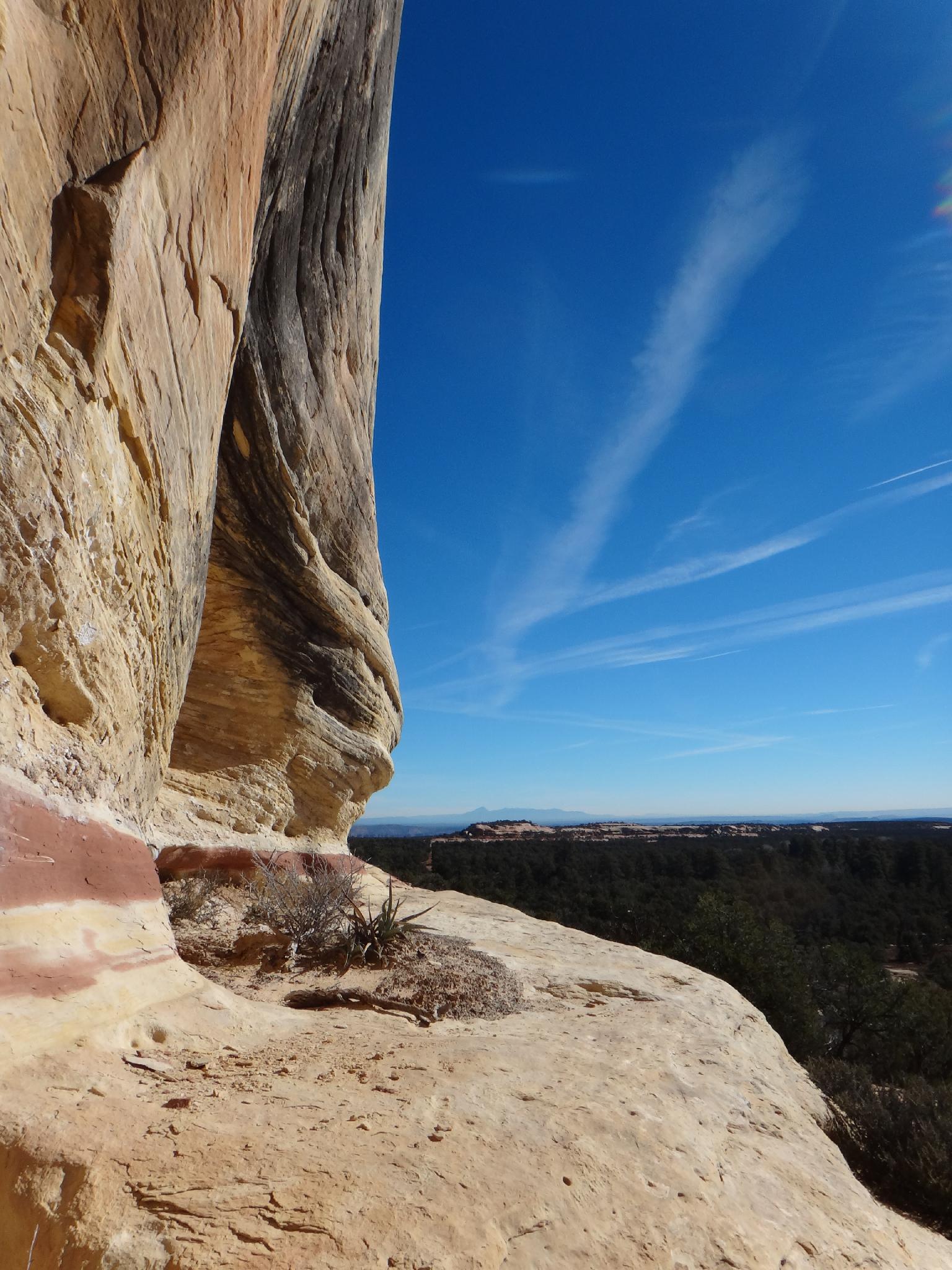
Views from Pine Spring Ruin
Getting There
Reaching the trailhead starts at milepost 97.2 on highway 95. This is 97.2 miles south of Hanksville, or 28 miles from Blanding. If coming from Blanding, go south out of town a few miles to the gunction with highway 95. Go west on 95 about 24.3 miles, 0.2 miles before to the large pullout and Salvation Knoll on the south side of the highway.
Road #2331 goes off to the south side of highway 95 here. Follow it, staying on the main road, 1.5 miles. The ruin is visible to the north (left) side of the road.
Continue an additional 0.2 miles to a good camping area where Pine Spring crosses the road.
Route
To visit the ruin, simply go cross country. Be mindful of the cryptobiotic soil, there is much of it along the way. The ruin is in fair shape.
If camping near Pine Spring, wandering up the valley around Pine Spring makes a good, short hike. It is 1-2 hours to wander up to near the head and highway 95, and return.
Photos
Maps

| Trailhead |
12S 605502mE 4156334mN N37° 32' 53" W109° 48' 20" |
| Ruin |
12S 605485mE 4156588mN N37° 33' 01" W109° 48' 21" |
| Pine Spring |
12S 605593mE 4156916mN N37° 33' 12" W109° 48' 16" |