 Hiking Red Canyon (Chimney Valley)
Hanksville
Overview
|
Sat 64 | 44 |
Sun 69 | 41 |
Mon 76 | 42 |
Tue 80 | 47 |
Wed 83 | 49 |
| View Full Weather Details | ||||
|
Sat 64 | 44 |
Sun 69 | 41 |
Mon 76 | 42 |
Tue 80 | 47 |
Wed 83 | 49 |
| View Full Weather Details | ||||
A stark beauty
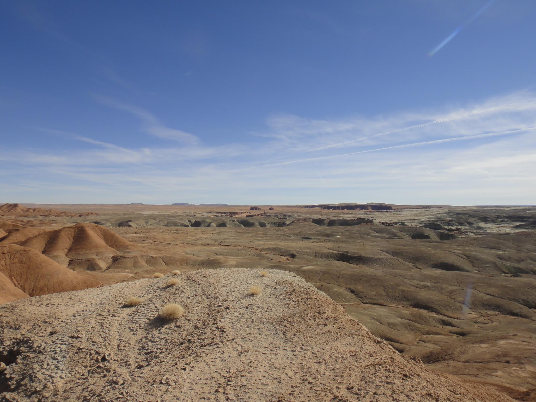
I wandered into Red Canyon (Chimney Valley) with high hopes of finding an Entrada sandstone paradise littered with towers similar to the View Finder area just north of Hanksville. Alas, I did indeed find a magical valley littered with towers. Instead of being the somewhat climbable Entrada spires I had hoped for, however, they turned out to be in the much more difficult, loose, and scary Moenkopi formation. Above both my skill level and interest level to try and climb, the area still makes a great day hike into a very stark and seldom visited corner of the desert.
Though a few prints were visible along Muddy Creek proper, the canyon itself showed no signs of any recent visits. Expect a casual hike to striking towers you are likely to have all to yourself. It has a gray and bleak beauty that is in contrast with the more colorful hikes in the Swell.
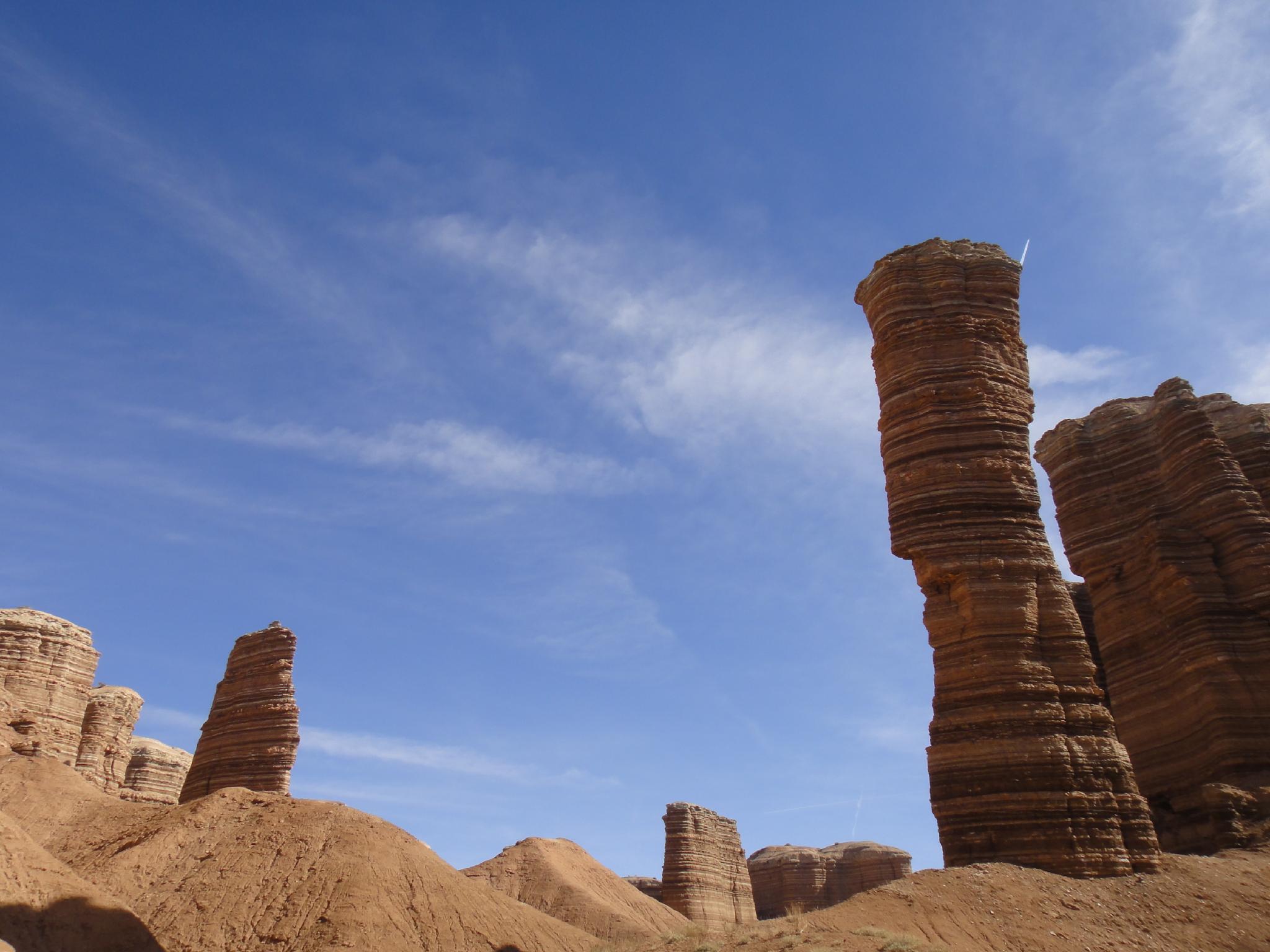
More Towers
Getting There
Go north out of Hanksville about 4 miles to mile post 120.6 on highway 24. A dirt road goes off on the left (west) side, not far north of the airport. Reset the odometer.
- Follow the road west, ignoring side roads. At about 0.7 miles from highway 24, the road turns south and begins a steep, rocky climb. Only 4x4's can make this.
- At the top of the climb, on slickrock, the road mostly disappears. Go north (right) over the slickrock until the road comes back into view on the other side.
- Follow the main dirt road as it meanders down the badlands. Many will stop short somewhere in here as the road can have bad washouts. At 2.5 miles from highway 24, the road descends into Well Draw. Park here, this is the trailhead.
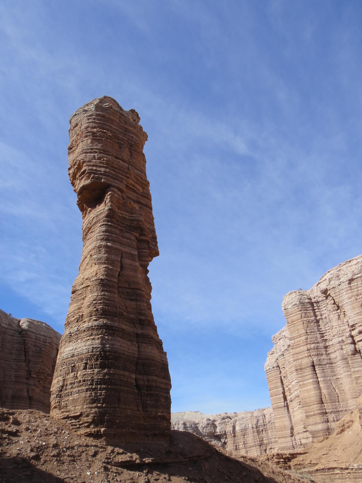
Tower in Chimney Valley
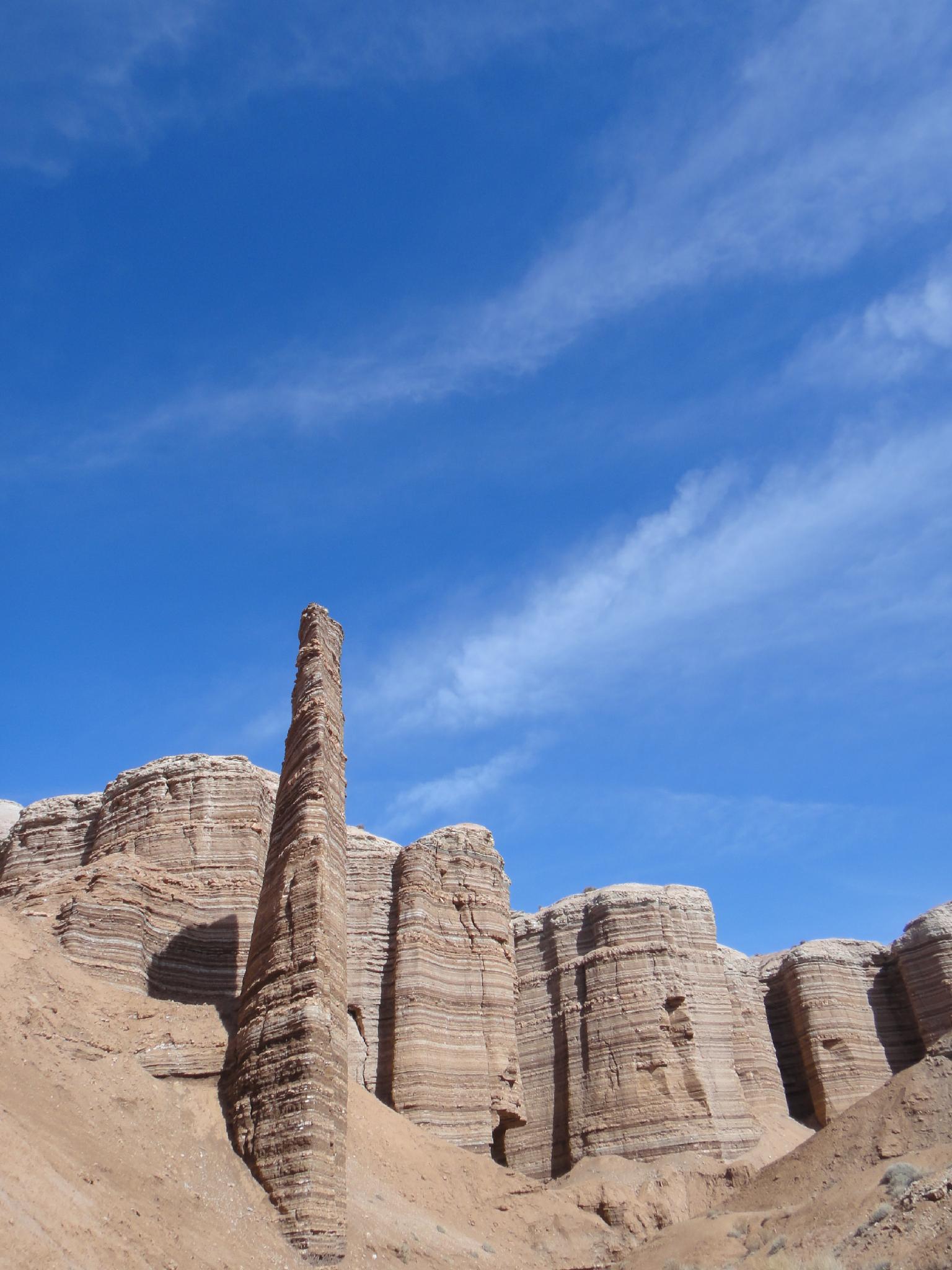
Pinnacle in Chimney Valley
Route
From the trailhead, follow Well Draw to Muddy Creek, and turn right (west) heading upstream. Good cow and even an occasional ATV track make this easy going.
A major side wash coming in on the right, with Moenkopi cliffs at its mouth is Red Canyon. (2.5 miles / 1 hour) Going up Red Canyon, it quickly divides. Left is not particularly interesting, go right, and the towers begin dotting the valley. At the next junction, a loop can be made going up the right, then traversing around and back down the left. It is probably easier, and equally scenic, to simply visit the side canyons individually and return the same way.
Photos
Maps
 Hiking Map")
| Trailhead |
12S 524335mE 4255360mN N38° 26' 46" W110° 43' 16" |
| Junction |
12S 521910mE 4256919mN N38° 27' 37" W110° 44' 56" |