 Hiking Catherine Pass
Little Cottonwood
Overview
|
Sun 34 | 25 |
Mon 41 | 26 |
Tue 41 | 25 |
Wed 42 | 27 |
Thu 47 | 28 |
| View Full Weather Details | ||||
|
Sun 34 | 25 |
Mon 41 | 26 |
Tue 41 | 25 |
Wed 42 | 27 |
Thu 47 | 28 |
| View Full Weather Details | ||||
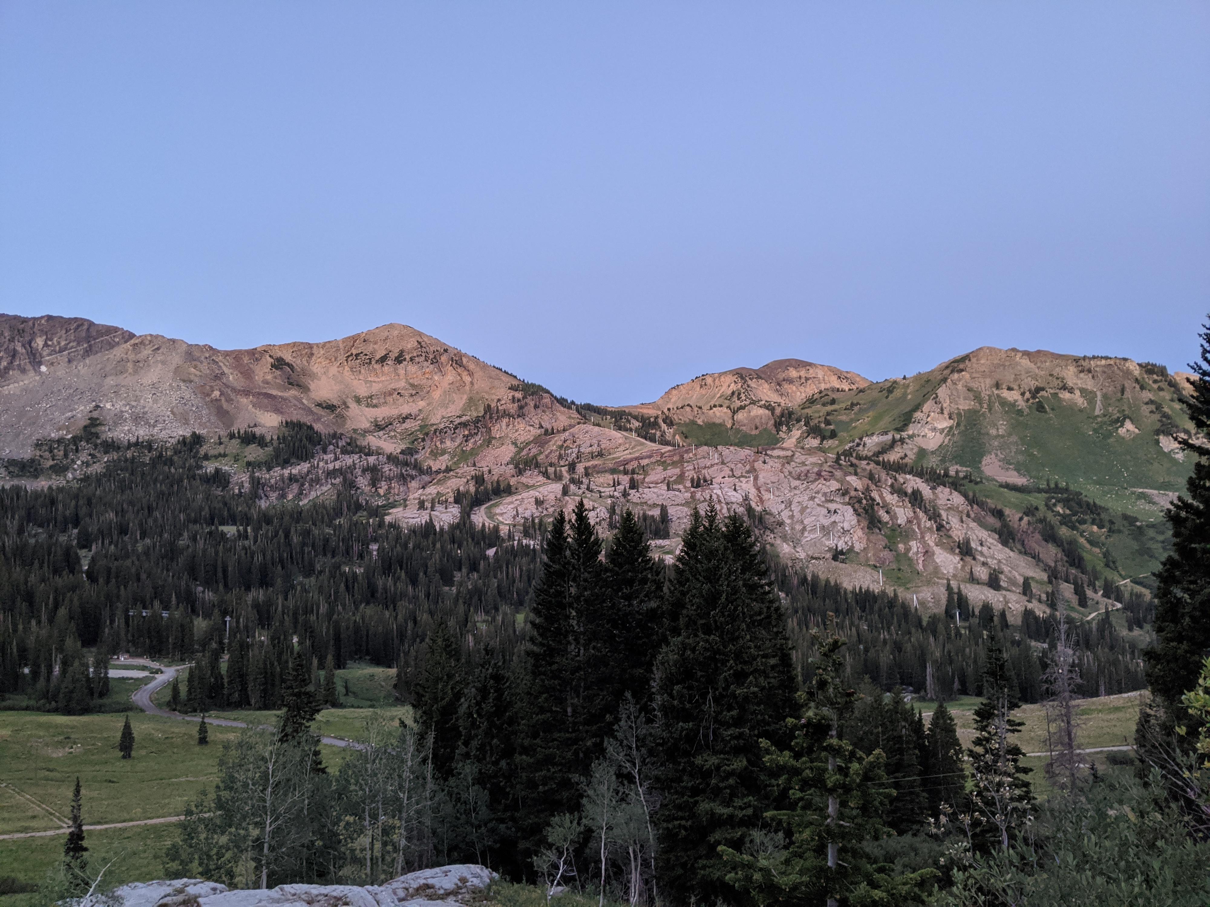
Sugarloaf Mountain (just left of center) and Mount Baldy (just right of center) from near the start of the hike.
Catherine Pass, allowing easy passage between Little and Big Cottonwood Canyons, is a stunning wildflower hike. In many ways, I like this hike better than Secret Lake. Because the hike is on the north side of the canyon, it has views of the south ridge of Little Cottonwood, and I would argue more dramatic scenery than Secret Lake. In addition, wildflowers, grassy meadows, and views into Big Cottonwood Canyon from the pass make this an excellent outing.
The distance and elevation gain make this a good shorter hike. Those wanting a longer outing can descend to Lake Catherine in the Big Cottonwood Canyon or traverse the ridgeline east to the summit of Sunrise Peak. From the pass, there are many options along the ridgelines.
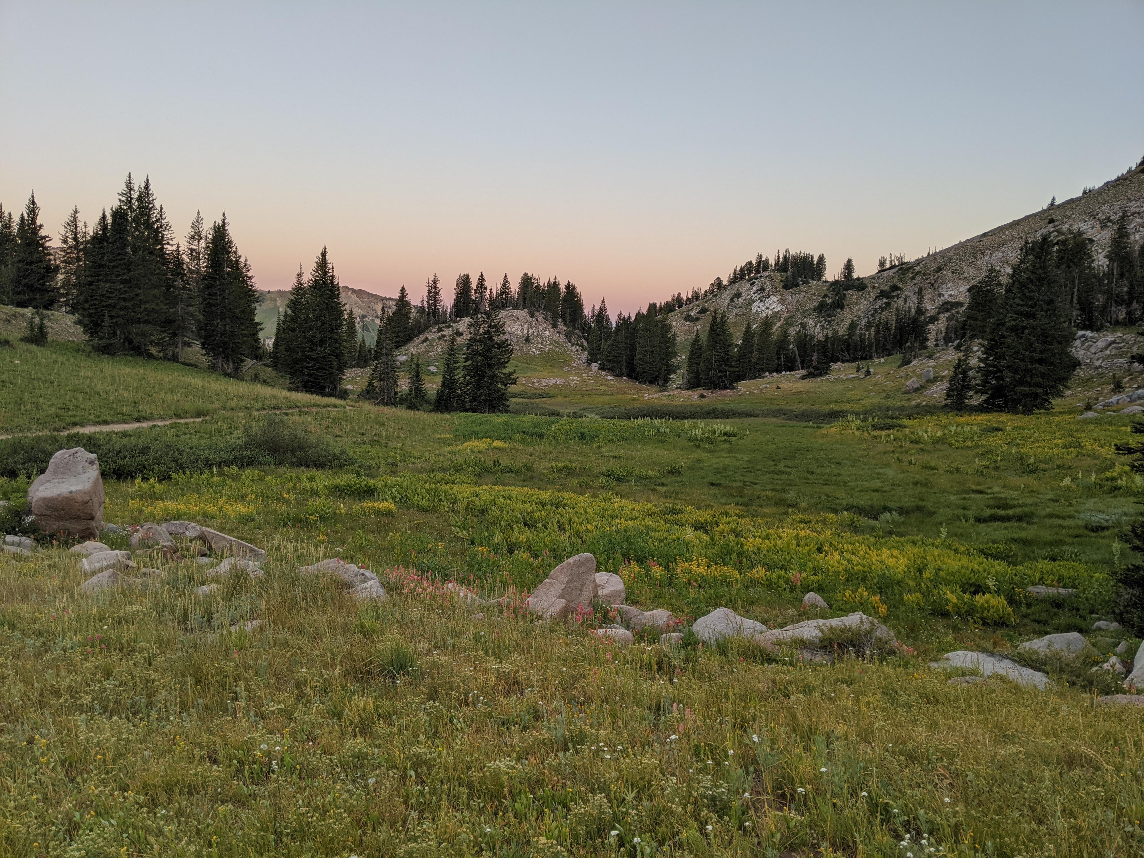
The meadow en route to the Catherines Pass.
Getting There
Little Cottonwood Canyon is on the east side of the Salt Lake City Valley. Get there by following I-215 to the east, taking exit 6 off the interstate and heading east toward the mountains.
Follow 6200 South which becomes Wasatch Blvd for 1.8 miles to the stop light and signs for Big Cottonwood Canyon. Continue south (straight) through the light an additional 2.3 miles to a junction and light. Stay left here, reaching the mouth of Little Cottonwood Canyon in an additional 1.6 miles.
From the mouth of Little Cottonwood, travel up the canyon 11.2 miles to the signed Secret Lake Trailhead parking, just before the Albion Basin Campground.
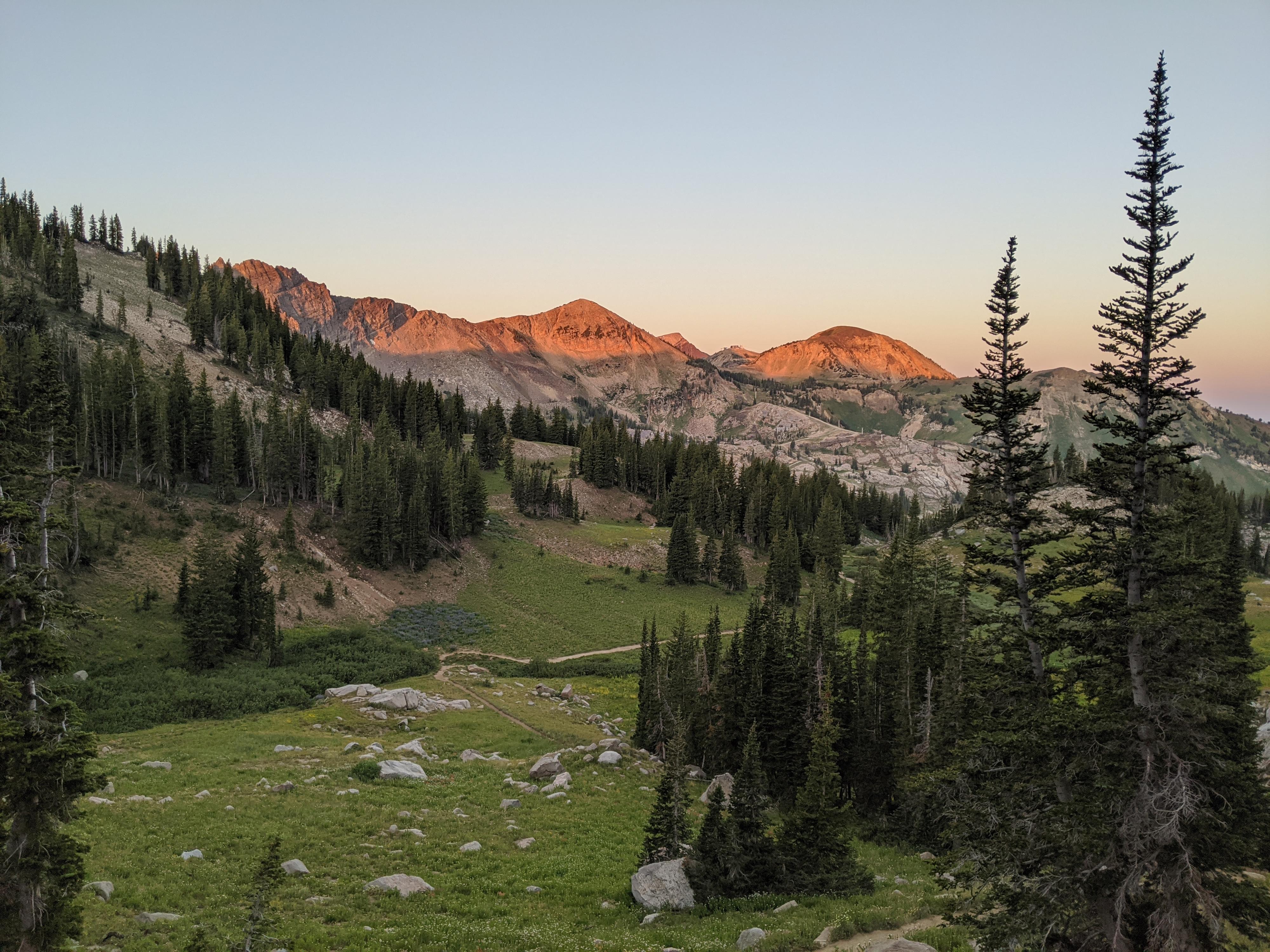
Excellent sunrise on the peaks above Alta.
Route
From the Catherine Pass Trailhead, cross the Albion Basin Road and start up the trail as it passes near the ski lifts. The trail, and old route used by miners, is easy to follow. It climbs with views of Devils Castle and Sugarloaf Mountain dominating to the south. At a junction, stay left (right goes down to the Albion Basin Campground).
The trial climbs a bit more and enters a stunning meadow. The meadow, at the base of Mt Tuscarora, if often a carpet of wildflowers in mid-to-late summer. The trail continues, climbing steeply and making switchbacks up to the pass.
From the pass, Lake Catherine is directly below on the Big Cottonwood side, with Sunset Peak east along the ridge (see the Sunset Peak - Big Cottonwood Canyon hike for more details). Either are good side trips! Or, take in the views and simply return the same way.
Photos
Maps

| Catherine Pass Trailhead |
12T 447651mE 4492634mN N40° 34' 58" W111° 37' 07" |
| Jct - Stay left |
12T 448561mE 4492207mN N40° 34' 45" W111° 36' 28" |
| Meadows |
12T 448977mE 4492410mN N40° 34' 51" W111° 36' 10" |
| Catherine Pass |
12T 449337mE 4492387mN N40° 34' 51" W111° 35' 55" |
| Lake Catherine |
12T 449766mE 4492456mN N40° 34' 53" W111° 35' 37" |
| Jct - Right (Down hill) |
12T 449359mE 4492052mN N40° 34' 40" W111° 35' 54" |
| Jct - Left |
12T 449450mE 4492040mN N40° 34' 39" W111° 35' 50" |
| Sunset Peak |
12T 449752mE 4491982mN N40° 34' 38" W111° 35' 37" |