 Hiking Red Pine Lake
Little Cottonwood Canyon
Overview
|
Sat 32 | 27 |
Sun 42 | 24 |
Mon 49 | 29 |
Tue 50 | 28 |
Wed 53 | 31 |
| View Full Weather Details | ||||
|
Sat 32 | 27 |
Sun 42 | 24 |
Mon 49 | 29 |
Tue 50 | 28 |
Wed 53 | 31 |
| View Full Weather Details | ||||
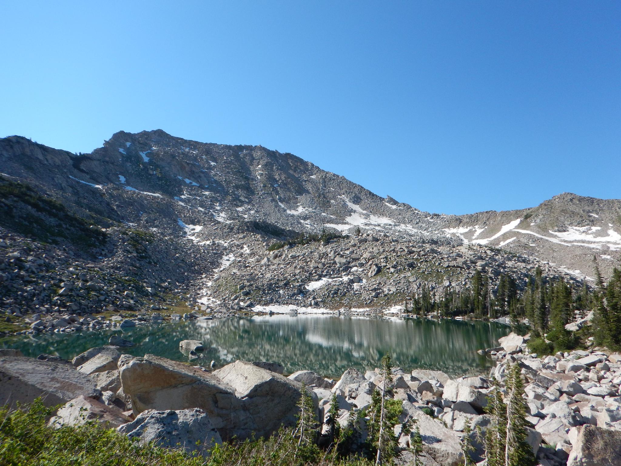
Upper Red Pine Lake in Late June
Red Pine Lake, situated just below tree line, is a very popular hike in Little Cottonwood Canyon. On a summer weekend, the trailhead parking lot can fill up well before 9AM! The hike is popular for good reason. It makes a good 1/2 day affair to very stunning scenery. Though a bit steep in spots and about 7 miles, the hike is family friendly. On our last visit, we saw everyone from toddler being carried to . . . well. . . I wouldn't want to guess at their age, but certainly "of advanced age".
Though many groups stop at the end of the official trail on the shore of Red Pine Lake, I think visiting the Upper Lake is well worth the effort and really makes the day. Upper Red Pine Lake offers a beautiful lake right at tree line, with dramatic ridges and peaks surrounding it. A must visit if you've already made the journey to Lower Red Pine.
Still motivated? The Pfeifferhorn is the ticket, though suitable for experienced hikers only.
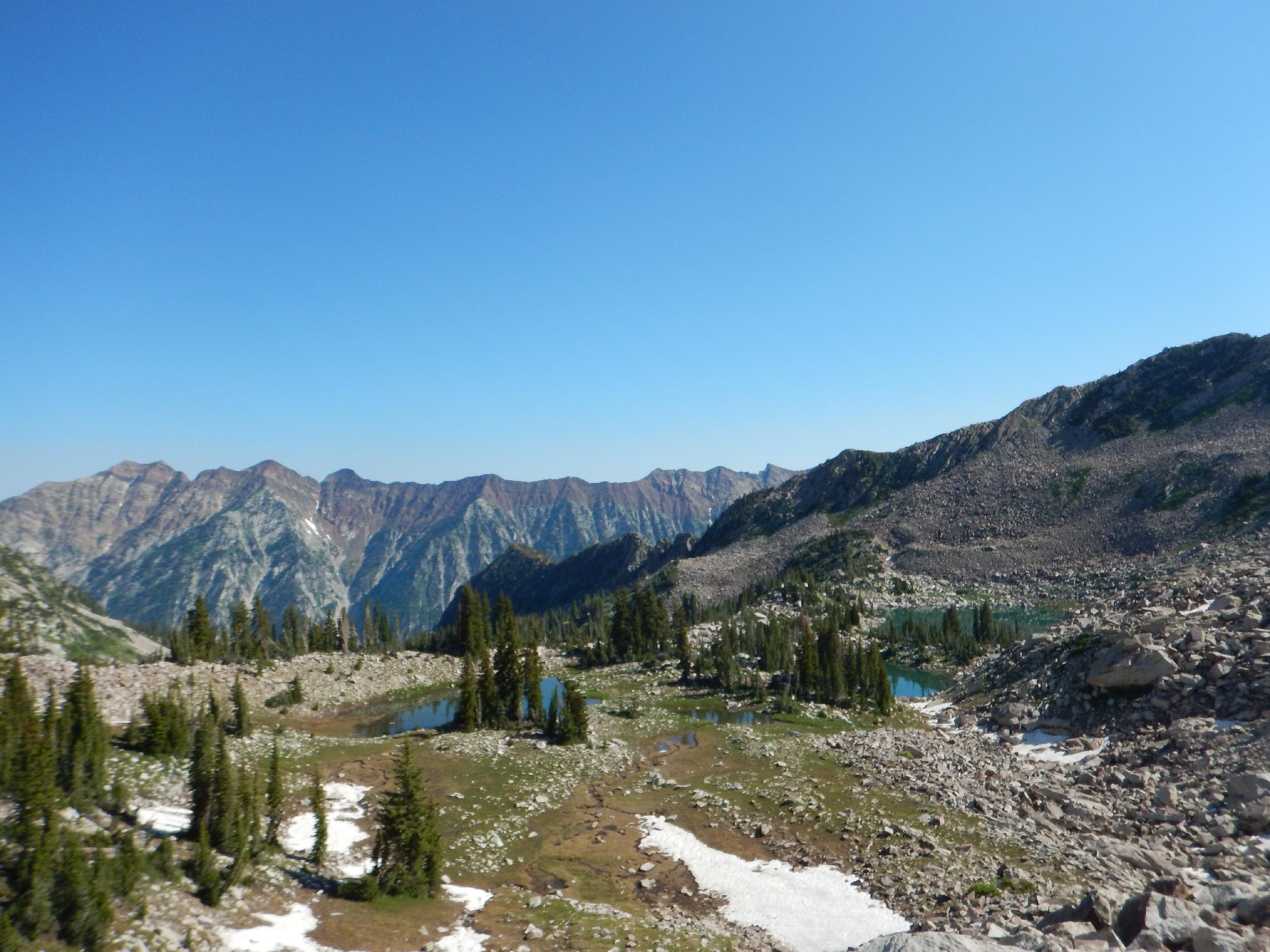
Upper Red Pine Lakes from Above.
Getting There
Little Cottonwood Canyon is on the east side of the Salt Lake City Valley. Get there by following I-215 to the east, taking exit 6 off the interstate and heading east toward the mountains.
Follow 6200 South which becomes Wasatch Blvd for 1.8 miles to the stop light and signs for Big Cottonwood Canyon. Continue south (straight) through the light an additional 2.3 miles to a junction and light. Stay left here, reaching the mouth of Little Cottonwood Canyon in an additional 1.6 miles.
From the mouth of Little Cottonwood, travel up the canyon 5.3 miles to the signed White Pine Trailhead on the south side of the road. This is about a mile up the canyon from the Tanners Flat Campground.
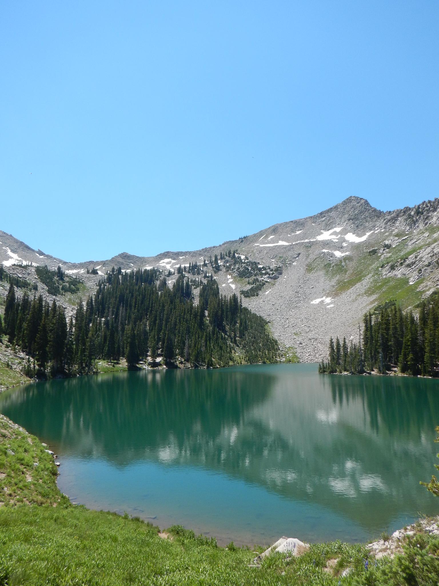
Lower Red Pine Lake in Little Cottonwood
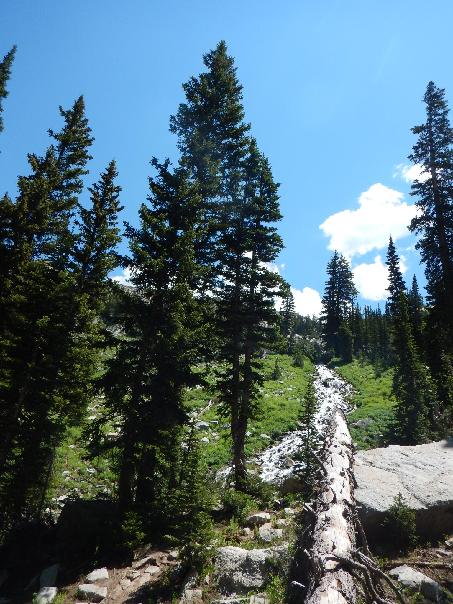
Cascade from Upper to Lower Red Pine Lakes
Route
To White Pine Junction (1 mile)
From the trailhead, follow the well-used White Pine/Red Pine trail as it descends from the trailhead, crosses a bridge, and begins its ascent from the valley floor. After about 20-30 minutes, the first junction is reached. Left goes to White Pine, right is signed for Red Pine. The Red Pine trail is just behind the wooden sign and is wide and well-travelled. The Red Pine trail climbs for a couple of minutes before crossing the stream on a bridge and heading west.
To Red Pine Junction (1.6 miles from White Pine Junction)
The trail gradually climbs as it traverses around the ridge into the Red Pine drainage. Just as the trail turns up Red Pine, a stunning overlook of the lower canyon and Salt Lake City comes into view. The trail then begins climbing more steeply before reaching the junction to Maybird Gulch. In summer of 2015, this junction was easy to find, but not signed for Maybird Gulch. Stay left at this junction.
To Red Pine Lake (0.6 miles)
2 minutes past the Maybird Gulch junction, an old mine in passed on the left and the trail begins climbing steeply up the rocky slope to Red Pine Lake in about 25 minutes and 500' of elevation gain.
To Upper Red Pine Lake (0.5 miles)
From Red Pine Lake, the official trail ends, however social trails continue up to Upper Red Pine Lake. A good social trail is on both the east and west side of the cascading stream coming down from Upper Red Pine Lake. Either gets you there, however the east side trail offers better views, the west side seems generally easier and more well traveled. Either trail is steep, but well worth the effort.
Upper Red Pine Lake is a stunning high mountain lake right at tree line. Thunder Mountain and high ridges surround this lovely area.
Return the same way.
Photos
Maps

| Trailhead |
12T 442344mE 4491861mN N40° 34' 32" W111° 40' 52" |
| White Pine Jct. |
12T 441644mE 4490823mN N40° 33' 58" W111° 41' 22" |
| Red Pine Jct. |
12T 441114mE 4489406mN N40° 33' 12" W111° 41' 44" |
| Red Pine Lake |
12T 441302mE 4488450mN N40° 32' 41" W111° 41' 35" |
| Upper Red Pine Lake |
12T 441657mE 4487922mN N40° 32' 24" W111° 41' 20" |