 Hiking Secret (Cecret) Lake
Alta
Overview
|
Mon 42 | 26 |
Tue 37 | 19 |
Wed 30 | 23 |
Thu 33 | 18 |
Fri 41 | 24 |
| View Full Weather Details | ||||
|
Mon 42 | 26 |
Tue 37 | 19 |
Wed 30 | 23 |
Thu 33 | 18 |
Fri 41 | 24 |
| View Full Weather Details | ||||
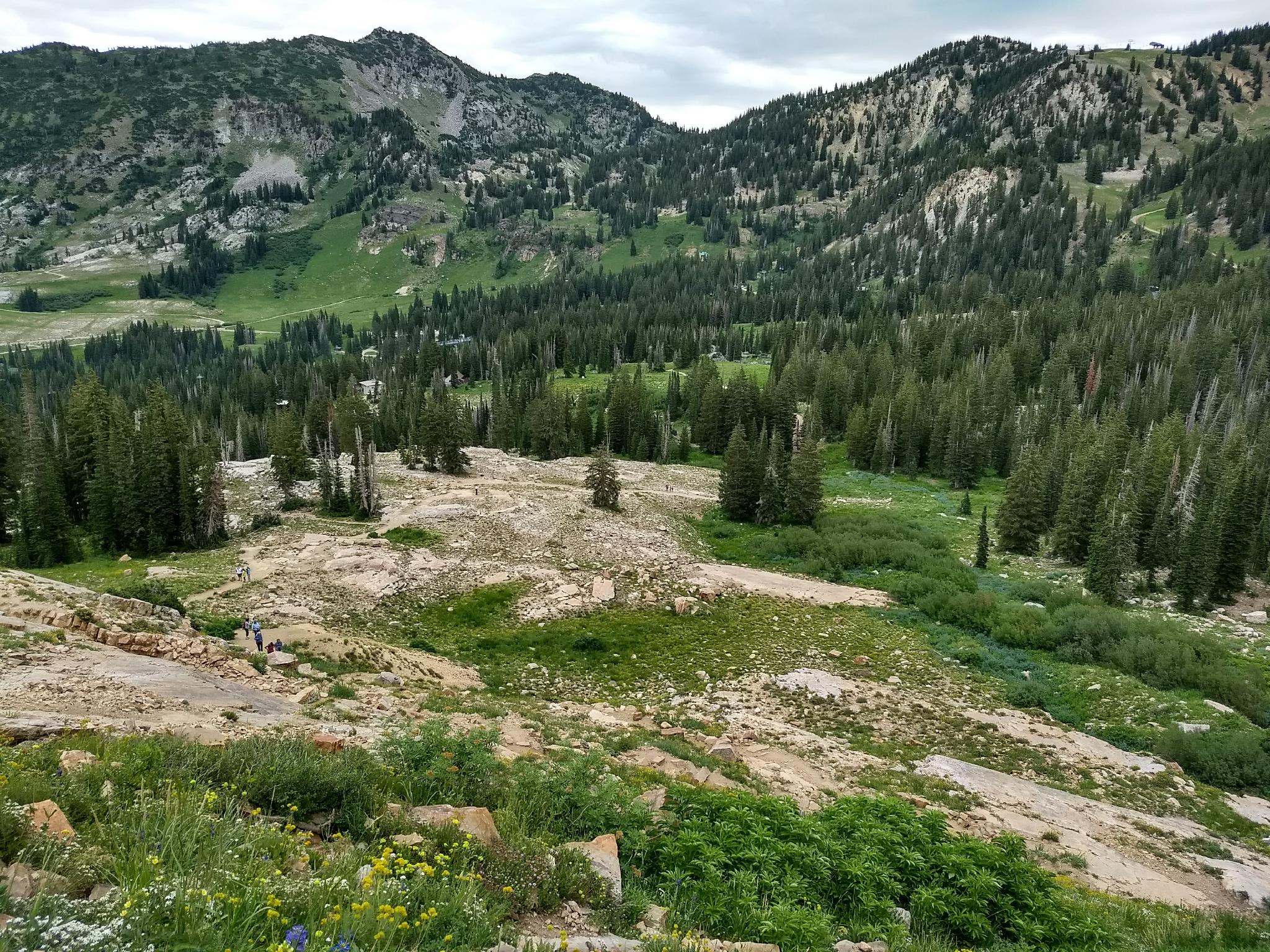
Albion Basin on the return hike.
Secret Lake, or Cecret Lake as it is also known, is one of the premier wildflower hikes in Little Cottonwood. The hike is short, family-friendly, and usually bursting with color during wildflower season. At about a mile round trip, this is a hike even young children can likely do part or most of and have a good time. Older children will love clambering around on the small boulders that line the trail
The lake is situated at the base of Sugarloaf Peak and Devils Castle, which provide a stunning background to its crystal clear waters. Though anytime is an excellent time to visit, morning light is my personal favorite.
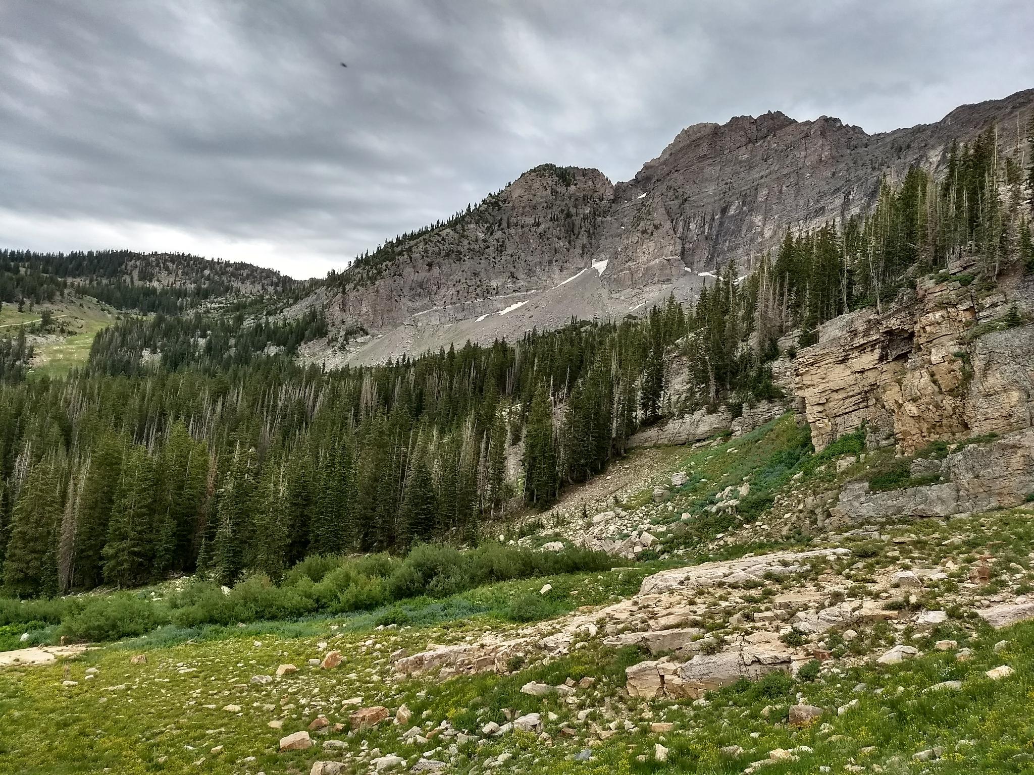
Devils Castle with a moody sky.
Getting There
Little Cottonwood Canyon is on the east side of the Salt Lake City Valley. Get there by following I-215 to the east, taking exit 6 off the interstate and heading east toward the mountains.
Follow 6200 South which becomes Wasatch Blvd for 1.8 miles to the stop light and signs for Big Cottonwood Canyon. Continue south (straight) through the light an additional 2.3 miles to a junction and light. Stay left here, reaching the mouth of Little Cottonwood Canyon in an additional 1.6 miles.
From the mouth of Little Cottonwood, travel up the canyon 11.2 miles to the signed Secret Lake Trailhead parking, just before the Albion Basin Campground.
Note: The trailhead described here starts in Albion Basin. The area is incredibly popular, and the parking can fill up by 7AM on the weekends. Even during the week, I have seen it full by 8AM. You can alternatively start this hike from the base of Alta and use the Albion Meadows trail to reach the trailhead described here. This drops the parking issue but adds about 4 miles roundtrip to the hike. There is an $8 fee (2020) to drive the road to Albion Basin above the base of Alta.
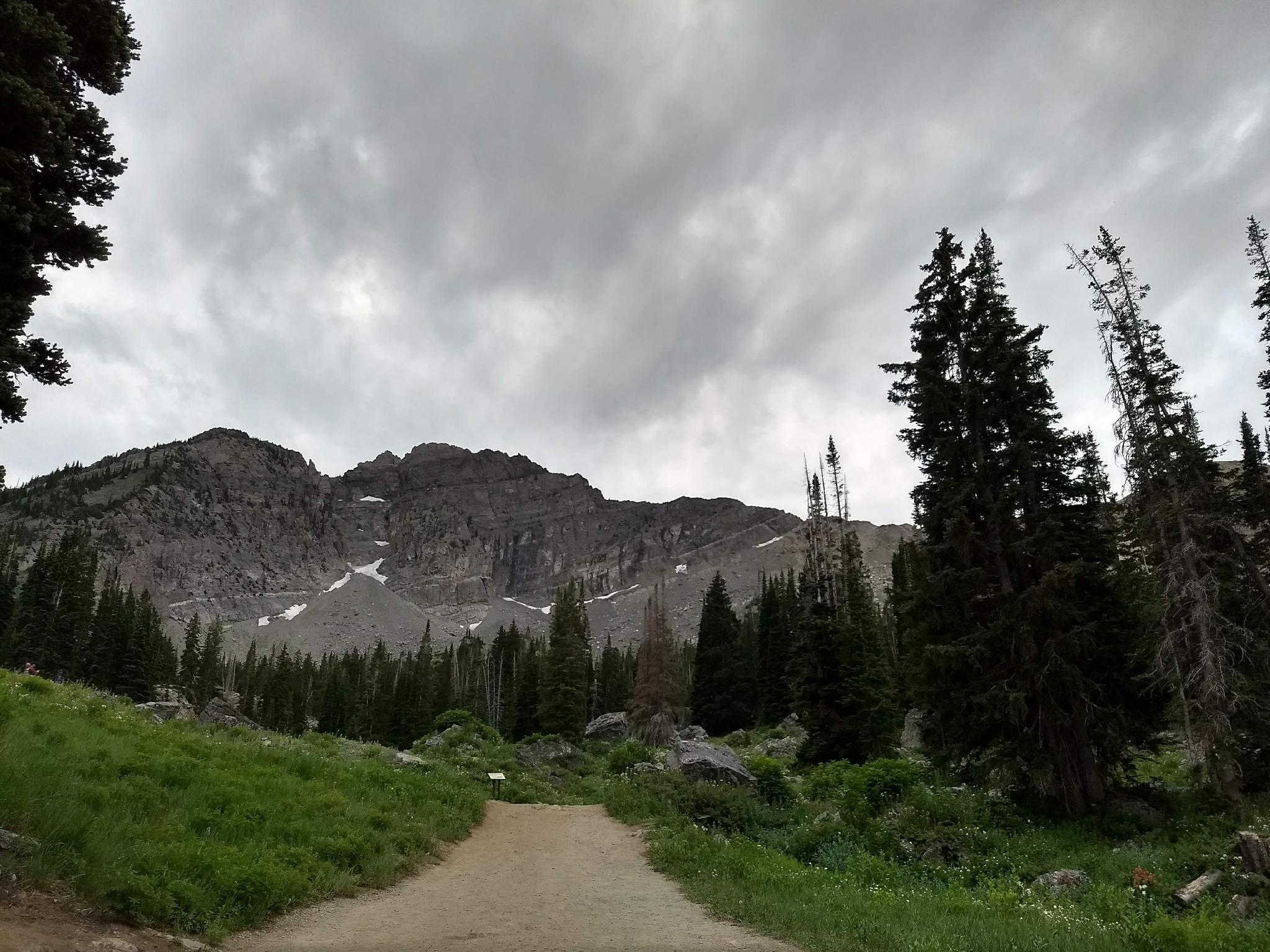
The trail to Secret Lake
Route
From the parking area, the trail takes off from the campground booth/gate. It is well marked, wide, and easy to follow. The area is crisscrossed with trails that go to the campground and Albion Basin. Stay on the most used trail. The interpretive markers along the way offer some history and geology information and are worth the read.
After 15-20 minutes, the trail begins a steeper path up to Secret Lake proper. The setting is sublime, and an excellent break/lunch spot. Bring bug repellent; bugs can be troublesome around the lake at times.
Photos
Maps
 Lake Hiking Map")
| Catherine Pass Trailhead |
12T 447647mE 4492638mN N40° 34' 58" W111° 37' 07" |
| Secret Lake Trailhead |
12T 448118mE 4492085mN N40° 34' 41" W111° 36' 47" |
| Trail |
12T 448089mE 4492053mN N40° 34' 40" W111° 36' 48" |
| Stay Left |
12T 447869mE 4491688mN N40° 34' 28" W111° 36' 57" |
| Secret Lake |
12T 447392mE 4491385mN N40° 34' 18" W111° 37' 17" |