 Hiking The Subway (From the Bottom)
Zion West Side
Overview
|
Thu 72 | 54 |
Fri 78 | 52 |
Sat 78 | 53 |
Sun 62 | 51 |
Mon 57 | 42 |
| View Full Weather Details | ||||
|
Thu 72 | 54 |
Fri 78 | 52 |
Sat 78 | 53 |
Sun 62 | 51 |
Mon 57 | 42 |
| View Full Weather Details | ||||
Subway

Subway small waterfalls
Intro
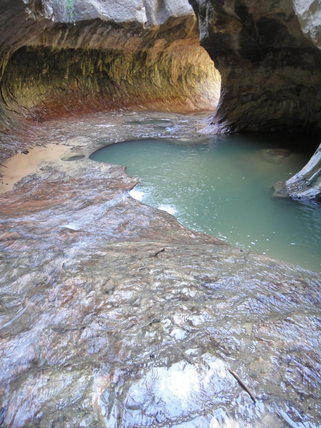
The Subway, also known as the Left Fork of Great West Canyon, is likely the second most sought after place to visit in Zion National Park after the Narrows. It often makes "Top Natural Wonders Of the World" lists, and on any given visit you are likely to run into international visitors. Why the attraction? The Subway offers stunning scenery and colors. The curved walls, crystal clear stream, and vibrant colors will leave an impression on most everyone that visits.
The popularity of the Subway has, unfortunately, led to more oversight and management of it that other areas of the park. No matter how you visit it, you must have a permit and visitation is limited. See the NPS site for current permit information. Getting a permit is difficult in the prime summer season. If you are a Zion Express account holder, I have had the best luck with the last minute lottery.
How to Visit The Subway
There are two ways to do the Subway:
Bottom Up
Visiting from the bottom up is about 9 miles round trip, and sees the bottom end of the Subway before a waterfall blocks upstream progress. Coming up from the bottom is suitable for all hikers, though is a moderately strenuous day. It does not visit the iconic spot with the log angling down into the Subway, but is an amazing hike and recommended if you do not have any technical canyoneering experience.
Top Down
Visiting the Subway from the top down sees much more of the canyon, but at a price. It requires a car shuttle (or hitchhike), and the route itself is technical, involving several short rappels. You must have technical experience to do the Subway from the top down safely. There have been many accidents, fatalities, and near misses by inexperienced hikers getting in over their heads in the top-down route. It is very easy for those with any technical canyoneering experience, but without technical experience, it can become dangerous very quickly. Wetsuits recommended in all but the very hottest conditions.
If you have technical experience, opt for the top-down route. It is by far the best way to see the Subway.
This description if for the bottom-up route.
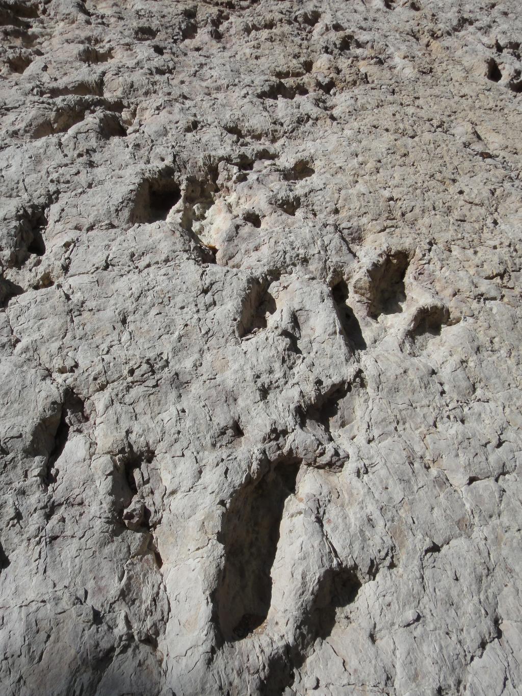
Dino Prints - Subway hiking route.
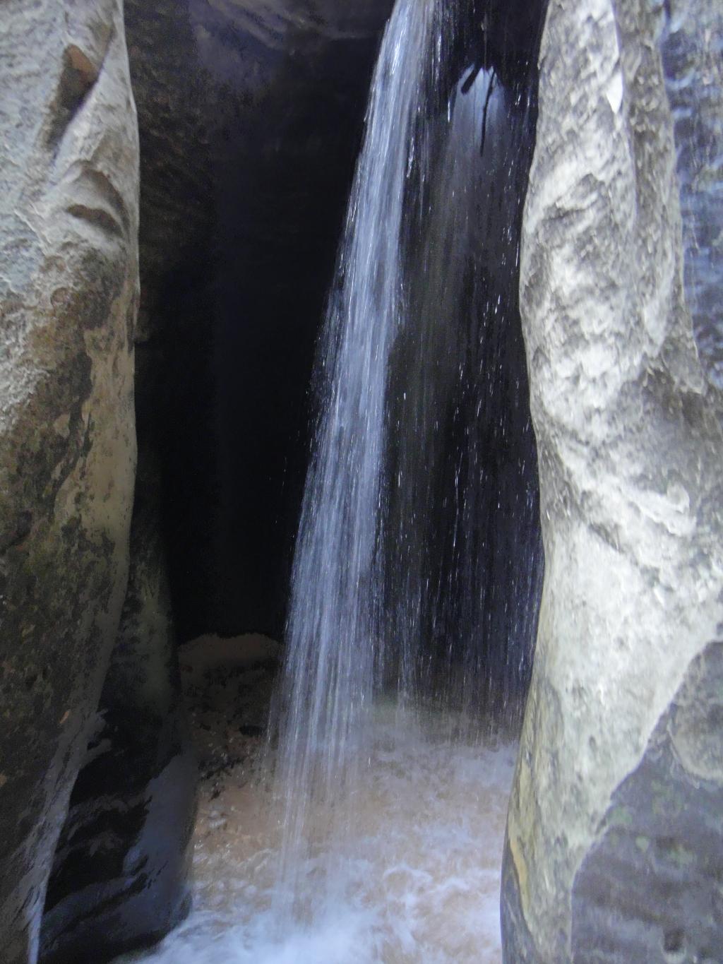
Waterfall - End of the Road - Subway
Getting There
From the Zion Visitor center, head west on UT-9 for about 12 miles until you reach the town of Virgin. The Kolob Reservoir Road goes off on the right as you enter town. Follow the Kolob Reservoir for 8.2 miles to the Left Fork Trailhead on the right hand side of the road.
Note: At 7.5 miles on the Kolob Reservoir road, a good, graded dirt road signed Smith Mesa goes off on the left. A 1/2 mile or so from pavement you leave Zion National Park and enter BLM land. There is decent camping on the BLM land outside the park.

Bottom end of the Subway
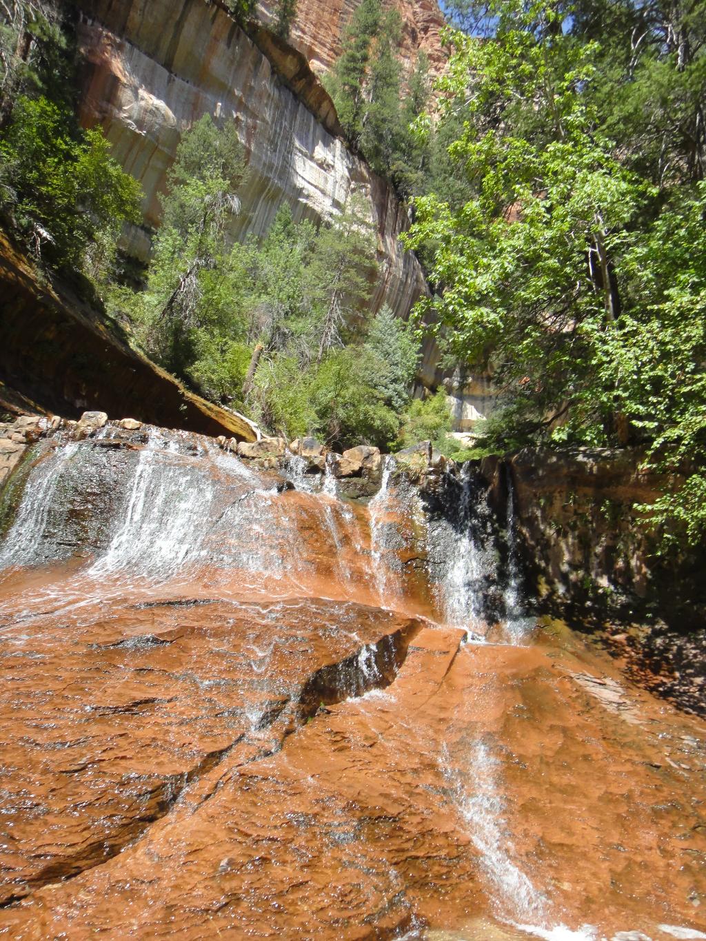
Red Ledges Cascades
Route
Follow the trail across the mesa for 10 minutes or so to where it drops steeply to the bottom of Left Fork. Pay attention to the junction of the trail and the bottom of Left Fork. It can be easy to walk past on your return if you are not careful.
Wander up the Left Fork. Social trails criss-cross the stream looking for the easiest path. A half hour or so after starting up the bottom of Left Fork proper, look for a large boulder on the left with dino prints.
Keep working up the canyon. When you reach the first of the red ledges, you are getting close to the Subway proper.
At the Subway, a short water filled slot and waterfall mark the end of the upstream journey. It is worth wading the water slot to the base of the waterfall. A fixed rope is sometimes in place on the right below the water filled slot to allow passage up the canyon. If attempting this, be careful, and make sure you can get back down what you climb.
Return the way you came.
Photos
Maps
 Hiking Map")
| Trailhead |
12S 314214mE 4128530mN N37° 17' 05" W113° 05' 45" |
| Exit |
12S 315186mE 4128994mN N37° 17' 21" W113° 05' 06" |
| Dino Print |
12S 316528mE 4130113mN N37° 17' 58" W113° 04' 12" |
| Red Falls |
12S 317867mE 4131100mN N37° 18' 31" W113° 03' 19" |
| Subway |
12S 318085mE 4131288mN N37° 18' 38" W113° 03' 10" |