
 100 Hands Panel
Highway 12
Overview
|
Fri 62 | 43 |
Sat 61 | 38 |
Sun 67 | 36 |
Mon 75 | 39 |
Tue 77 | 45 |
| View Full Weather Details | ||||
|
Fri 62 | 43 |
Sat 61 | 38 |
Sun 67 | 36 |
Mon 75 | 39 |
Tue 77 | 45 |
| View Full Weather Details | ||||
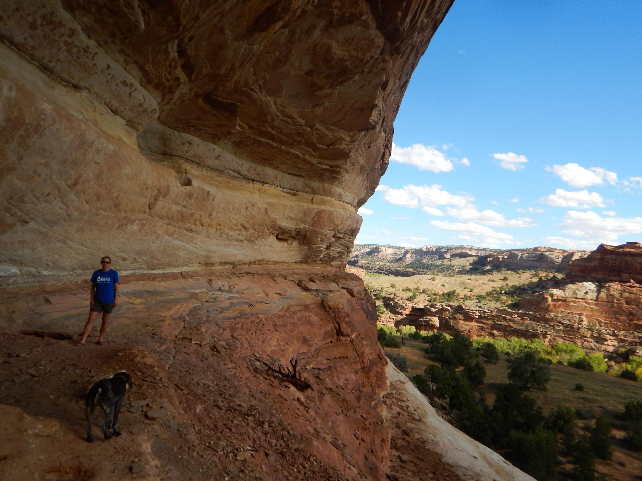
Diane in the alcove with some very faded rock art.
This short hike (< 1 mile) is suitable for most and offers an excellent excursion to several good pictograph and petroglyph panels. This short hike is one I would recommend to anyone passing through the area.

Shaman panel
Getting There
From Escalante, go east on highway 12 toward Boulder. About 14 miles out of Escalante, just after crossing the bridge over the Escalante River (MP 73.9), turn left (west) to a parking area and trailhead. This is just a couple of miles BEFORE the Calf Creek campground.
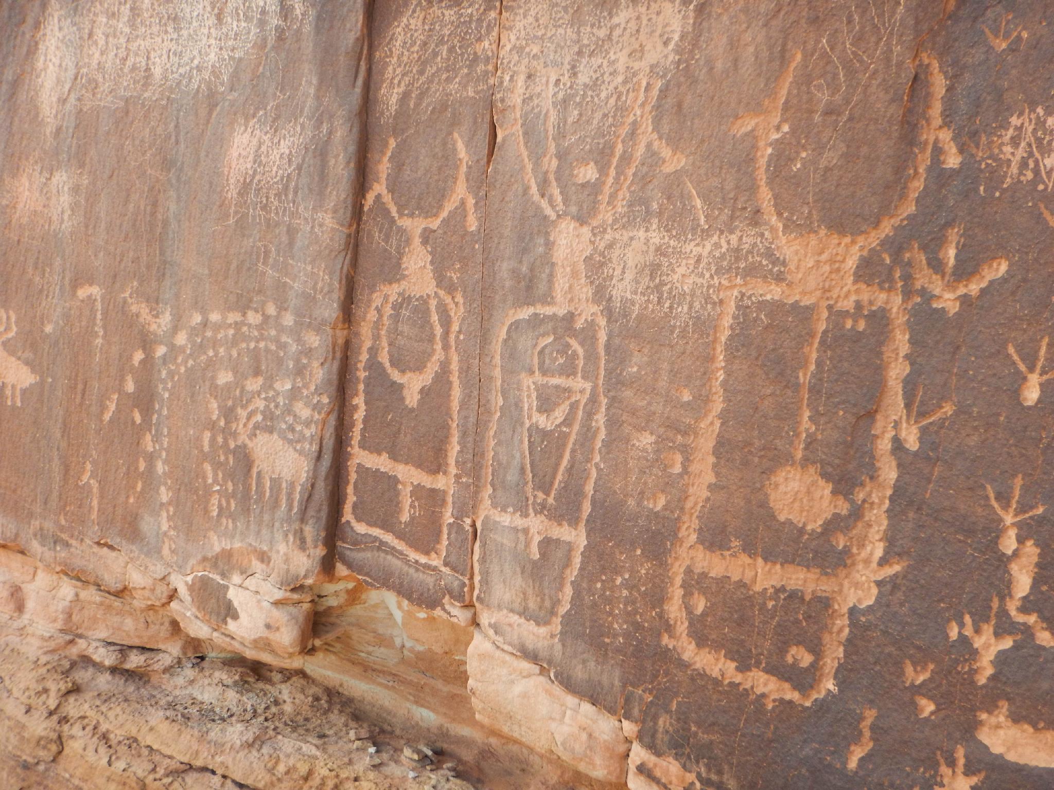
Excellent panel near 100 hands
Route
Rock art and historic sites are fragile, non-renewable cultural resources that, once damaged, can never be replaced. To ensure they are protected, please:
- Avoid Touching the Petroglyphs: Look and observe, BUT DO NOT TOUCH!
- Stay on the Trails: Stay on the most used trails when visiting sites, and don't create new trails or trample vegetation.
- Photography and Sketching is Allowed: Do not introduce any foreign substance to enhance the carved and pecked images for photographic or drawing purposes. Altering, defacing, or damaging the petroglyphs is against the law -- even if the damage is unintentional.
- Pets: Keep pets on a leash and clean up after them.
- Artifacts: If you happen to come across sherds (broken pottery) or lithics (flakes of stone tools), leave them where you see them. Once they are moved or removed, a piece of the past is forever lost.
From the trailhead, cross the driveway marked No Parking and pick up the well-used social trail on the other side. The trail hikes up to the cliff band in 1 minute, then requires a big step up to a ledge that is followed up and around to a shallow wash. Several faint pictographs appear here. Follow the trail up the shallow wash with 1 small obstacle en route. The trail leaves the wash on the right at a cairn.
Once out of the wash on the right, a wall has a large, faint snake petroglyph. This is not as visited as the others, but worth the 2 minute side trip. Follow the main trail as it curves around the wash. The trail splits; stay near the base of the cliff band. The first major petroglyph panel, with several bighorn sheep, appears on the right here.
From the bighorn sheep panel, follow the social trail a couple of minutes. When it reaches the next sandstone wall, look up! This is the 100 hands panel, 30-feet up on the wall. Truth in advertising, a quick count put the number quite a bit over 100 in my opinion. This is a fascinating panel!
Continue along the social trail/base of the cliff. A small alcove around the corner has some faint petroglyphs, but keep going. The trails moves onto slickrock before reaching a corner. The corner has the final petroglyph panel, that some refer to as the Shaman and the Hunter. Return the same way.
Photos
Maps

| Trailhead |
12S 463051mE 4181049mN N37° 46' 34" W111° 25' 10" |
| Very Faded Pictograph |
12S 462956mE 4181085mN N37° 46' 35" W111° 25' 14" |
| Snake |
12S 463009mE 4181229mN N37° 46' 40" W111° 25' 12" |
| Bighorn Panel |
12S 462959mE 4181177mN N37° 46' 38" W111° 25' 14" |
| 100 Hands |
12S 462849mE 4181169mN N37° 46' 38" W111° 25' 19" |
| Faint Panels |
12S 462772mE 4181205mN N37° 46' 39" W111° 25' 22" |
| Shaman |
12S 462627mE 4181162mN N37° 46' 37" W111° 25' 28" |