 Hiking Grandview Peak
Bountiful
Overview
|
Sun 39 | 30 |
Mon 46 | 31 |
Tue 41 | 26 |
Wed 36 | 29 |
Thu 42 | 27 |
| View Full Weather Details | ||||
|
Sun 39 | 30 |
Mon 46 | 31 |
Tue 41 | 26 |
Wed 36 | 29 |
Thu 42 | 27 |
| View Full Weather Details | ||||
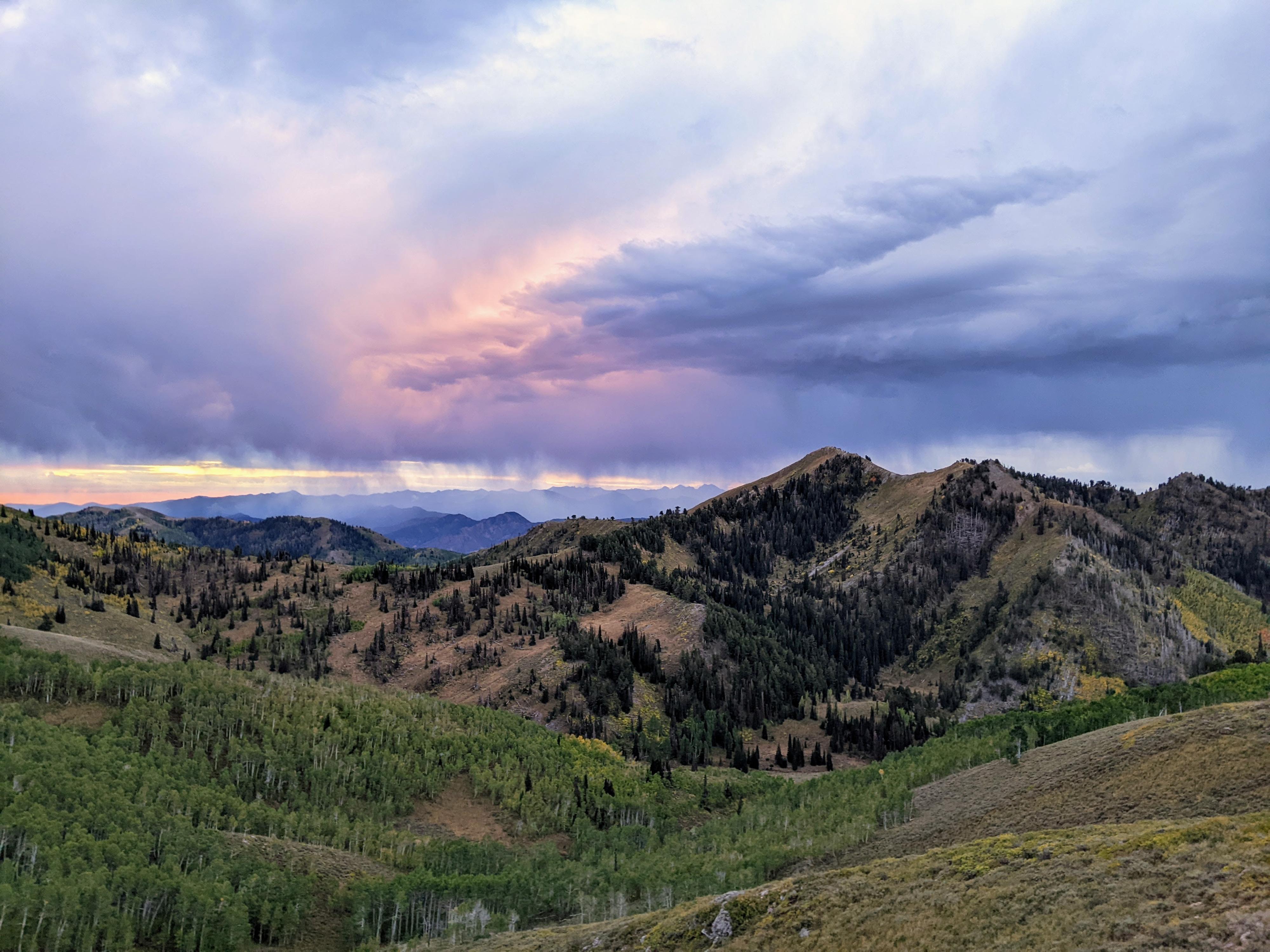
Grandview Peak on a very stormy and moody day. Peak is the highpoint just right of center. Picture from the top of the first climb up from the trailhead.
Grandview Peak sits above the Wasatch Front along the spine of the Wasatch. Though near a major metropolis, the peak sees relatively little visitation. It can be easy to spot from the south due to a distinctive large landslide on its southern slope.
The peak was my white whale for a couple of years and proved very elusive to my attempts to reach its summit! I tried it via City Creek Canyon, Rudy Flat, Big Mountain Pass, and the Session Mountain road from the north. All attempts were thwarted by bad weather, difficult conditions, limited time, etc. I was finally successful via the Sessions Mountain road from the north.
Most routes are 15+ miles and over 3000' of gain to attain the summit. The route described here, from the Sessions Mountain road, is by far the shortest and least physical route. This route is a little less than 9 miles and just under 3000' of gain round-trip. The challenge of the route is reaching the trailhead! The approach road is rocky, rough, narrow in spots, and has very steep sections. You will need a true 4-wheel drive vehicle with good clearance. I have seen full-size pickups and 4-Runners at the trailhead, though several narrow sections might be tough to pass in a full-size vehicle without scratching. I took a stock Ford Ranger to within about 1/4 of a mile of the trailhead with no issue apart from airing down the tires a bit to help to get up the steep rocky slopes on the way out.
Aside from the terrible approach road, the trail from the north is exquisite. It starts in evergreen forest, passes through aspen, and spends much of its time along ridges with broad views. Both times I have hiked from the north I have thoroughly enjoyed the trail and highly recommend it.
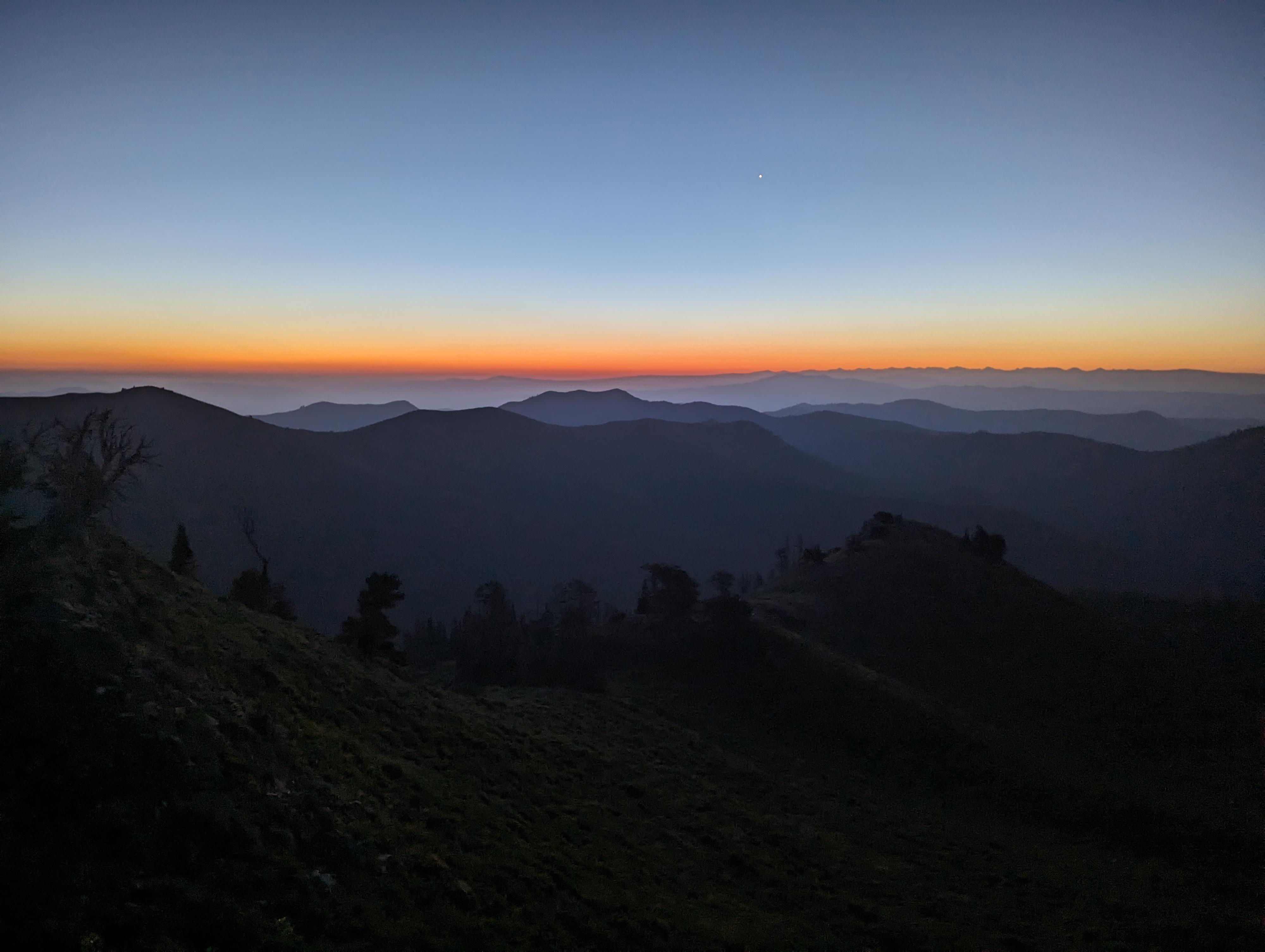
Sunrise near the summit on a very smoky morning.
Getting There
Reaching the trailhead starts at the Bountiful Staging area near the Bountiful B on the hillside. To reach the staging area, take exit 317 off of I-15 for UT-106 E/400 North. Go east on 400 North for about 2 miles and turn left on 1300 East. Take the next right on 600 North, then the following right onto Skyline Drive. Skyline Drive winds up the hillside. Take a final right where Skyline Drive makes a hard right and straight goes into a shooting range. Soon Skyline Drive reaches a large dirt parking area that is the Bountiful Staging area.
- Reset your odometer at the Bountiful Staging area. Follow the Skyline Drive as it heads up the mountain. It is generally a good, wide road though has some washboard and rough spots. ( 12T 428769mE 4527526mN / N40° 53' 45" W111° 50' 44" )
- 8.25 miles - Major junction. Go straight here and reset your odometer. This is the Sessions Mountains road. If you turned left here, you would be continuing on the Skyline Drive instead. The road quickly reaches a large dirt staging area. Continue south out of the staging area on a rough dirt road. There are quite a few small side roads to camp spots along the way. In general, stay heading south on the most used road. ( 12T 433218mE 4531249mN / N40° 55' 47" W111° 47' 36" )
- 1.6 miles - Tuttle Loop Trailhead on the right. Stay straight. ( 12T 434007mE 4529378mN / N40° 54' 46" W111° 47' 01" )
- 2.5 miles - Junction. Go straight (south). ( 12T 434494mE 4528228mN / N40° 54' 09" W111° 46' 40" )
- 3.1 miles - Junction in an open area. Continue straight (south). ( 12T 434812mE 4527380mN / N40° 53' 42" W111° 46' 26" )
- 3.51 miles - The road enters trees and comes to a very rough and difficult section. ( 12T 435160mE 4526874mN / N40° 53' 25" W111° 46' 11" )
- 3.75 miles - Junction at the top of a steep and rocky hill. Go straight, but be sure you are comfortable with being able to get back up the hill on the way out. ( 12T 435451mE 4526676mN / N40° 53' 19" W111° 45' 58" )
- 4.35 miles - Last big hill down to the trailhead. This is steep and rough. Easily walked since the trailhead is only 0.15 miles away. ( 12T 435710mE 4525864mN / N40° 52' 53" W111° 45' 47" )
- 4.5 miles - Trailhead ( 12T 435557mE 4525763mN / N40° 52' 49" W111° 45' 53" )
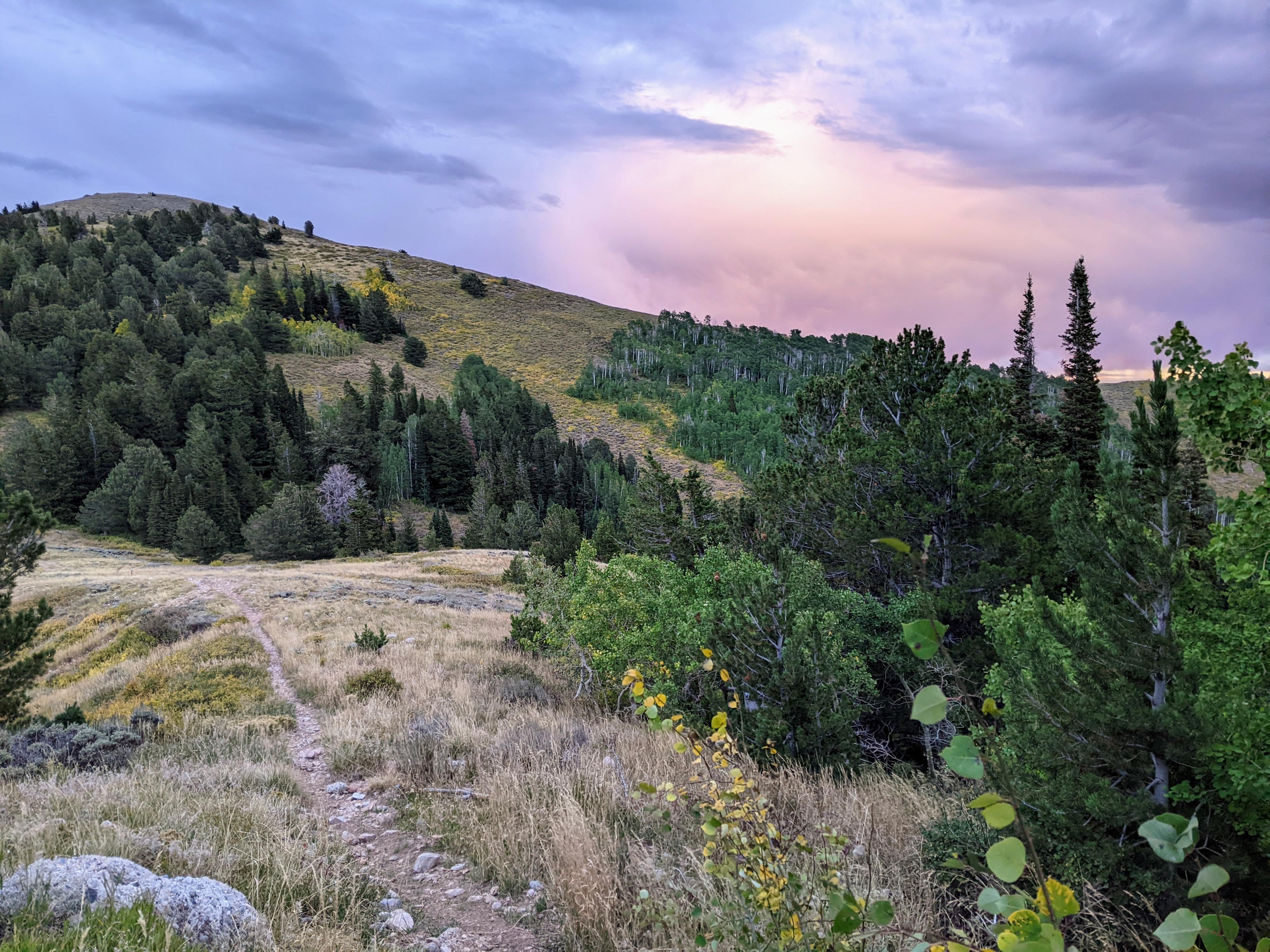
Hiking along the ridge. This is on the private land section.
Route
To The Ridge (1.25 miles / 45-60 minutes)
From the trailhead, find the Great Western Trail heading south. It is marked with a small wooden sign and quickly begins angling up the hillside in sweeping switchbacks through the forest. It passes through an aspen area and open area before reaching the ridge after about 1.25 miles and 850' of gain. Once the ridge is reached, Grandview Peak is visible to the south across Mill Creek Canyon below. The trail will follow the long ridge to the east and then south.
Along The Ridge (2 miles, 45-60 minutes)
The trail descends a bit and reaches a private land sign. The land is private, but access is allowed as long as you stay on the trail. Once on private land, the trail becomes and old two-track road. Follow it down to a saddle, then up the hill to the east. It curves and eventually becomes a single track trail again as it heads south. The views along this section are expansive and fantastic. To me, Grandview Peak looked a long way away, but the hiking is fairly quick on easy terrain.
After about 2.5 miles, a junction is reached right before the Great Western Trail climbs a little and bends around a hill. The side trail is the social trail to Grandview Peak and clearly heads out along the ridge to Grandview.
From GWT To Grandview (1.25 miles / 30-45 minutes)
Follow the social trail that leaves the Great Western Trail and heads west toward Grandview. It is generally easy to follow, but in spots is braided and a mix of animal and human trails. It seemed, to me, that anytime I lost the trail a little poking around found the correct one. The trail stays fairly close to the ridge.
As you approach the bottom of Grandview, a rocky ridge comes into view that leads to near the summit. The social trail goes right here, but climbing either up the rocky ridge or very near it is the shortest route and has a faint trail in spots. With good route finding, there are no difficult or exposed moves. Once up the ridge, the summit is just to the south. I couldn't find a summit register on my visit.
Views of City Creek Canyon, below the peak, and the jagged mountains of the Cottonwood Canyons are excellent, as well as the Wasatch Back to the east.
Return the same way.
Photos
Maps

| Trailhead |
12T 435557mE 4525763mN N40° 52' 49" W111° 45' 53" |
| Private Land Sign |
12T 436007mE 4524866mN N40° 52' 21" W111° 45' 34" |
| Leave GWT |
12T 437637mE 4523640mN N40° 51' 41" W111° 44' 24" |
| Up Ridge |
12T 436696mE 4522811mN N40° 51' 14" W111° 45' 04" |
| Grandview Peak |
12T 436592mE 4522575mN N40° 51' 06" W111° 45' 08" |