 Hiking Anasazi Ridge Petroglyphs
Santa Clara
Overview
|
Sun 78 | 48 |
Mon 83 | 51 |
Tue 87 | 54 |
Wed 87 | 54 |
Thu 88 | 54 |
| View Full Weather Details | ||||
|
Sun 78 | 48 |
Mon 83 | 51 |
Tue 87 | 54 |
Wed 87 | 54 |
Thu 88 | 54 |
| View Full Weather Details | ||||
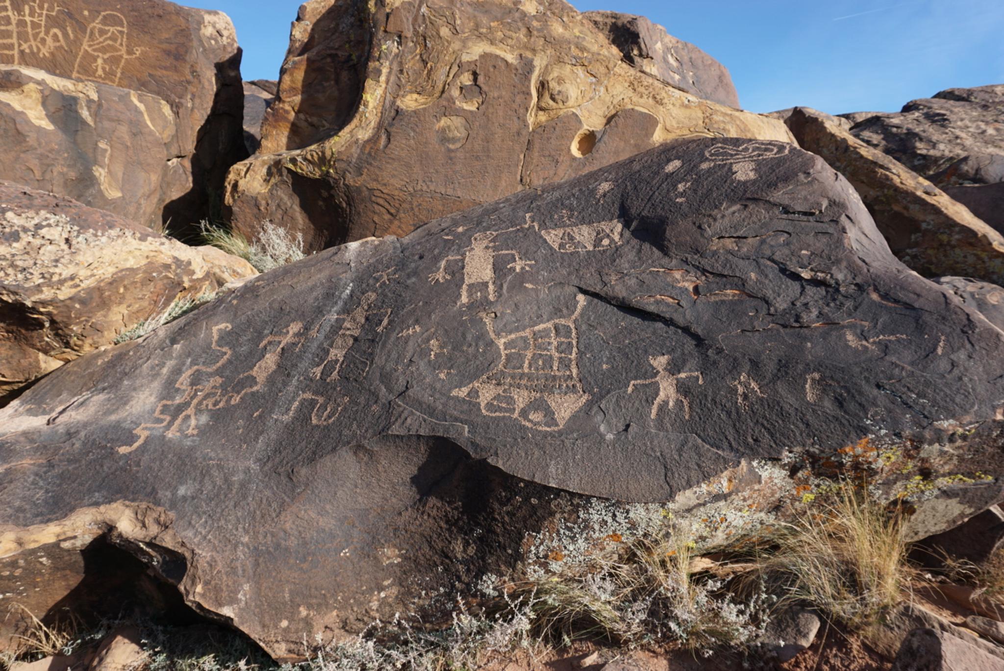
Great rock art on the ridge.
My personal favorite rock art sites around St. George, this short stroll goes to the top of a small hill. The top of the small hill has basalt boulders covered in rock art - hundreds of images from small glyphs and geometric shapes to large bighorn sheep. The number and quality of the petroglyphs make this a must visit for the rock art connoisseur, and family friendly. There are shapes and images I have not seen elsewhere.
In addition to the rock art, the trail visits a 1,000-year-old Puebloan farmstead. This fascinating piece of history was excavated in 2006/2007 by students from Brigham Young University. Their excavations uncovered eight small rooms, animal bones, stone tools, pottery shards, and even an abalone shell.
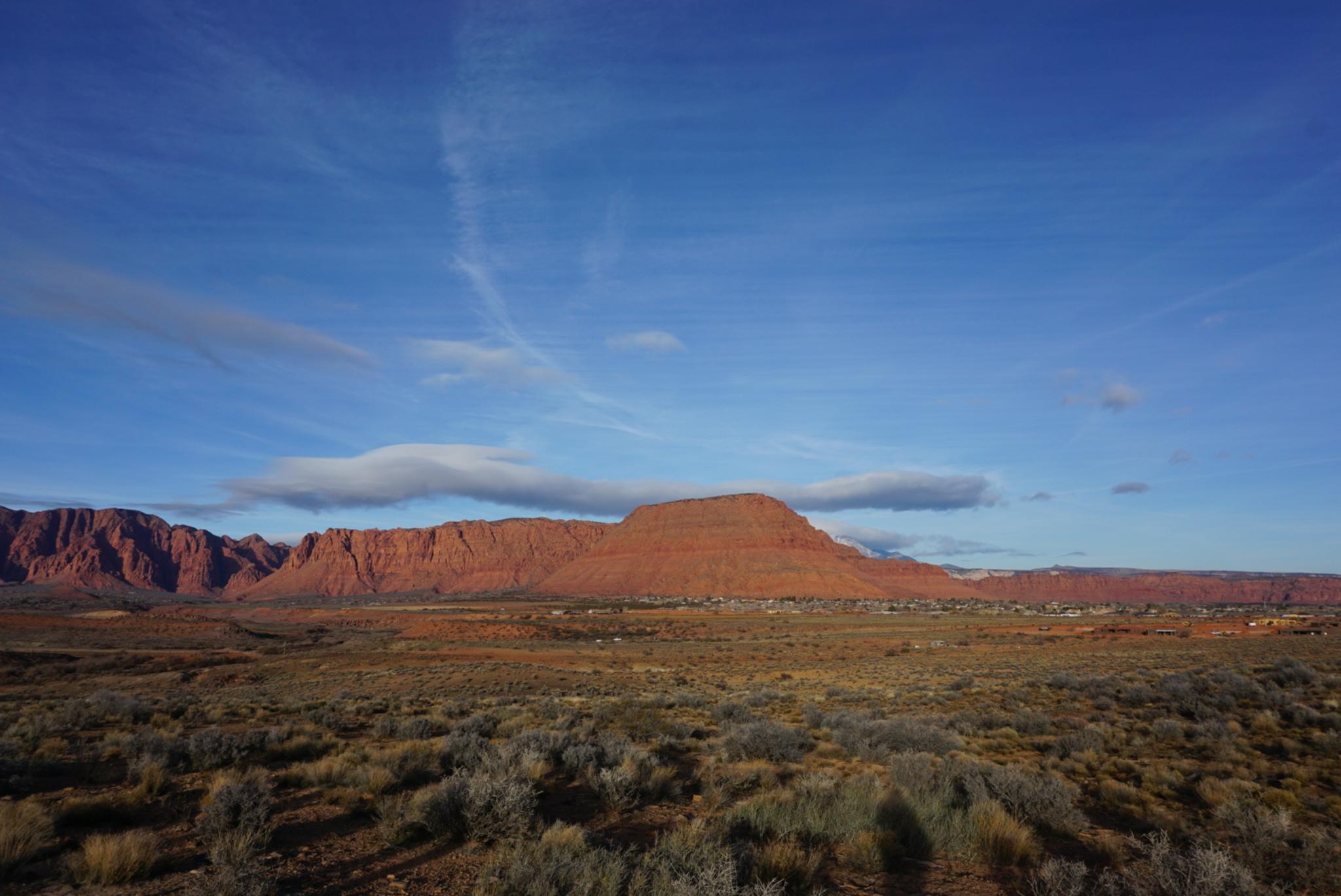
View of Red Mountain on the return.
Getting There
From St. George, travel to Santa Clara on Sunset Blvd. In Santa Clara, this main thoroughfare becomes Old Highway 91. Follow it toward Ivins UT. About 2.8 miles from Santa Clara, the Anazasi Valley Trailhead is signed on the left. Follow this road 0.4 miles to a large parking area/trailhead and a pit toilet.
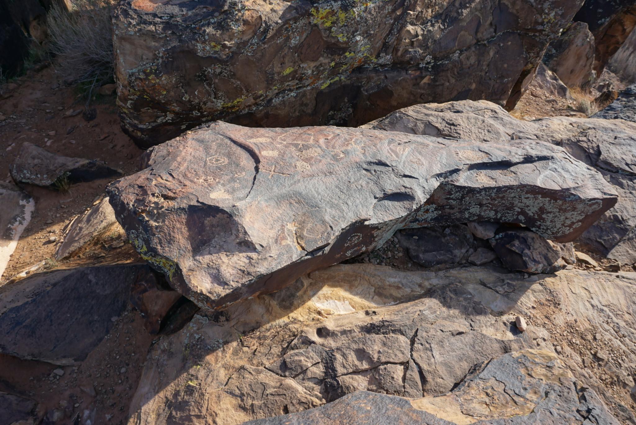
Rock art on the ground.
Route
Rock art and historic sites are fragile, non-renewable cultural resources that, once damaged, can never be replaced. To ensure they are protected, please:
- Avoid Touching the Petroglyphs: Look and observe, BUT DO NOT TOUCH!
- Stay on the Trails: Stay on the most used trails when visiting sites, and don't create new trails or trample vegetation.
- Photography and Sketching is Allowed: Do not introduce any foreign substance to enhance the carved and pecked images for photographic or drawing purposes. Altering, defacing, or damaging the petroglyphs is against the law -- even if the damage is unintentional.
- Pets: Keep pets on a leash and clean up after them.
- Artifacts: If you happen to come across sherds (broken pottery) or lithics (flakes of stone tools), leave them where you see them. Once they are moved or removed, a piece of the past is forever lost.
From the trailhead, follow the trail as it meanders slowly up to the ridge. At the crest, go right to visit the farmstead a short distance from the junction.
To see the rock art, you have two choices. Choice one is to go due south up the steeper trail. This is the shortest distance to the rock art, and what I recommend. Alternatively, go left on the main path. It takes several lazy zig-zags before reaching the summit and rock art overlooking the Santa Clara River below.
Be sure when visiting the rock art to watch your step. There are many panels carved on boulders in the ground that could be easily walked on in you are not paying attention. Also, be sure to hike down off the ridge to the west and through the boulders. There are many panels and glyphs on the rock along the cliff.
Return the same way.
Photos
Maps

| Trailhead |
12S 259711mE 4116328mN N37° 09' 45" W113° 42' 22" |
| Farm |
12S 259752mE 4115805mN N37° 09' 28" W113° 42' 20" |
| Loop Junction |
12S 259761mE 4115722mN N37° 09' 25" W113° 42' 19" |
| Rock Art |
12S 259823mE 4115402mN N37° 09' 15" W113° 42' 16" |