 Hiking
Steele Butte
Hiking
Steele Butte
Western Henry Mountains
Overview
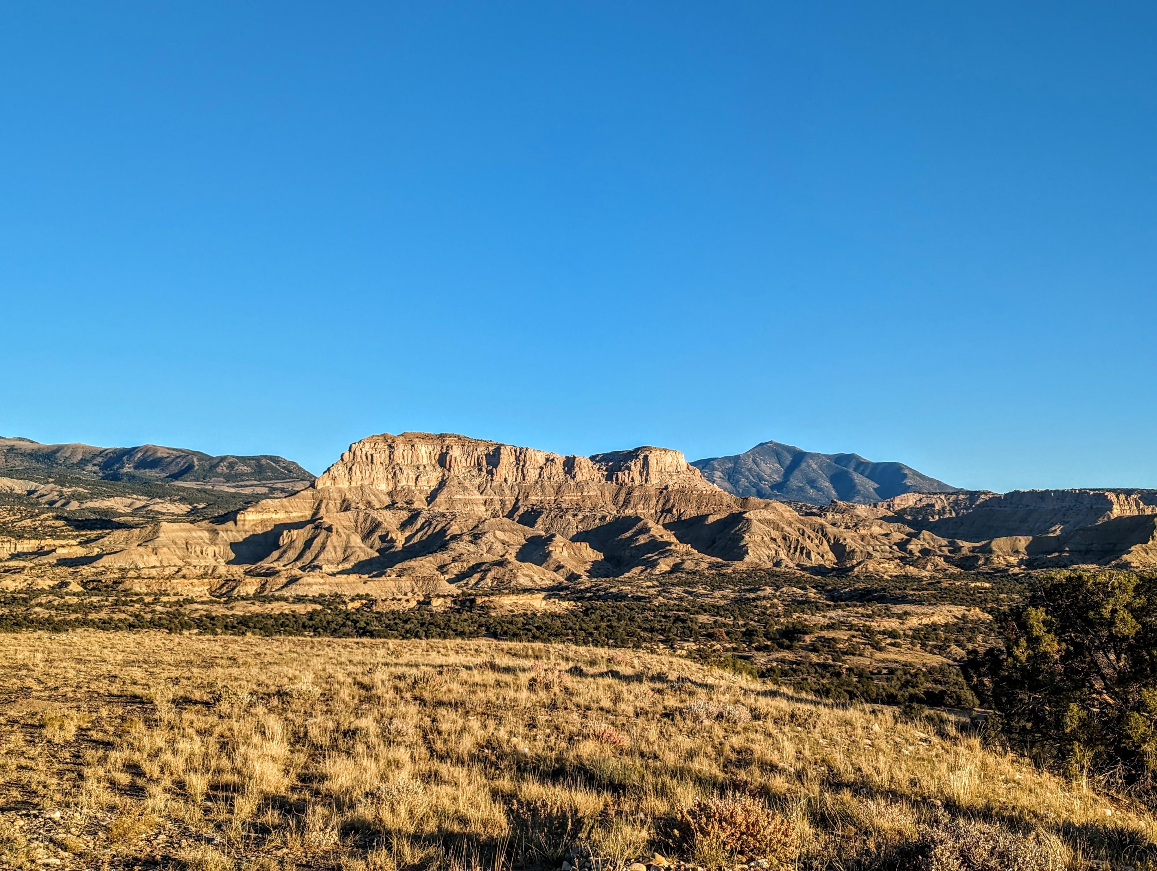
Steel Butte is one of those summits that I think perhaps the route to the top is the best of the day! To be sure, the views of the Henry Mountains, Capitol Reef, and badlands to the north are excellent from Steel Butte, but the route up, ascending a narrow slot canyon, is so much fun!
I'm not sure what first caught my attention about Steele Butte. We visited as a family in the winter of 2021, planning on poking around a bit to see if there was a route to the summit. We found a social trail on the ridge, but ran out of time to follow it far. When I returned in 2023, I found an exquisite and fun route to the summit.
Getting There
Travel east out of Capitol Reef National Park on highway 24. Just past the park, 0.25 miles, is the well signed Notom road. Turn right onto the Notom Road and follow it for 13.6 miles to the Sandy Ranch Junction on the left (east) side of the road.
Route Description
The first challenge is to reach the ridge. From the parking area, head north. I entered a major wash a few minutes from the car that I followed up to a steep dirt gully that eventually reaches the ridge proper. This, on my visit, showed signs of a social trail mostly washed out by summer rains.
Head along the ridge toward Steel Butte. When the ridge reaches a rocky slope heading up to steeper cliffs, look for a cairn near a tree to the north at about the same elevation you are at. The goal is to contour around, finding a more defined trail just around the corner that heads northeast above a drainage and into the headwall of Steele Butte.
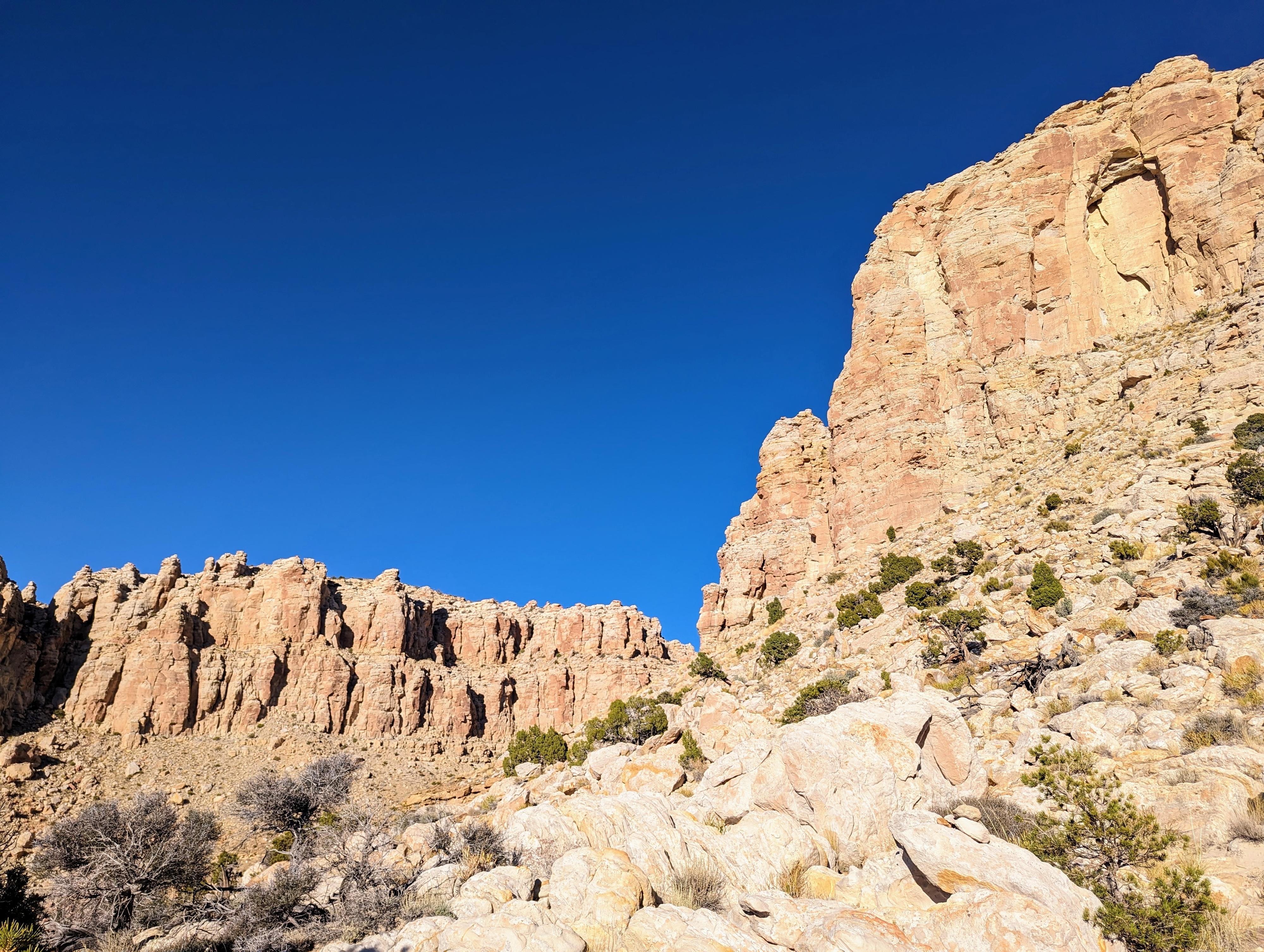
From a distance, it may not look like there is a way up the imposing cliffs at the head of the drainage. Once there, begins the slot canyon adventure. A move or two of fourth-class climbing leads into the slot. The slot is gorgeous, and narrow. At 6'1" with a 42" chest, I had to turn sideways but fit easily.
Work up the slot, reaching a large boulder blocking the slot that marks the crux of the route. The left looked easiest to me. Once you start feeling around, you will find many well-defined holds, making this short steep step reasonable. Above the boulder, a couple of forks in the canyon lead to dead ends. Continue up until a dry fall blocks the way ahead, but an easy exit is found on the left (looking up canyon) just before the dry fall. The exit out of the slot is 4th class or easy 5th. Be sure you can recognize it on the way back down. Once above the slot, easy open country leads up to the rim overlooking the Henry Mountains between the two high points of Steel Butte.
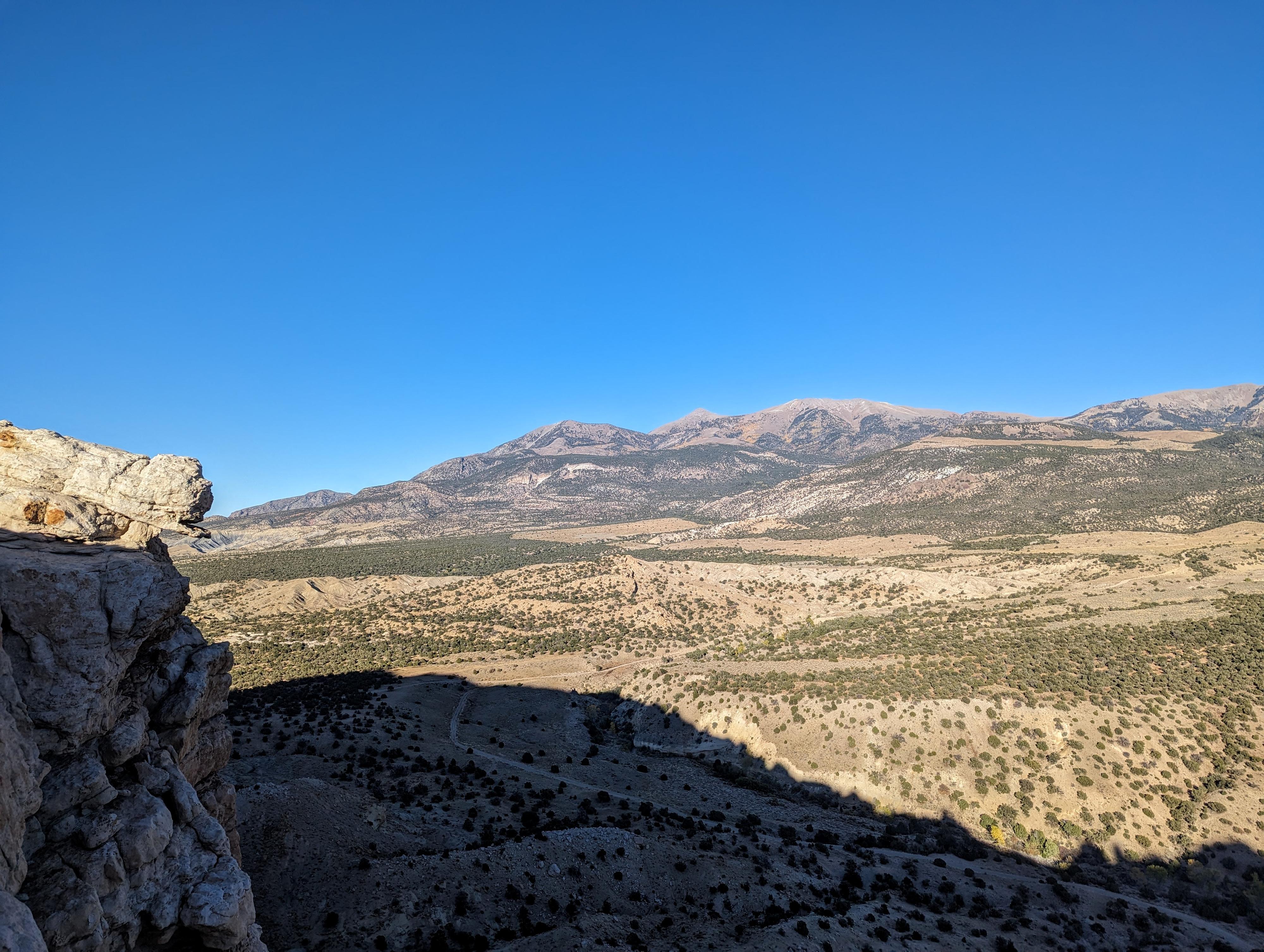
The true high point is to the north. From the overlook, it is a relatively easy scramble to the summit, with a little route finding. On my last visit in the fall of 2025, there was a glass jar with a summit register in it. The summit doesn't see many ascents! From the summit, you have expansive views of the Henry Mountains, San Rafael Swell to the north, Thousand Lake Mountain to the northwest, and of course the prominent Waterpocket Fold that makes up Capitol Reef to the west.
Return the same way.
Photos
Videos

A day hiking up Steele Butte in the Henry Mountains
Maps

12S 506292E 4213007N
38°03'53"N 110°55'42"W
12S 506328E 4213426N
38°04'07"N 110°55'40"W
12S 506631E 4213699N
38°04'16"N 110°55'28"W
12S 506914E 4213857N
38°04'21"N 110°55'16"W
12S 507026E 4213900N
38°04'22"N 110°55'12"W
12S 506937E 4214217N
38°04'33"N 110°55'15"W