Hell'n Moriah Canyon | House Range

Canyoneering Hell'n Moriah Canyon - House RangeHiking Hell'n Moriah Canyon - House Range Hell'n Moriah Canyon

House Range

Overview

MAPS: SKULL ROCK PASS, UT; HELL'N MARIA CANYON, UT; MILLER COVE, UT

Tue

Sunny, with a high near 76. South southwest wind around 17 mph.

76 | 60

Wed

Sunny, with a high near 78. South southwest wind around 12 mph.

78 | 60

Thu

Sunny, with a high near 78.

78 | 61

Fri

Sunny, with a high near 80.

80 | 60

Sat

Sunny, with a high near 79.

79 | 60

View Full Weather Details
SEASON: Fall, Winter (if little or no snow on the ground), Spring (Hot in summer)
GEAR: Standard Hiking Gear/Technical Gear if doing the full canyon
RAPPELS: 0-2 to 60 m ( 197 ft. )
WATER: None
FLASHFLOOD: Low/Moderate
NOTES: High clearance required and 4x4 recommended. The last few miles are rocky and quite rutted in spots.

Tue

Sunny, with a high near 76. South southwest wind around 17 mph.

76 | 60

Wed

Sunny, with a high near 78. South southwest wind around 12 mph.

78 | 60

Thu

Sunny, with a high near 78.

78 | 61

Fri

Sunny, with a high near 80.

80 | 60

Sat

Sunny, with a high near 79.

79 | 60

View Full Weather Details
 Hell'n Moriah Canyon the stunning limestone narrow section.

Hell'n Moriah Canyon the stunning limestone narrow section.

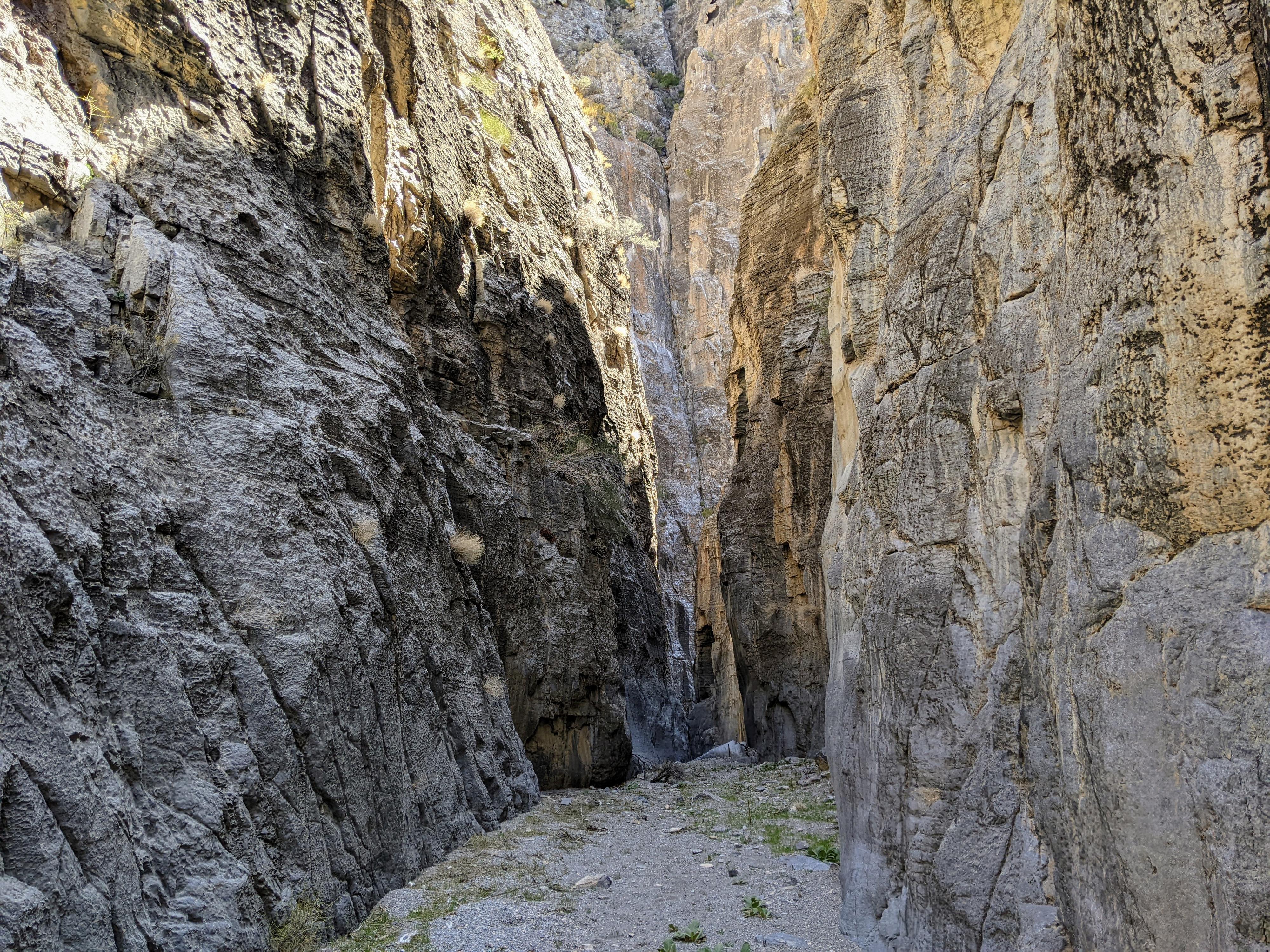
Starting at the same trailhead as the far more popular Notch Peak hike, Hell‘n Moriah Canyon seems like an overlooked gem to me. The canyon is wide open at its head, but has a short and dramatic section that cuts through a limestone layer. The section that cuts through the limestone is high walled, and very scenic. One of the prettiest sections of canyon I have seen in the West Desert so far.

For hikers, you can visit most of the narrows as an out-and-back hike, which is likely how I would most recommend it. Those wanting to do some rappels can descend the full canyon, though this requires a lengthy car shuttle.

Note: On my trip, the narrows were littered with animal bones in various stages of decay and what appeared to be mountain lion tracks. Make some noise while hiking!
The lower canyon near the WSA Boundary.

The lower canyon near the WSA Boundary.

Getting There

From Delta, head west on US-50/US-6 for about 40 miles to just after mile post 48. The side road is on the north side of the road:

  • Reset your odometer as you leave the highway. There are many side roads along the way. Stay on the main road, major junctions are specified. ( 12S 305376E 4325742N / 39°03'33"N 113°14'58"W )
  • 4.35 miles - Miller Canyon on the left. Turn left onto this road. ( 12S 308034E 4331647N / 39°06'46"N 113°13'13"W )
  • 9.5 miles - Picnic area/pit toilet on the right. Junction. Go left, staying on the most used road heading west. ( 12S 300572E 4335019N / 39°08'30"N 113°18'27"W )
  • 11.3 miles - Junction crossing a wash. Stay straight (not left). ( 12S 298013E 4334063N / 39°07'56"N 113°20'13"W )
  • 12.1 miles - Cabin on the right. ( 12S 296764E 4333784N / 39°07'46"N 113°21'04"W )
  • 12.8 miles - Notch Peak and Hell n' Moriah Canyon Trailhead and end of the road. ( 12S 295705E 4333619N / 39°07'40"N 113°21'48"W )
  • Canyoneering Exit Trailhead
  • Continue on US-50/US-6 to mile post 33.1 where a side road leaves on the right. Reset your odometer as you turn onto the side road.
  • 0.8 miles - Left at the T-Junction ( 12S 287875E 4328479N / 39°04'47"N 113°27'08"W )
  • 2.45 miles from US-50/US-6 is a side road on the right. This is the road up Hell'n Moriah Canyon. You can leave the shuttle vehicle at this junction, or drive up the rough two track 2 miles to the wilderness boundary and leave it there. Time wise, it is likely as fast to just walk the 2 miles instead of trying to shuttle it. ( 12S 287410E 4331073N / 39°06'10"N 113°27'31"W )
  • Hell'n Moriah Side Road It was rocky on my visit, but passable with high clearance. If driving, go left at the only junction 1.1 miles up. At about 2.0 miles the road ends at a WSA sign where the road has washed out anyway. There is so-so primitive camping at the end of the road.
The upper part of the canyon known as Hell'n Moriah Kitchen

The upper part of the canyon known as Hell'n Moriah Kitchen

Route

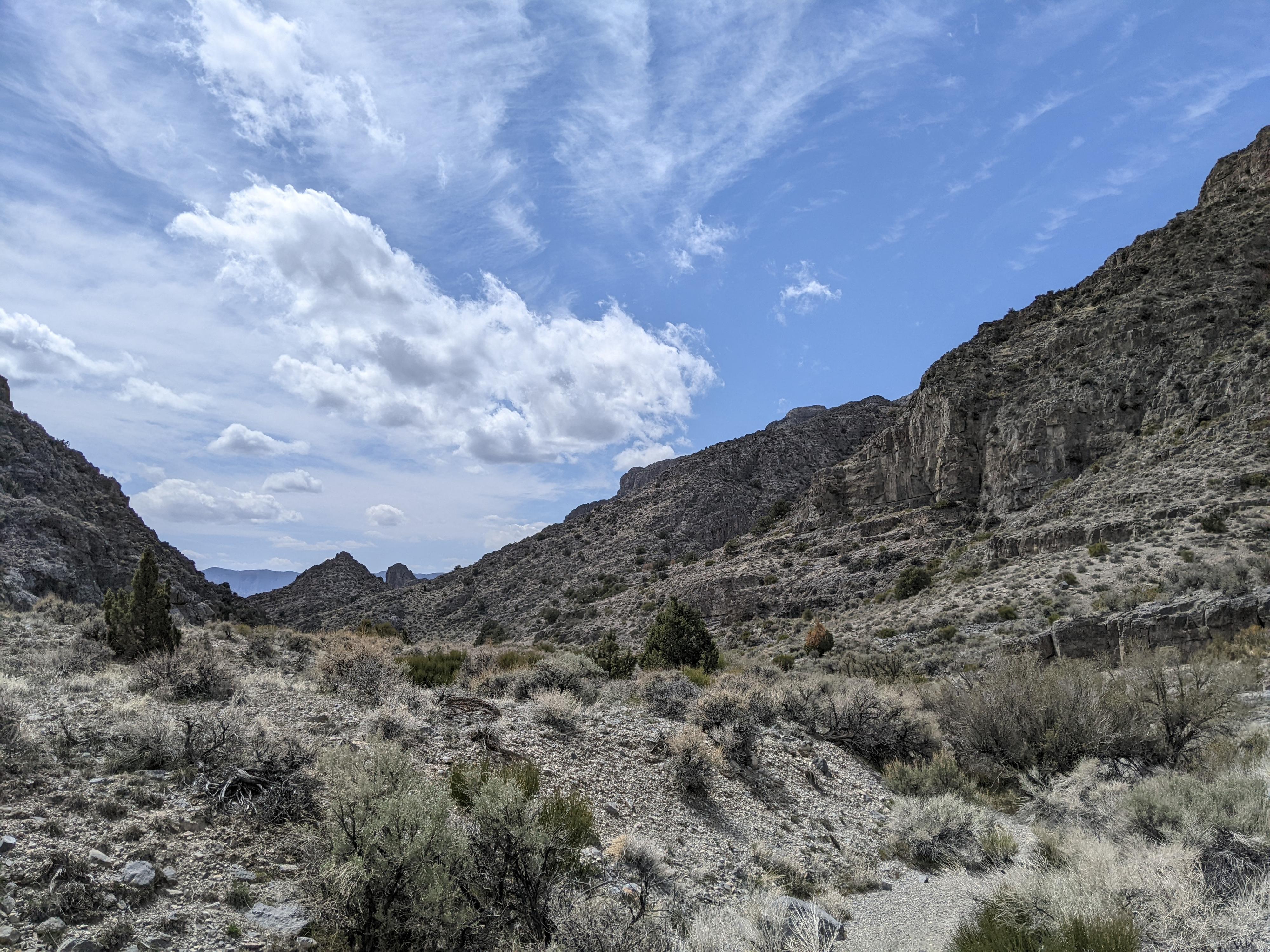
From the trailhead, locate the old road heading south up the hill. The road is now closed, but has a social trail on it. Follow the trail as it climbs up the hill, then descends into the wide valley that is the upper end of Hell’n Moriah Canyon. The canyon meanders down. Stay on the old ATV track when convenient, but it is hard to get lost now. Simply stay in the main drainage.

After about 30 minutes (1.5 miles), the limestone walls grow and the canyon narrows. This is the start of the dramatic limestone narrows.

The Narrows
A short 2 m ( 7 ft. ) drop most should be able to reverse. Just after this, the canyon turns left.

Side Trip: At the left turn, you can hike up the crack straight ahead for an excellent (and airy) view straight down a high cliff. A ledge here makes for a pleasant spot for a break and to take in the views unless you are acrophobic.

Just after the canyon turn, a significant obstacle is reached.

R1 - 6 m ( 20 ft. ) - A drop over a boulder. This is the turnaround spot for hikers and will need rappelling/ascending gear to safely descend and reverse.

Note: For canyoneers, I would recommend sending one person forward to check the anchor for the final rappel to make sure it is suitable before committing. The anchor, on my visit, was a well wedged chockstone that I had to dig out the upper side of to sling for an anchor. If it washes away, other anchor possibilities may require a bit of work.

There are two small drops after the first rappel in the corridor that most should be able to reverse fairly easily.

The canyon turns right, and plummets! This is the final rappel.

R2 - 60 m ( 197 ft. ) - Extend the anchor out as far as comfortable, as the drop is just shy of 60 m from near the edge.

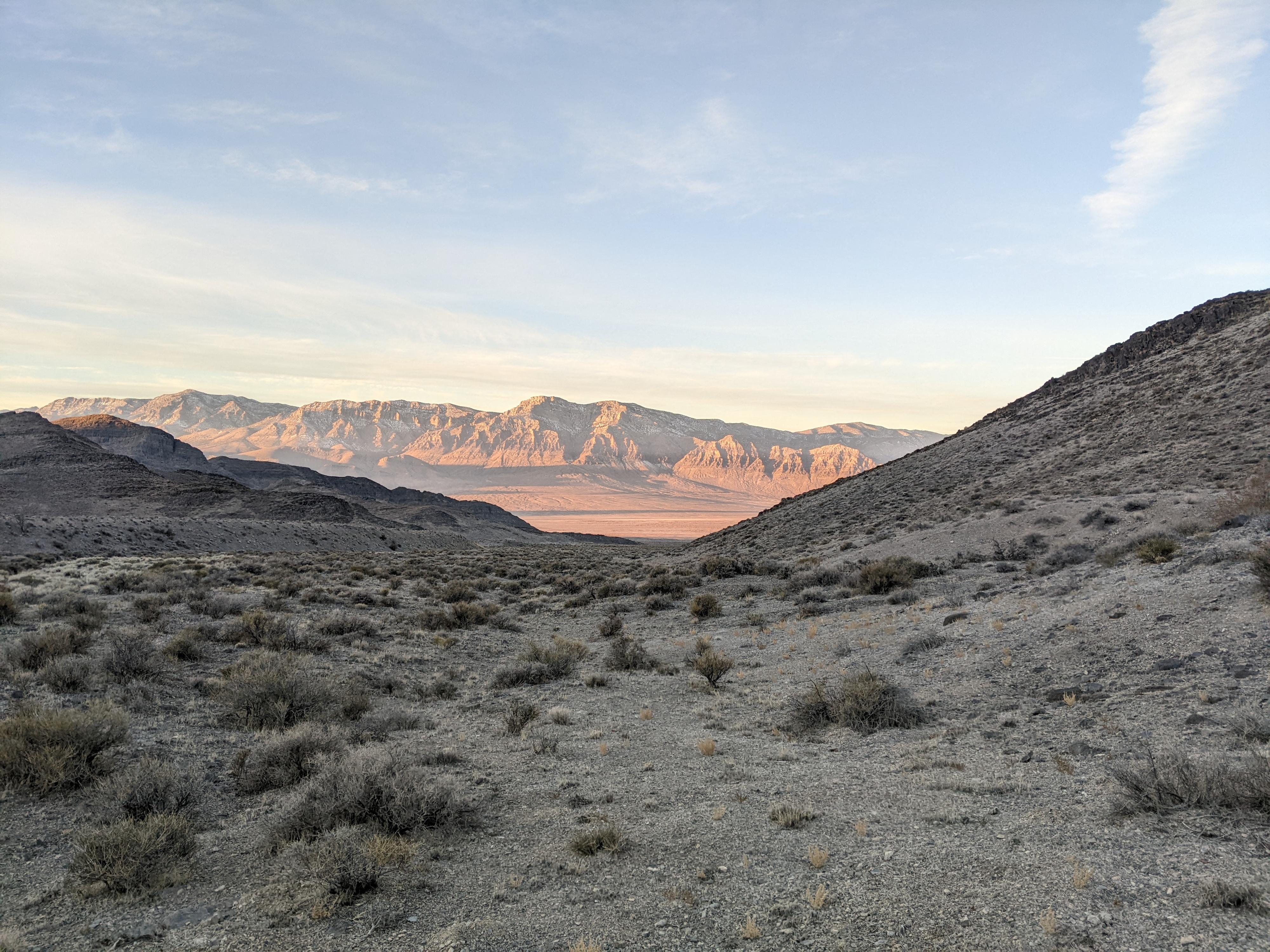
Exit (about 5 miles / 2 hours)
Coil up your ropes and take off your harnesses. The technical section is over. Head down canyon on a road. This road, now in a Wilderness Study Area, is closed, though showed some signs of use. In just a few minutes, the road leaves the canyon bottom on the left. Leave the road here and stay in the canyon bottom, heading down canyon. There once was a road in the canyon bottom as well, though time has mostly reclaimed it, with only occasional signs of its prior existence. The high walls surrounding the canyon are lovely and heavily pocketed.

From the final rappel, it is about 3 miles to the Wilderness Study Boundary. Keep an eye out on the right for the old road cutting steeply up the bank. Once you find that, and the WSA boundary, a 2-track makes for easy walking down to the Tule Valley road in about 2 more miles unless you drove this last section and spotted the car higher up.


Maps

Hike / 4.12 miles / Elevation Range 6,498 - 7,062 ft.
Canyoneering / 7.11 miles / Elevation Range 4,505 - 7,062 ft.
Printable Maps:

Trailhead

12S 295704E 4333619N

39°07'40"N 113°21'48"W

Rappel

12S 293692E 4332017N

39°06'46"N 113°23'10"W

Final Rappel

12S 293681E 4331979N

39°06'45"N 113°23'11"W

Wilderness boundary

12S 290292E 4330116N

39°05'42"N 113°25'30"W

Tule Valley Road

12S 287402E 4331070N

39°06'10"N 113°27'31"W

Comments

Want to make a comment? Login and let yourself be heard.