 Hiking Popo Agie Falls
Lander
Overview
|
Sun 70 | 48 |
Mon 74 | 51 |
Tue 71 | 51 |
Wed 68 | 50 |
Thu 69 | 49 |
| View Full Weather Details | ||||
|
Sun 70 | 48 |
Mon 74 | 51 |
Tue 71 | 51 |
Wed 68 | 50 |
Thu 69 | 49 |
| View Full Weather Details | ||||
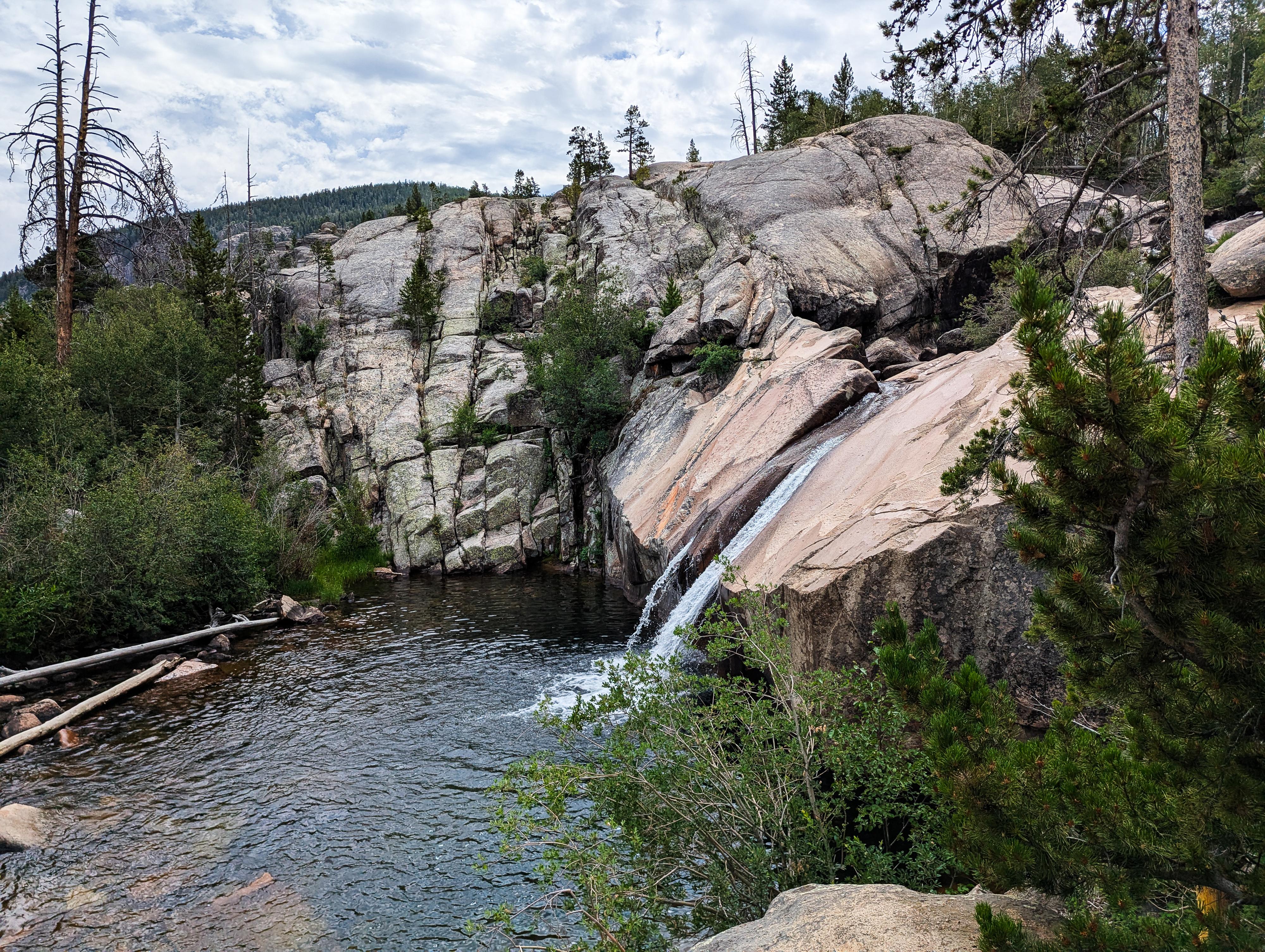
The final falls in Popo Agie Falls
Just up the road from Sinks Canyon State Park, the Popo Agie Falls is, to me, a must-do if in the area. The trail ambles up to some of the most stunning falls I have seen in Wyoming. At about 4.5 miles roundtrip, the trail is suitable for most. It is a bit rugged and gains a bit of elevation, but our 8-year-old found it suitable and fun. It does, however, get quite a bit of sun. If it is a hot day, start early and bring plenty of water.
The trail, after ambling up to the start of the falls, visits a number of falls and cascades. At the end of the trail, a stunning waterfall cascades down a smooth rock face into a deep plunge pool. Some, including myself, slide down next to the falls into the pool at the bottom when flows are reasonable (generally mid-to-late summer). Be sure to check the depth and landing zone if you slide it. I barely touched a sandy bottom on my slide, but one other person at the falls on our visit had hit a rock. He was OK, but a good reminder to be sure of your landing.
The pronunciation is "Puh-poe zha", spoken as two separate words. That being said, I grew up in Wyoming, and most of the non-Lander locals I have encountered pronounce it as it looks, "Poe-poe ah-g-ee".
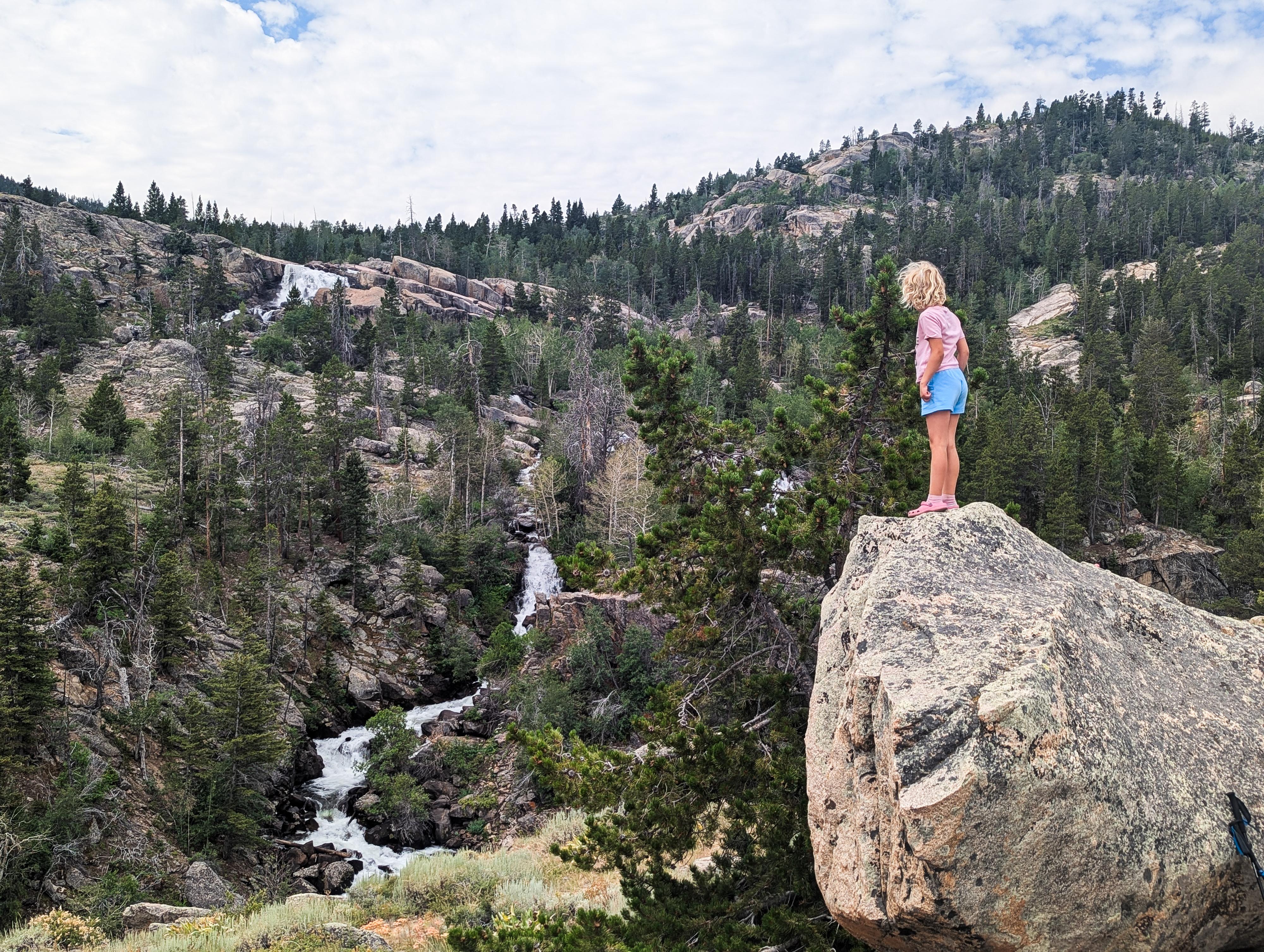
Many falls and cascades in the background along the trail.
Getting There
From downtown Lander, turn south on WY-131 S / 5th St. Follow this for about 0.7 mile to where it comes to a T-intersection.
Turn right here and follow WY-131 for 9.7 miles, passing through Sinks Canyon State Park along the way. At 9.7 miles, there is a large parking area on the left side of the road just before a curve. This is the trailhead. There is a pit toilet at the trailhead.
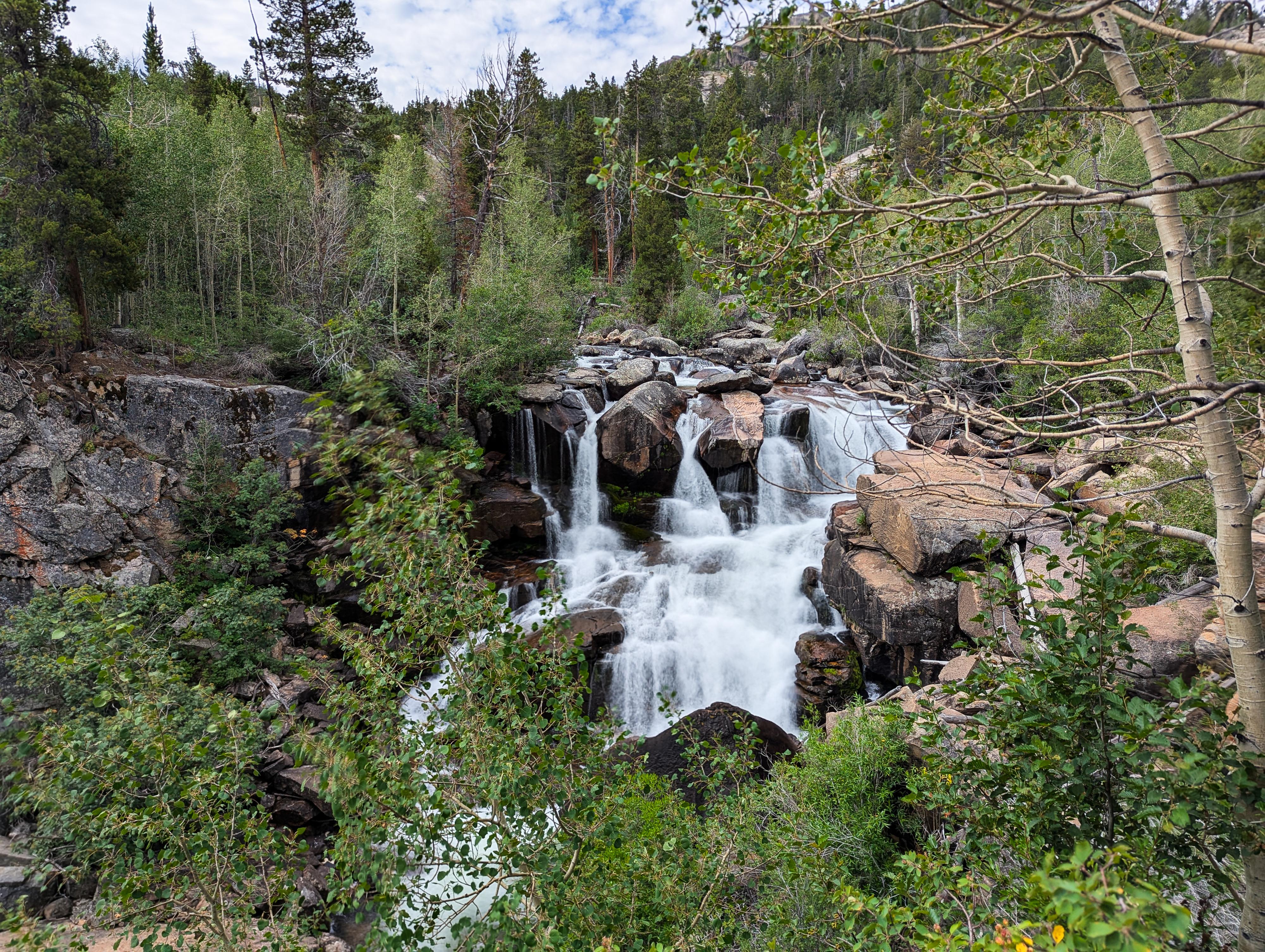
Stunning falls along the trail.
Route
From the trailhead, cross the road to the start of the trail. The trail crosses the river almost immediately on a bridge. Just after the bridge, go left.
The trail ambles up along the river, but away and above it. As you continue up, the views both down into the chaotic whitewater of the Popo Agie and of the surrounding cliffs and mountains become more dramatic. The trail gains fairly steady elevation through this section, then makes a steeper climb up switchbacks to a junction about 1.5 miles from the trailhead.
Go left at this junction 1.5 miles from the trailhead. The trail dips down, crosses a bridge, then climbs to more open country. You'll come to another junction in a few minutes. Either way seems to work, but stay left again. This is the trail that stays near the edge of the canyon that the river is in and has some great views down of the Popo Agie. It is in this section that more waterfalls and cascades are visible. The trail passes over a lush area via a wooden boardwalk and continues up past a lovely shallow pool area (depending on flows). Not far above this shallow pool area the trail reaches the most impressive falls of the hike.
This final falls, coming down smooth rock into a deep plunge pool, is quite a sight! This is only a small portion of the Popo Agie's flow coming over these falls. The river splits a bit above the falls, with more of the flow going south, re-joining down canyon aways below this fall. You can see this other falls from a distance as you hike in on the left.
Return the same way.
Photos

Maps

| Trail |
12T 675369E 4732996N 42°43'46"N 108°51'28"W |
| Jct - Left |
12T 675356E 4733077N 42°43'49"N 108°51'29"W |
| Jct - Left |
12T 673630E 4732307N 42°43'25"N 108°52'46"W |
| Jct - Left |
12T 673505E 4732158N 42°43'20"N 108°52'51"W |
| Shallow Pool |
12T 673283E 4732016N 42°43'16"N 108°53'01"W |
| Waterfall |
12T 673267E 4731939N 42°43'13"N 108°53'02"W |