 Hiking
Ruth Lake
Hiking
Ruth Lake
Western Uintas
Overview
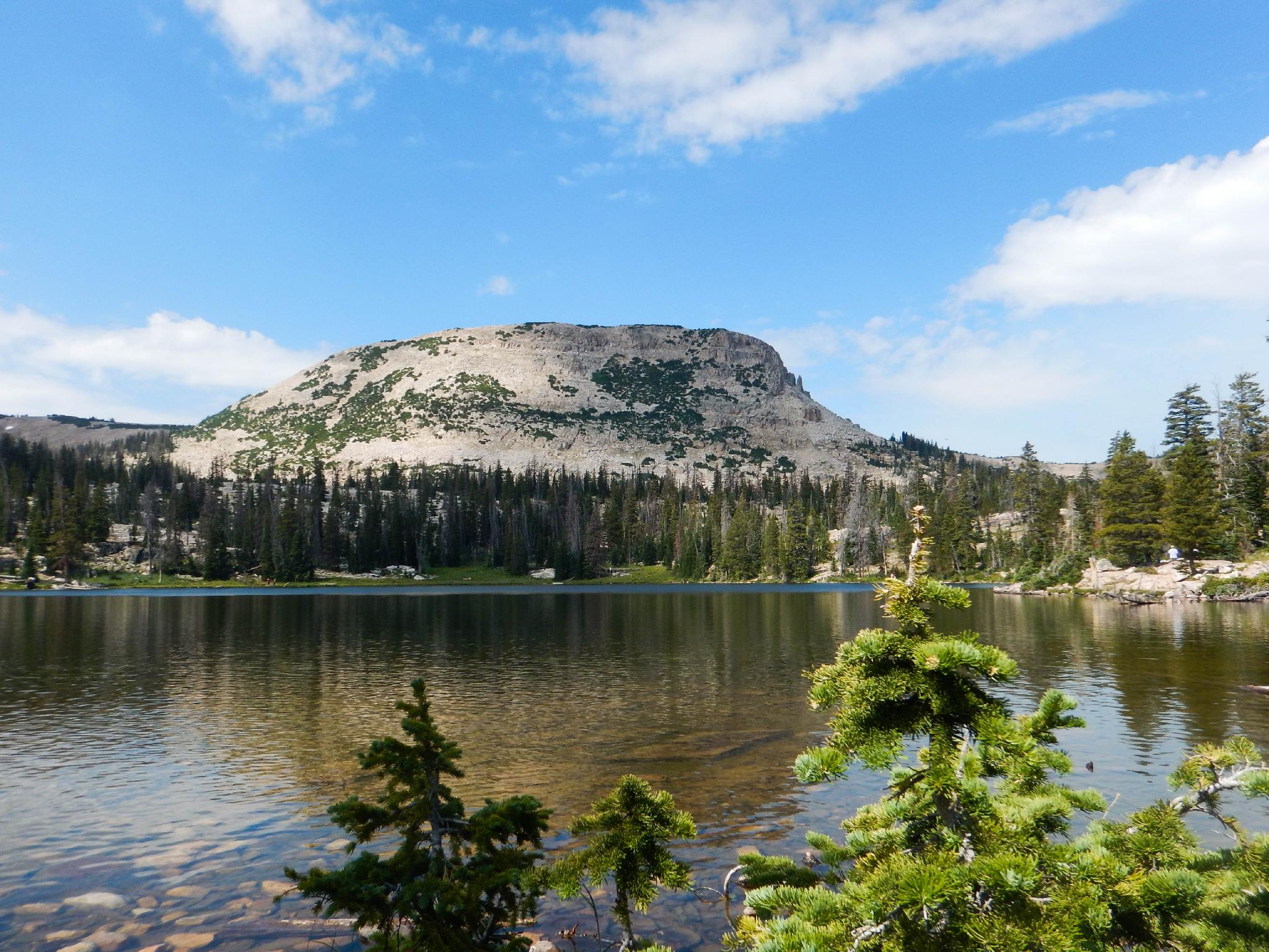
Ruth Lake is tough to recommend enough. This is a fantastic short hike with little elevation gain, making it an excellent family hike or for almost anyone. The lake is nestled in an alpine setting with cliffs that are popular with rock climbers high above the trail. The alpine setting, cliffs to the south, and views of Hayden Peak to the east make for a breathtaking setting.
Because of the beauty, ease of access, and ease of the hike, this is also a very popular hike. On a typical summer weekend, the parking lot will likely be full with day hikers, rock climbers, and backpackers all heading in the short 0.8 miles to the lake. Please practice low-impact hiking and backpacking techniques if visiting.
For the experienced hiker, there are a handful of other lakes within a short distance of Ruth Lake. These typically have social trails to them and require good navigation skills but are much less busy than Ruth Lake proper. On our last visit, we made a leisurely loop of six lakes, and, once away from Ruth Lake, only saw a few people at each of the other lakes.
Getting There
The trailhead is the Ruth Lake Trailhead off the Mirror Lake highway. This is at mile post 35, which is 35 miles from Kamas Utah on highway 150, or about 42 miles south of Evanston, Wyoming on highway 150. The trail will probably be very snowy until late June in most years.
The trailhead has a pit toilet and a large parking area on the side of the road.
Route Description
Ruth Lake
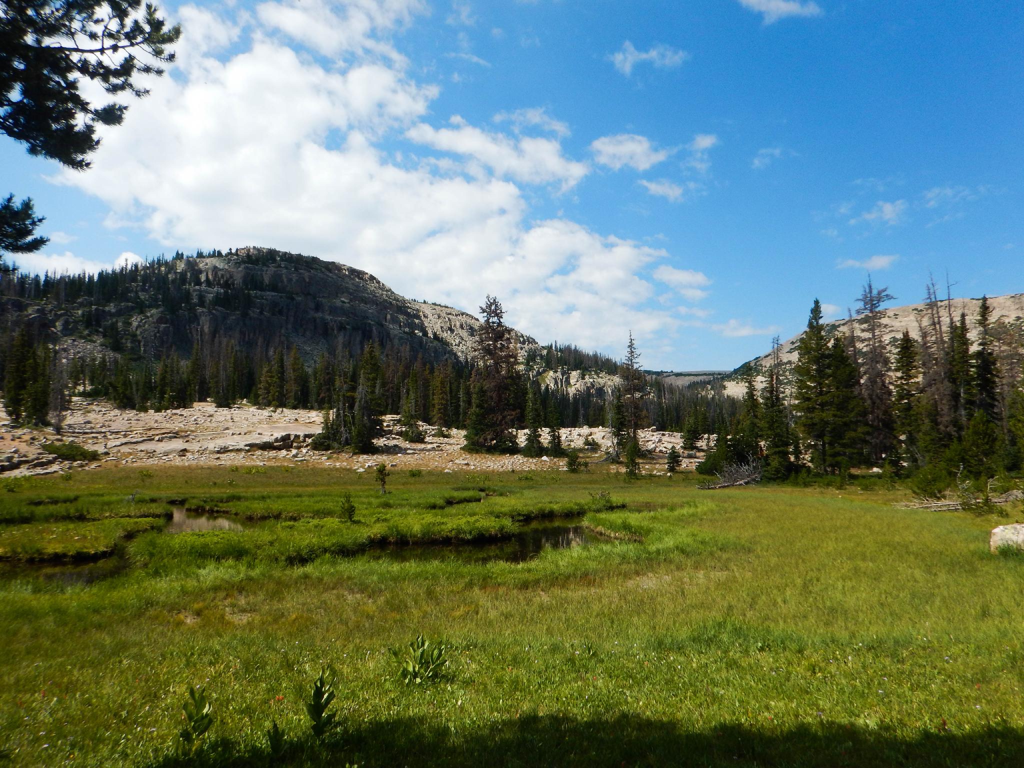
From the trailhead, follow the trail as it heads west. It is well-traveled and easy to follow, complete with interpretive signs along the way to keep children interested. The trail gains a small bit of elevation, then meanders along near several marshes and wetlands. These are dotted with wildflowers in summer. The rocky flats make for a photogenic backdrop.
The prominent peak to the east (behind you on the trail) is Hayden Peak.
Once at the lake, there are many fantastic campsites, but if camping, be sure to follow the Forest Service rule and camp at least 200 feet away from water sources.
Visiting Hayden, Jewel, Cutthroat, Teal, and Naomi Lakes
To visit the additional lakes, continue on the trail along the north side of Ruth Lake. At the west side of the lake, a junction is reached with the left staying low and going around the lake. Go right instead, climbing a little in elevation to another junction in just a few minutes (0.15 of a mile).
At this second junction, go right. This is not an official trail but a well-worn social trail. In just a few minutes, it splits again. Right goes down to a pond, then you can continue cross-country east a few minutes to Naomi Lake, then south back to Ruth Lake. This makes for a very short loop.
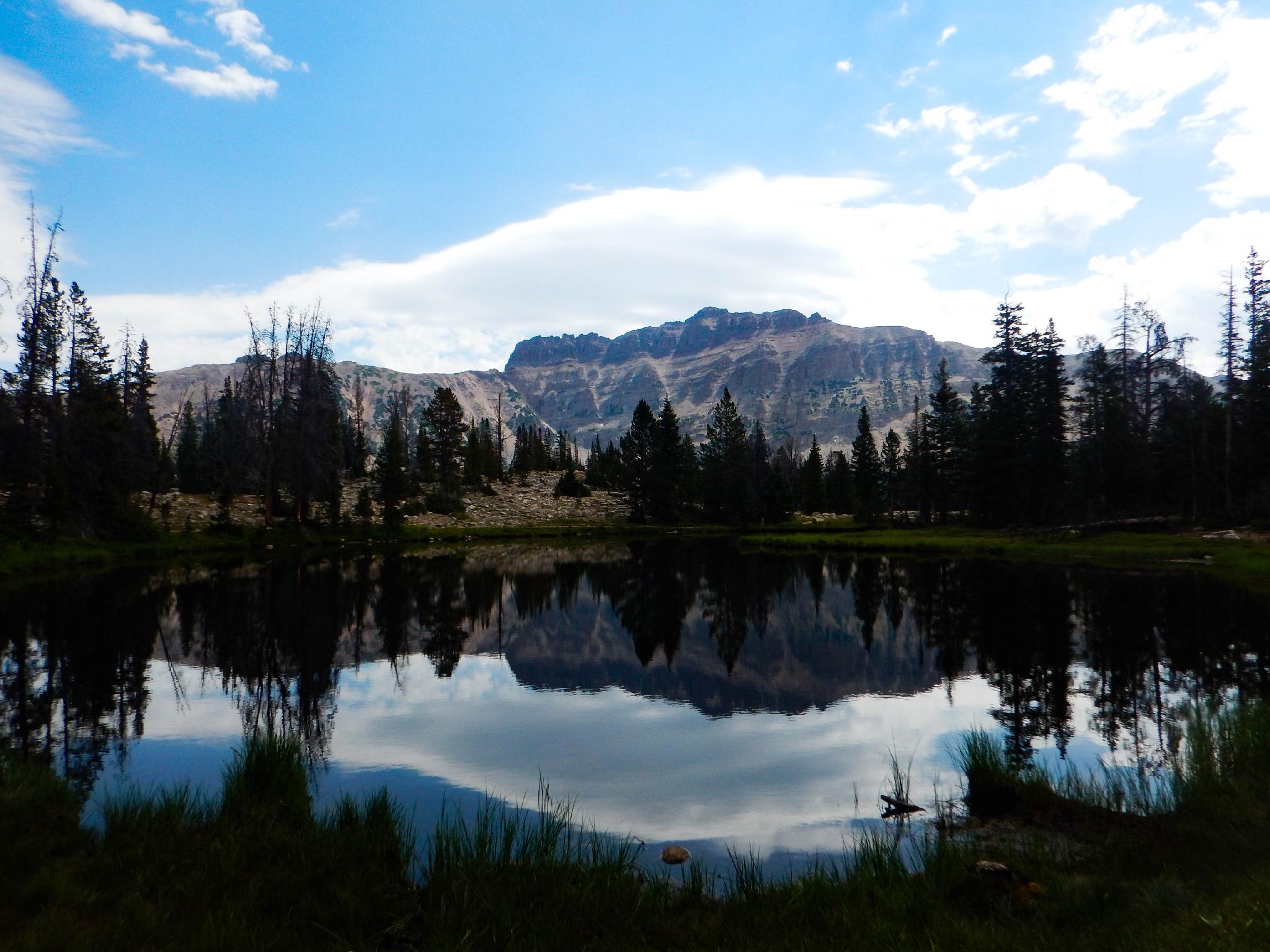
If you go left, recommended, the well-worn social trail passes near Hayden Lake, though you will have to leave the trail to get to it, another small lake, and then descends to Jewel Lake. Jewel Lake is one of my favorites in the area and about a mile from Ruth Lake. There are a few excellent campsites on the northwest side of the lake.
Cutthroat and Teal Lakes
From Jewel Lake, there are two more commonly visited lakes, Cutthroat and Teal. Both of these lakes (as of 2025) have intermittent trails to them and require good navigation skills. GPS highly recommended. Diane and I both visited them separately, both found intermittent trails, but neither of us took the same path!
To Cutthroat Lake (about 0.8 miles from Jewel Lake)
From the west side of Jewel Lake, there are many social trails heading to various campsites and west toward Cutthroat Lake. Follow whichever one appears best heading west and a touch north. The goal is to reach a wide meadow area about 1/4 of a mile from Jewel Lake. There was a pretty good social trail once at the meadow. Follow the meadow area west to the base of the talus slopes, then follow the base of the talus slopes north to reach Cutthroat Lake.
From Cutthroat Lake to Teal Lake (about 0.7 miles from Cutthroat Lake to Teal Lake)
From Cutthroat Lake, head north, staying near the bottom of the talus field, but not directly next to it. This, to me, is a stunning section with great views and some lush meadow along the way. Again, intermittent game and social trails come and go, but if you head north, you should spot the large Teal Lake after about 3/4 of a mile.
Teal Lake Back to Jewel Lake
From Teal Lake, I would recommend returning to Cutthroat Lake and then to Jewel Lake via the same path you came from. I, as shown on the map, headed southeast to make a loop. This is a shorter route back to Jewel, but it doesn't have much of a trail that I could find, and the terrain makes navigation a little difficult.
Photos
Maps

12T 511181E 4509217N
40°44'02"N 110°52'03"W
12T 510141E 4509248N
40°44'03"N 110°52'48"W
12T 509903E 4509206N
40°44'01"N 110°52'58"W
12T 509722E 4509151N
40°43'60"N 110°53'05"W
12T 509871E 4509405N
40°44'08"N 110°52'59"W
12T 509652E 4509230N
40°44'02"N 110°53'08"W
12T 509491E 4509119N
40°43'59"N 110°53'15"W
12T 509353E 4509722N
40°44'18"N 110°53'21"W
12T 508614E 4509447N
40°44'09"N 110°53'53"W
12T 508410E 4510171N
40°44'33"N 110°54'01"W