Fehr Lake |

Western Uintas

Hiking Fehr Lake - Western Uintas Hiking Fehr Lake

Western Uintas

Overview

RATING: Easy Hike
MAPS: MIRROR LAKE, UT; HAYDEN PEAK, UT

Sat

A chance of snow showers before noon, then snow showers and a slight chance of thunderstorms. Cloudy. High near 34, with temperatures falling to around 32 in the afternoon. North wind 6 to 14 mph. Chance of precipitation is 100%. New snow accumulation of 1 to 3 inches possible.

34 | 23

Sun

Snow showers likely. Mostly cloudy, with a high near 34. Northwest wind around 15 mph. Chance of precipitation is 60%. New snow accumulation of less than one inch possible.

34 | 22

Mon

A chance of snow showers and a slight chance of thunderstorms after noon. Mostly sunny, with a high near 39. Chance of precipitation is 30%. Little or no snow accumulation expected.

39 | 20

Tue

A slight chance of snow showers after noon. Mostly sunny, with a high near 42.

42 | 22

Wed

A chance of snow showers. Mostly sunny, with a high near 40.

40 | 23

View Full Weather Details
SEASON: Summer, Fall
GEAR: Standard Hiking Gear
WATER: Filterable at the lake.

Sat

A chance of snow showers before noon, then snow showers and a slight chance of thunderstorms. Cloudy. High near 34, with temperatures falling to around 32 in the afternoon. North wind 6 to 14 mph. Chance of precipitation is 100%. New snow accumulation of 1 to 3 inches possible.

34 | 23

Sun

Snow showers likely. Mostly cloudy, with a high near 34. Northwest wind around 15 mph. Chance of precipitation is 60%. New snow accumulation of less than one inch possible.

34 | 22

Mon

A chance of snow showers and a slight chance of thunderstorms after noon. Mostly sunny, with a high near 39. Chance of precipitation is 30%. Little or no snow accumulation expected.

39 | 20

Tue

A slight chance of snow showers after noon. Mostly sunny, with a high near 42.

42 | 22

Wed

A chance of snow showers. Mostly sunny, with a high near 40.

40 | 23

View Full Weather Details
Murdock Mountain from Fehr Lake

Murdock Mountain from Fehr Lake

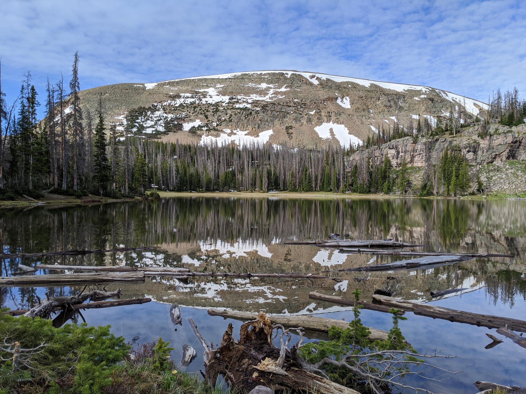
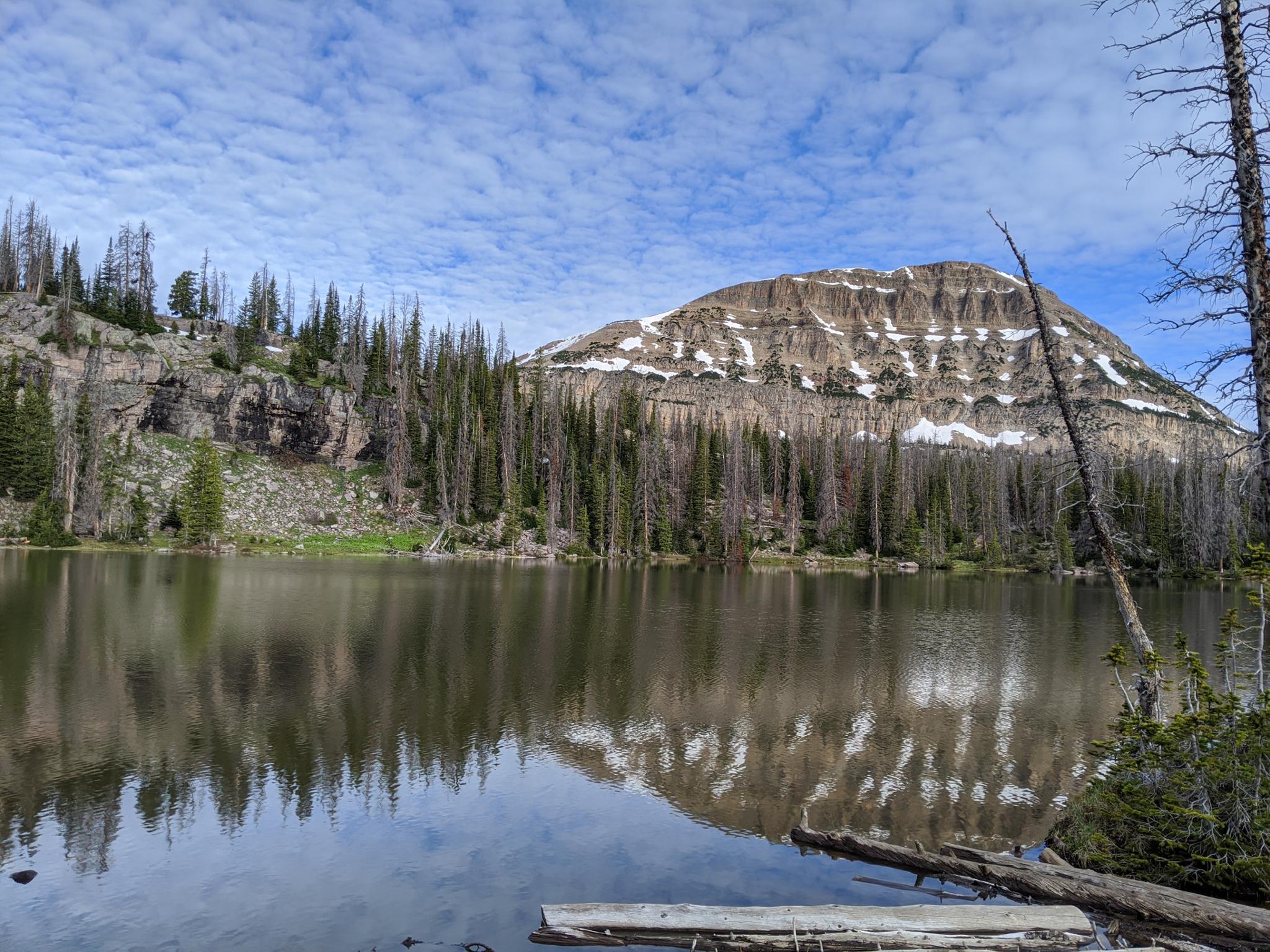
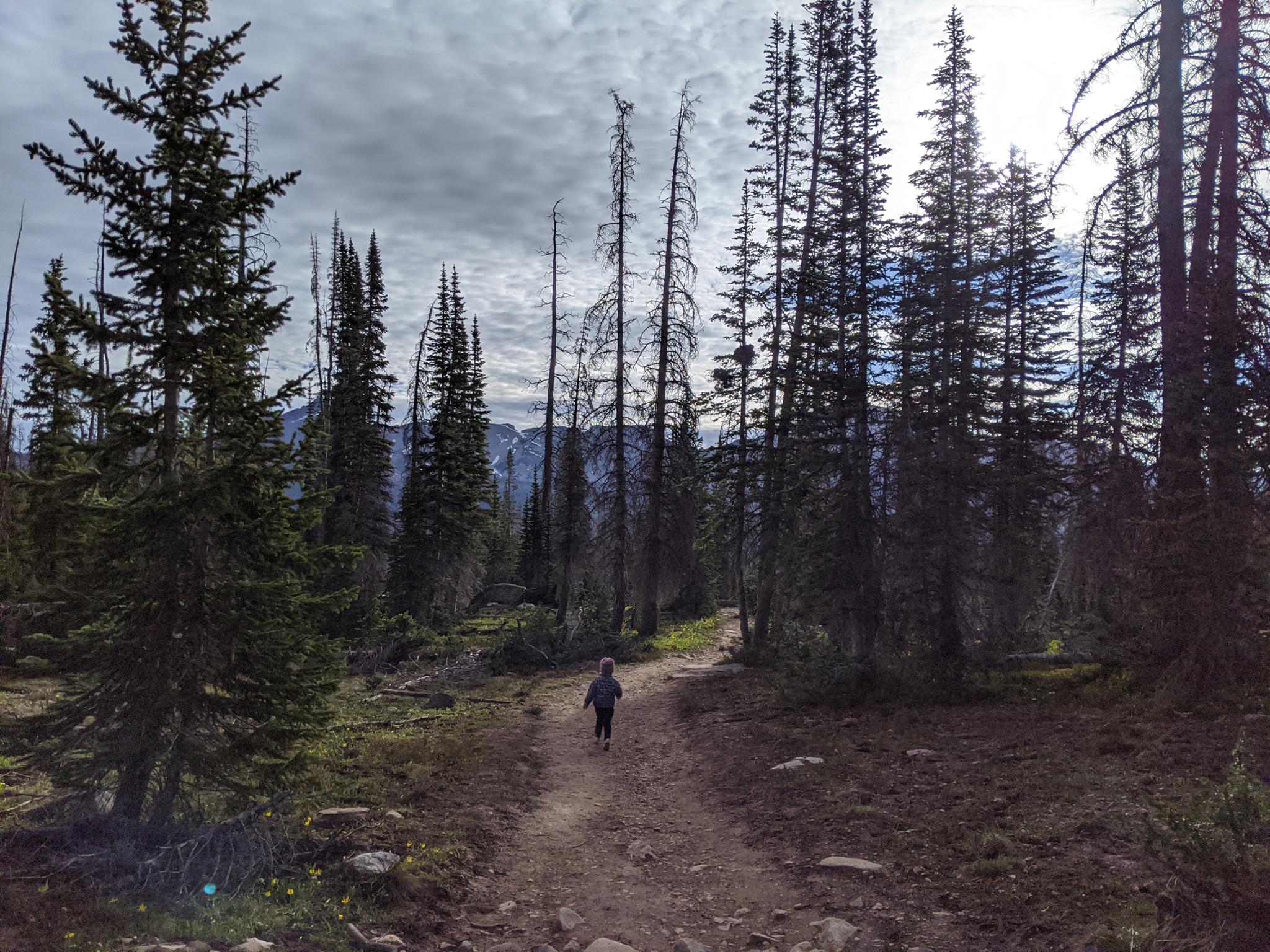
Fehr Lake is one of my favorite short hiking destinations along Mirror Lake highway. The trail to the lake is short enough, our toddler easily and happily managed the hike on her own. Though the hike is short, the views are astounding! Particularly in morning light, seeing Bald Mountain and Murdock Mountain from the pristine Fehr Lake is stunning. It has some of the best views of any hike I have done in the area.

Those wanting a longer hike can continue past Fehr Lake down into the lakes of Murdock basin, such as Shepard and Hoover. We continued past Fehr but, at least in my opinion, the views beyond are not as good as Fehr Lake. Once past Fehr, the trail becomes much rockier and steeper. Anglers, at least on the day we visited, seemed to have a much stronger preference for Shepard than Fehr. I assume easy access makes Fehr receive high usage, and more elusive fish.

Bald Mountain from Fehr Lake

Bald Mountain from Fehr Lake

Getting There

Note: The Mirror Lake highway that is used to access this hike is closed in the winter. The gate is typically open from Memorial Day until late October, but if planning this hike on the shoulder season, call the forest service to see if it is open. ((801) 466-6411)

The trailhead is off of the Mirror Lake Highway at milepost 30.6. This is 30.6 miles out of Kamas, UT on UT-150, just before both the Moosehorn and Mirror Lake Campgrounds. Alternatively, this is about 47 miles south of Evanston Wy on the Mirror Lake Highway.

The trailhead is signed on the east side of the road. No facilities available at the trailhead, but Moosehorn Campground is just across the road and has pit toilets.

Toddler getting a morning trail run in.

Toddler getting a morning trail run in.

Route

From the trailhead follow the wooden trail across the wetland. The trail is a mix of open areas and short tree covered sections. The path is easy going, with the large mountain to the south being Murdock Mountain, and the mountain to the west being the always popular Bald Mountain. The trail meanders before descending to the base of a short cliff band with Fehr Lake in view. There are a few excellent primitive camping sites around Fehr for those looking for a short backpack.

The trail continues along the west side of Fehr Lake, then head further west and descends a rocky hillside, passes a small pond, and continues its descent to Shepard, Hoover, and Maba lakes. These lakes are also accessible via the 4-wheel drive Murdock Basin road.

Return the same way.


Maps

Fehr / 0.92 miles / Elevation Range 10,284 - 10,398 ft.
Fehr and Shepard / 3.44 miles / Elevation Range 9,996 - 10,398 ft.
Printable Maps:
Trailhead

12T 509122mE 4504669mN

N40° 41' 34" W110° 53' 31"

Fehr Lake

12T 509508mE 4504418mN

N40° 41' 26" W110° 53' 15"

Shepard Lake

12T 510512mE 4503502mN

N40° 40' 56" W110° 52' 32"

Hoover Lake

12T 510828mE 4503329mN

N40° 40' 51" W110° 52' 19"

Comments

Want to make a comment? Login and let yourself be heard.