
 Jump Creek
Boise Idaho
Overview
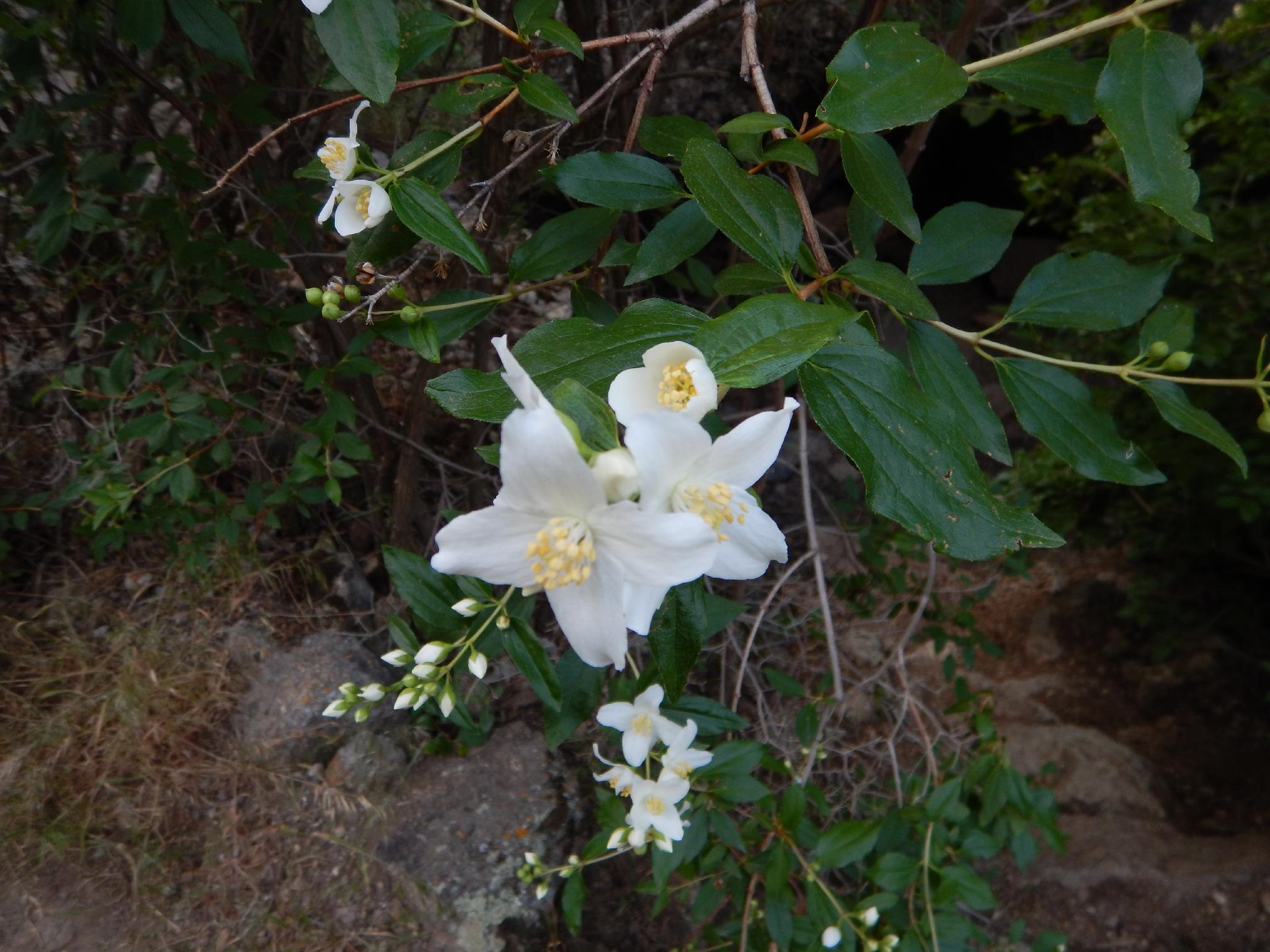
Apparently THE go to place for everyone and their dog within a 100 mile radius of Boise, this is not a hike you do for solitude. The hike is very popular, and easy enough most won't have a problem reaching the falls. The destination, Jump Creek Falls, is about 20 m ( 66 ft. ) in height and quite stunning, with a delightful plunge pool at the bottom to hang out and swim in on hot days. Motivated hikers can scramble around the falls an continue up, but most will be quite content to just visit the falls. The volcanic rock surrounding the trail offers great views, and many pockets and cubbies for the kids to climb in and around.
Getting There
Reach the trailhead by first getting to Marsing, Idaho, just south west of Boise.
- Go west on ID 95 for 4.0 miles to the Cemetery where Cemetery Road takes off on the left.
- Go left on Cemetery road for 1 mile to Jump Creek Road.
- Go left on Jump Creek road for 3.5 miles.
- Turn right (staying on Jump Creek Road) and continue about 2 miles to the trailhead and large parking area. There is a pit toilet at the trailhead.
Route Description
From the trailhead, follow the trail about 5 minutes up canyon to the falls. There are many scenic spires and pockets in the rock along the way.
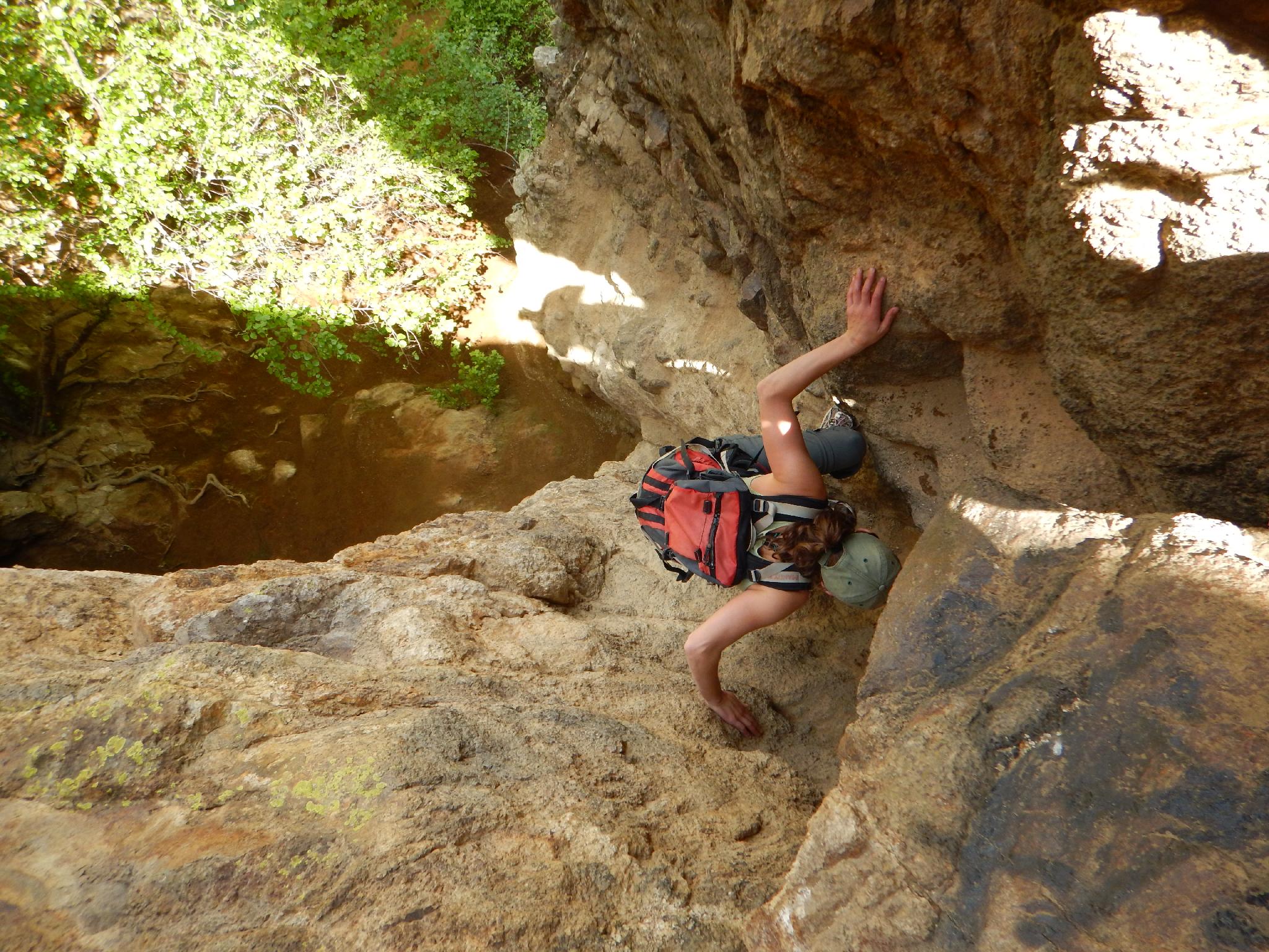
Motivated? You can get around the falls on the right (looking up canyon) via a social trail. The trail climbs steep dirt up next to the cliff before scrambling up a crack (the Devils Staircase) to the top of the falls. The climbing is easy, but somewhat exposed. Not recommended for kids or dogs. Be sure if you go up, you are comfortable down climbing the route.
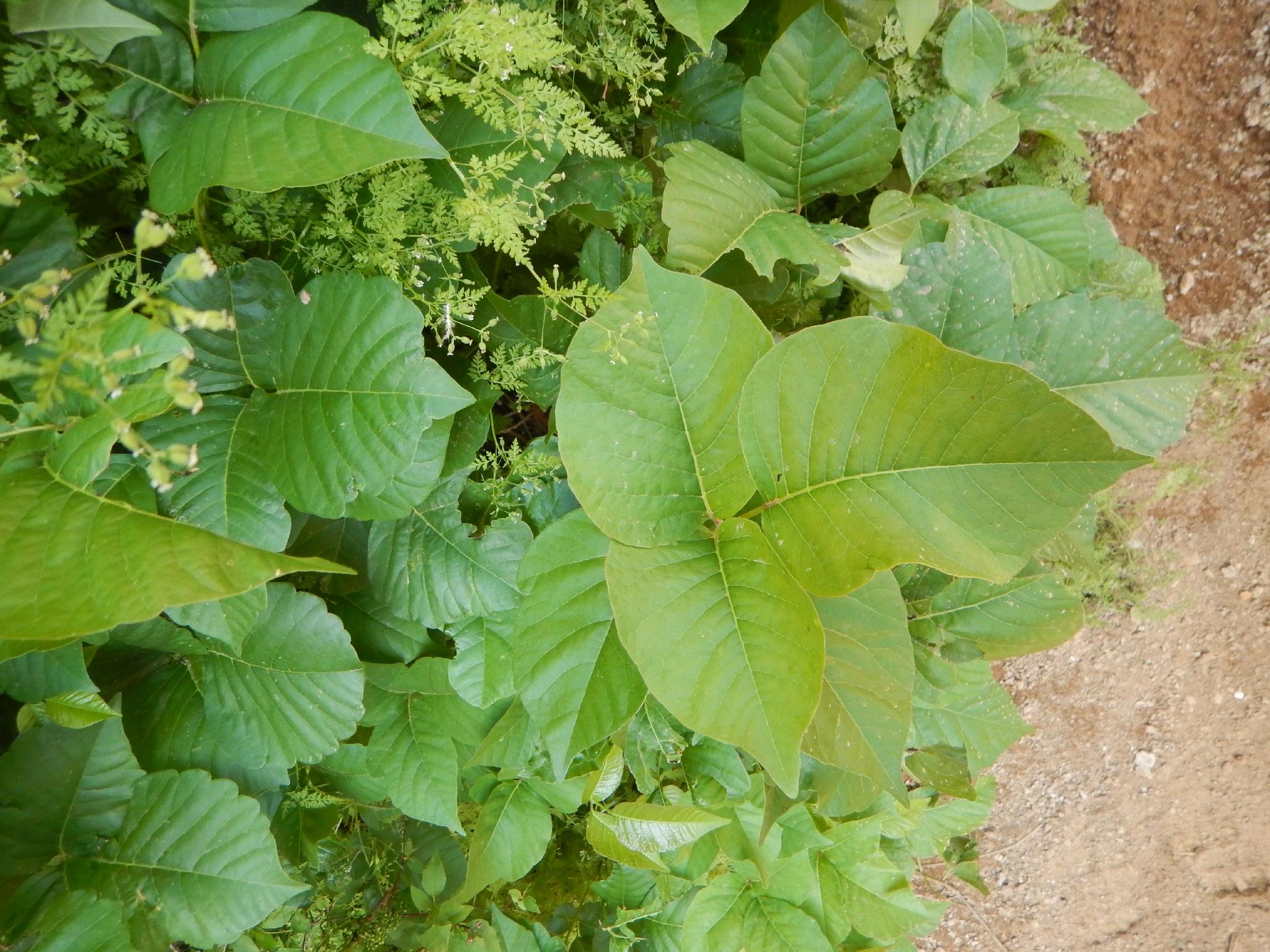
Above the falls it is somewhat slow going up the stream bed trying to find the easiest path and avoid poison ivy. Our motivation waned not far above the falls, though the upper canyon is supposed to narrow a bit and be quite pretty.
Maps

11T 506162E 4814117N
43°28'48"N 116°55'26"W
11T 506066E 4813837N
43°28'39"N 116°55'30"W