 Hiking
Singletree Falls
Hiking
Singletree Falls
Torrey
Overview
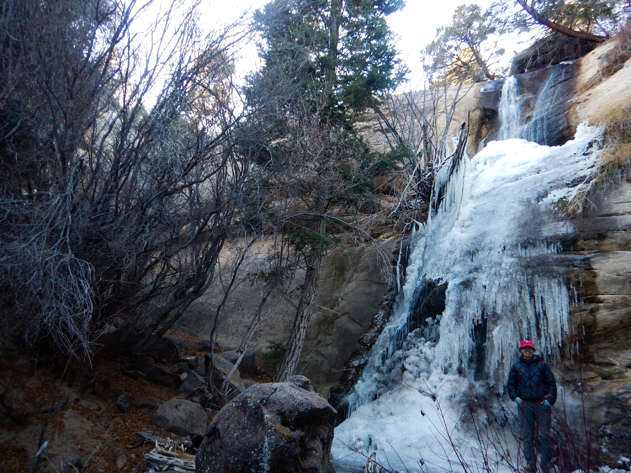
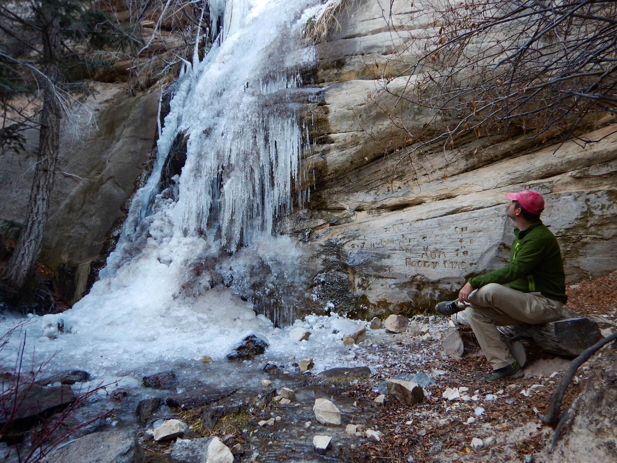
Is the family looking for an escape from the oppressive summer heat that can descend on Capitol Reef National Park? Need a short hike to get some of the kids’ energy out? Single Tree Falls is the ticket! The hike is short and family friendly, ending at a soothingly cool mountain waterfall.
The trail starts at Single Tree Campground, which makes a great camping destination away from the lower elevation heat in warmer times of the year. Expect about a 20-minute drive from Torrey proper.
Getting There
From the east side of Torrey, head south on highway 12, toward Boulder/Escalante. Follow highway 12 for 11.8 miles to Singletree Campground on the left.
Route Description
When entering the campground, follow the main road to the first loop. The trail is on the right side just at the start of the loop, across the road from the bathrooms.
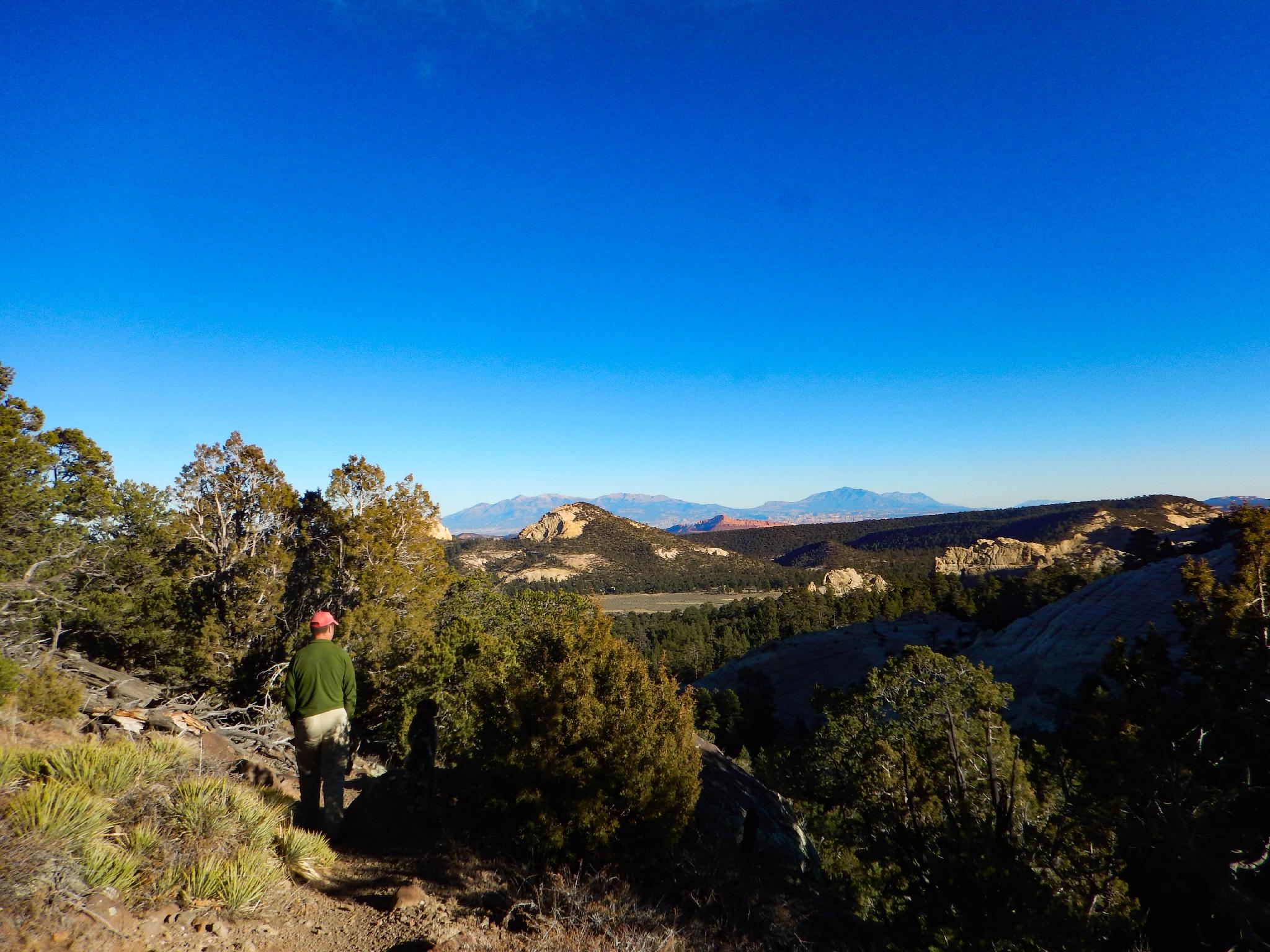
Follow the trail as it easily meanders down along the stream. It soon passes through a gate, please close it! From the gate, the trail drops a bit more steeply to an old road. There are excellent views to the east from this section of Happy Valley right below, and the Henry Mountains/Capitol Reef in the distance.
Cross the road; the trail continues on the other side, crossing the small stream on a bridge.
Once past the bridge, the trail drops steeply down to the base of the falls. At the final junction, go right, with the falls less than a minute up from the junction. It generally flows year around.
Maps

12S 470937E 4223848N
38°09'43"N 111°19'54"W
12S 471080E 4223782N
38°09'41"N 111°19'48"W
12S 471309E 4223672N
38°09'38"N 111°19'39"W
12S 471433E 4223613N
38°09'36"N 111°19'34"W
12S 471391E 4223606N
38°09'36"N 111°19'36"W