 Hiking
North Caineville Mesa Septentrional Route
Hiking
North Caineville Mesa Septentrional Route
Cainville
Overview
For whatever reason, I have always been fascinated with North and South Cainville Mesa's. The towering formations are both steeped in history and really iconic landmarks that can be seen from many areas around Capitol Reef and the southern San Rafael Swell.
The first route I did was the North Caineville Mesa South Route. It is tough, but I thought rewarding. Then I heard of a second route that at the time people were calling the North Caineville Mesa North Route. It is also a bit tough, but an equally rewarding route in my opinion. Well, then I heard of ANOTHER route on the very northern end of the formation! To avoid confusion with the other north route, I'll call this one the septentrional route.
This route, like the others, is a historic route likely put in and used by sheep men in the mid-1900s. This route is, also like the others, a fair bit of effort, but I think a very rewarding route. Because it climbs the very north end of the formation, it has an entirely different view of the surrounding desert than the other routes.
Getting There
Reaching the trailhead starts at mile post 97.95 on UT-24 which is about 18 miles west of Hanksville, or 30 miles east of Torrey on UT-24.
Route Description
From the trailhead, spot the steep dirt and boulder slope angling up south to the shortest cliff band at the top of North Cainville Mesa. The old trail works up that dirt slope. Getting to the base requires heading east and a bit southeast across the bumpy moonscape. The detached mesa north of the main North Cainville Mesa is unnamed, but quite dramatic during the hike.
Because there are no rocks for cairns, and footprints wash out with heavy rain, there isn't a trail that we could find. Simply keep an eye on the dirt slope and head toward it. You should hit a wide wash after about 10 minutes (1/2 mile or so) that has some rocks strewn along it in spots. Head up the wide wash. It will head in the direction you want to go, and soon has some cairns to reassure you that you are heading in the right direction.
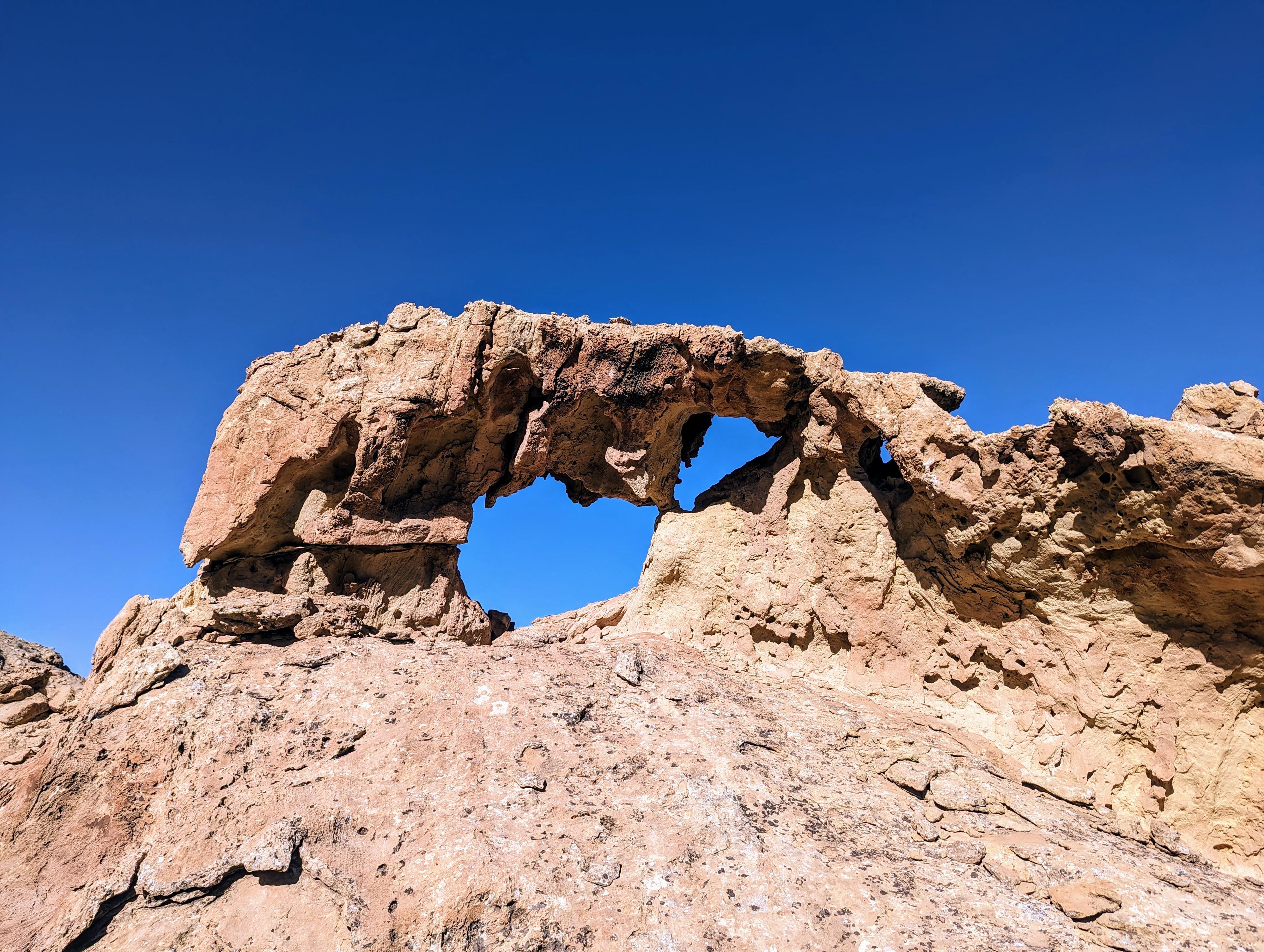
When the wash hits the base of North Cainville Mesa, look for cairns and the trail. The trail angles up left out of the wash and begins climbing the slope. Just a few minutes up, the trail passes a large boulder with an arch in it. This is a good landmark that you are on the right path.
Initially, the trail is pretty easy to follow, but soon narrows and requires a close eye to spot cairns and prints that mark the trail. Keep working up. If you lose the trail, it is worth taking a few minutes to re-find it. We tried to take a shortcut on the way down, and it was much more difficult than if we had stayed on the trail.
As the trail gets up 3/4 or more of the way up, it crosses a very deep gully. Not far above this crossing, the cairns and social trail got too thin for us to follow, but the short cliff band and notch are easy to shoot for, mostly heading straight up.
The notch appears to have had some blasting done to widen it and make it easier. There is a lot of loose rock at its base, the actual climb up through the notch is pretty easy.
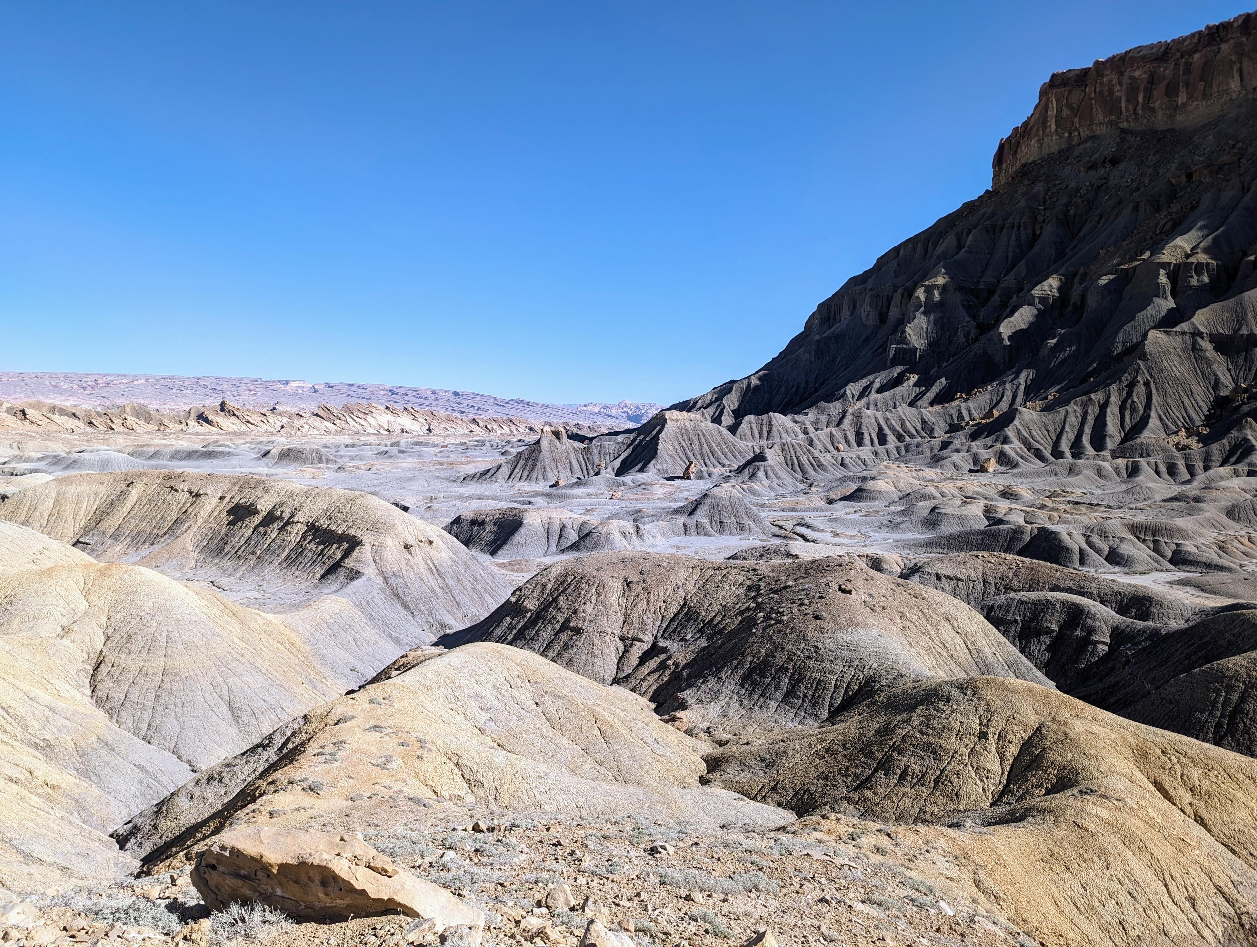
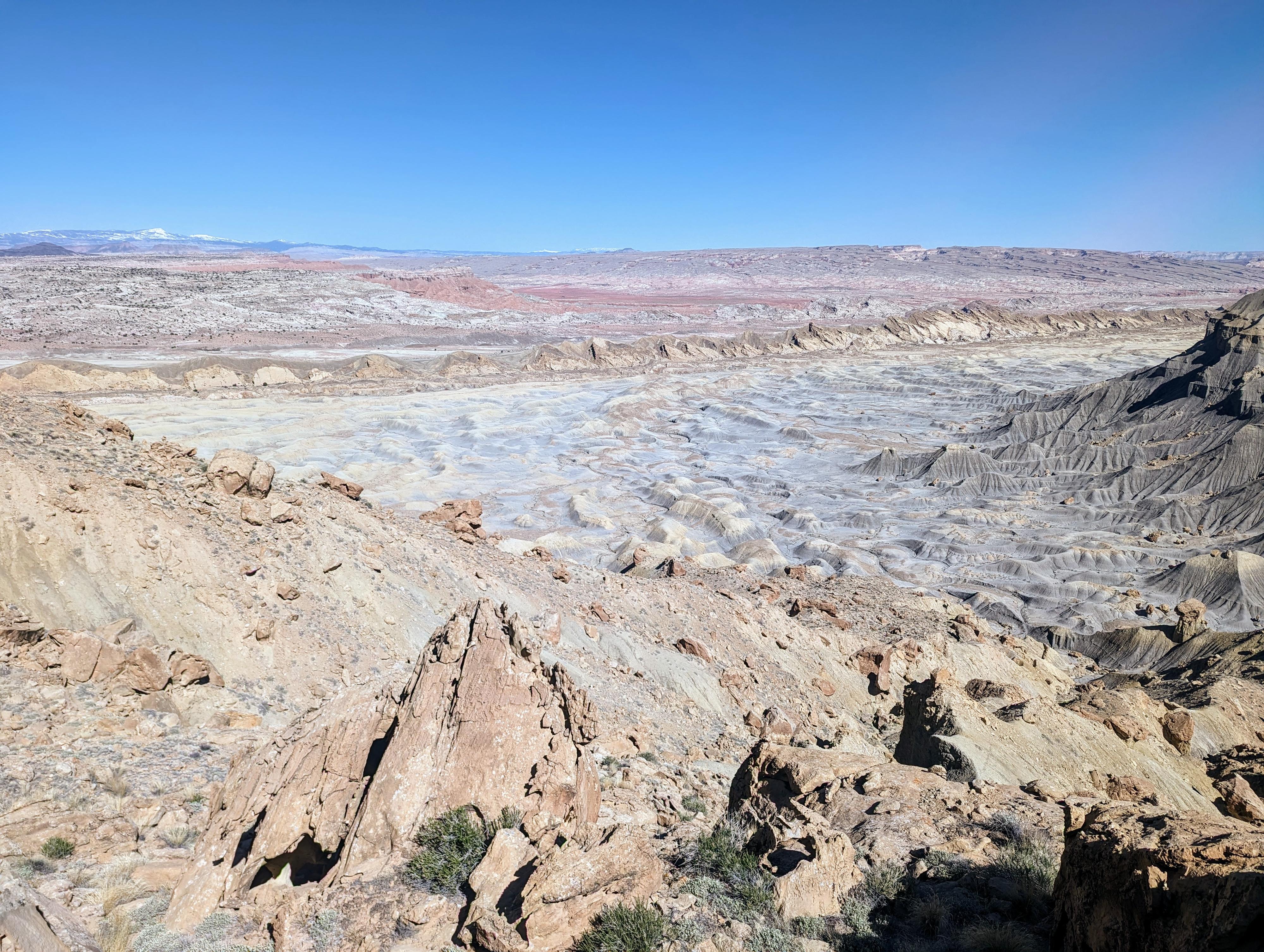
Once on top, the expanse of North Cainville Mesa is to the south, with the Henry Mountains in the distance. Hiking to either the east or west side give a neat perspective on the badlands surrounding the mesa. The high point of the mesa is to the west. Be sure to pay attention to where the route down is for when you come back!
Photos
Maps

12S 502802E 4252303N
38°25'08"N 110°58'04"W
12S 502971E 4252135N
38°25'03"N 110°57'57"W
12S 503565E 4251795N
38°24'52"N 110°57'33"W
12S 503795E 4251580N
38°24'45"N 110°57'23"W
12S 503828E 4251517N
38°24'43"N 110°57'22"W
12S 504011E 4251119N
38°24'30"N 110°57'15"W
12S 504133E 4250965N
38°24'25"N 110°57'10"W
12S 503264E 4250685N
38°24'16"N 110°57'45"W