 Roadside Attraction
Nine Mile Canyon
Roadside Attraction
Nine Mile Canyon
Wellington
Overview
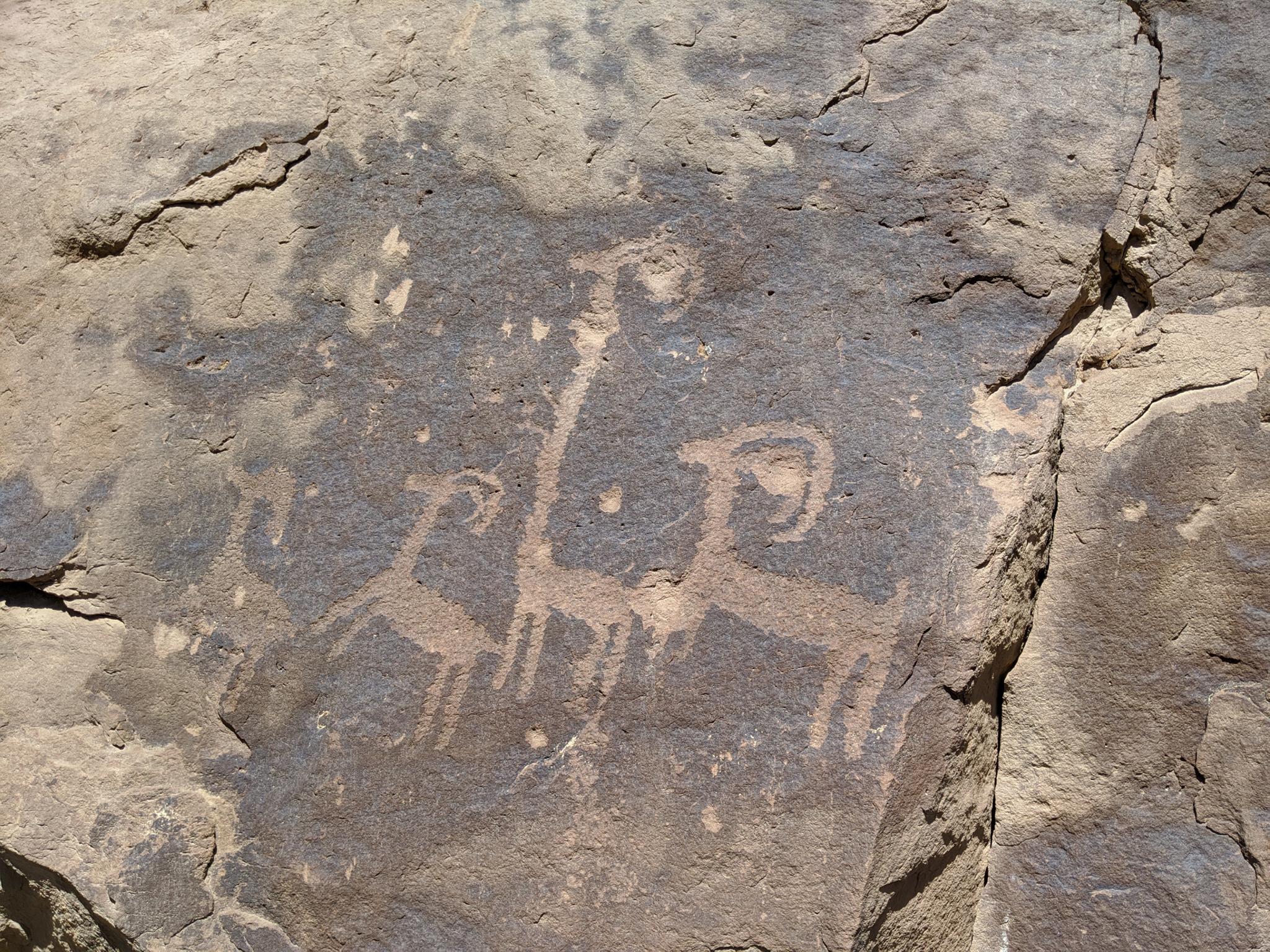
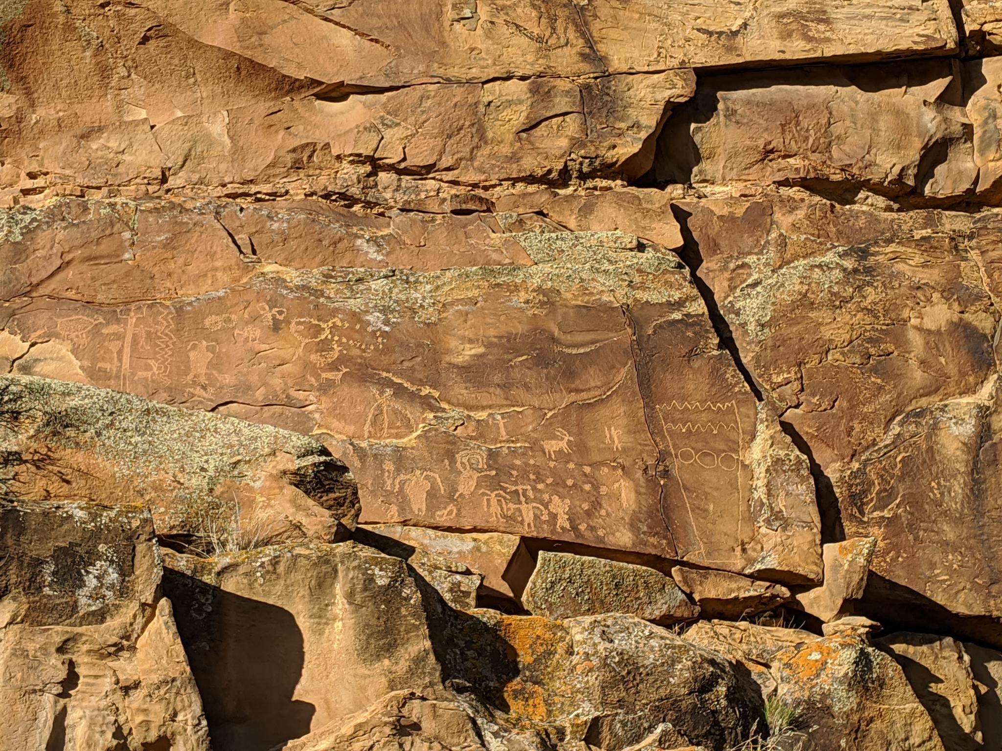
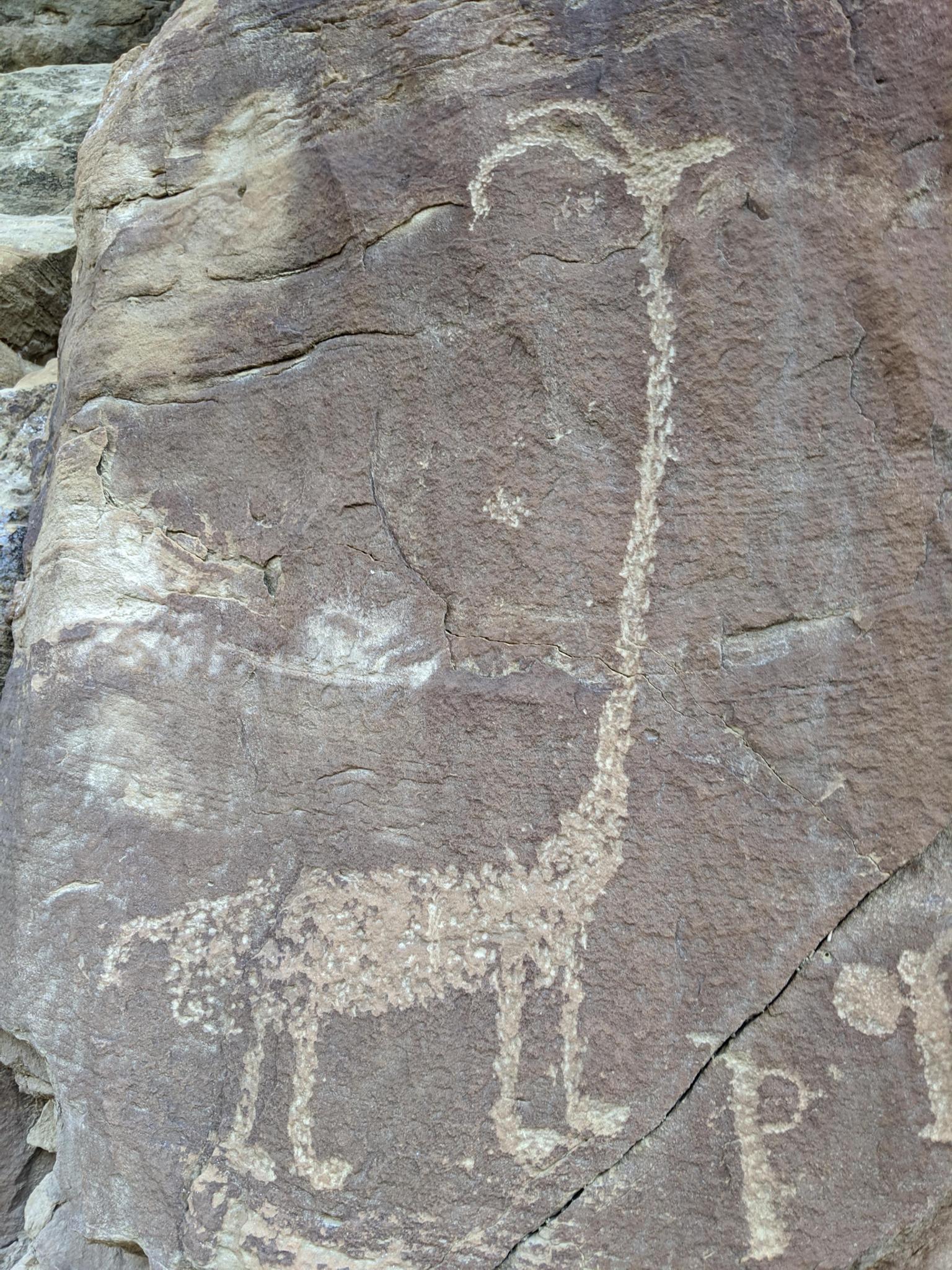
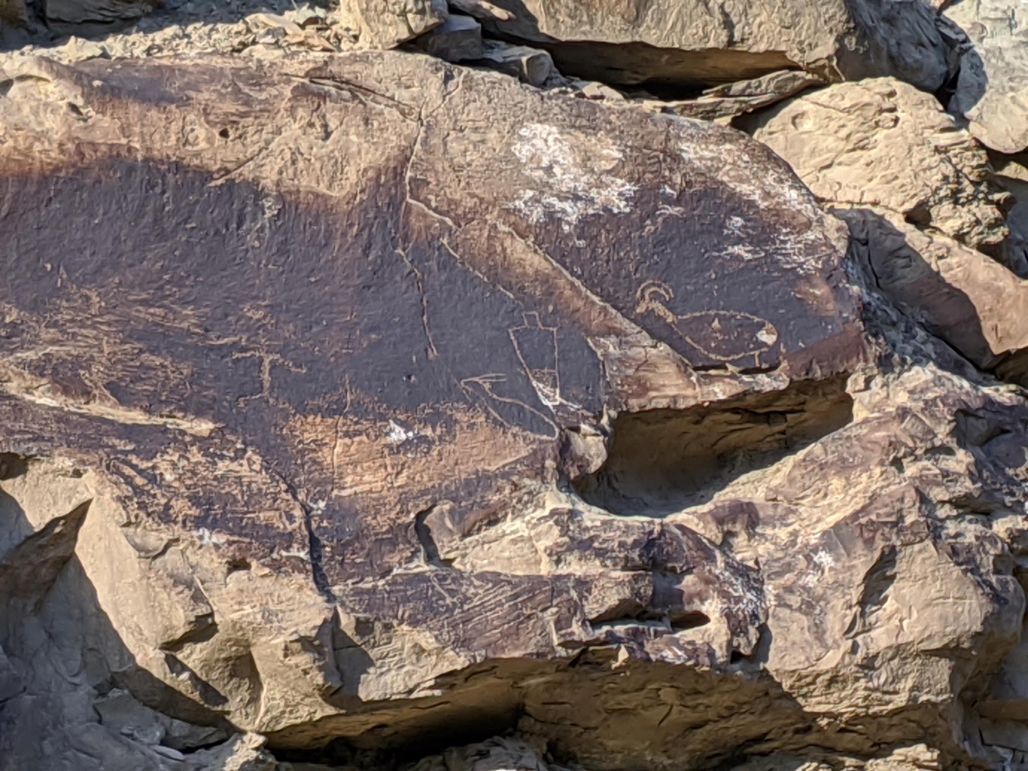
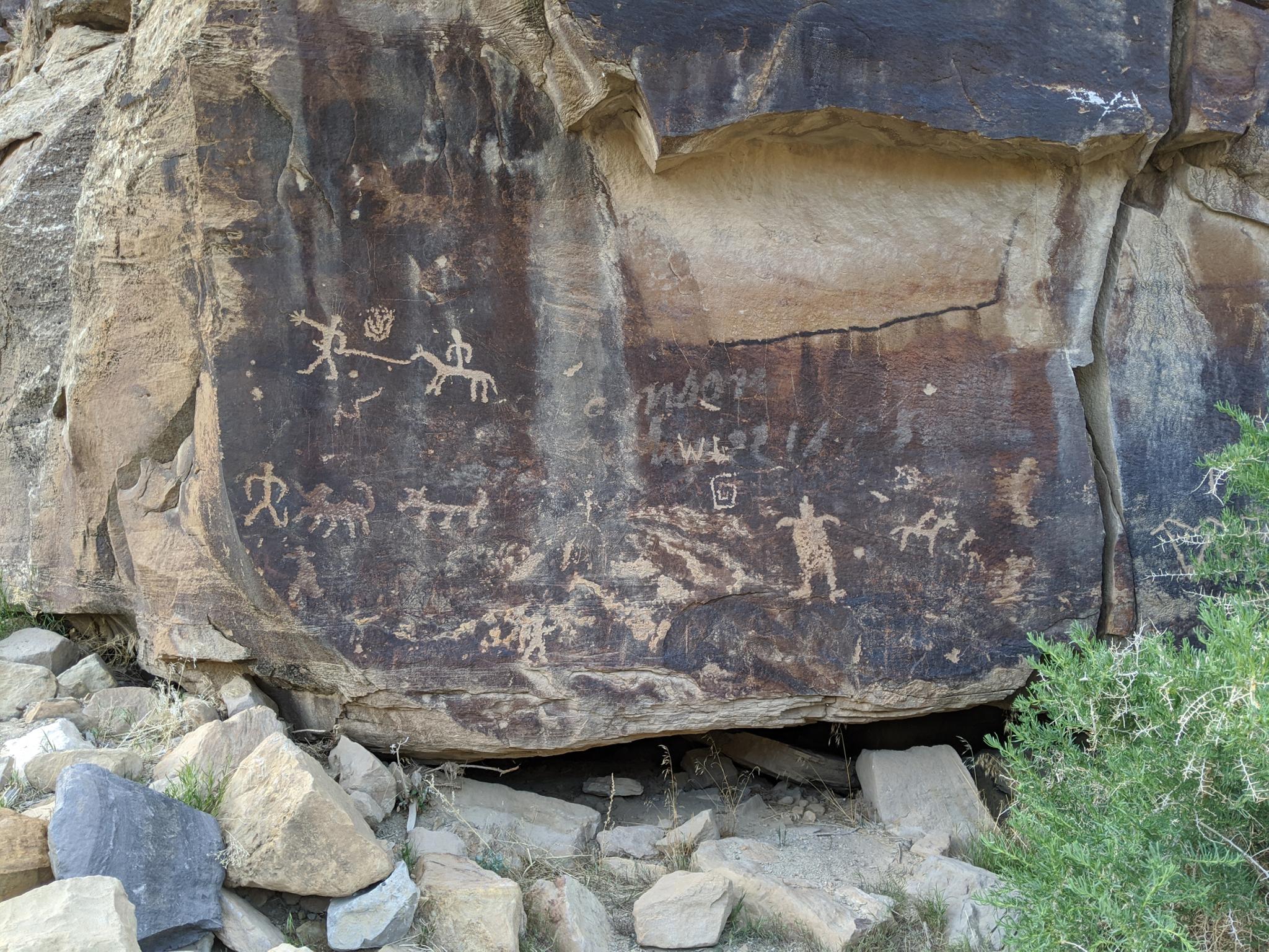
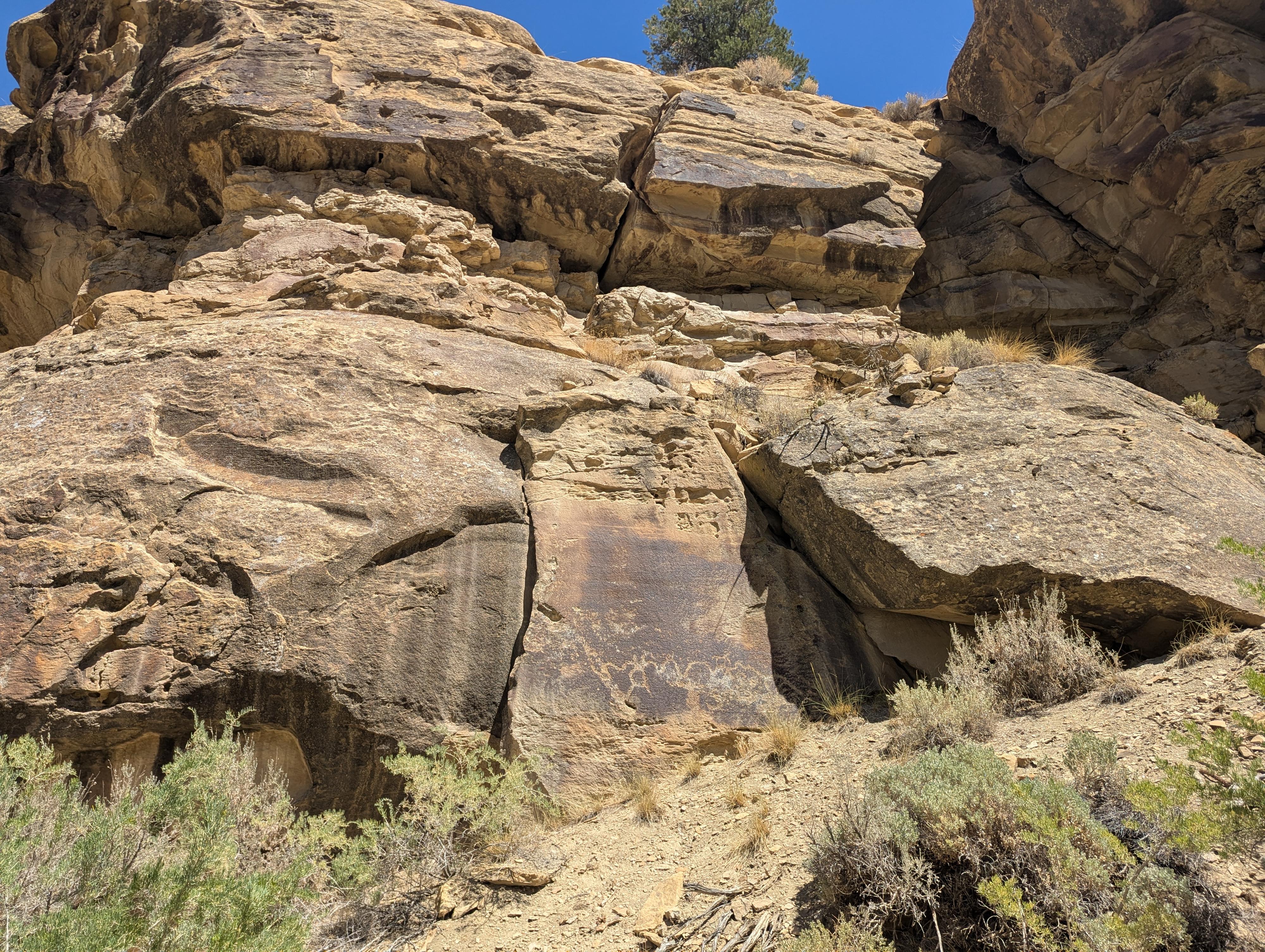
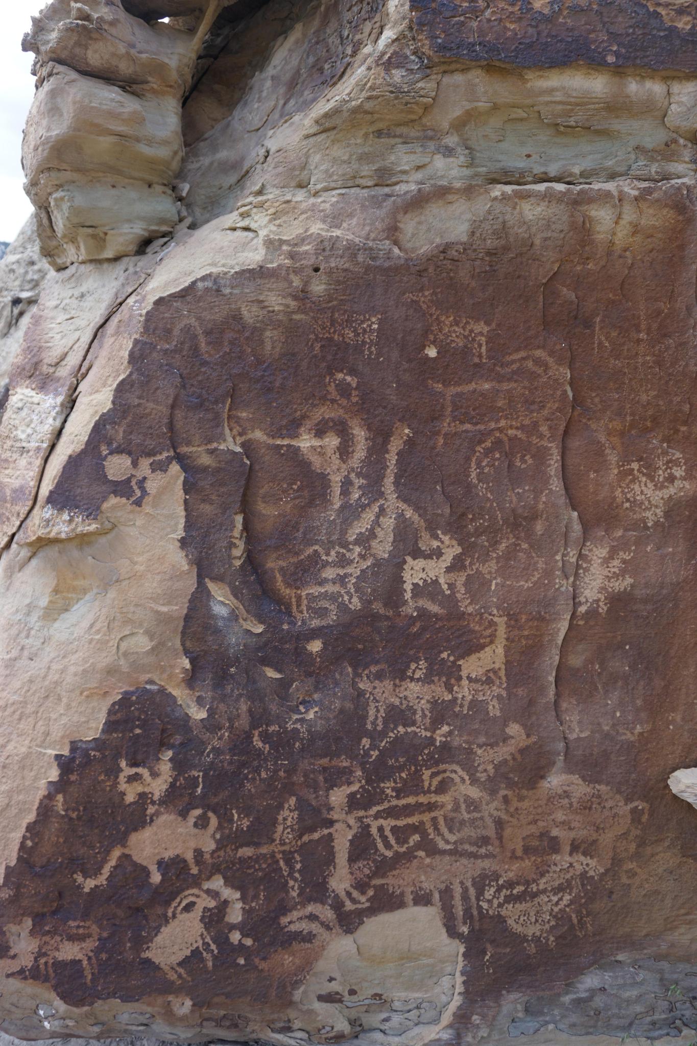
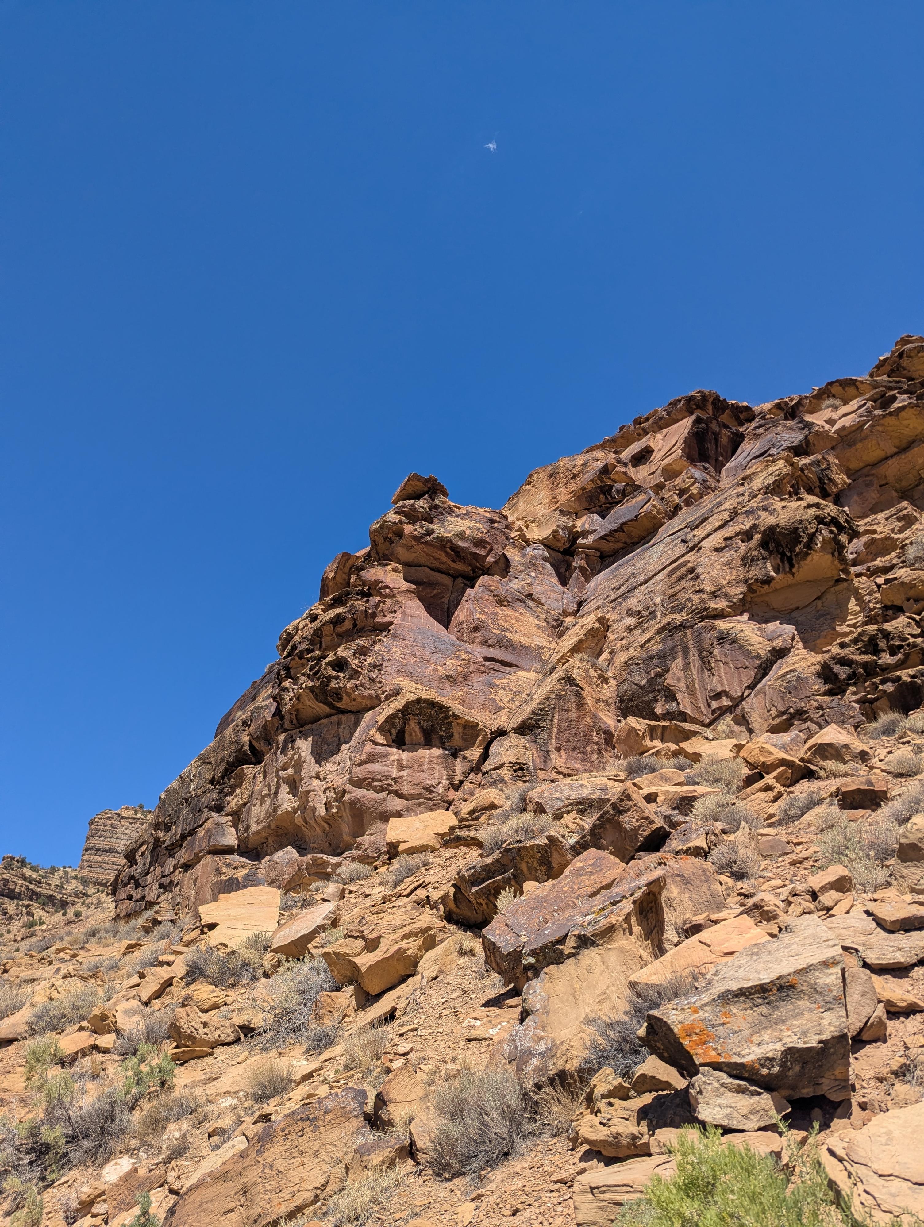
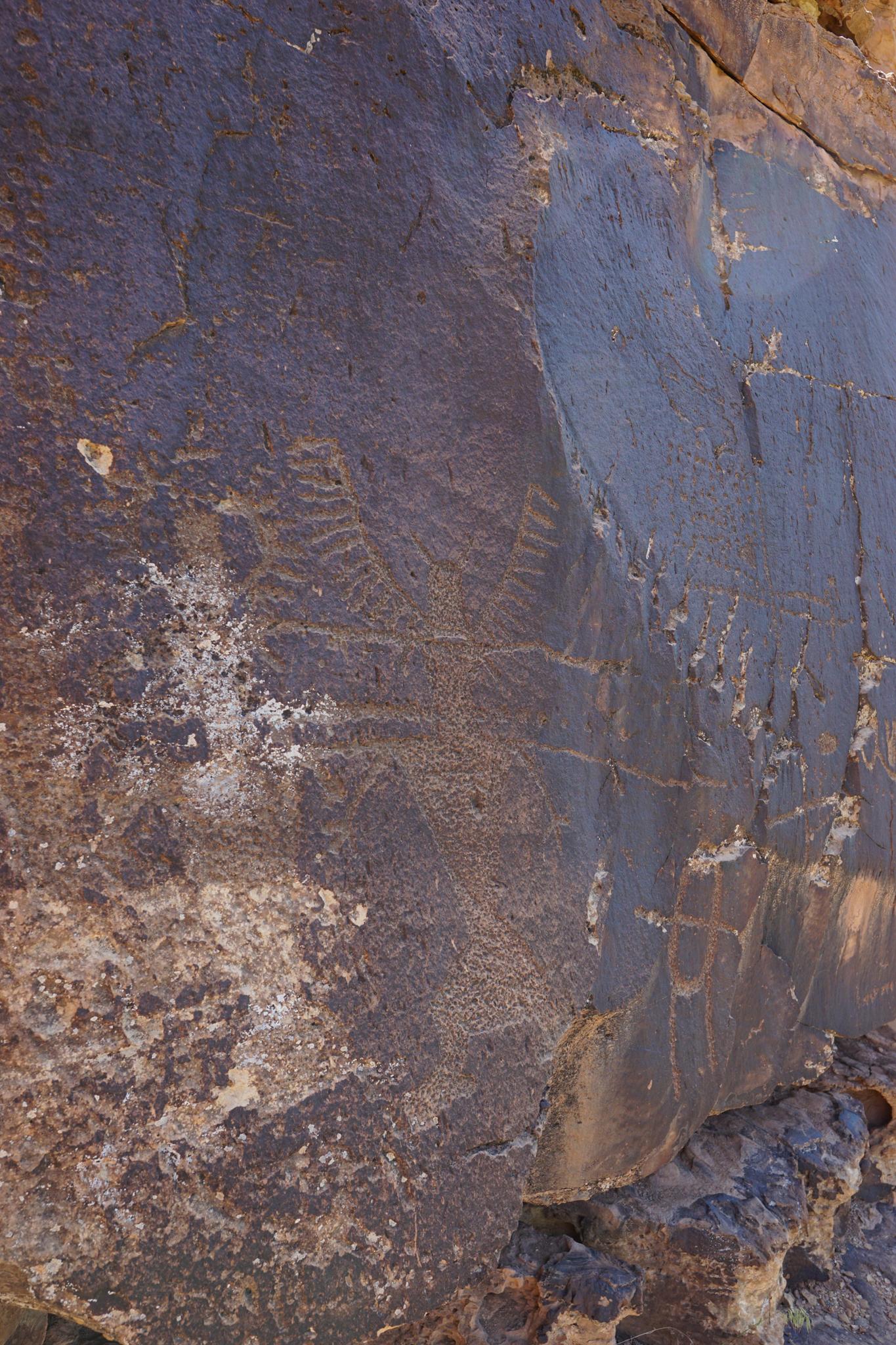
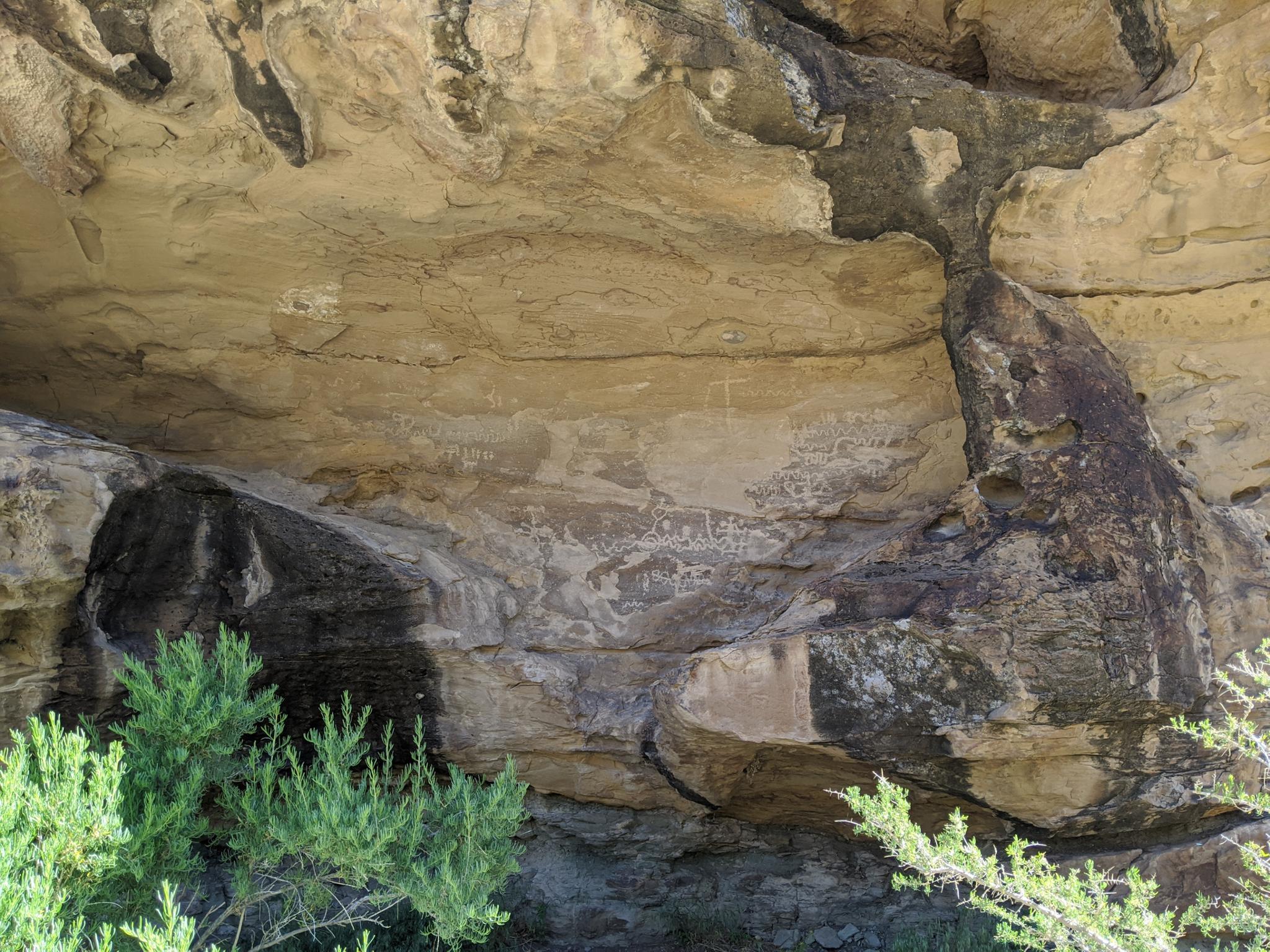
Nine Mile Canyon is known as the world's longest art gallery. The canyon is about 40 miles long but became named Nine Mile Canyon when F. M. Bishop on Powell’s expedition to the area did a nine-mile triangulation drawing he named Nine Mile Creek. For rock art enthusiasts, this is an absolute top of the list place to visit. The canyon is home to hundreds of rock art panels, as well as granaries, and other Native American sites. It is an astonishing place to visit.
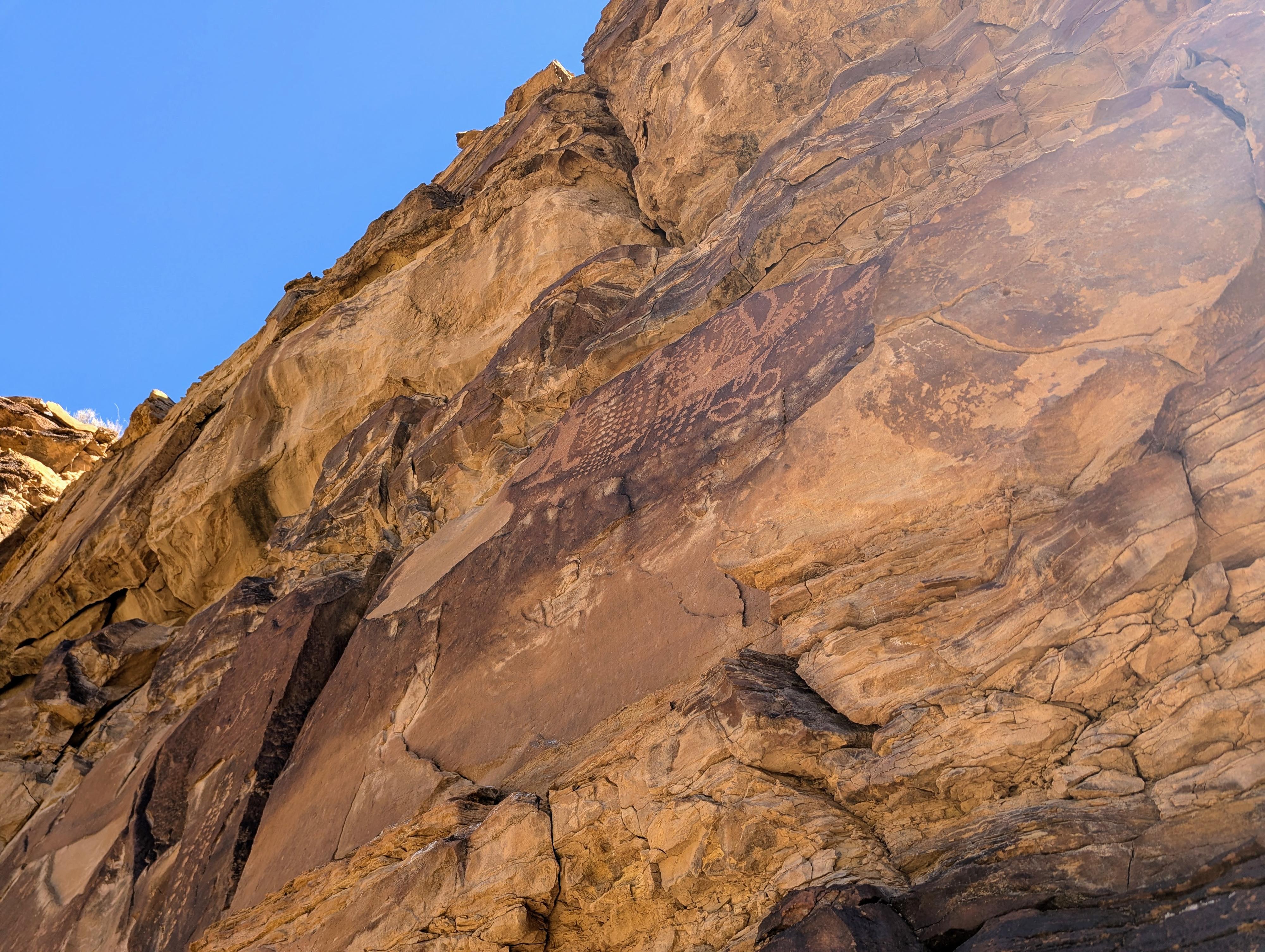
With more than 1,000 cataloged rock art sites, the sheer volume of imagery is staggering. Driving the canyon road, it’s easy to miss panels tucked behind cottonwoods or perched high on sandstone walls. Each trip reveals something new: a figure you hadn’t noticed, a spiral pattern suddenly catching the light, or a faint outline of an ancient dwelling. Nine Mile Canyon remains not just a corridor of history, but a place of discovery and wonder for every traveler who passes through.
I've visited many times over the years and see new panels or intricacies I have missed on previous visits every time I visit.
History
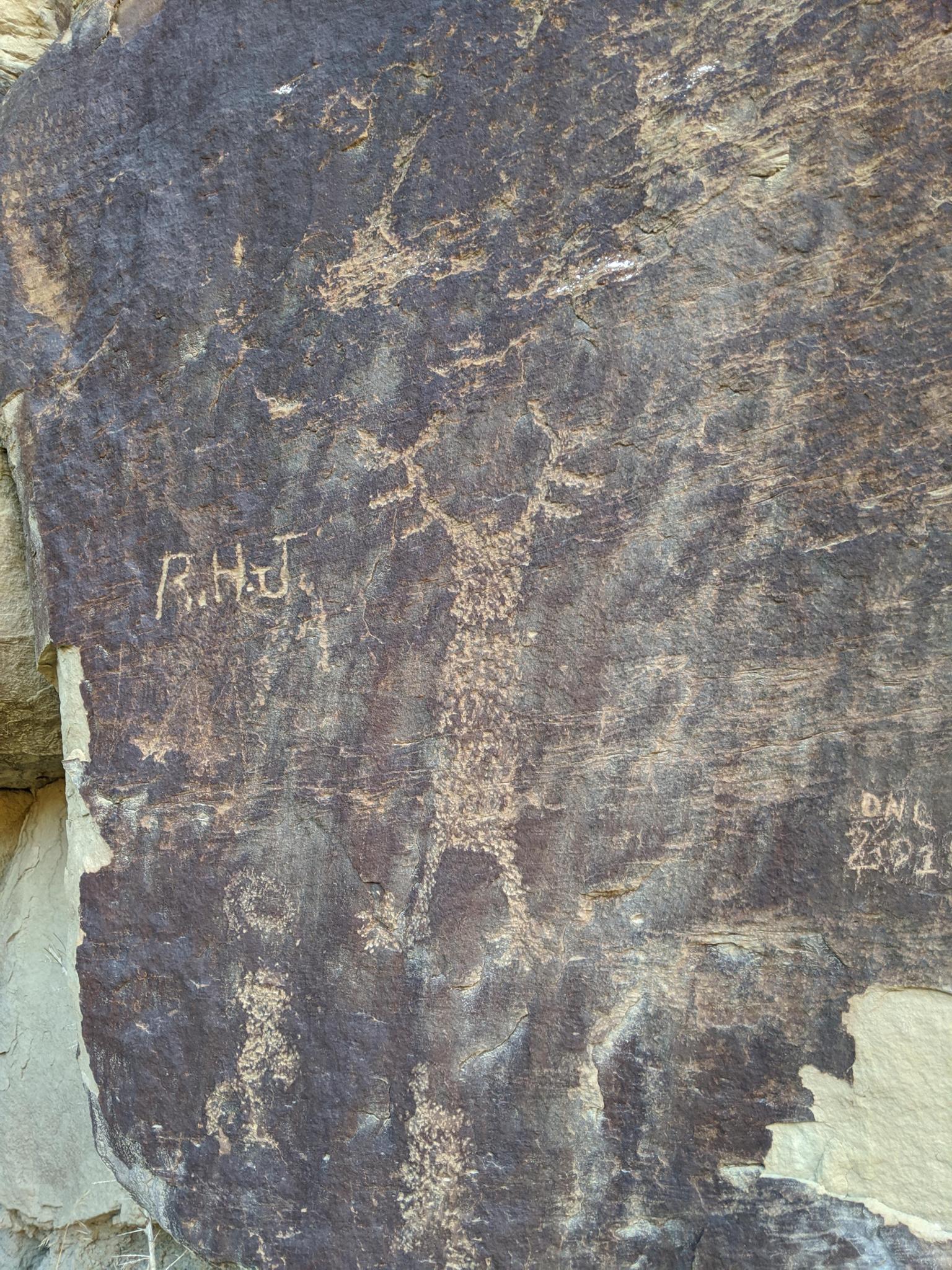
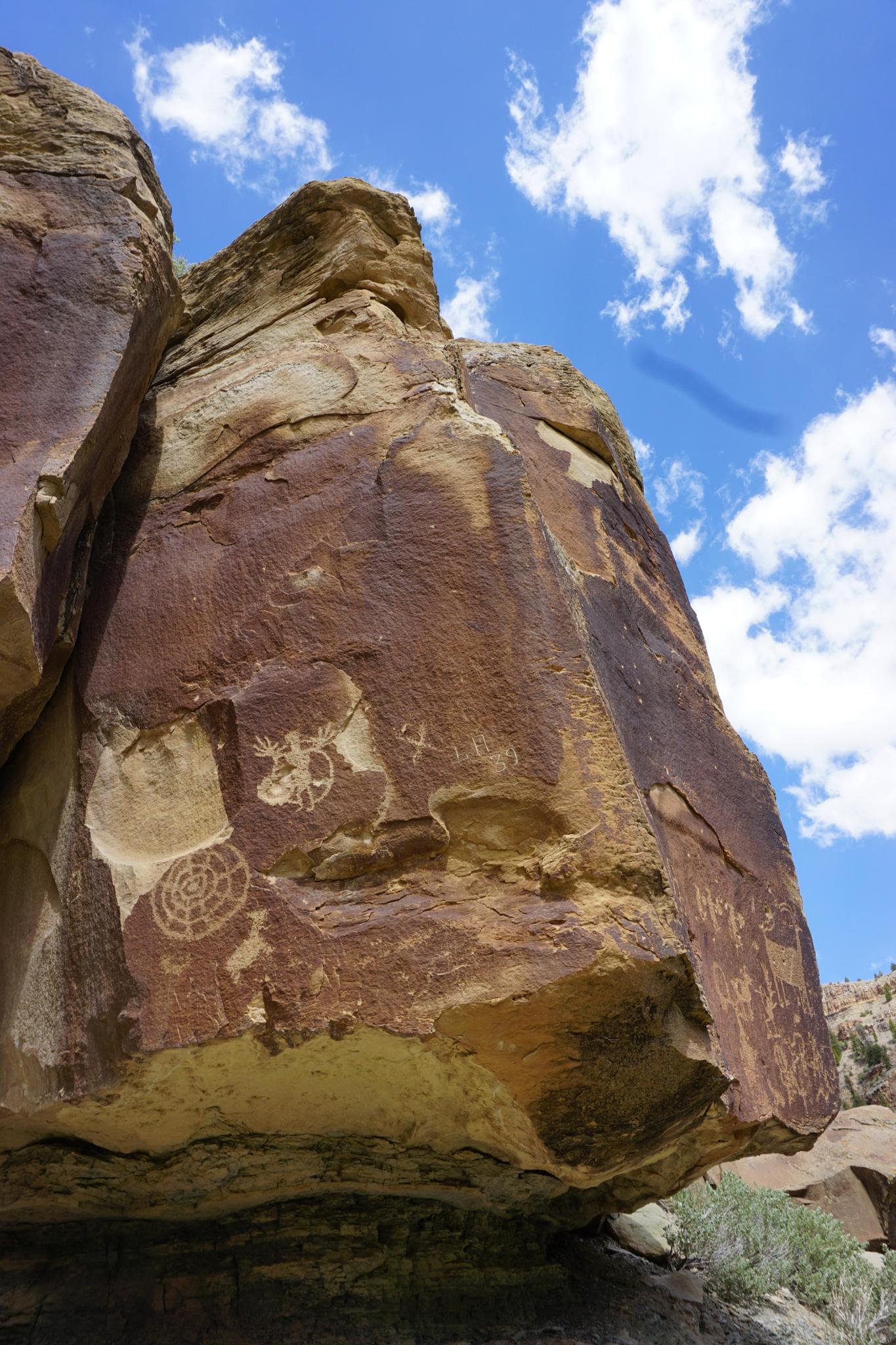
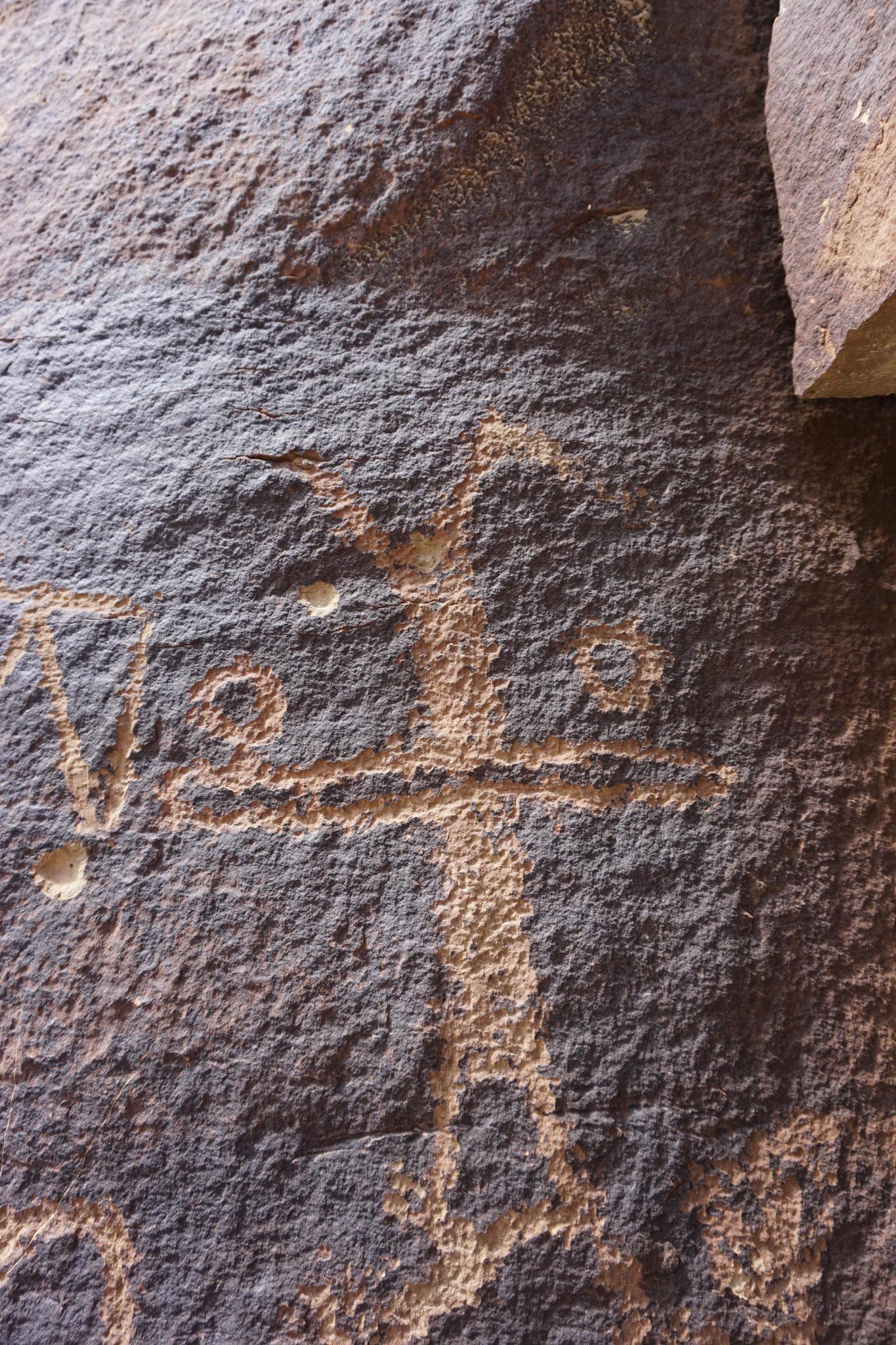
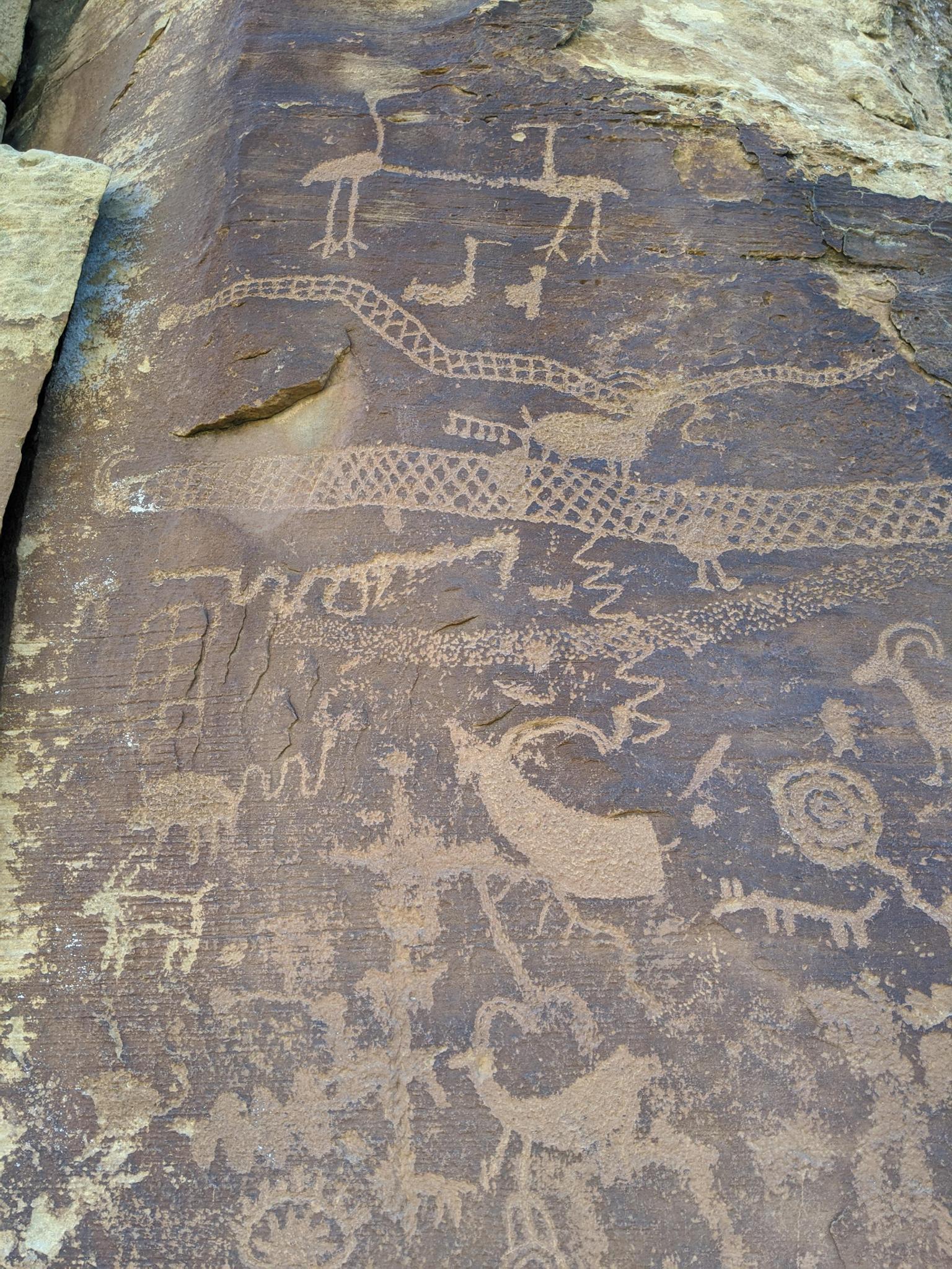
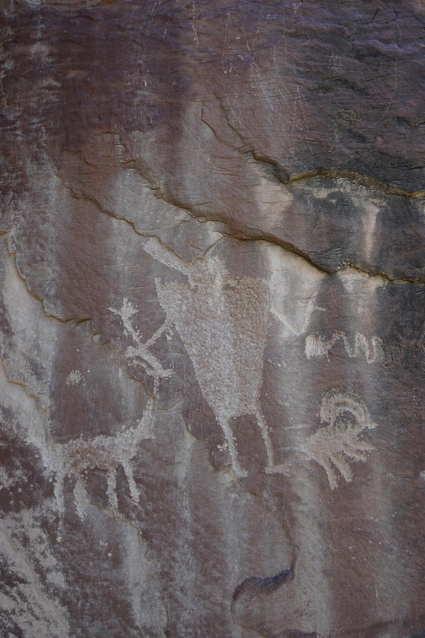
Nine Mile Canyon is often called the "world’s longest art gallery," and for good reason. Its cliffs and boulders are etched with thousands of petroglyphs and pictographs that trace centuries of human history. The story begins with the Fremont people, who occupied the canyon from about 950 to 1250 AD. Unlike purely nomadic cultures, the Fremont developed semi-permanent villages, farmed corn, beans, and squash, and engineered small-scale irrigation systems that used Nine Mile Creek to water their crops. Their rock art - abstract designs, hunting scenes, and depictions of animals and people - still covers the canyon walls today, offering a window into their beliefs and daily lives.
By the late 1200s, the Fremont disappeared from the region. Archaeologists still debate whether they migrated, assimilated into other groups, or were displaced. What is clear is that by the 1500s and 1600s, the Shoshoni, Paiute, and especially the Ute peoples were active in the canyon. The Utes left their own distinctive rock art, often more dynamic in style. Notably, some panels show horses - animals introduced to the Americas by Europeans in the 1600s - signaling that these carvings were created long after the Fremont.
The first confirmed Euro-American visitor to Nine Mile Canyon was S. Groesbeck, who carved his name into the rock on August 19, 1867. While his inscription survives as the earliest dated evidence, it is highly likely that fur trappers, explorers, and perhaps members of the Domínguez–Escalante Expedition passed nearby in the late 1700s and early 1800s.
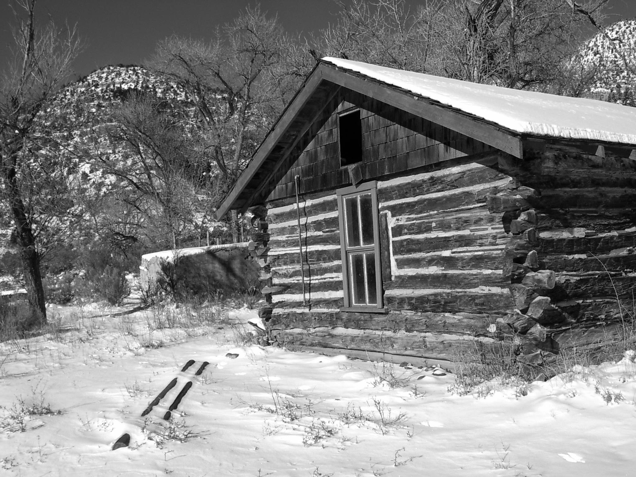
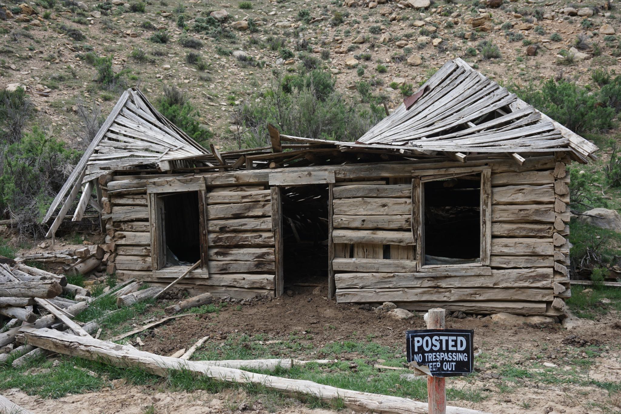
A major turning point came in 1886, when Buffalo Soldiers of the 9th Cavalry constructed a wagon road through Nine Mile Canyon to connect Fort Duchesne with the rail hub at Price. This new route opened the canyon to greater settlement, bringing ranchers, farmers, and homesteaders. By 1905, the town of Harper had formed, with a school, post office, and as many as 190 residents at its peak. Like many frontier towns, Harper’s prosperity was short-lived, and by the 1920s it was largely abandoned, leaving behind foundations and fading memories.
Today, Nine Mile Canyon is a place of intersections: ranching, tourism, and energy development. Ranchers still graze livestock in the canyon, while oil and gas operations dot the rim and valley floor. Conflicts over access have occasionally flared between private landowners and visitors eager to see the rock art. In response, the Bureau of Land Management (BLM) negotiated land swaps that increased public access to many key cultural sites while preserving ranching operations elsewhere.
Notes on visiting:
- Though many people visit for a day, if you enjoy rock art, it is a wonderful place to spend a couple of days.
- The Nine Mile Ranch in the canyon bottom is the only lodging in the canyon. It offers cabins and a campground.
- There is no camping allowed on public lands in Nine Mile Canyon. If camping, you will need to drive out of the canyon to camp.
- Have plenty of gas, water, and supplies. There are no services in the canyon.
- I highly recommend bringing binoculars.
- Visiting in the winter (if there is not heavy snow on the ground), is a lovely time to visit.
If you have limited time....
While I recommend a full day, or more, when visiting the canyon, many people have limited time. Here would be my recommendation if you only have a 1/2 day or so to visit:
Stop 1: First Panel
- Just a short drive into the canyon, this site gives a great introduction to Fremont rock art.
Stop 2: Daddy Canyon Complex (Allow 30–45 minutes)
- One of the best pullouts, with trails leading to multiple panels and alcoves.
- Includes impressive Fremont anthropomorphs, animal figures, and a shaded canyon feel.
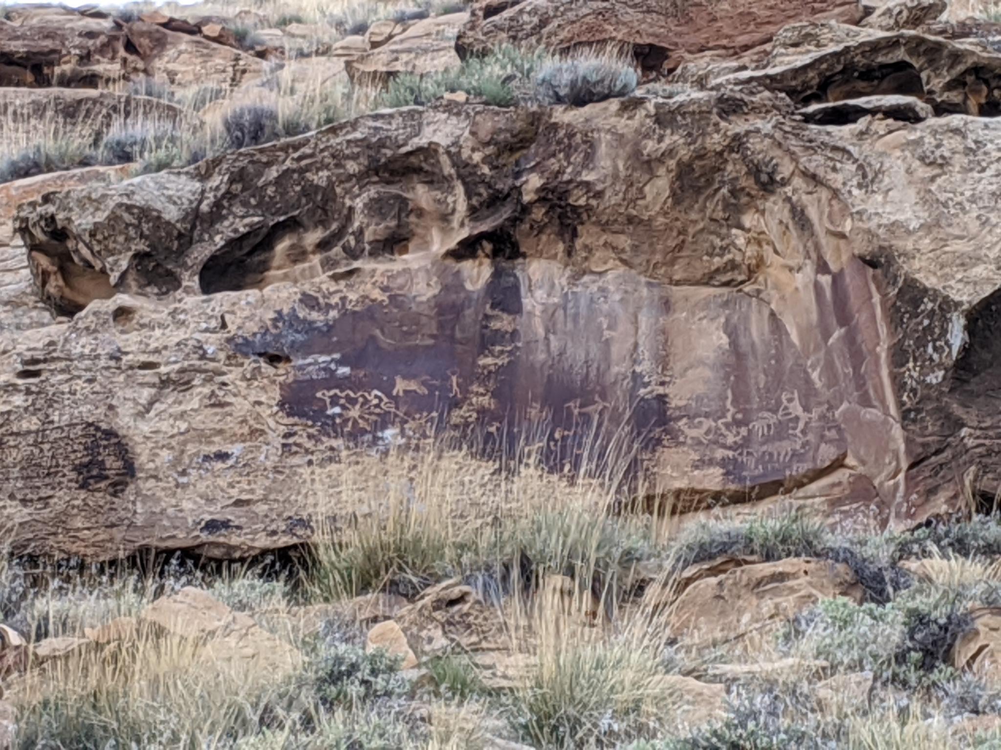
Stop 3: Great Hunt Panel (Allow 15-30 minutes)
- The most famous rock art in Nine Mile Canyon.
- A well-marked pullout and short trail lead to a massive panel depicting hunters and bighorn sheep.
Stop 4: (time permitting) Balanced Rock and/or Big Buffalo Panel
- Two other iconic sites, Big Buffalo Panel features one of the canyon’s largest buffalo petroglyphs.
- Balanced Rock is one of my favorites as well.
Getting There
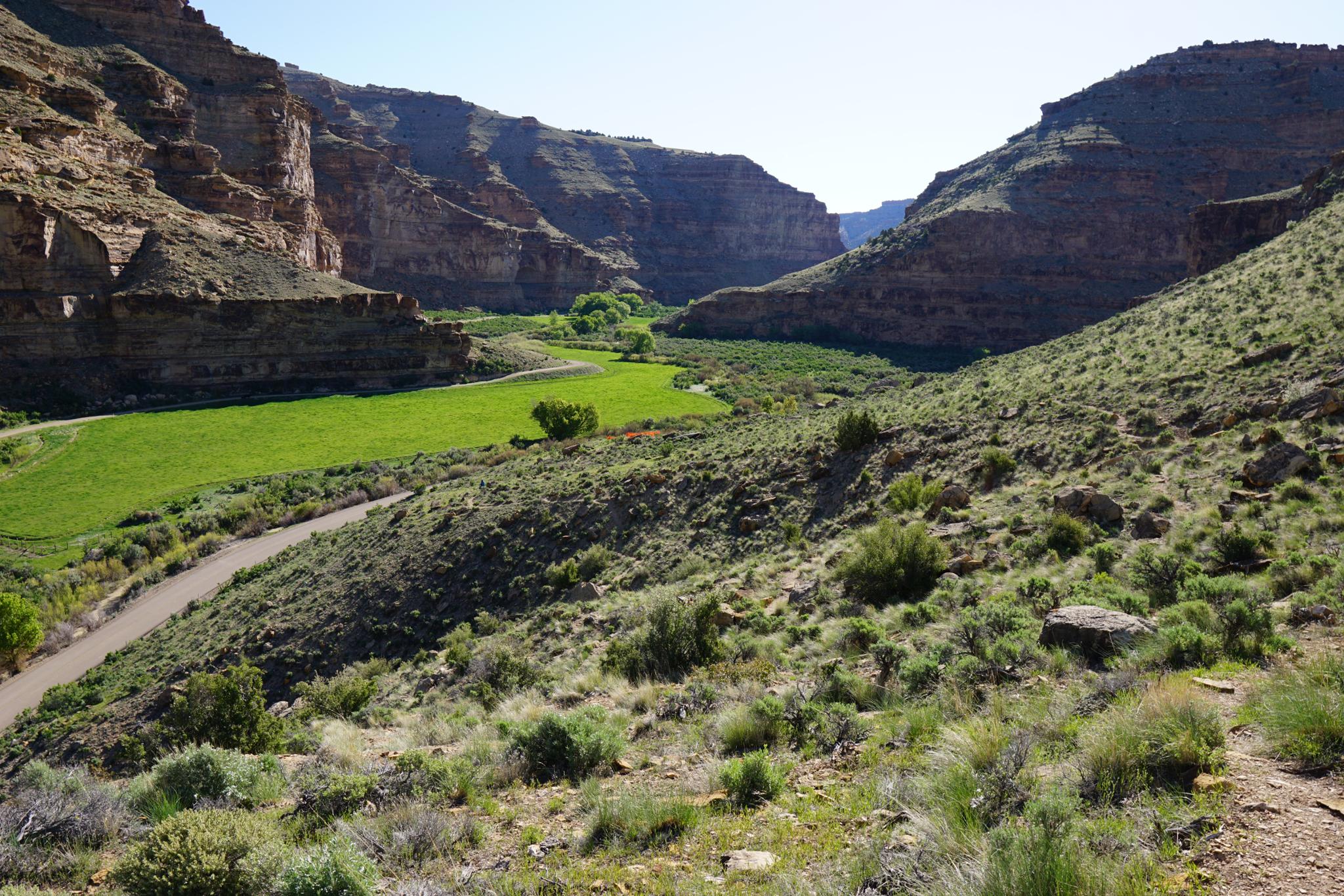
Nine Mile Cayon is reached from either Myton or Wellington. Starting from Wellington is the most common and what is described here. From Wellington, travel east on US-191 (Main Street). On the east end of Wellington, about 2 miles from the main town of Wellington is a Cheveron Station on the left.
There is an informational sign at the Cheveron for Nine Mile Canyon. The road to Nine Mile begins south of the Cheveron as Soldier Creek Road. Reset your odometer at the junction of US-191 and Soldier Creek Road, and head north on Soldier Creek Road. Nine Mile Canyon is well signed, with the first site being about 20 miles from the 191/Soldier Creek Junction.
Route Description
Rock art and historic sites are fragile, non-renewable cultural resources that, once damaged, can never be replaced. To ensure they are protected, please:
- Avoid Touching the Petroglyphs: Look and observe, BUT DO NOT TOUCH!
- Stay on the Trails: Stay on the most used trails when visiting sites, and don't create new trails or trample vegetation.
- Photography and Sketching is Allowed: Do not introduce any foreign substance to enhance the carved and pecked images for photographic or drawing purposes. Altering, defacing, or damaging the petroglyphs is against the law -- even if the damage is unintentional.
- Pets: Keep pets on a leash and clean up after them.
- Artifacts: If you happen to come across sherds (broken pottery) or lithics (flakes of stone tools), leave them where you see them. Once they are moved or removed, a piece of the past is forever lost.
20.45 - First Panel
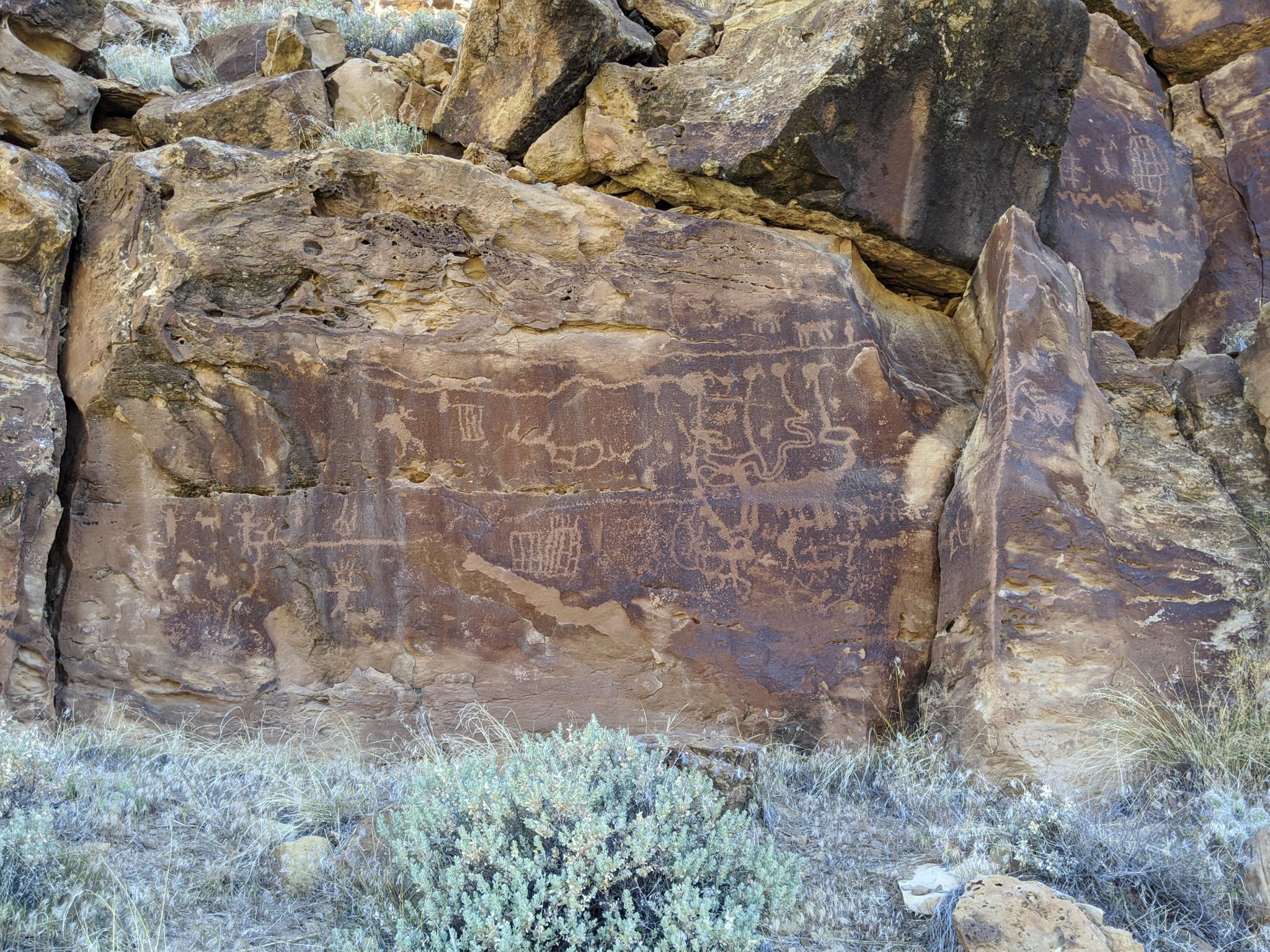
26.7 - First Large Panel
27.7 - Cottonwood Glen Day Area
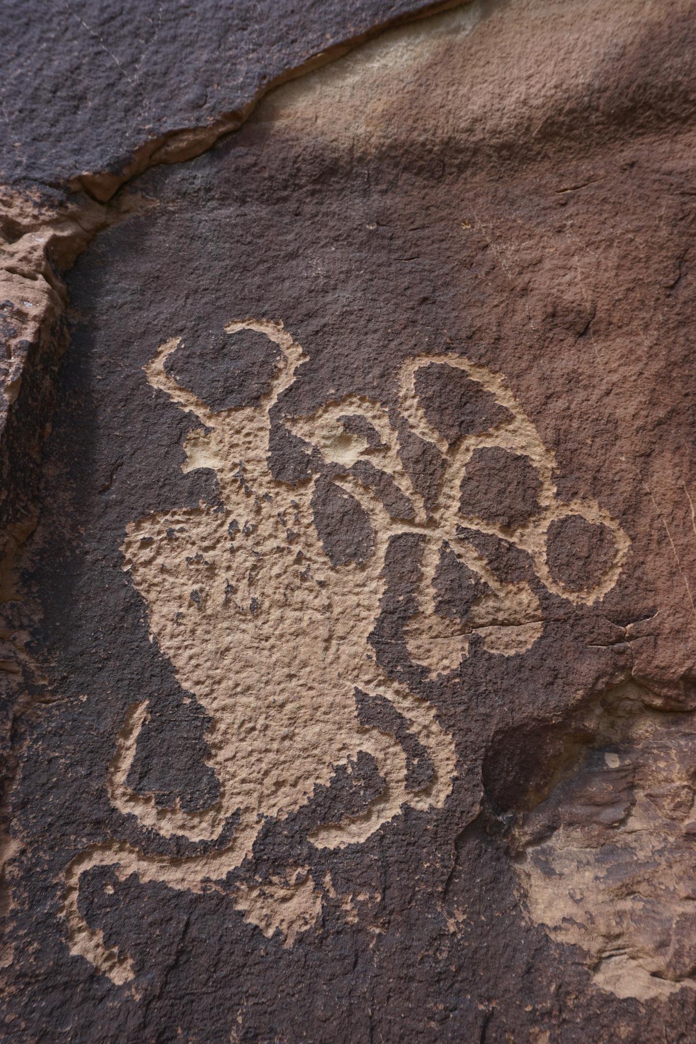
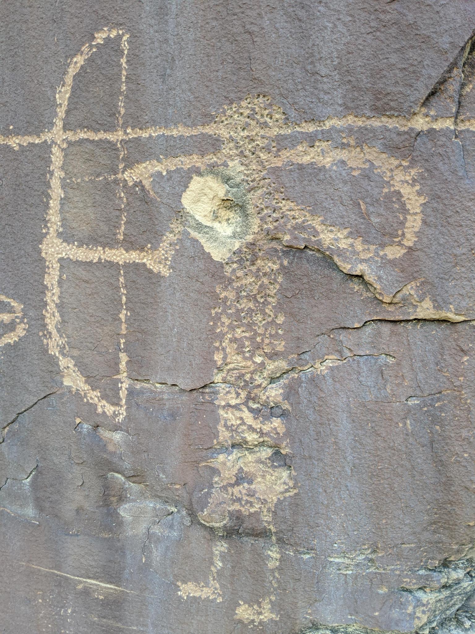
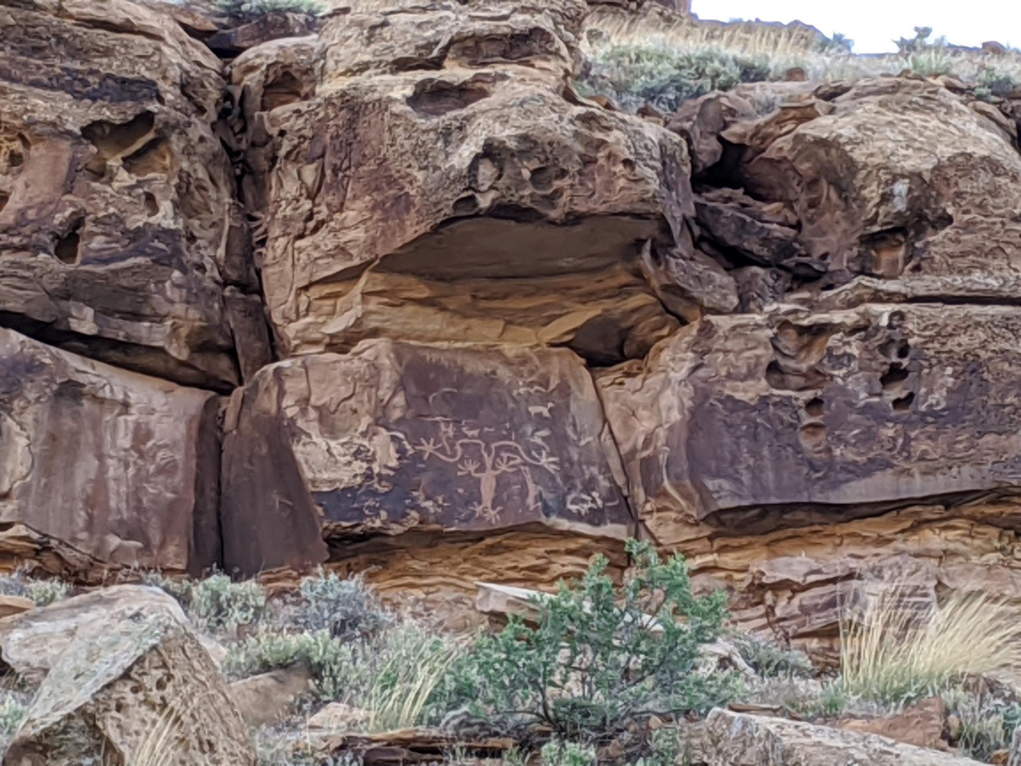
29.4 - Long neck!
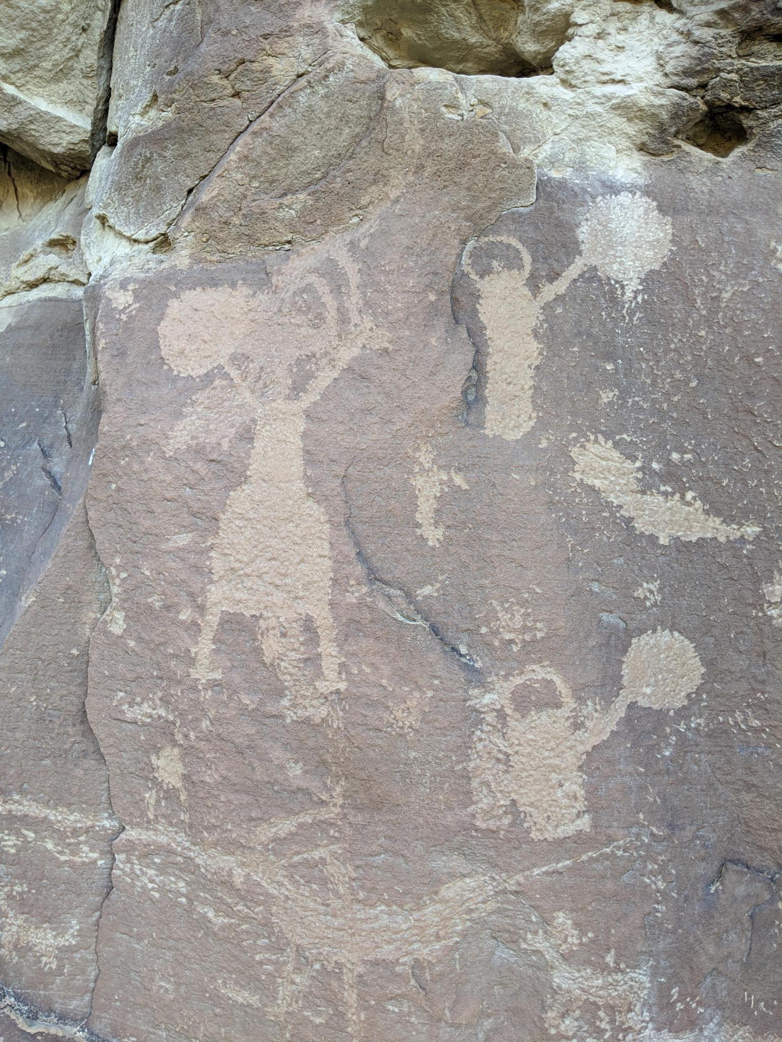
29.4 - Men with shields.
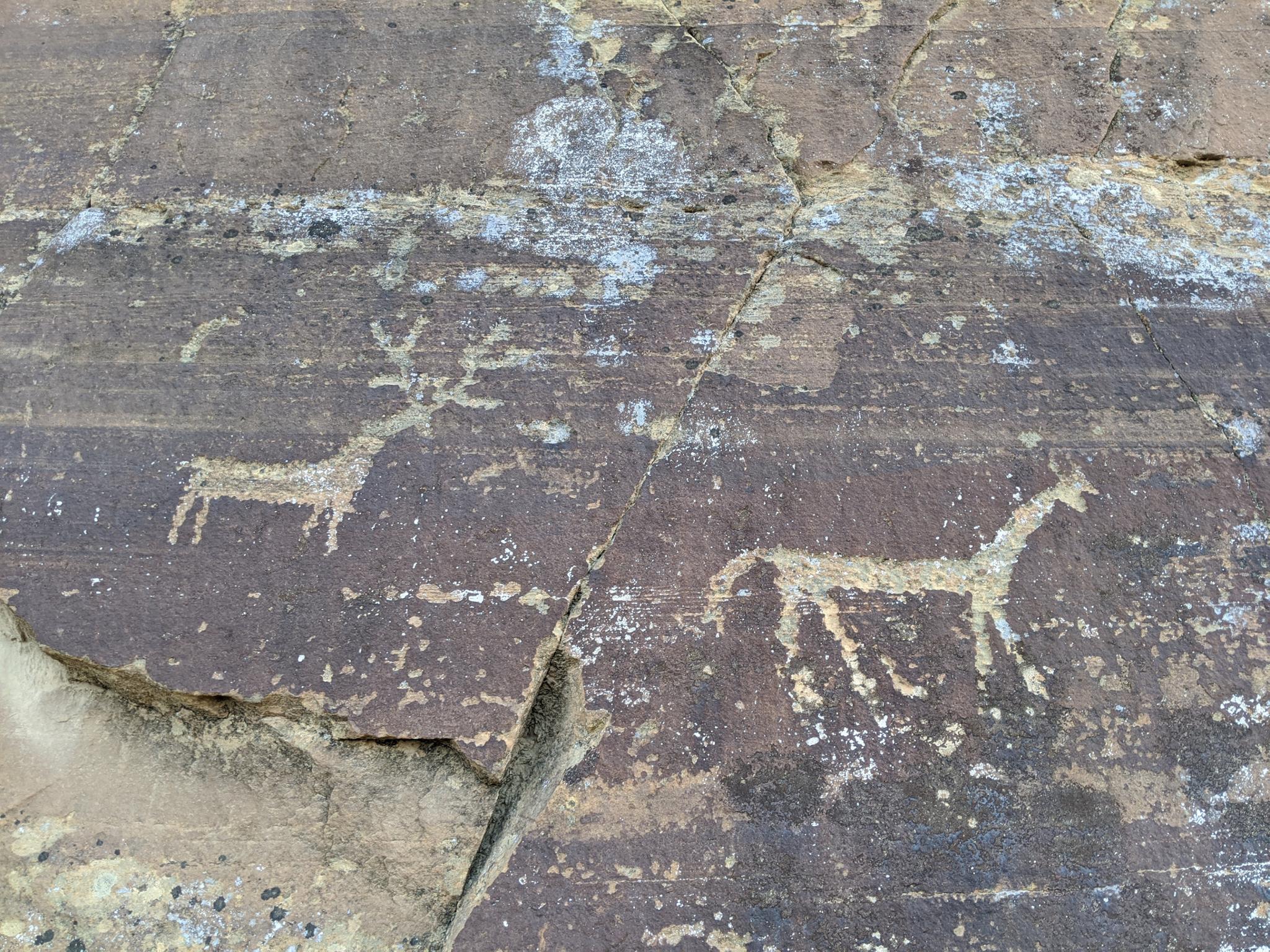
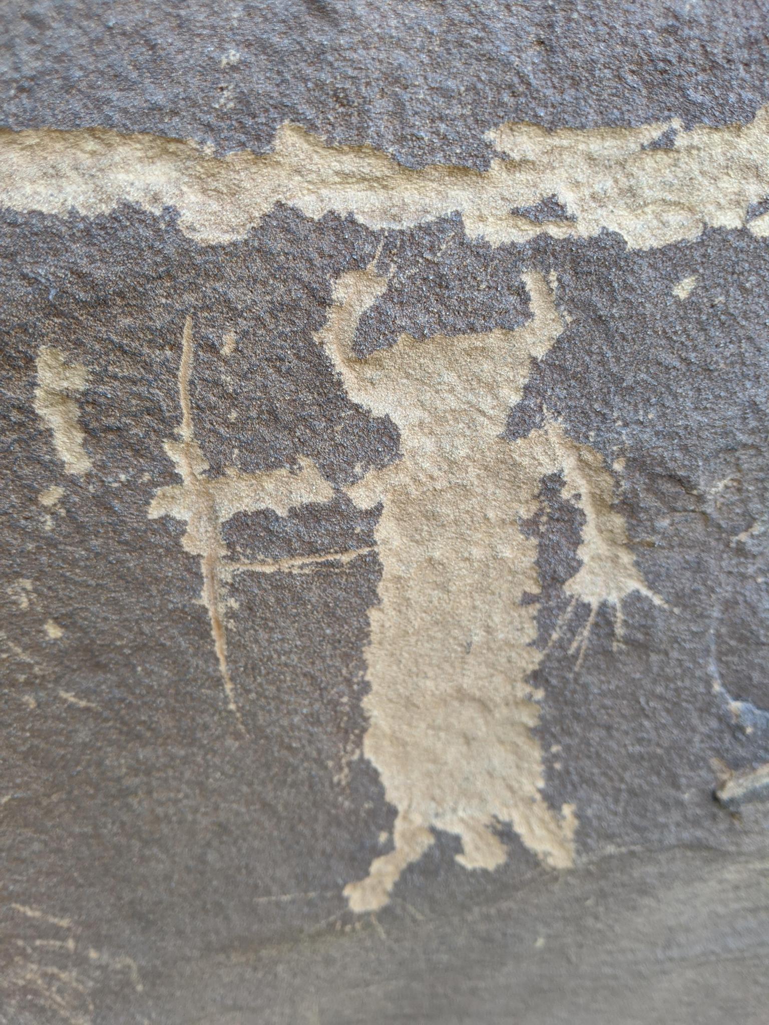
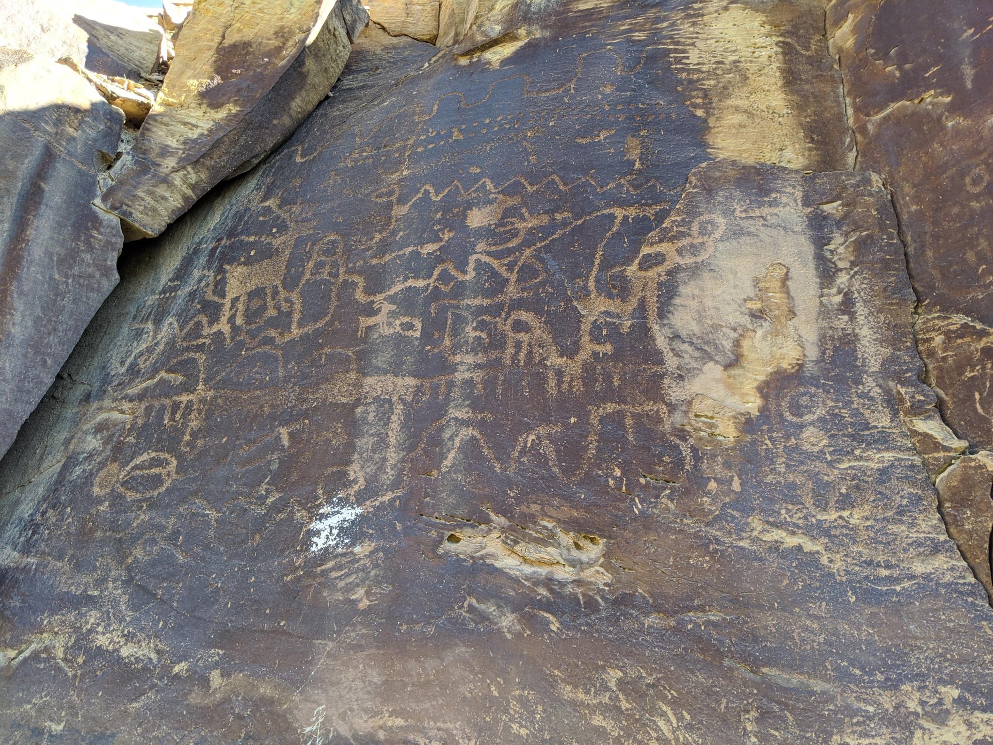
30.2 - Horse and deer or elk?
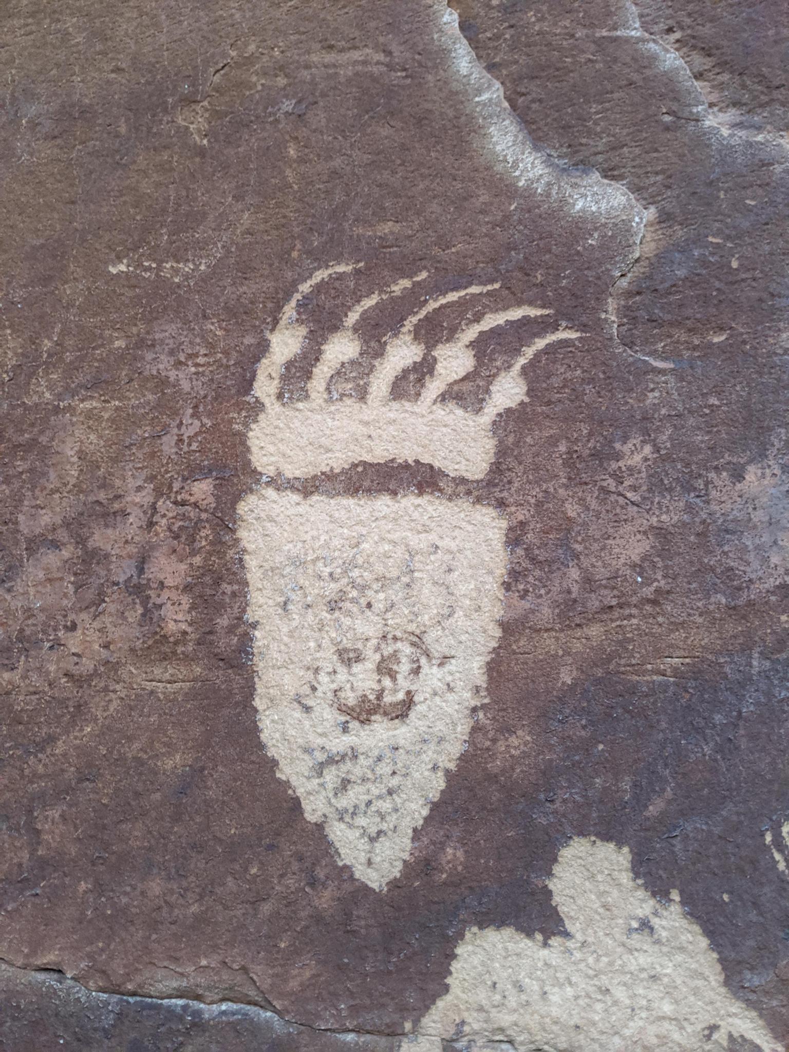
30.2 - Baby sheep?
30.2 Sheep and Baby sheep in context.
30.6
Harper
31.1 - Small panel with a person leading a horse.
Very small panel about 1/2 mile up Argyle Canyon
32.4
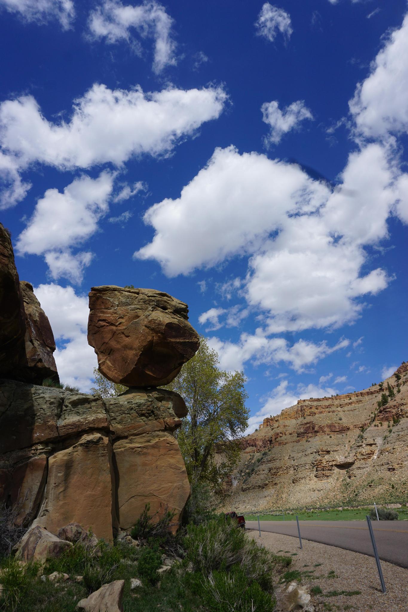
32.475 - Balanced Rock / Pig Head Rock
Just past Balanced Rock
32.475
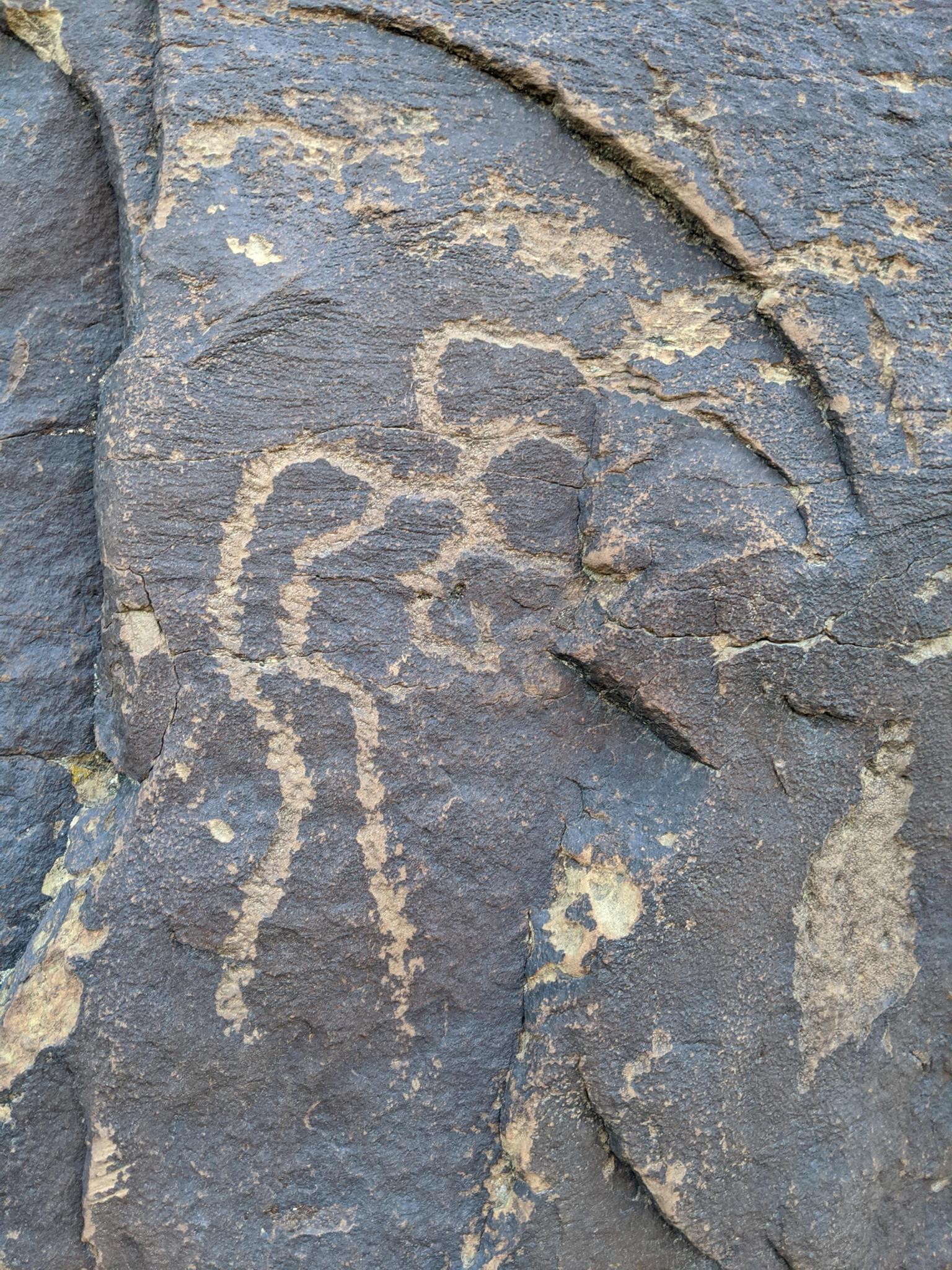
32.475 - Amazing petroglyph
32.6
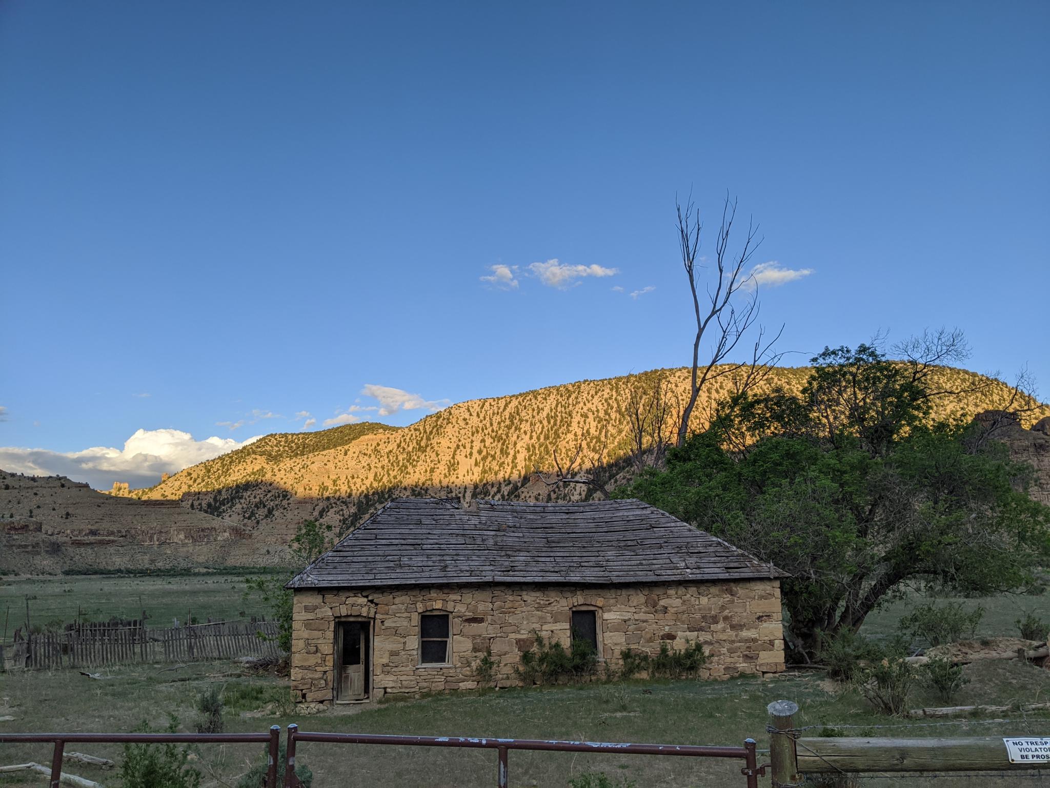
33.1 - Stone house at sunset
33.6 - Many panels at Harmon Junction
33.6 - Harmon Junction
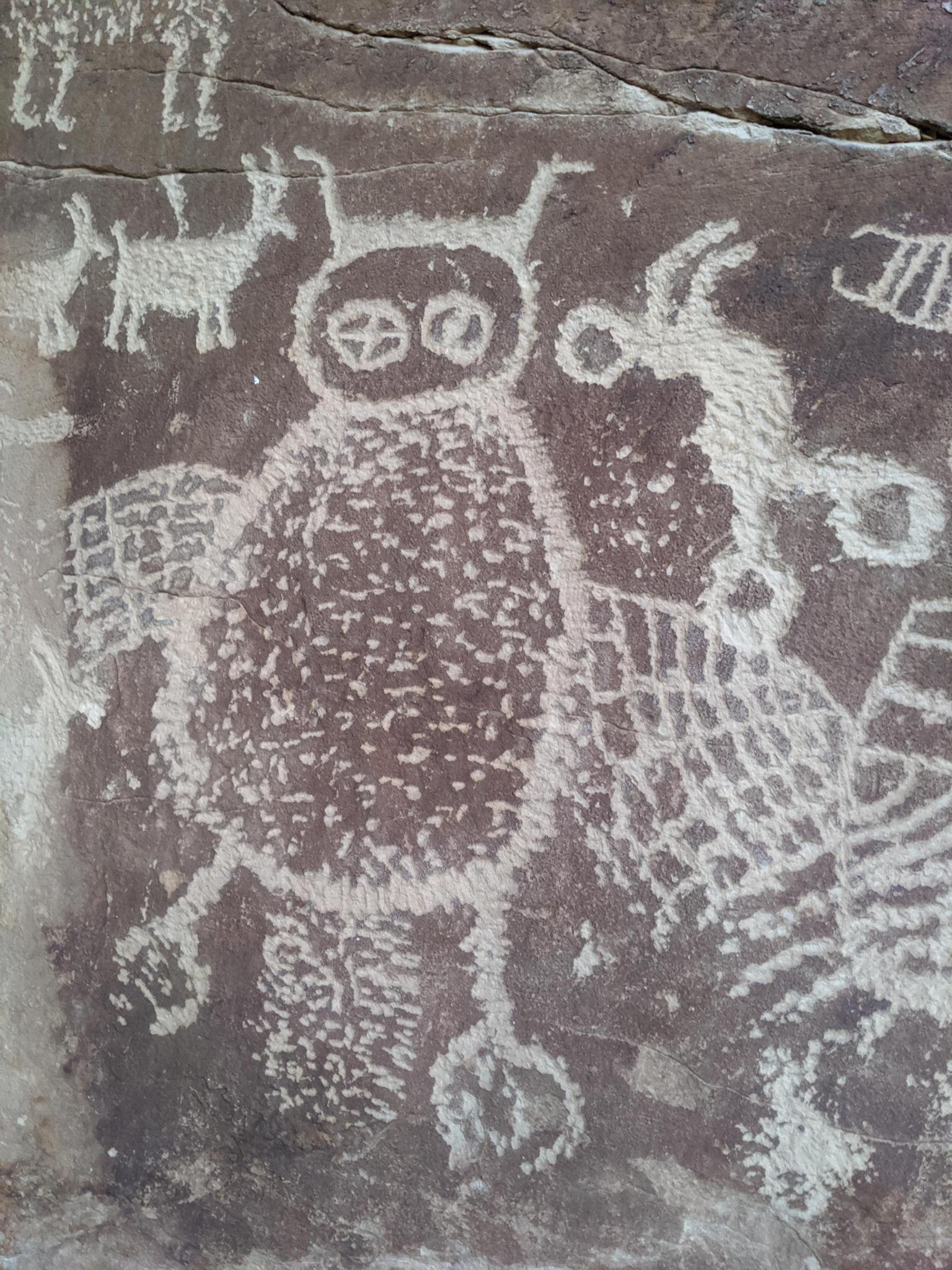
35 - Owl Panel
35 - Owl Panel - Excellent bear print.
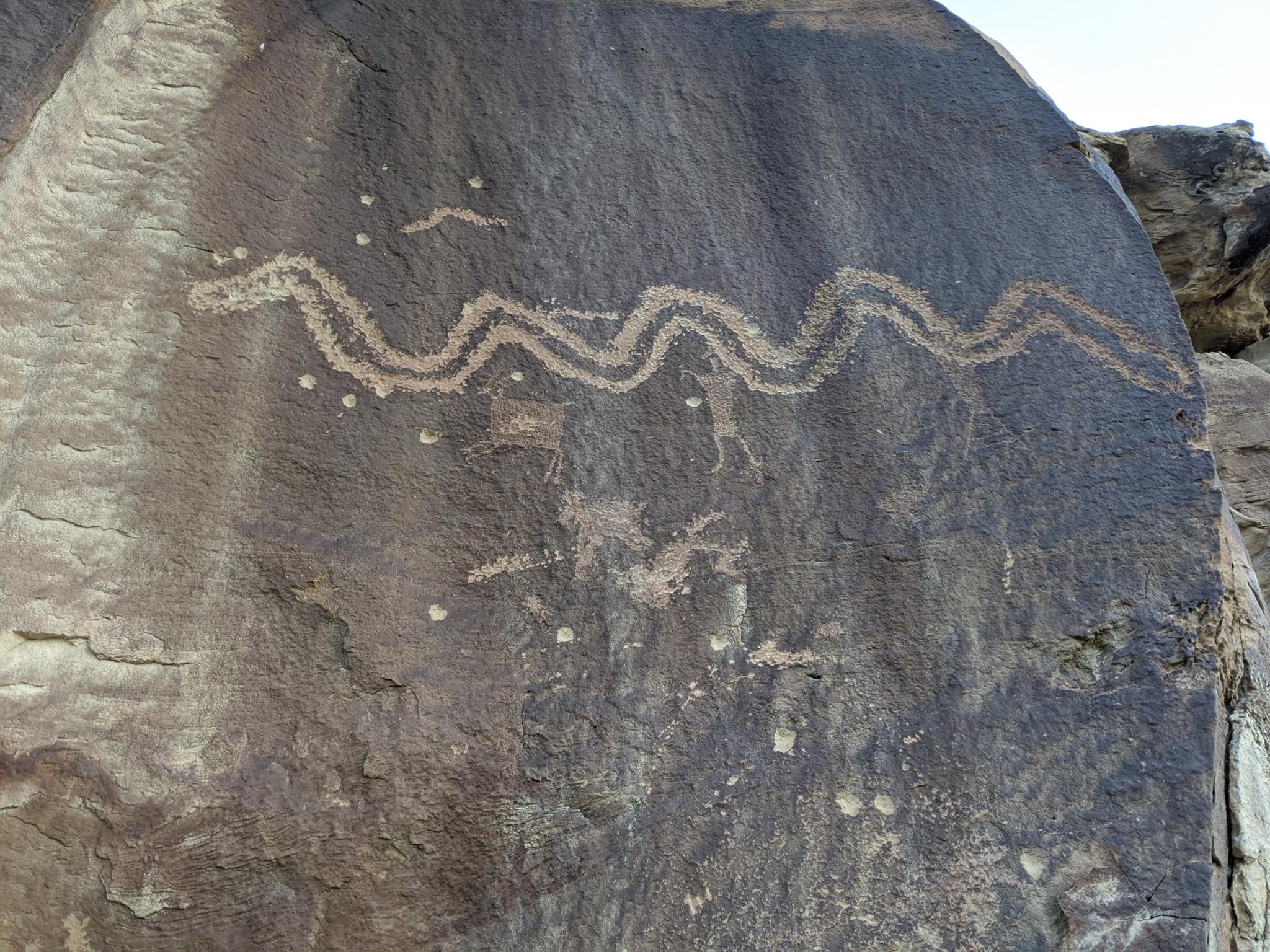
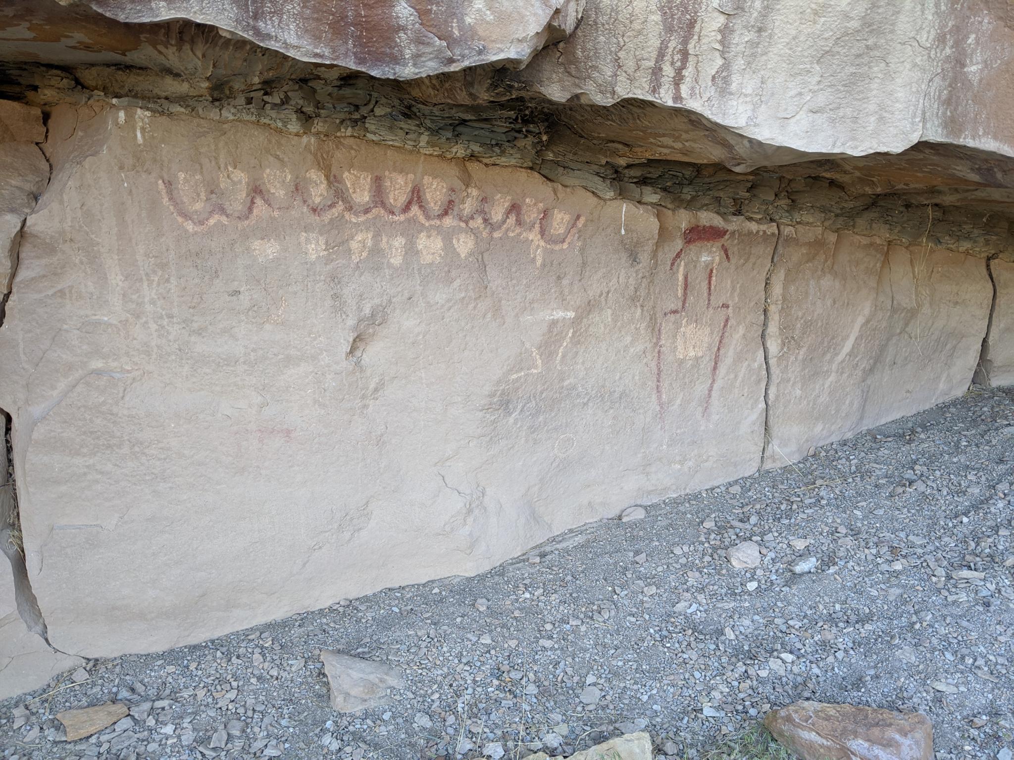
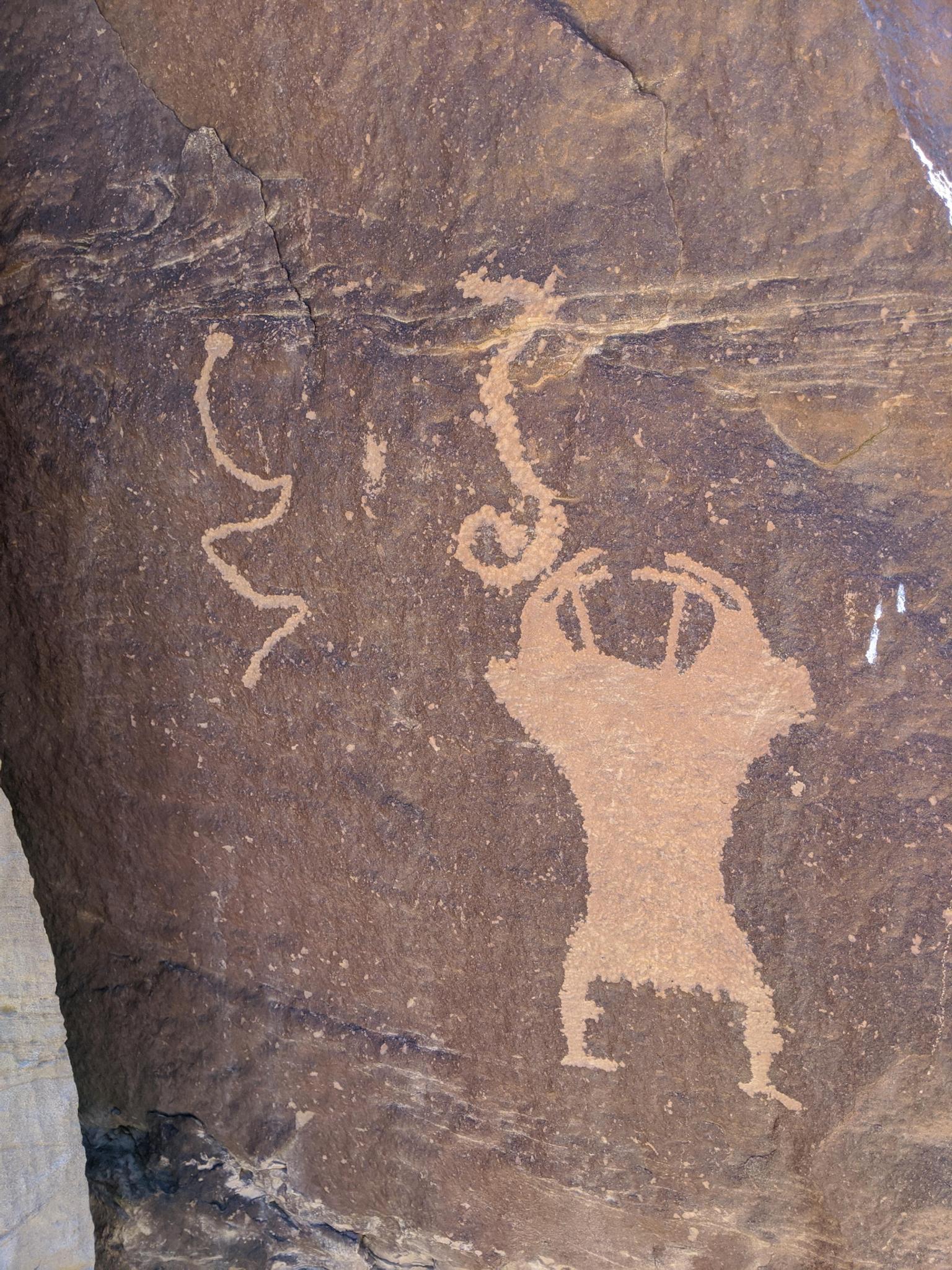
35.2 - Snake Panel
35.5 - A warrior?
35.5 - Interesting figure with a line above it.
35.6
35.9 - Cranes at the top?
36.6 - Panel
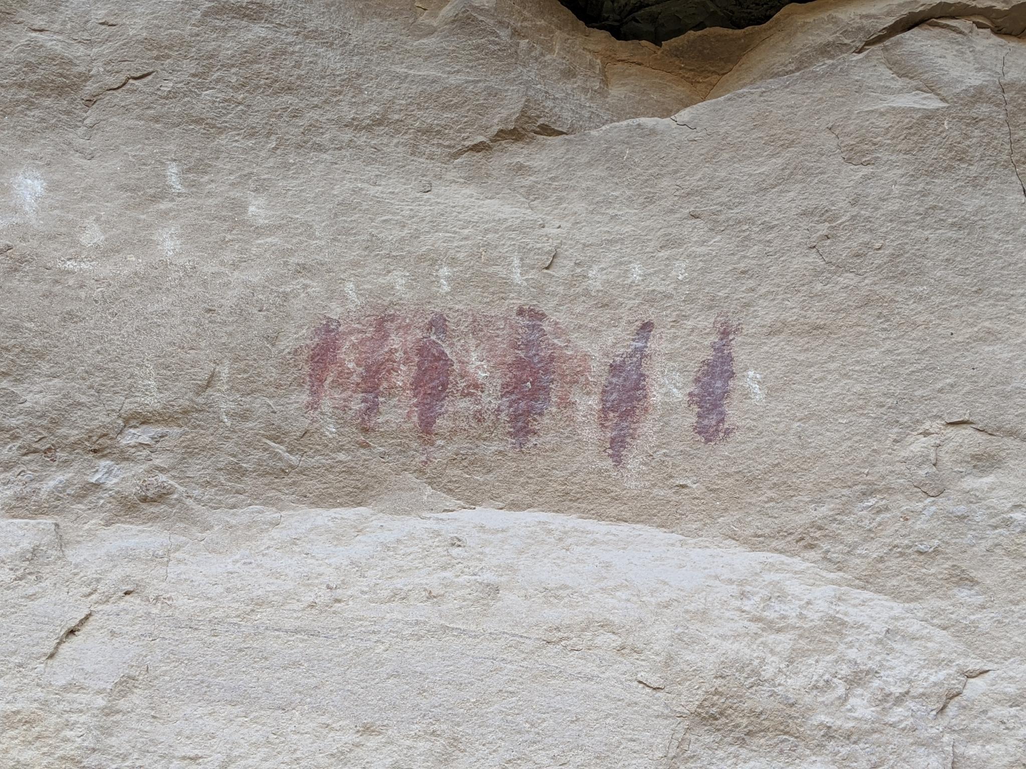
37.05 - Small men pictograph
37.2 - Pictographs
38.8
39.3 - Water Canyon Area
40.1
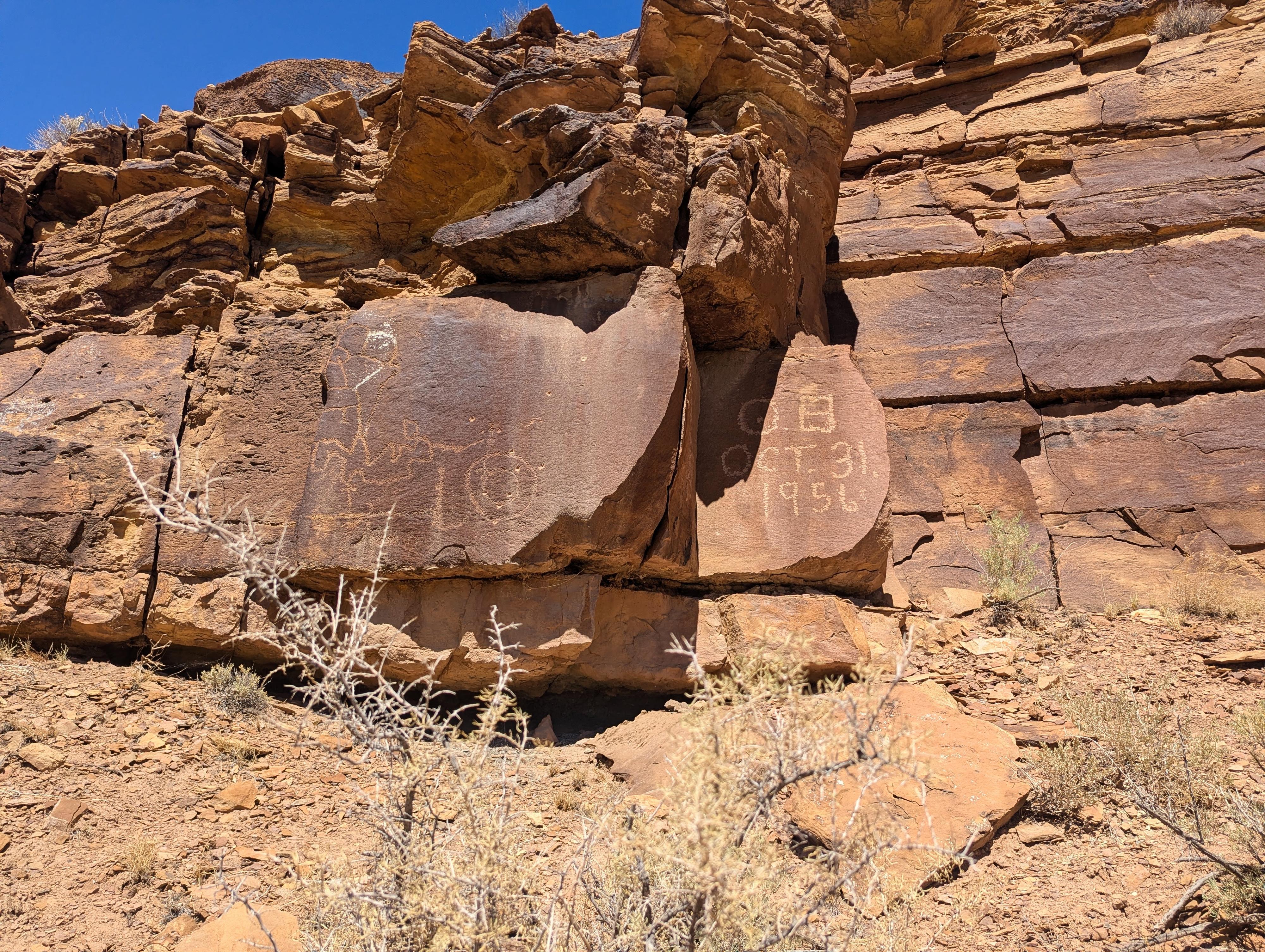
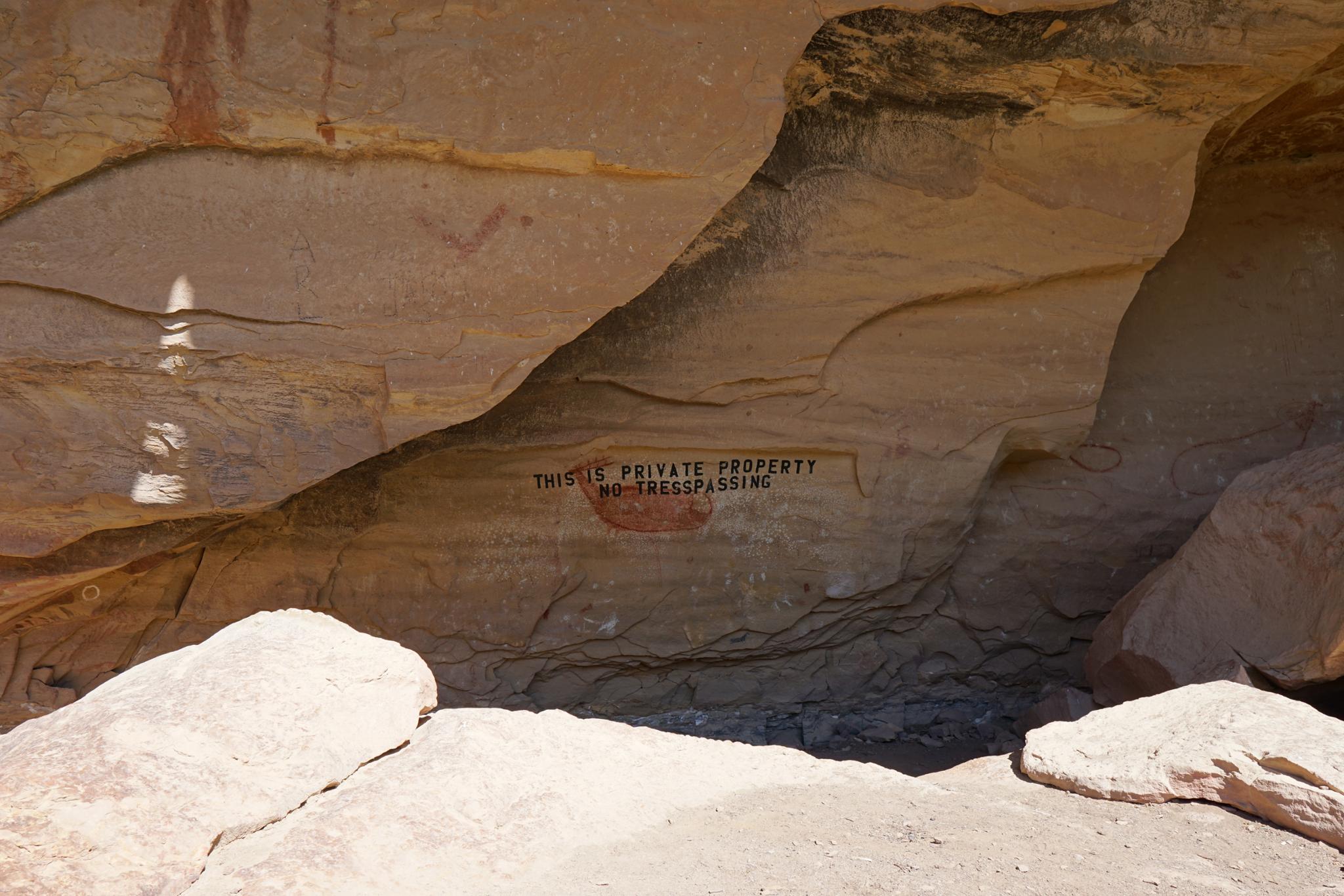
Modern graffiti, "OB Oct 31 1956" is placed right in between two panels.
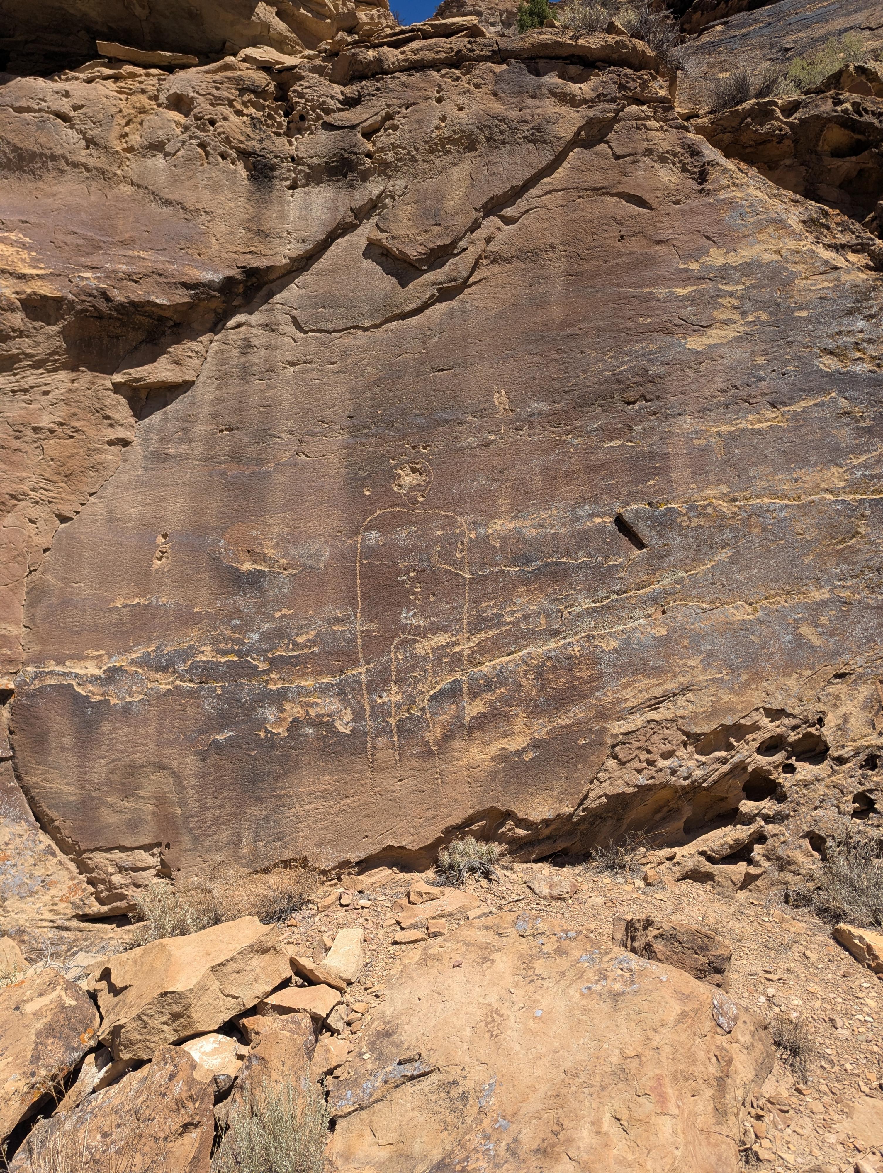
Person outline near 40.6
Rock are up in the corner, center of this photo about 40.6. Hard to see well from the road, but short steep walk to visit.
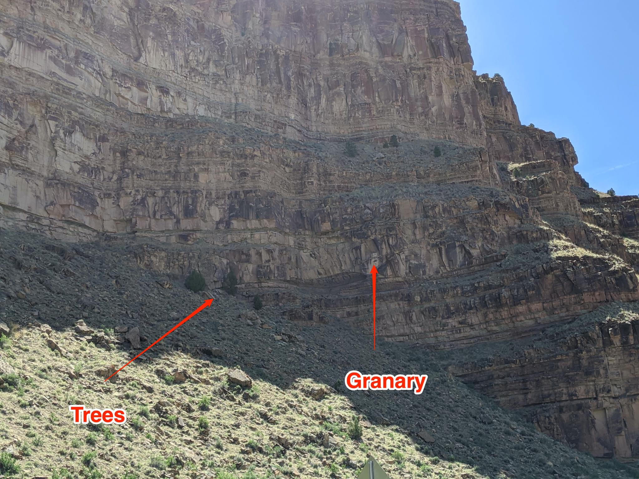
41.1 - Granary View
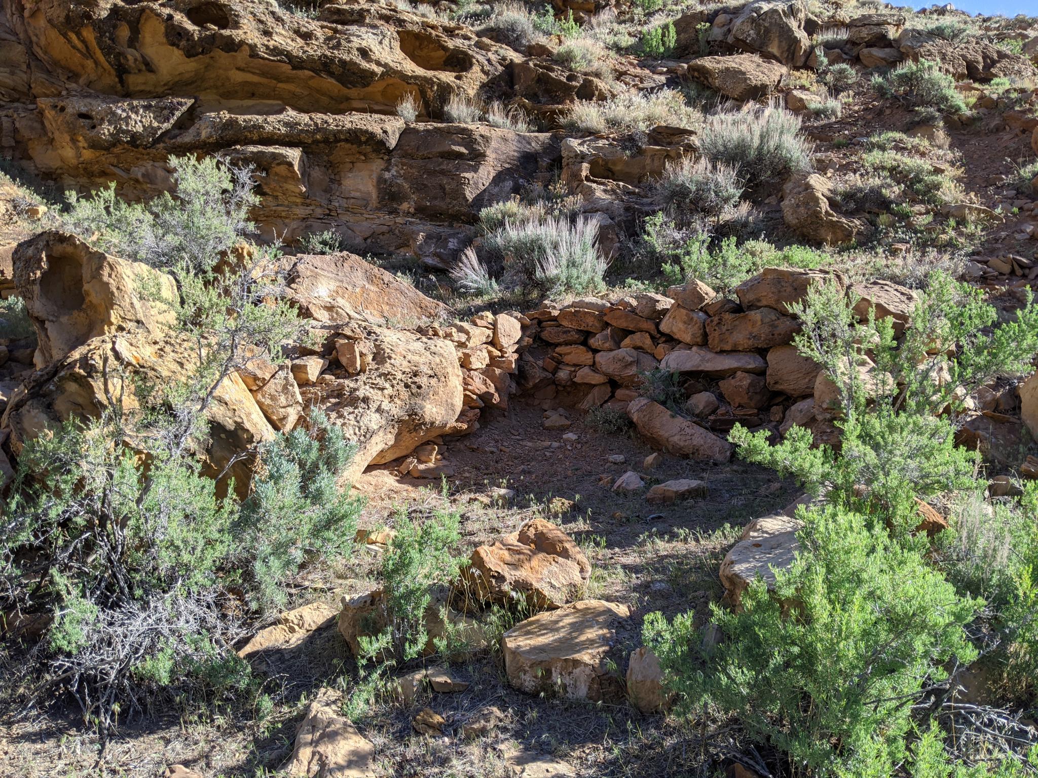
41.6 - Stone Structure
The stone structure just a bit up above the road.
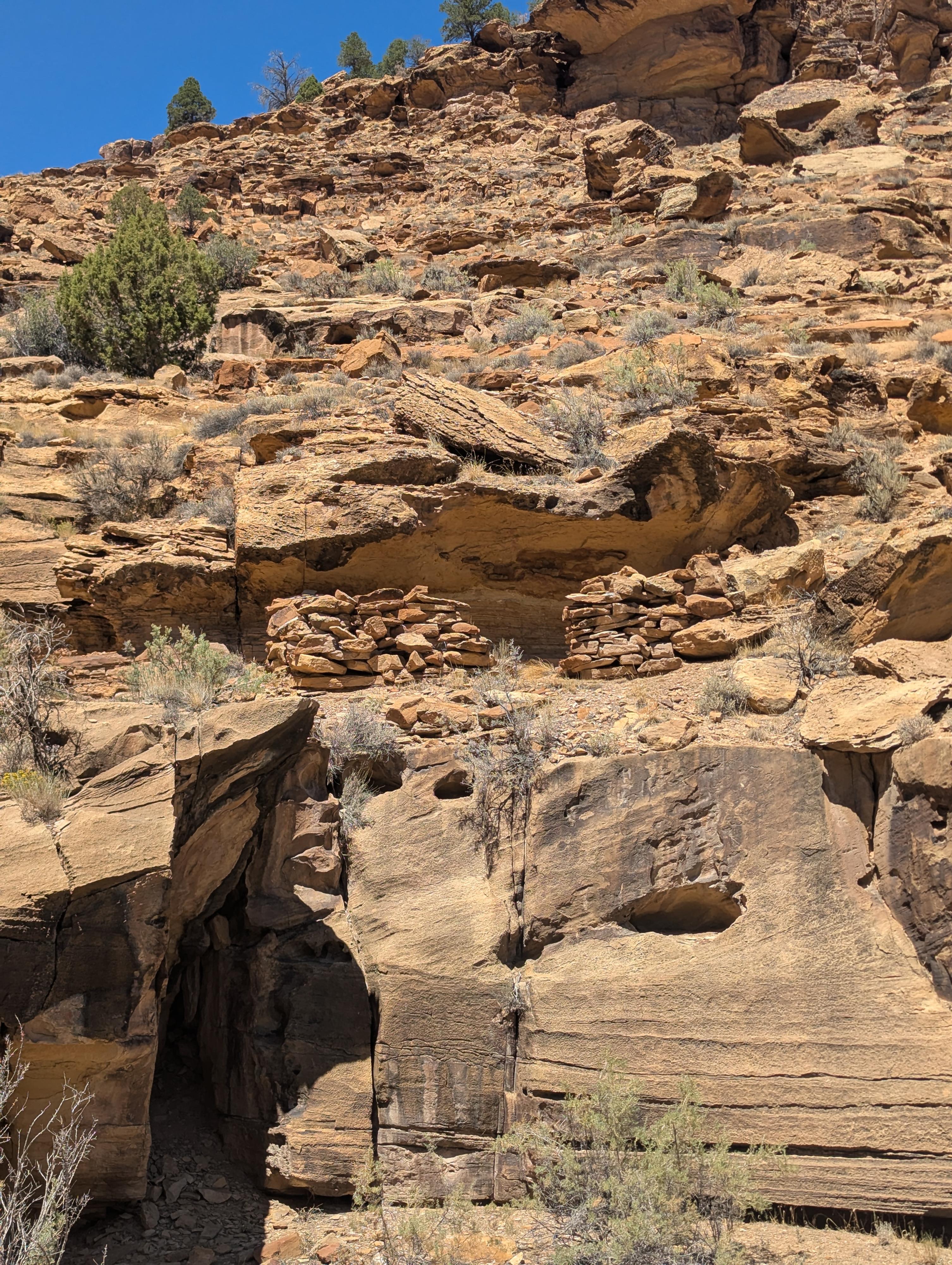
44 - Rassmussen's Cave
Daddy Canyon Area
44.15 - Daddy Canyon area

44.85 - Small panel on a bend in the road.
View from the Fremont Village
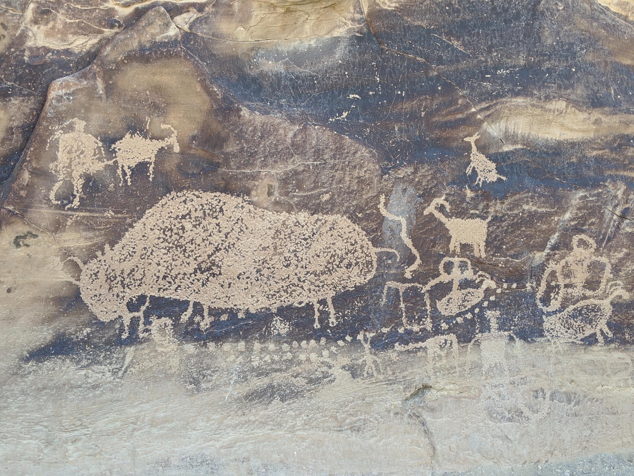
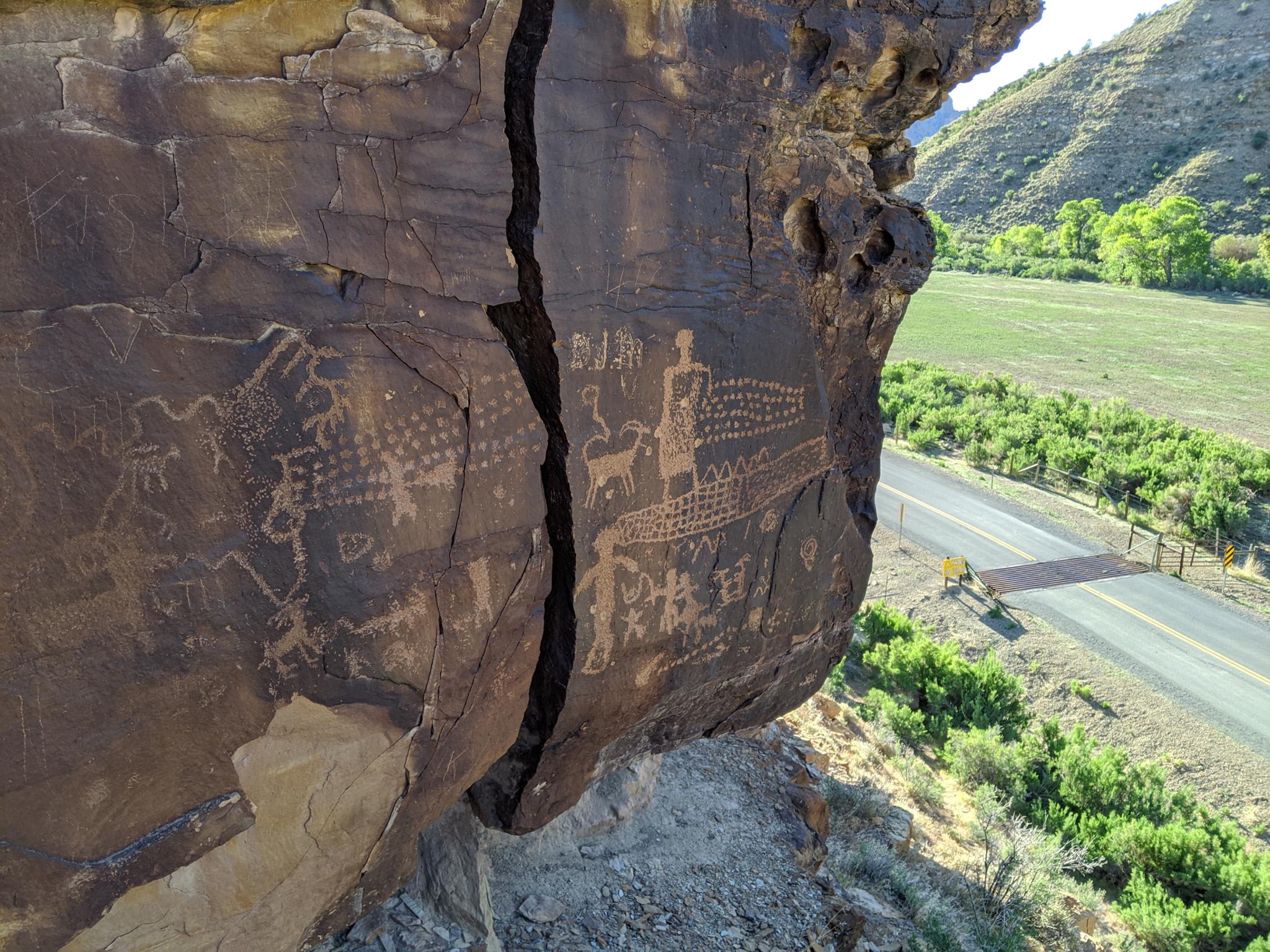
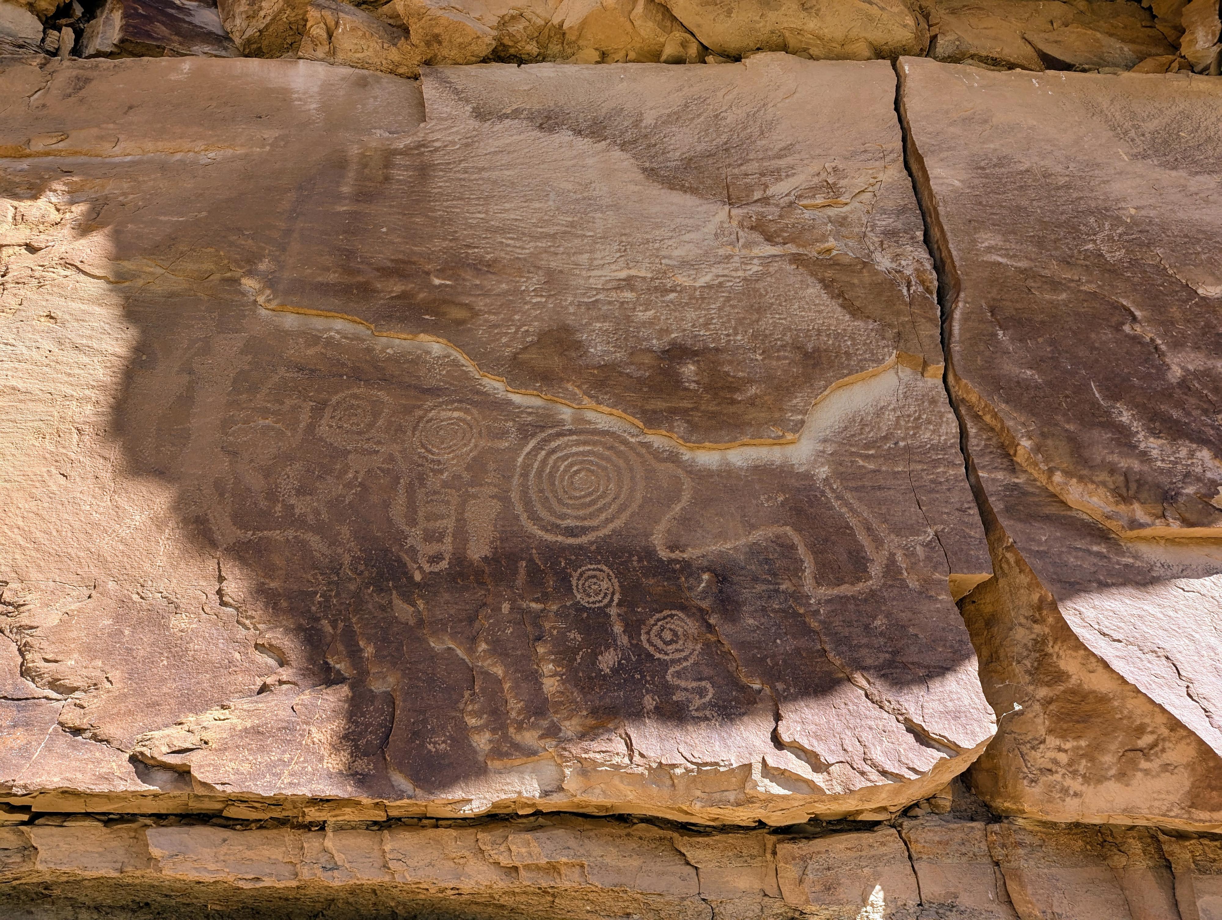
Big Buffalo
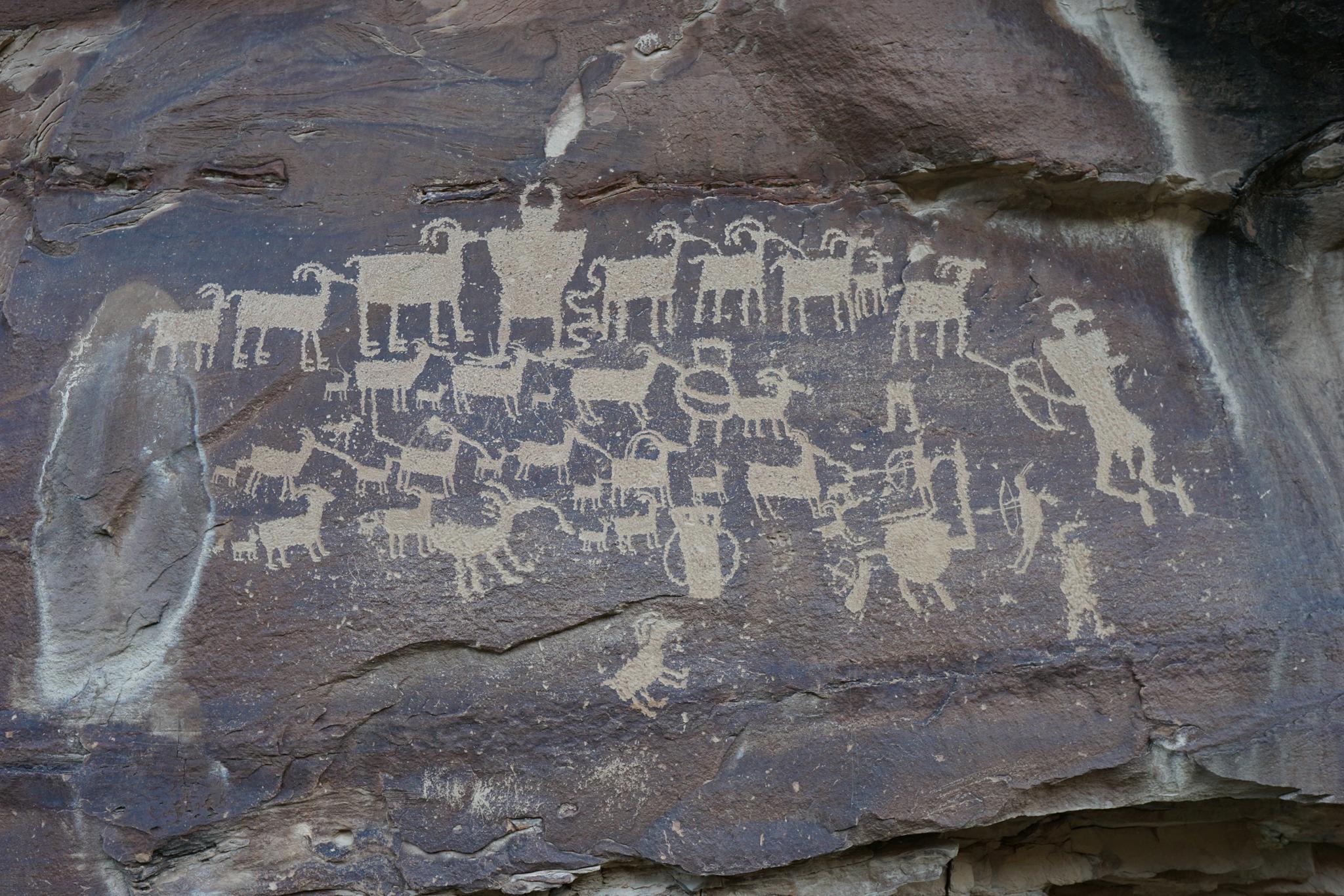
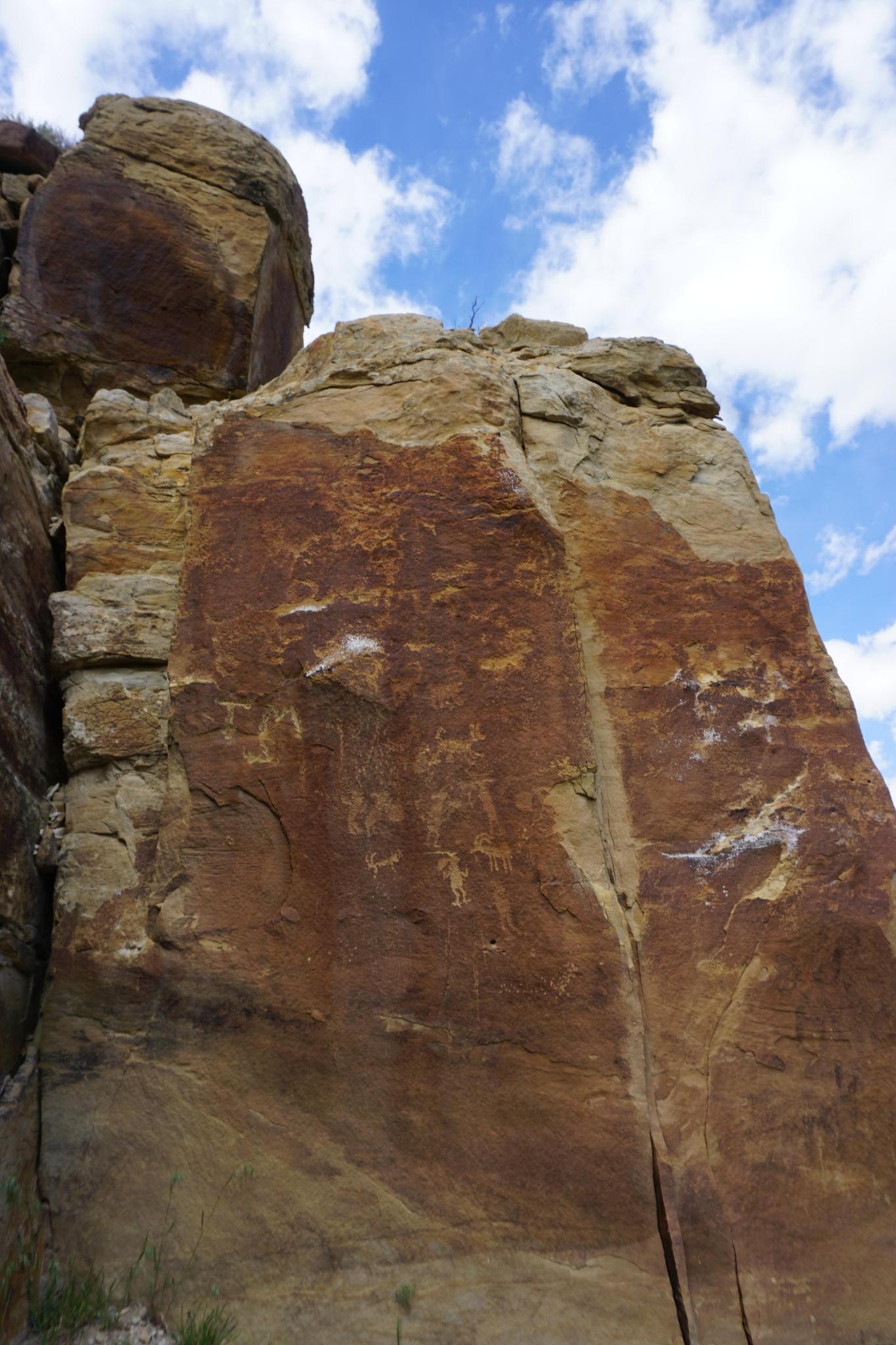
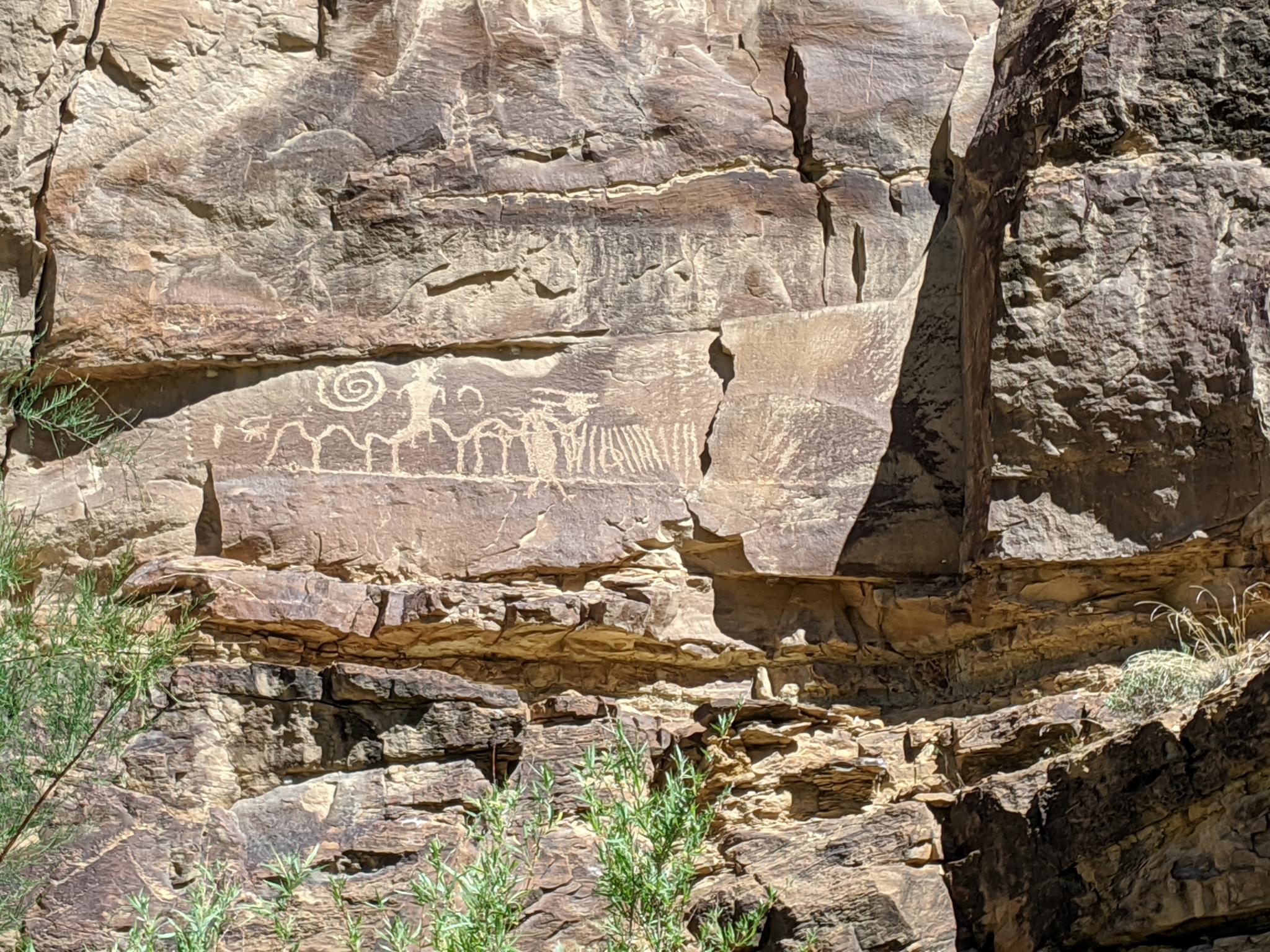
The Great Hunt Panel
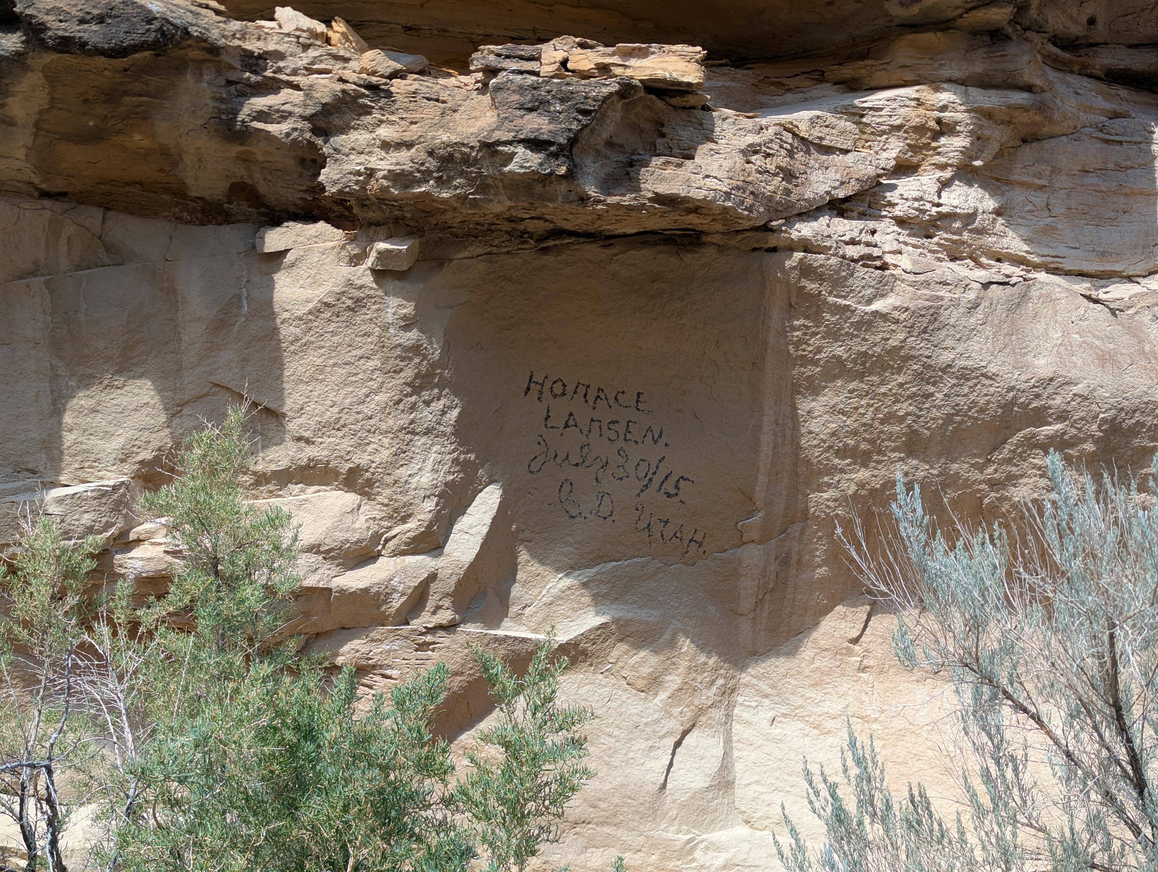
Horace signature

Panel just beyond the Great Hunt Panel.
Dry Canyon - 1.8
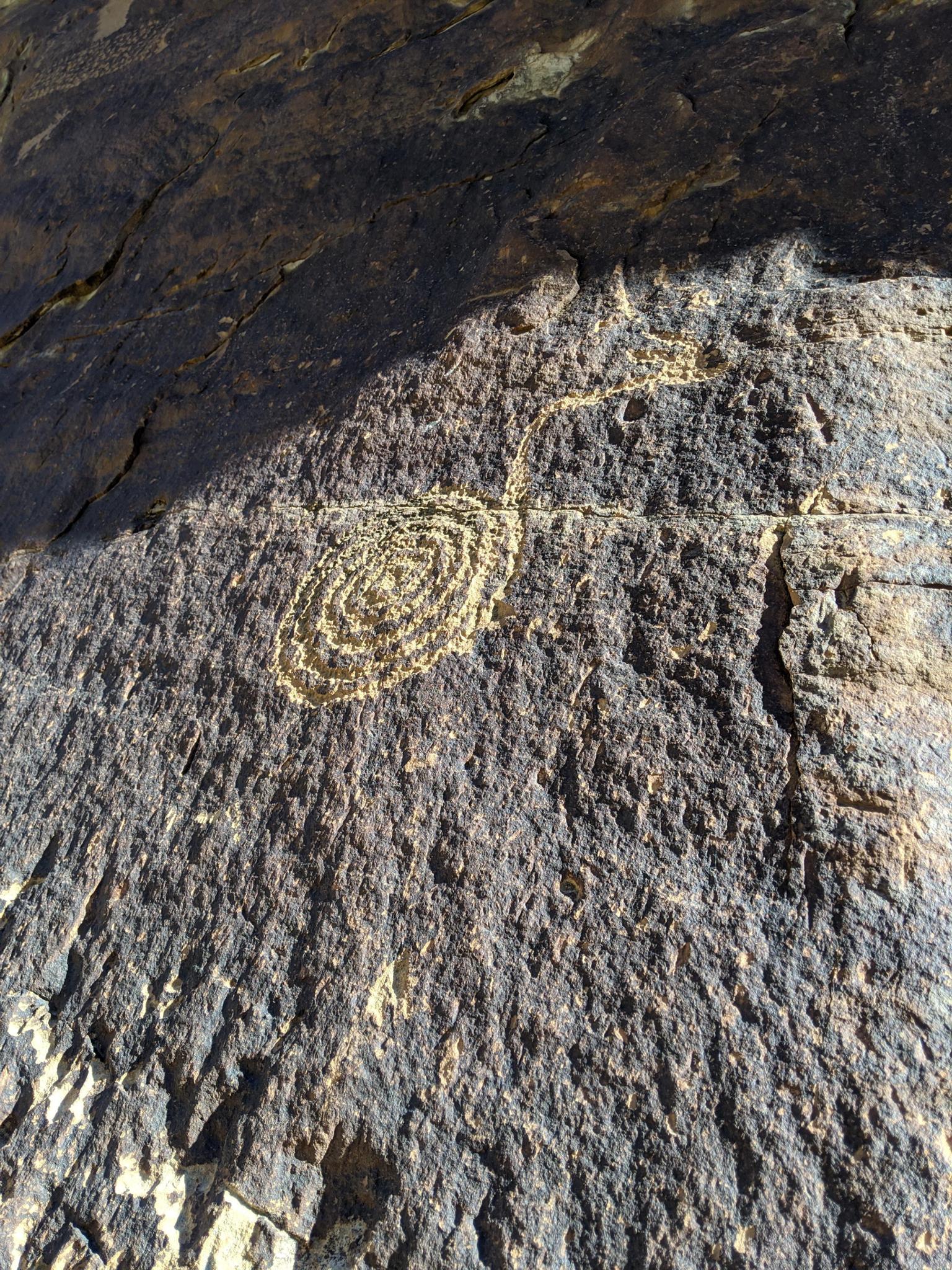
Dry Canyon - 1.8 - Neat spiral
Small panel justeast (right) side of the side canyon. Faces south.
Panel before the cattle guard.
Lower Nine Mile - 2.25
Lower Nine Mile - 4.4
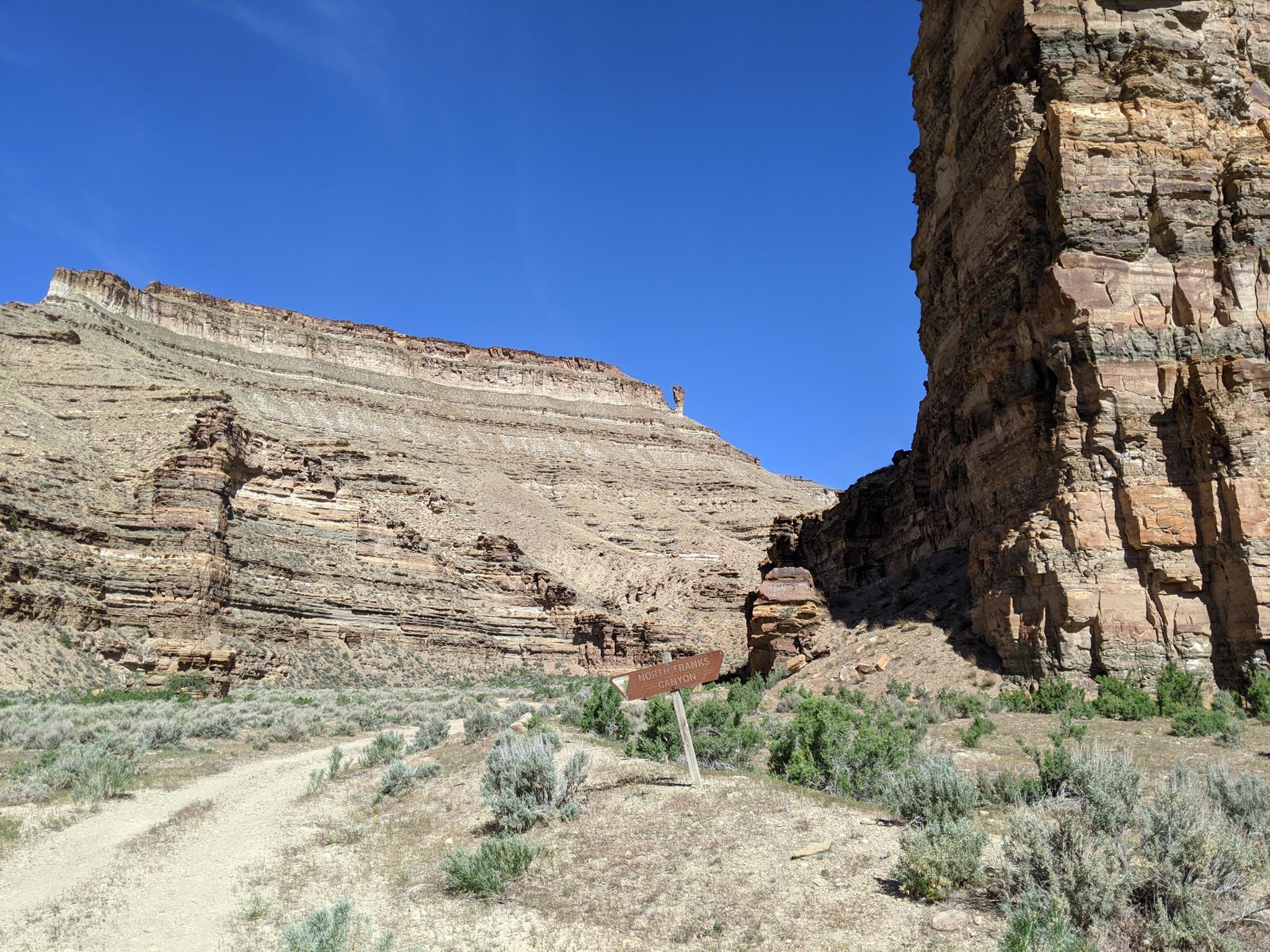
North Franks Canyon
Photos
Maps
")
")
")
")
")