 Roadside Attraction
Atlatl Rock and Arch Rock
Roadside Attraction
Atlatl Rock and Arch Rock
Valley of Fire
Overview
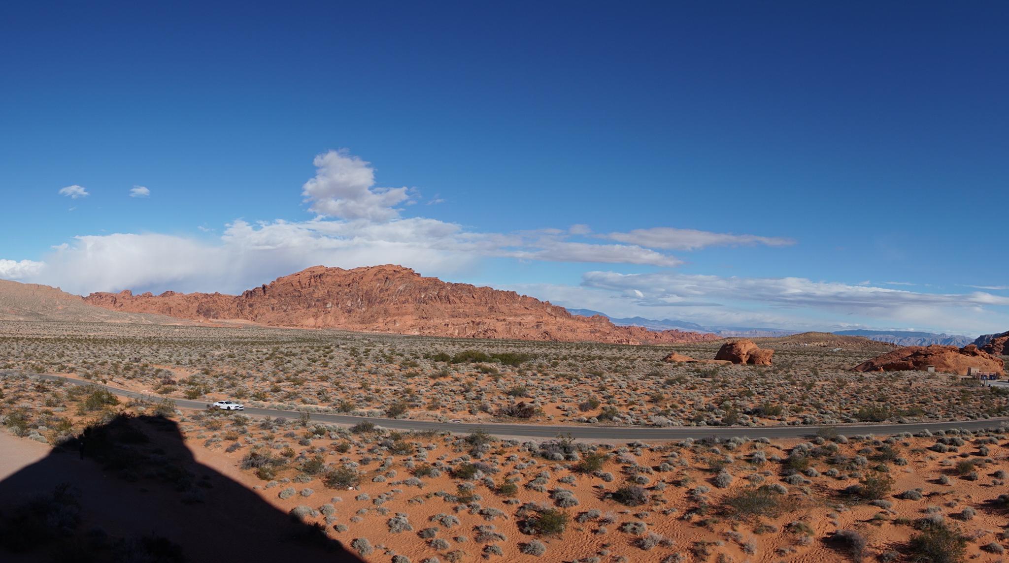
A short side road goes to the two campgrounds in Valley of Fire. Part of this road is dirt, but passable to all vehicles. This side road also visits Arch Rock and Atlatl Rock.
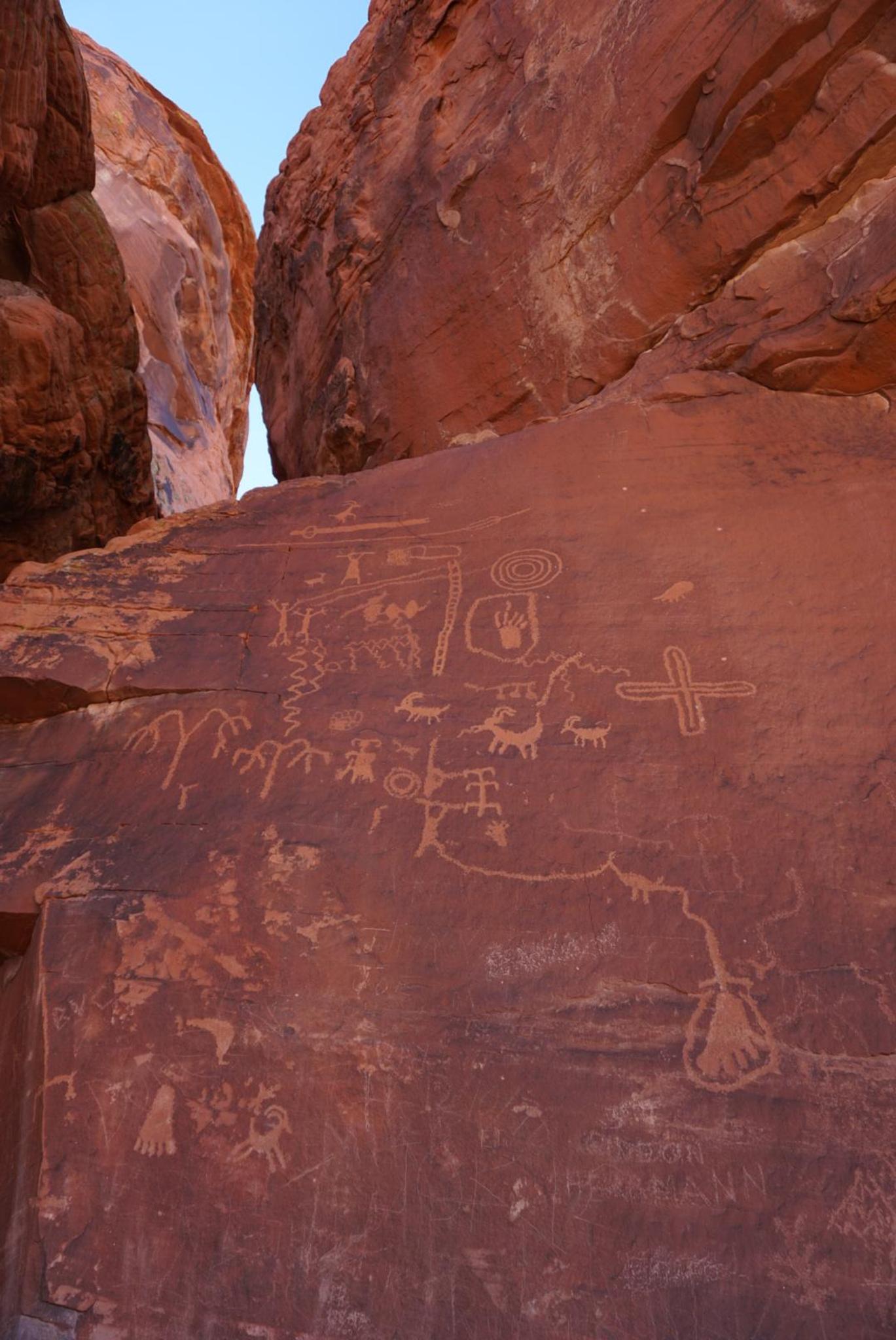
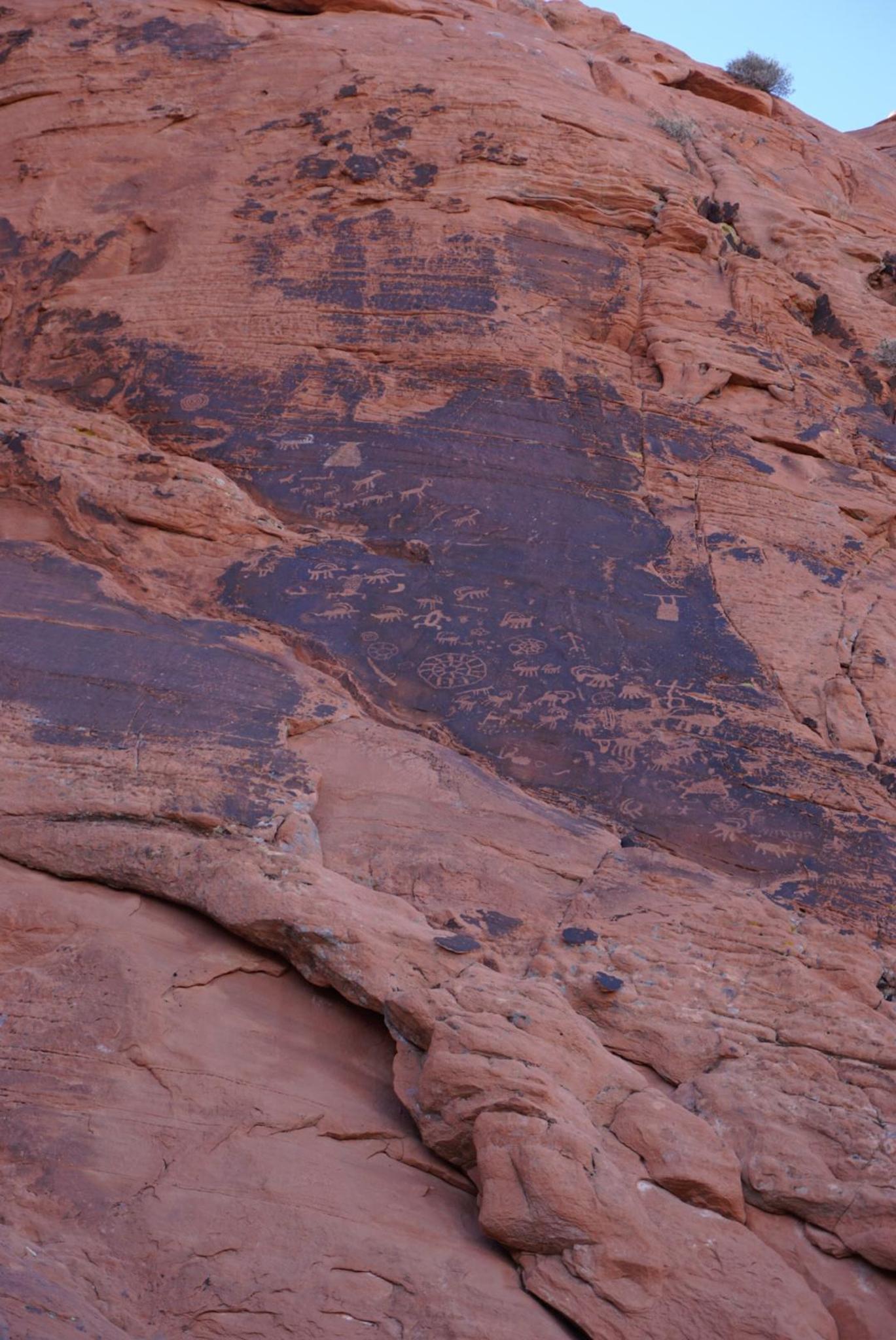
Atlatl Rock is one of the easiest to access and most significant concentrations of petroglyphs in Valley of Fire State Park. The central panel, with a staircase and viewing platform, is the highlight of many visitors trip to the park. The picnic and toilet facilities make this a great lunch or break spot to spend a little time. In addition to the main Atlatl Rock, there are numerous panels of rock art in the immediate area.
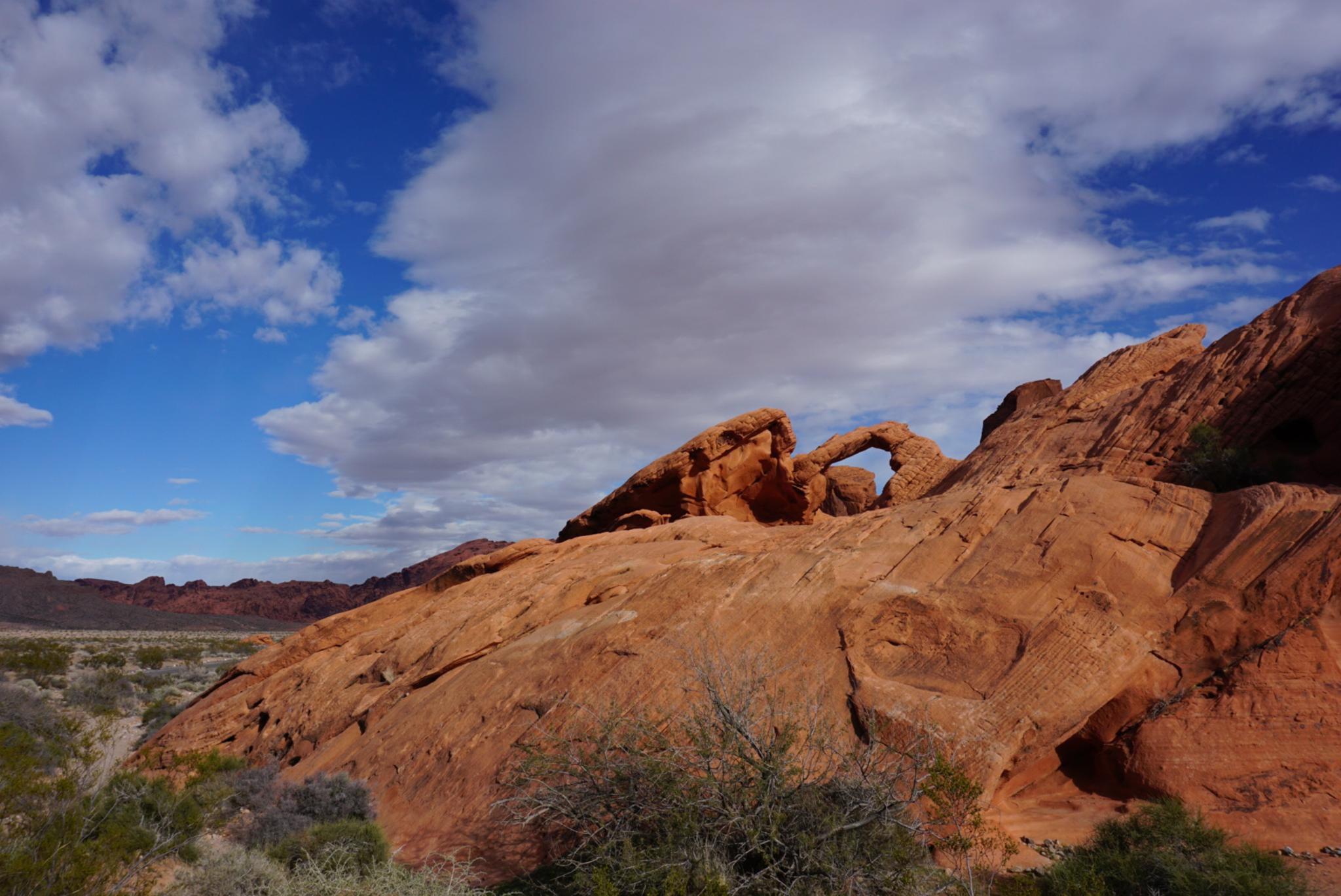
Arch Rock is an arch next to the road. The colors and position of the arch, in my book, are quite stunning. We visited on very dark blue sky day, and the contrast of the arch and sky were very remarkable.
Getting There
Reach the park visitor center by taking exit 93 from I-15 if coming from the east ,or exit 75 if coming from the west (Las Vegas). From the highway, the route to the park is well signed. There is a fee to enter the park ($10 as of 2018 for day use).
From the Visitor Center, go south to the main Valley of Fire Highway. Go right (west) on Valley of Fire Highway for 1.9 miles. Turn right here, on the well-signed road. Atlatl rock is 0.5 miles, and Arch Rock is 0.8 miles but signed on the left side of the road. This section of road is paved. If you continue the loop back to Valley of Fire highway, there is a section of well-graded dirt road. (the side road is about 3 miles)
Route Description
Rock art and historic sites are fragile, non-renewable cultural resources that, once damaged, can never be replaced. To ensure they are protected, please:
- Avoid Touching the Petroglyphs: Look and observe, BUT DO NOT TOUCH!
- Stay on the Trails: Stay on the most used trails when visiting sites, and don't create new trails or trample vegetation.
- Photography and Sketching is Allowed: Do not introduce any foreign substance to enhance the carved and pecked images for photographic or drawing purposes. Altering, defacing, or damaging the petroglyphs is against the law -- even if the damage is unintentional.
- Pets: Keep pets on a leash and clean up after them.
- Artifacts: If you happen to come across sherds (broken pottery) or lithics (flakes of stone tools), leave them where you see them. Once they are moved or removed, a piece of the past is forever lost.
Atlatl rock has a staircase and platform to view the panel. It can be busy. Be sure to go west and south of the parking area to visit the other panels nearby. Social trails visit the best panels. Try to stay on social trails rather than cause additional impacts.
When continuing the drive from Atlatl Rock, Arch Rock is about 0.3 miles away. Arch Rock is visible from the park road.
Maps

11S 719482E 4032286N
36°24'39"N 114°33'08"W
11S 719215E 4033533N
36°25'19"N 114°33'17"W
11S 719578E 4033765N
36°25'26"N 114°33'03"W
11S 720173E 4033496N
36°25'17"N 114°32'39"W
11S 718920E 4033221N
36°25'09"N 114°33'30"W
11S 719058E 4033267N
36°25'11"N 114°33'24"W
11S 719708E 4033568N
36°25'20"N 114°32'58"W