 Roadside Attraction
Devils Garden
Roadside Attraction
Devils Garden
Escalante
Overview
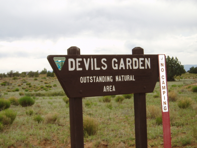
Devil's Garden seems to be an often overlooked gem. A short side trip from the Hole in the Rock road leads to a unique landscape of hoodoos and arches. This is one not to miss if you're in the area. Essentially a roadside attraction, visiting should be accessible to move everyone. A picnic area and pit toilet make this a good spot to have a family picnic.
BLM Information Signs at the Site:
Devil's Garden
Four miles west, just below the rim of the Straight Cliffs, a small drainage course begins a steep descent. It cuts downward through layers of the Straight Cliffs, Tropic and the Morrison formations, before making a turn southward to expose the Entrada sandstones of "The Devil's Garden."
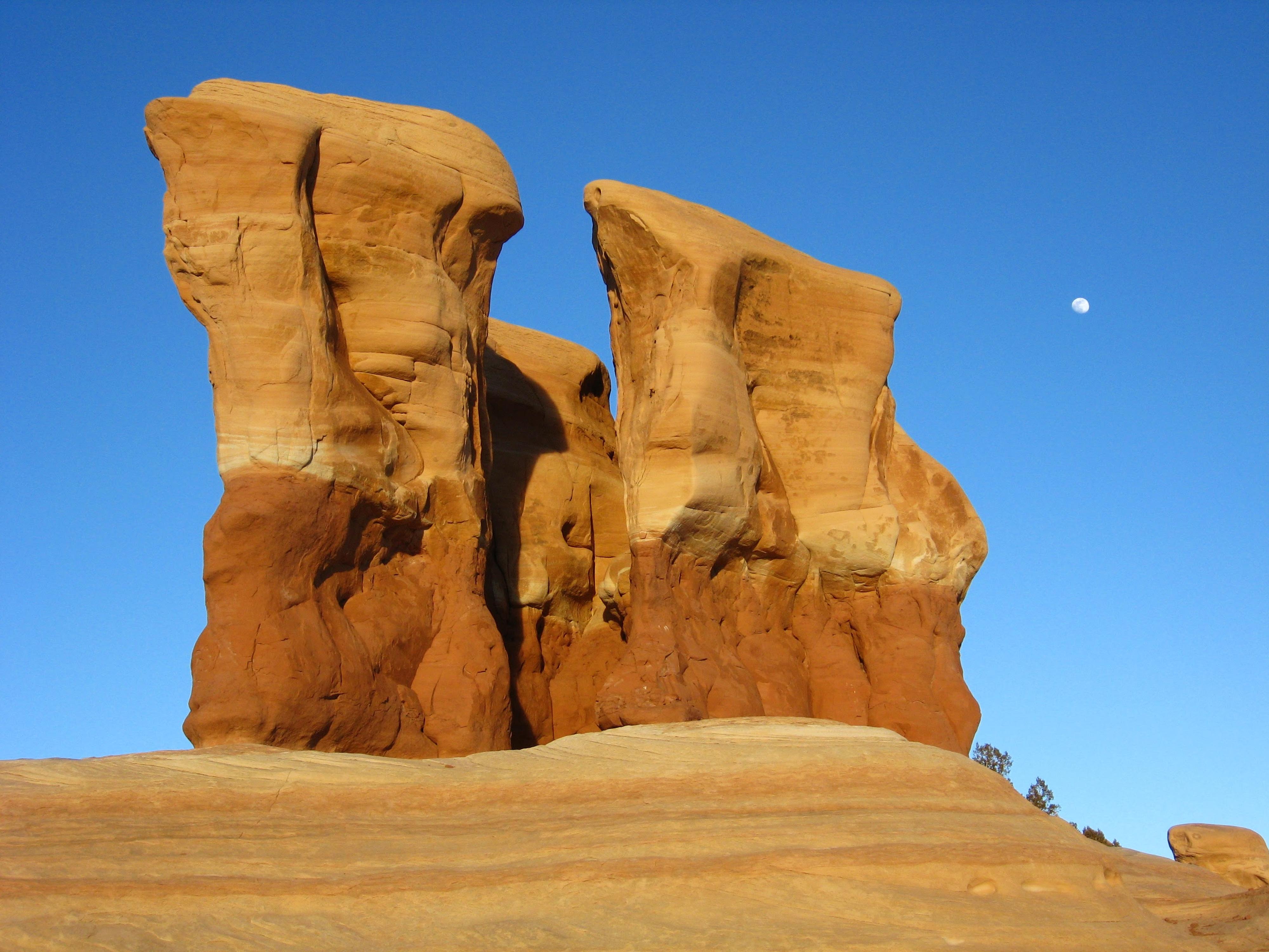
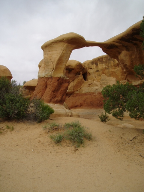
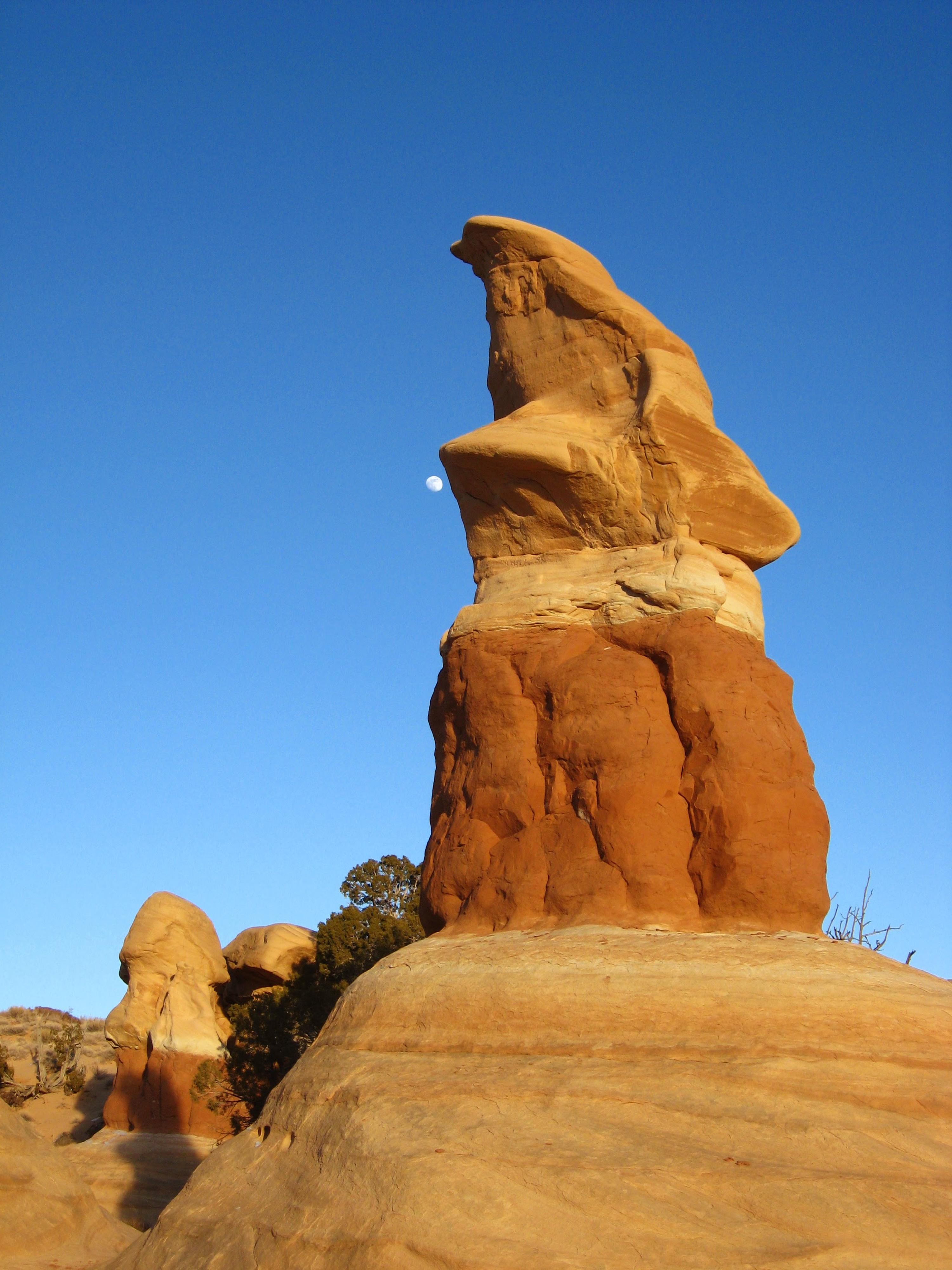
Here, erosion creates visual magic. Fanciful hoodoos, stone goblins, and subtle arches are found on a scale in stark contrast to the grand and immense landscapes that dominate Grand Staircase-Escalante National Monument.
Devil's Garden is a place to contemplate time. One scale is vast and embraces millions of years of earth history. Another scale is more intimate and familiar — a step back towards childhood, when it was easy to turn imagination and creativity loose while playing in the sand.
The Geologic Past
This geologic story begins some 160 million years ago, late in the Jurassic Period of earth history. Though not yet at their evolutionary peak, a great diversity of dinosaurs roamed the earth and swam in the sea.
The lands that would become modern-day Utah looked much different then. Vast coastal sand dunes bordered a long, narrow seaway whose shoreline repeatedly advanced and retreated from the north over many millions of years.
The Formation Process
At the microscopic level, Entrada Sandstone consists of countless quartz grains naturally cemented together by calcium carbonate and iron oxide. The Cannonville Member contains more clay and silt than the Gunsight Butte and Escalante Members and therefore erodes more readily. In the Devil's Garden area, erosion has stripped the Cannonville Member away, exposing the more resistant Gunsight Butte Member.
Stages of Erosion:
(A) Cracks and fractures in the rock naturally form, allowing agents of erosion to attack the surface. Endless cycles of rain, wind, snow, and ice weather away at the fractures creating deeper fissures.
(B) Daily freeze-thaw cycles of winter continue to break the rock at the surface, while summer thunderstorms carry away accumulating debris. Isolated ridges and fins appear as the rock is slowly sculpted.
(C) With time, hoodoos begin to take shape as harder rock layers above erode more slowly than softer layers below.
At Devil's Garden we see many hoodoos in their prime. Look for evidence of old hoodoos worn away, and imagine others that lay beneath your feet, waiting for weathering processes to create them from eroding Entrada Sandstone.
The Entrada Sandstone Members
Geologists separate the Entrada Sandstone in the vicinity of Devil's Garden into three distinctive subunits or "members" from top to bottom:
Escalante Member: Smooth, yellowish-white slickrock you can see about halfway up the bench to the west.
Cannonville Member: Softer, slope-forming beds that lie beneath the slickrock of the Escalante Member. Look for pinyon-juniper covered slopes that descend into the wash along the west side of Devil's Garden.
Gunsight Butte Member: Red and tan slickrock lying at the bottom of the Entrada Sandstone. The hoodoos of Devil's Garden form where it intersects with the overlying Cannonville Member.
Getting There
Head east out of the town of Escalante about 5 miles on highway 12 until the well signed Hole in the Rock road.
Route Description
From the parking area, an information sign describes the formations. Short, well traveled dirt trails lead in and around the various towers and hoodoos. Several arches and unique colors lend themselves to great photographs. This is a fun place for photographers, kids, or those that are kids at heart.
Maps
12S 463382E 4159924N
37°35'08"N 111°24'53"W