 Roadside Attraction
Hot Springs State Park
Roadside Attraction
Hot Springs State Park
Thermopolis
Overview
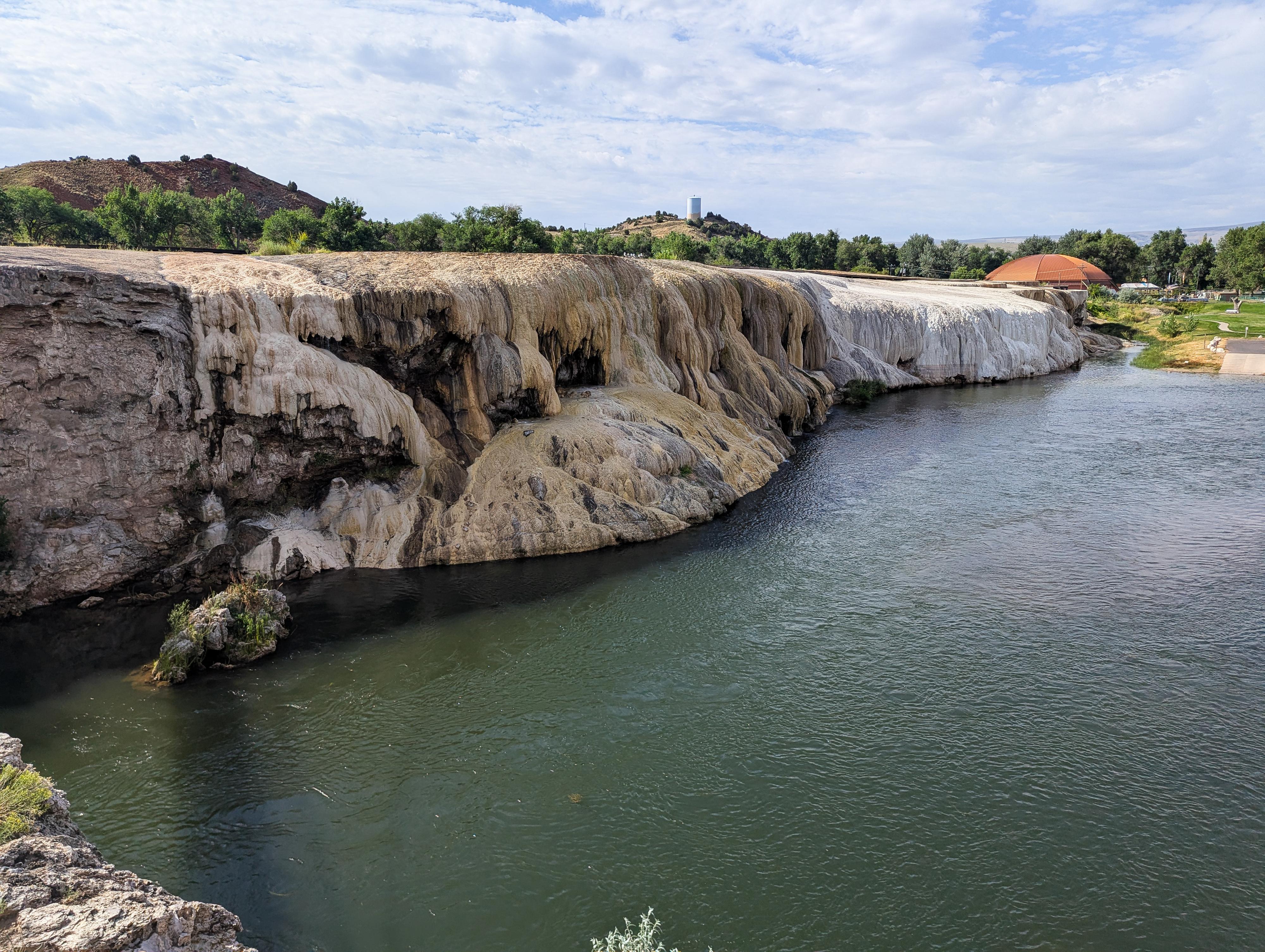
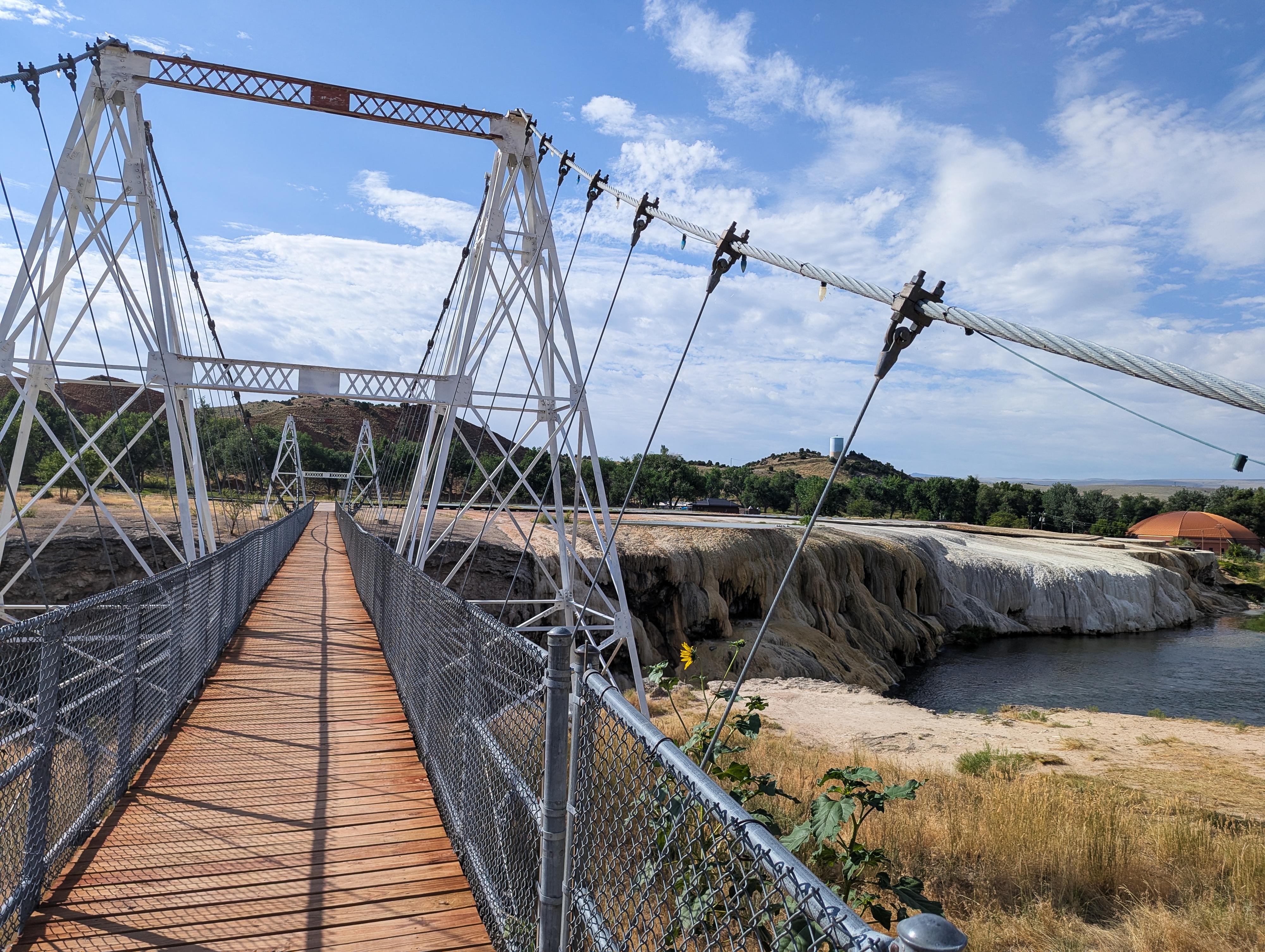
Hot Springs State Park in Thermopolis, Wyoming, is a remarkable destination known for its steamy mineral waters, dramatic travertine terraces, and deeply rooted cultural history. Located in the heart of Wyoming’s Bighorn Basin, this state park is home to one of the world’s largest mineral hot springs. The park features a free public bathhouse where you can soak in the naturally heated waters, believed for centuries to have healing properties. Beyond the hot springs, the park has trails, bison viewing, picnic areas, and a suspension footbridge that spans the Bighorn River.
The history of Hot Springs State Park is deeply connected to the Native American tribes who originally inhabited the region. The land surrounding the hot springs was considered sacred by the Eastern Shoshone and other indigenous peoples, who used the area for healing and spiritual purposes long before the arrival of European settlers. In the late 19th century, the U.S. government negotiated with the Shoshone to acquire the land, promising that the hot springs would remain free and open to the public - a promise still honored today through the park’s public bathhouse.
After the land was transferred to the state of Wyoming in 1897, Hot Springs State Park was established to preserve and share this natural treasure. Early development included the construction of soaking pools, bathhouses, and landscaped gardens to attract visitors from across the country. The park quickly became a popular health resort destination in the early 20th century, part of a nationwide trend of spa tourism and therapeutic bathing. Many of the original stone and log structures from this era remain preserved, adding a nostalgic charm to the park’s grounds.
The state park and town that surrounds it are an excellent place to visit year-round. We visited while passing through on a summer road trip and enjoyed spending a couple of days both enjoying the mineral pools and also the rest of the park as well.
Getting There
The state park is on the northeast side of the town of Thermopolis, just below the hill that says Worlds Largest Mineral Hot Spring.
Route Description
The bath house and travertine area behind it are the most popular destination at the park. The bath house is free, and allows 20 minute soaks in the hot water. Walking around the travertine behind the bathhouse, and crossing the swinging bridge over the river are an excellent pre or post-soak activity. Just across the road from the travertine area is Big Spring, one of the sources of the hot springs, and Black Sulphur Spring, just north of Big Spring, which is a sulphur spring.
There are a few additional sights in the park that most visit by vehicle via Big Spring Drive, which heads north from the travertine terraces. Big Spring Drive splits, and Pasture Road circles behind Monument Hill and returns back to the park. We thought it was worth the time and enjoyed stopping at the sights along the way. Sites below are encountered in order when doing the drive in a clockwise direction.
As you head north on Big Spring Drive, the road comes to a split. The loop goes right, but left goes a short distance to the White Sulphur Spring trailhead.
White Sulphur Spring
This very short walk down a set of stairs goes to a warm sulfur spring coming out of the rock. The white stream is quite interesting.
Continuing on the loop, the next stop encountered is the Spirit Hole.
Spirit Hole
This shallow sinkhole is a former spot where the spring bubbled out of the ground. Changing conditions caused it to dry up and leave the sinkhole.
As the road reaches a split that goes to the buffalo ranch, the Devils Punch Bowl is just before the ranch structures.
Devil's Punch Bowl
This is another spot that used to be a spring but has since dried up leaving the sinkhole. The ranch is used for the care of the buffalo you are likely to see as you continue the drive.
Buffalo Corral Overlook
The area behind Monument Hill is often used by the buffalo for pasture. The overlook is a good spot to look for them, or there is a one-way loop you can drive through the pasture to look for them as well.
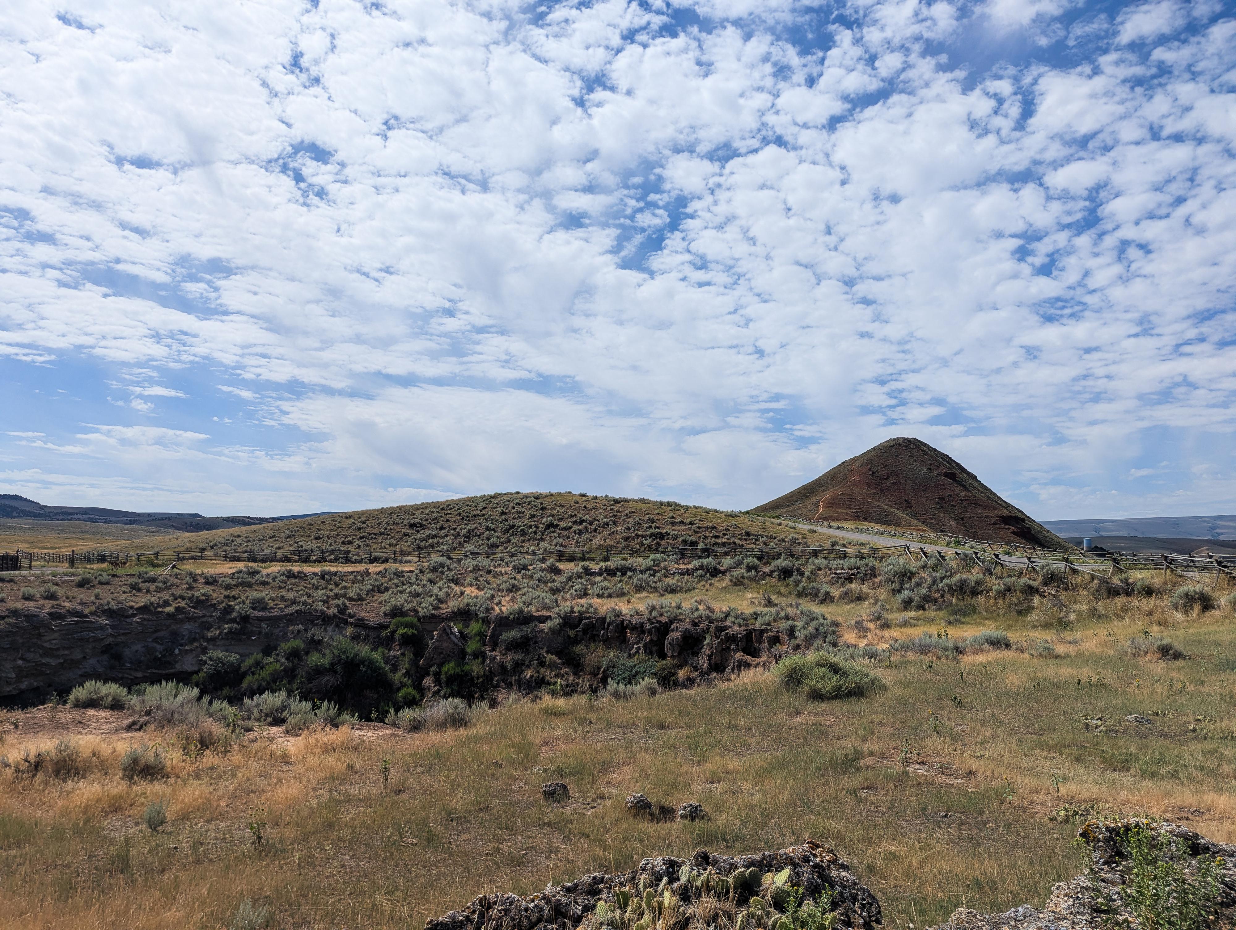
Monument Hill
This is the iconic hill that has Worlds Largest Mineral Hot Spring written on it using white rocks that you can see from town. There is a trail to its summit from the back side. The hill gets its name because people who felt they were cured by the mineral waters would hike up to the summit and place a stone on top, hence the large cairn of rocks on top. It has great views of the area, highly recommended if you have time.
Sneider's Point Overlook
This short side road goes over to a parking area and short hike to Sneider's Point. From the informational sign: In 1884 Joe Sneider with Ed Crapon passing through this area, noticed steam rising from the hot springs. Mistaking it for smoke and suspecting a hostile Indian Camp, the area was scouted from this point before descending to the valley.
Smokey Row Cemetery
This small cemetery goes back to the 1890s. Smoky row was where some early settlers to the hot springs lived in dugouts. The cemetery contains nine graves dating for 1890-1900.
Photos
Maps

12T 726042E 4837066N
43°39'08"N 108°11'49"W
12T 726063E 4837386N
43°39'18"N 108°11'48"W
12T 726250E 4837340N
43°39'17"N 108°11'39"W
12T 726230E 4837415N
43°39'19"N 108°11'40"W
12T 726119E 4838056N
43°39'40"N 108°11'44"W
12T 726276E 4838029N
43°39'39"N 108°11'37"W
12T 726438E 4838096N
43°39'41"N 108°11'30"W
12T 726383E 4837508N
43°39'22"N 108°11'33"W
12T 726510E 4837421N
43°39'19"N 108°11'28"W
12T 726505E 4837142N
43°39'10"N 108°11'28"W
12T 726513E 4837908N
43°39'35"N 108°11'27"W