 Hiking
South Indian Canyon
Hiking
South Indian Canyon
Mt. Carmel
Overview
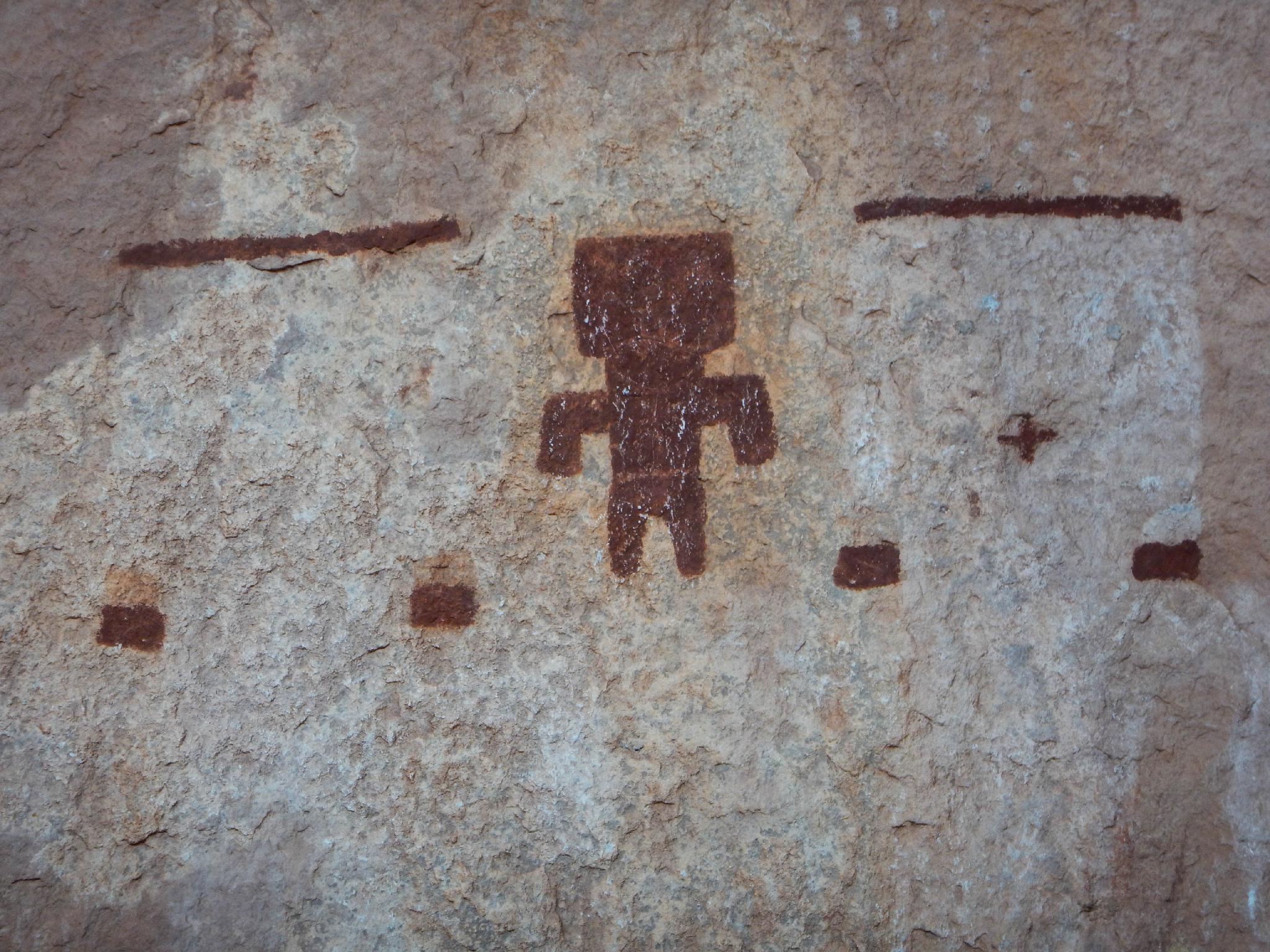
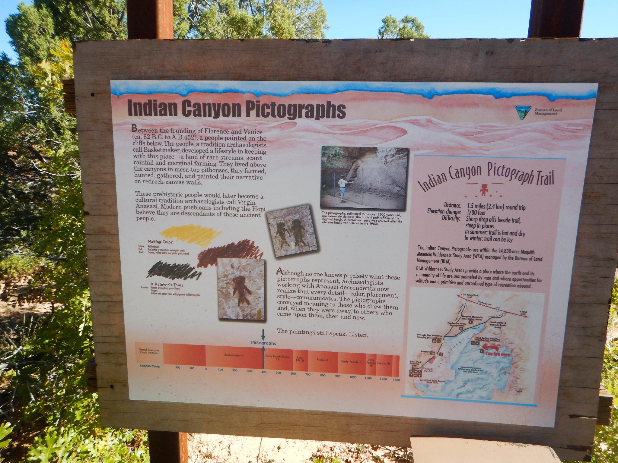
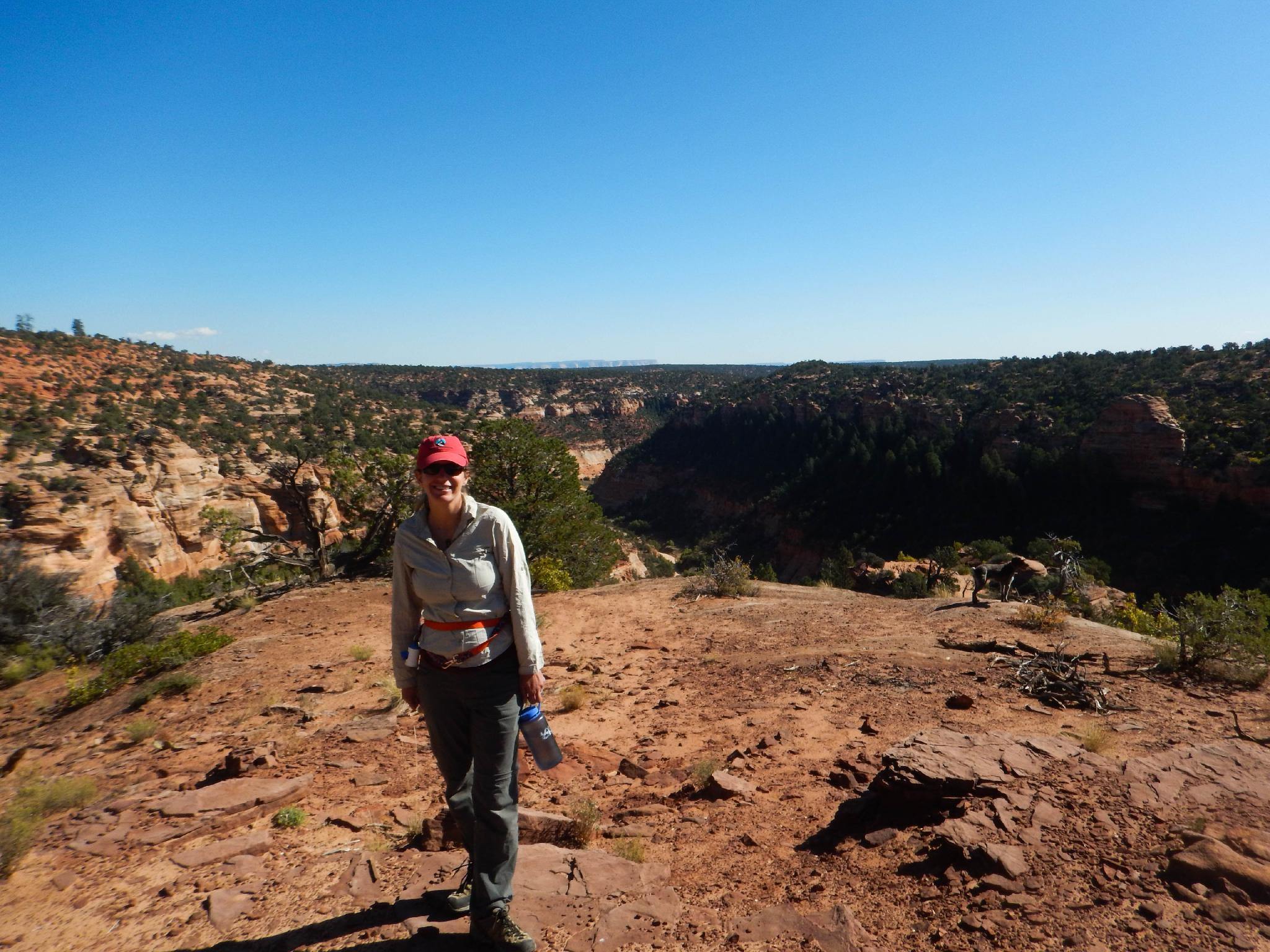
South Indian Canyon offers one of the best pictograph panels I know of in southwestern Utah. This short hike offers stunning views into two forks of South Indian Canyon and a large panel set in a stunning alcove overlooking the canyon. This is a hike most will be capable of doing, though there are a couple of rugged spots requiring high steps and a touch of scrambling. Don't believe the sign at the trailhead, the TOTAL distance is only about 0.8 miles, 0.4 miles each way.
Sounds great, right? It is, though the access road turns out to be quite tricky. ATV and true 4x4s only for this trip. The first few miles to the trailhead are quite sandy, the last few are both sandy and narrow/winding. A short wheelbase helps on the last few miles. Sand driving is an art, but visiting in cooler times of the year right after recent rains, and/or lowering your vehicle's tire pressure can all help ensure success. The road could be walked if needed but would take most of the fun out of the trip.
Getting There
The first step is reaching Mt. Carmel Junction. From Springdale (or the Zion National Park West Entrance), follow highway 9 about 25 miles through the park to Mt. Carmel Junction.
From Mt Carmel Junction, go south (right from highway 9) on US-89 for 3.5 miles and turn right on the signed county road for Coral Pink Sand Dunes. 0.3 miles from US-89, go right again and continue 8.4 miles to a junction. Go left here onto Hancock Road, and continue for 3.6 miles to a major side road on the right. (Sand Spring Road)
Route Description
Rock art and historic sites are fragile, non-renewable cultural resources that, once damaged, can never be replaced. To ensure they are protected, please:
- Avoid Touching the Petroglyphs: Look and observe, BUT DO NOT TOUCH!
- Stay on the Trails: Stay on the most used trails when visiting sites, and don't create new trails or trample vegetation.
- Photography and Sketching is Allowed: Do not introduce any foreign substance to enhance the carved and pecked images for photographic or drawing purposes. Altering, defacing, or damaging the petroglyphs is against the law -- even if the damage is unintentional.
- Pets: Keep pets on a leash and clean up after them.
- Artifacts: If you happen to come across sherds (broken pottery) or lithics (flakes of stone tools), leave them where you see them. Once they are moved or removed, a piece of the past is forever lost.
From the trailhead, follow the trail that starts behind the information board on the northeast side of the parking lot. The trail on the south side of the parking area goes to an overlook.
The trail meanders slowly down, then cuts along a cliff face with a fence on the left. From here a step down of a ledge leads to the trail cutting back left and to the panels.
The panels make a great lunch spot, with big views down into South Indian Canyon and its many seeps. Or, the trail on the south side of the parking area offers excellent views into the other fork of South Indian Canyon and is also a terrific lunch spot.
Maps

12S 353121E 4103390N
37°03'55"N 112°39'08"W
12S 353378E 4103523N
37°03'59"N 112°38'57"W