Sinbad Canyon |

House Range

Canyoneering Sinbad Canyon - House Range Canyoneering Sinbad Canyon

House Range

Overview

RATING: 3A
MAPS: SWASEY PEAK, UT; MARJUM PASS, UT; SWASEY PEAK SW, UT

Sun

Sunny, with a high near 61. Southwest wind 6 to 14 mph.

61 | 41

Mon

Sunny, with a high near 58.

58 | 39

Tue

Sunny, with a high near 59.

59 | 41

Wed

Mostly sunny, with a high near 58.

58 | 42

Thu

A chance of snow showers. Mostly sunny, with a high near 52.

52 | 41

View Full Weather Details
SEASON: Late spring, fall
GEAR: Standard Technical Gear, Fiddlestick type device very useful. Extra webbing.
RAPPELS: 6+ to 30 m ( 99 ft. )
WATER: Generally none.
FLASHFLOOD: Moderate

Sun

Sunny, with a high near 61. Southwest wind 6 to 14 mph.

61 | 41

Mon

Sunny, with a high near 58.

58 | 39

Tue

Sunny, with a high near 59.

59 | 41

Wed

Mostly sunny, with a high near 58.

58 | 42

Thu

A chance of snow showers. Mostly sunny, with a high near 52.

52 | 41

View Full Weather Details
Sinbad Spring

Sinbad Spring

Though Southern Utah gets much more attention, the West Desert has many charms for those willing to put in the effort to see them, including technical canyons. Sinbad Canyon is one of those charming little canyons that requires work to visit. The canyon is a steep limestone canyon draining off Swasey Peak in the House Range.

The limestone narrows are brief, but pretty and very different from the sandstone canyons of Southern Utah. The area is quite similar in feel to the Virgin River Gorge, though much more remote. For those seeking solitude and adventure, this is a great outing.

Note: This is an infrequently visited canyon in a remote setting. Good anchor skills are required. Though the biggest rappel is about 21 m ( 69 ft. ), bring gear for a 30 m ( 99 ft. ) rappel and extra webbing. Several drops will require either building a deadman, or using an anchor back from the drop. A fiddlestick is very helpful for anchors back from the edge.
Limestone walls in lower Sinbad Canyon

Limestone walls in lower Sinbad Canyon

Getting There

Note: Reaching the trailhead requires quite a bit of good dirt road. Though mostly good enough for a family sedan, I would recommend high clearance. The canyon requires a shuttle, so you will need two vehicles.

From Delta, Ut, head west on US-50 W/US-6 W toward Baker Nevada for about 12 miles to mile post 76.2 where old highway 6 is signed on the right.

  • Reset your odometer as you turn north onto old highway 6. This good gravel road has many side roads. Stay on the main old highway 6 as it briefly goes north, then turns west and heads toward the House Range in the distance. ( 12S 345584mE 4352404mN / N39° 18' 26" W112° 47' 28" )
  • 22.7 miles - 4 way junction. Go right here, heading north. ( 12S 311189mE 4348015mN / N39° 15' 39" W113° 11' 18" )
  • 27.6 miles - Major 4-way intersection. Stay straight, continuing in a northerly direction. ( 12S 306231mE 4353959mN / N39° 18' 48" W113° 14' 51" )
  • 31.5 miles - Junction to Dome Canyon. Stay straight. Left (Dome Canyon) is used for setting up the shuttle. Directions below under Exit Trailhead. ( 12S 303385mE 4358495mN / N39° 21' 13" W113° 16' 55" )
  • 35.2 miles - Side roads on the left. There is good primitive camping down thes side road on the left a short distance. For Sinbad Spring/Canyon, stay straight. ( 12S 300127mE 4360627mN / N39° 22' 19" W113° 19' 13" )
  • 35.9 miles - Sinbad Spring is on the left (south) side of the road. This is the trailhead, though there is not a great place to park. Find the widest spot on the road you can for a parking spot. Note: Continuing to 36.6 miles ends at a fantastic overlook of the Tule Valley and several excellent primitive camping sites. ( 12S 300090mE 4361610mN / N39° 22' 51" W113° 19' 16" )
  • Exit Trailhead
  • Drive down Dome Canyon for 6.9 miles to a rough two track on the right just after the canyon opens. The two track heads north. This is the recommended exit trailhead, though you can drive the two track about 1 mile and leave the vehicle where a lesser used two track leaves on the right. (labeled Exit Road on the map) All-in-all, this section seems easier to just walk! ( 12S 294570mE 4358135mN / N39° 20' 54" W113° 23' 02" )
Interesting limestone walls.

Interesting limestone walls.

Route

Approach (5 minutes)
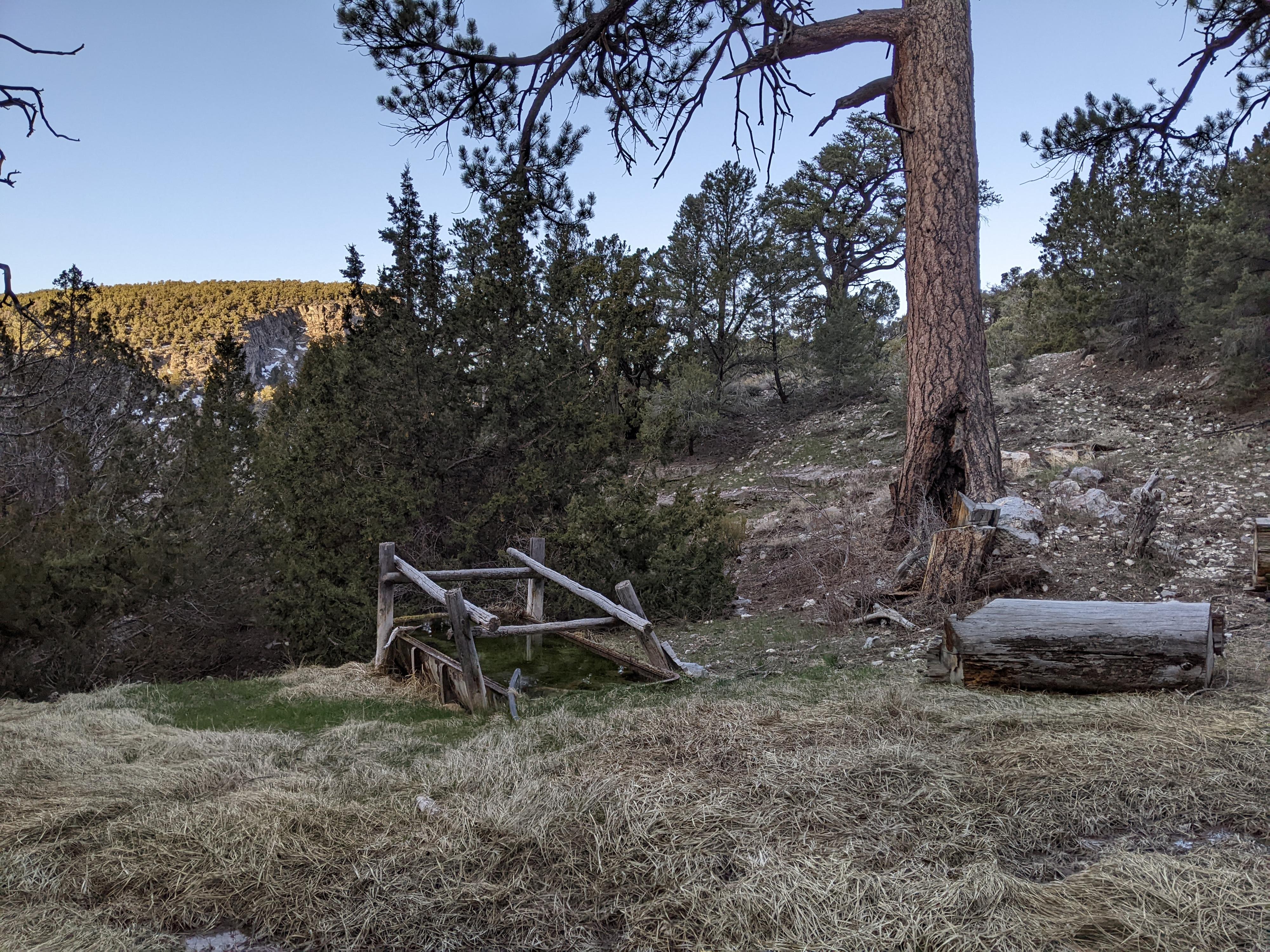
From the road, head downhill toward the drainage. The spring, with a livestock trough, is on the right a couple of minutes below the road. Stay in the grassy canyon bottom. A minute past the spring is a short drop that is avoidable on the left, just before rappel 1.

Canyon
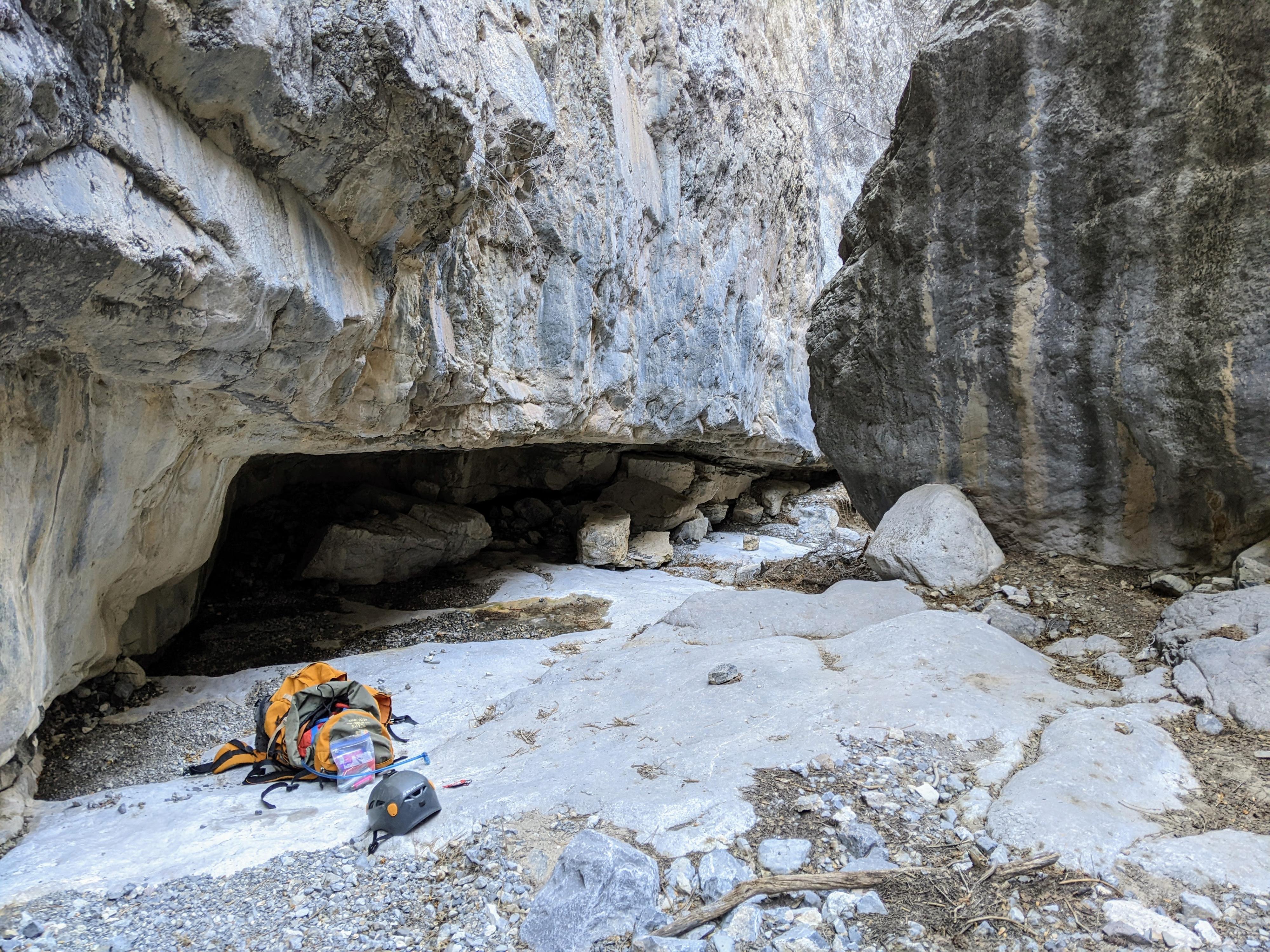
R1 about 21 m ( 69 ft. ) from the edge. You may need 30 m ( 99 ft. ) if using an anchor back from the edge. This is the biggest rappel of the day, and likely down a small dripping waterfall.

Below rappel 1, the canyon is open. Head down the stream bed, deviating as required to avoid the trees/brush. It is only about 20 minutes to where the canyon narrows again and deepens. There is a small down climb or two just before R2.

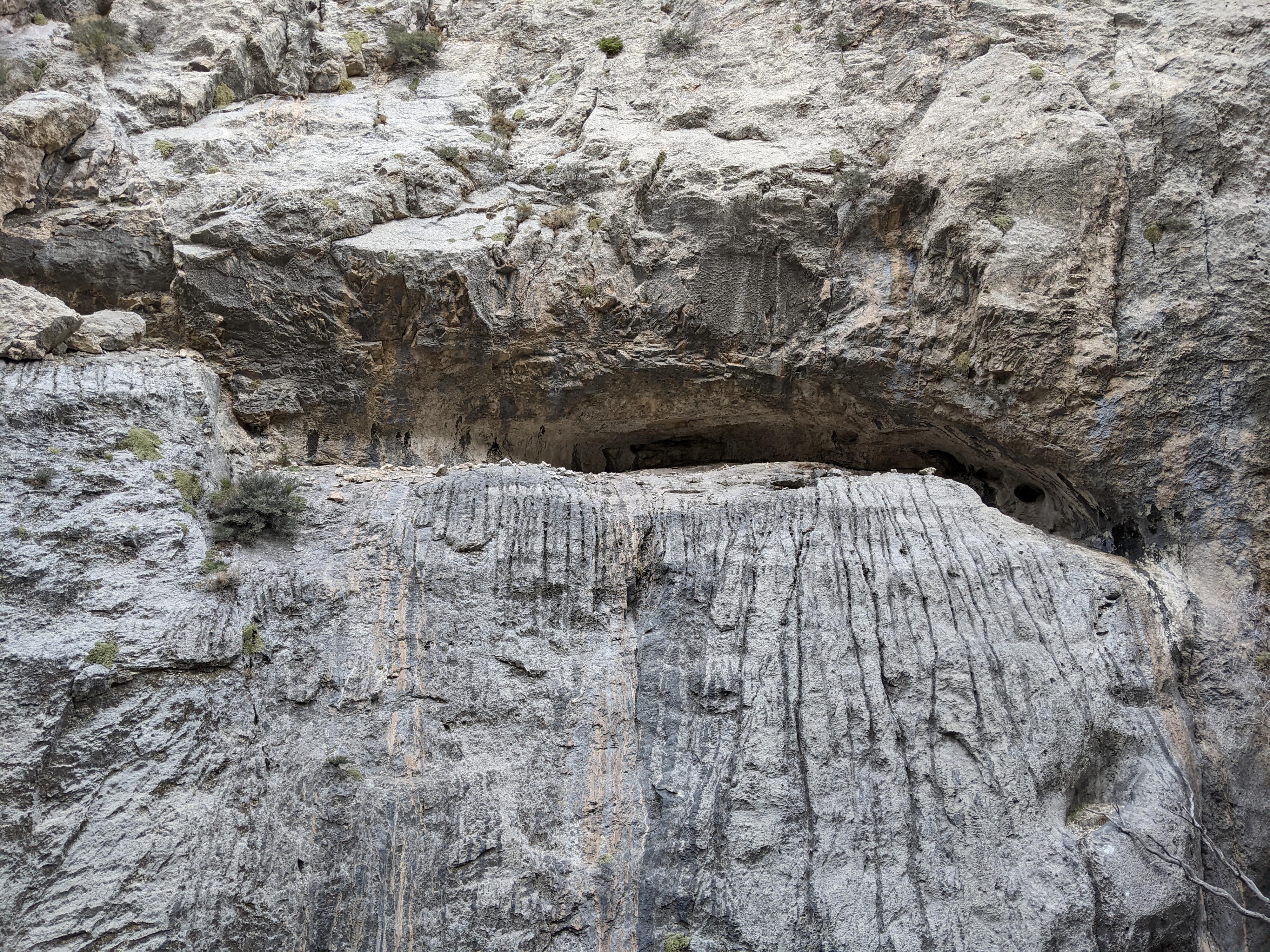
R2 is about 18 m ( 60 ft. ) if using the tree back from the edge that makes an easy fiddlestick anchor. This is the start of the deepest section of the canyon. The rappels all come in quick succession from here.

R3 about 15 m ( 50 ft. ) depending on what you use as an anchor. I rappelled down the left side (looking down canyon). Be mindful of the rope pull on this one.

R4 short drop that many groups may want to down climb.

R5 another short rappel, about 4 m ( 14 ft. ).

R6 About 10 m ( 33 ft. ). This rappel can be avoided on the right looking down canyon via a brushy thrash along the canyon wall. Rappelling is easier.

R7 lots of options, in about the 4 m ( 14 ft. ) to 8 m ( 27 ft. ) range. Boulders on the left are shorter, but straight down the middle of the canyon offers an easier rappel.

Exit (about 5 miles / 2 hours)
All too soon, the narrows are over. The canyon is opening here, a short bit of brush and route finding around boulders below leads to the more open desert and easier walking. Continue down the canyon bottom. It gets easier as it opens and becomes less boulder strewn.

About 1.5 miles below the last rappel, a couple of side canyons come in on the left. Ignore these, and stay in the main canyon, continuing downhill. About 2.5 miles (60-ish minutes below the final rappel), you will come across an old road that is also heading down canyon. Stay on this old road as it heads left (west) when the canyon opens up into the wide open desert. After about 4 miles, the old road meets up with a more used road. Go left (south) down this more well-defined road for just under a mile to where it joins to Dome Canyon road.


Maps

Printable Maps:
Sinbad Spring Trailhead

12S 300090mE 4361609mN

N39° 22' 51" W113° 19' 16"

Sinbad Spring

12S 300080mE 4361561mN

N39° 22' 49" W113° 19' 16"

R1

12S 300049mE 4361503mN

N39° 22' 48" W113° 19' 17"

R2

12S 299535mE 4361254mN

N39° 22' 39" W113° 19' 38"

Last Rappel

12S 299383mE 4361122mN

N39° 22' 35" W113° 19' 45"

Exit Road

12S 294820mE 4359506mN

N39° 21' 38" W113° 22' 53"

Dome Canyon Road

12S 294566mE 4358135mN

N39° 20' 54" W113° 23' 03"

Comments

Want to make a comment? Login and let yourself be heard.