 Hiking
Mount Ogden
Hiking
Mount Ogden
Snowbasin Resort
Overview
Mount Ogden (~9,579') is the highest peak on the ridgeline directly east of Ogden. From Ogden, it is the dramatic backdrop you see to the east. This is a peak that has a couple of long routes with fairly big elevation gains or a much shorter and easier route via the tram at Snowbasin Ski Resort. Our family opted for the tram route, which made for a very pleasant 1/2 day outing with a very civilized feel. It was quite the treat to take the tram up, hike the peak, and then end with a summer music event at the base of the tram on the way down!
Getting There
From the south end of Ogden, take I-84 East toward Cheyenne/Morgan for 4.6 miles. Then take Exit 92 off of I-84 for UT-167 toward Mountain Green and Huntsville.
Follow UT-167 for about 8 miles; it is also signed for Snowbasin Resort.
Turn onto UT-226, and follow it about 3 miles to the Snowbasin Resort parking lot.
Route Description
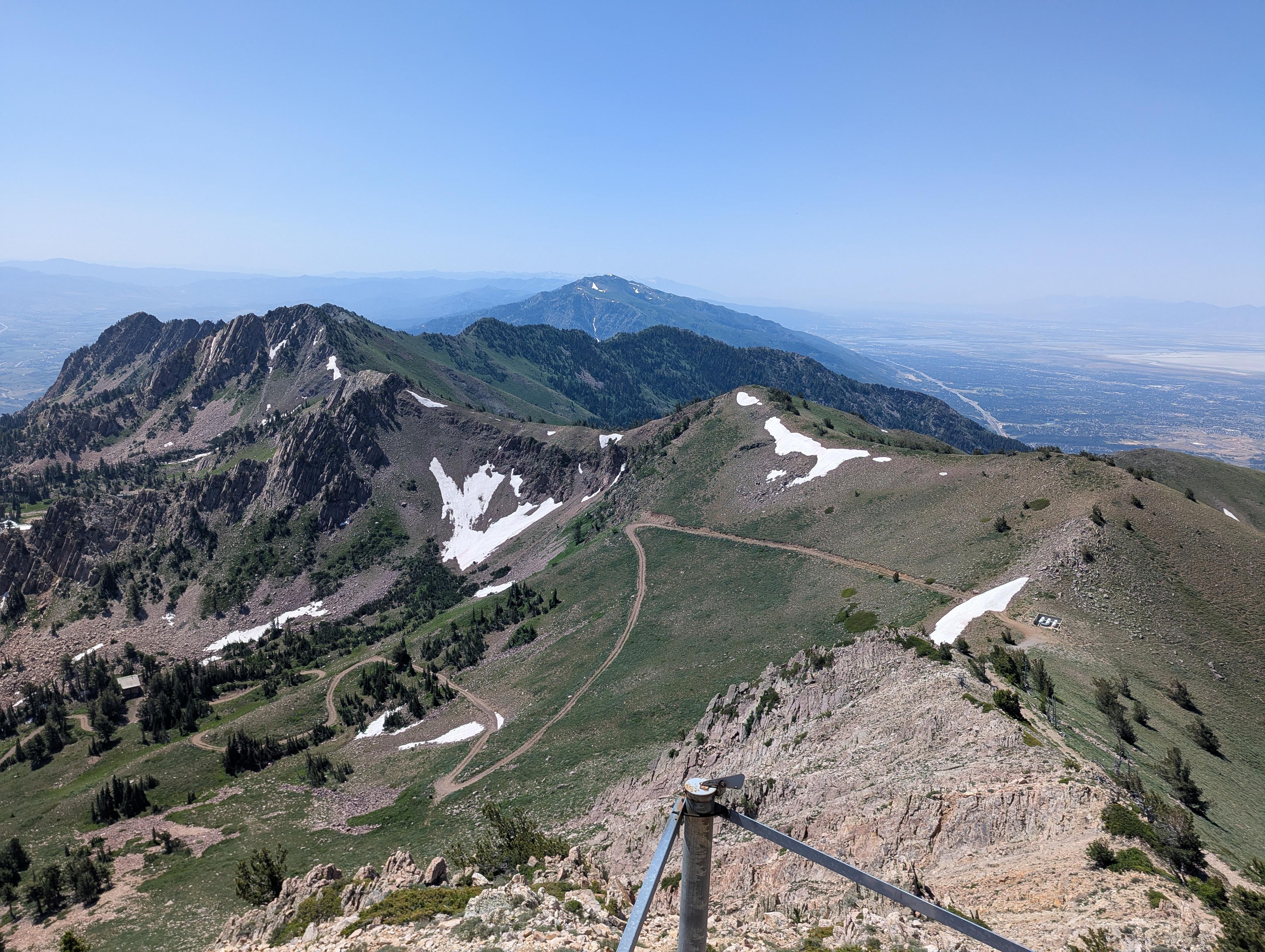
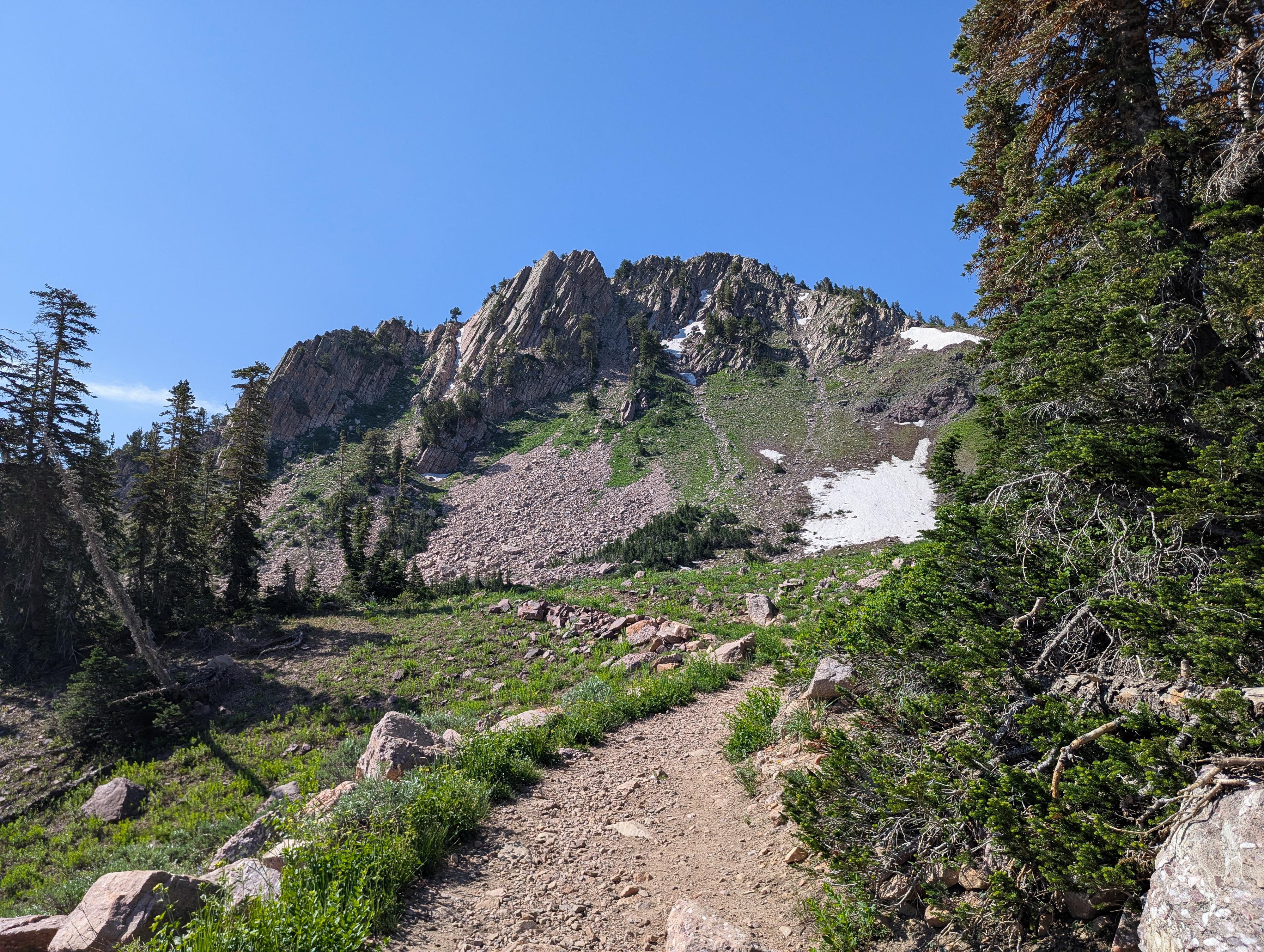
From the top of the tram in The Needles area, head up the hill a short distance to the Middle Bowl lift. From the lift, follow the single-track trail as it heads south, curves around, and begins climbing steeply to the ridge with a couple of long switchbacks. The ridge is a great place to catch your breath and take in the big views of the Ogden Valley and Great Salt Lake beyond.
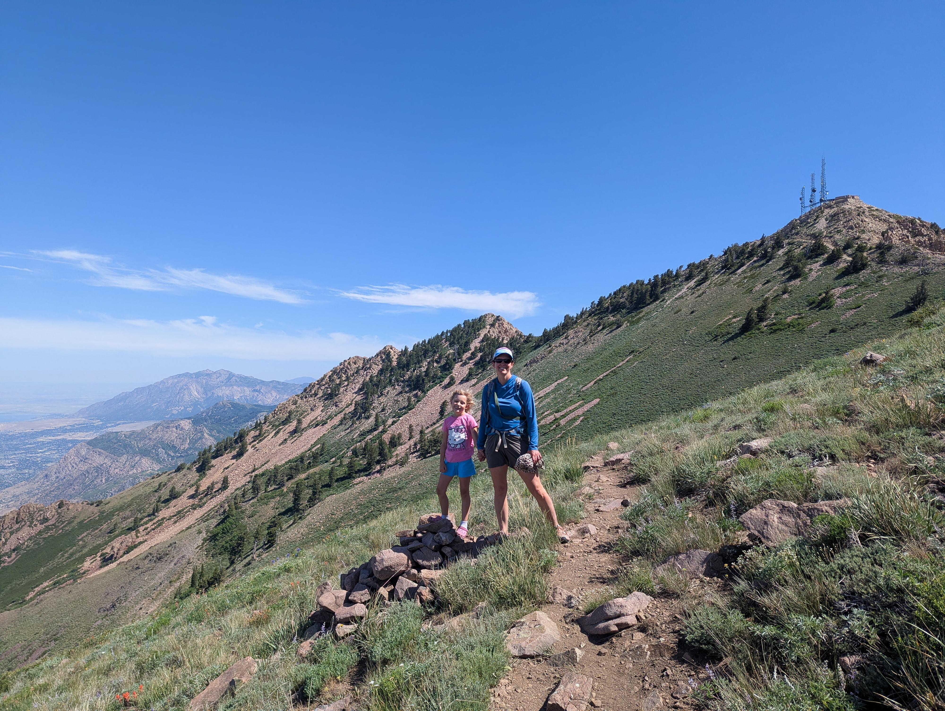
On the ridge, head right (north). The trail stays on the east side of the ridge and is easy to follow. Along the way, you may notice two trails joining from the canyon below. The first is from Beus Canyon, the second from Malans Basin. The single track traverses around to join up with a service road at a saddle below Mount Ogden.
From the saddle, the summit is obvious at the communication tower just to the north. The road to get there is incredibly steep and loose! Be cautious; we saw several groups struggle with both the up and down on this section. There is a social trail to the right of the road part way up that seemed a bit easier and the route we took on the way down.
The summit has a large communication facility that includes a helicopter pad. It is a great lunch spot to take in the views.
Returning
You can return the way you came, or if seeking an alternative, I recommend the following loop.
From the saddle, take the ski resort road that angles down on the west side of the ridge. This makes a few big switchbacks as it loses elevation and passes the top of a lift. The service road is easy walking. Stay on the main service road, going right at the two major junctions. This circles around back to The Needles area and requires regaining just a bit of elevation on the service road to get back to the top of the tram and your ride down.
Photos
Maps

12T 428119E 4563059N
41°12'57"N 111°51'27"W
12T 426704E 4560627N
41°11'37"N 111°52'27"W
12T 425956E 4561024N
41°11'50"N 111°52'59"W
12T 426044E 4561312N
41°11'59"N 111°52'55"W
12T 426746E 4561114N
41°11'53"N 111°52'25"W
12T 426937E 4560944N
41°11'48"N 111°52'17"W