 Hiking
No Thoroughfare Canyon
Hiking
No Thoroughfare Canyon
Colorado National Monument
Overview
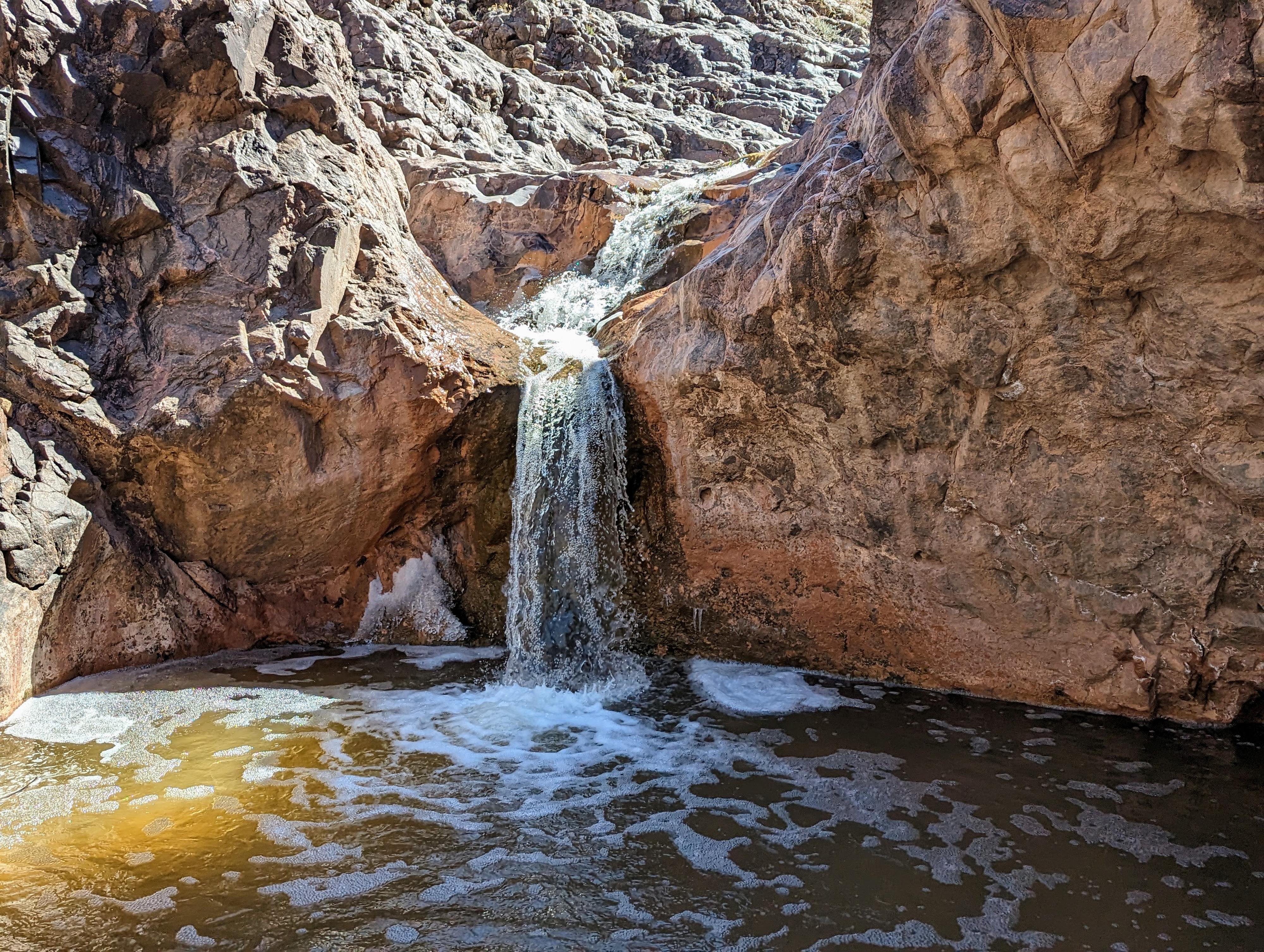
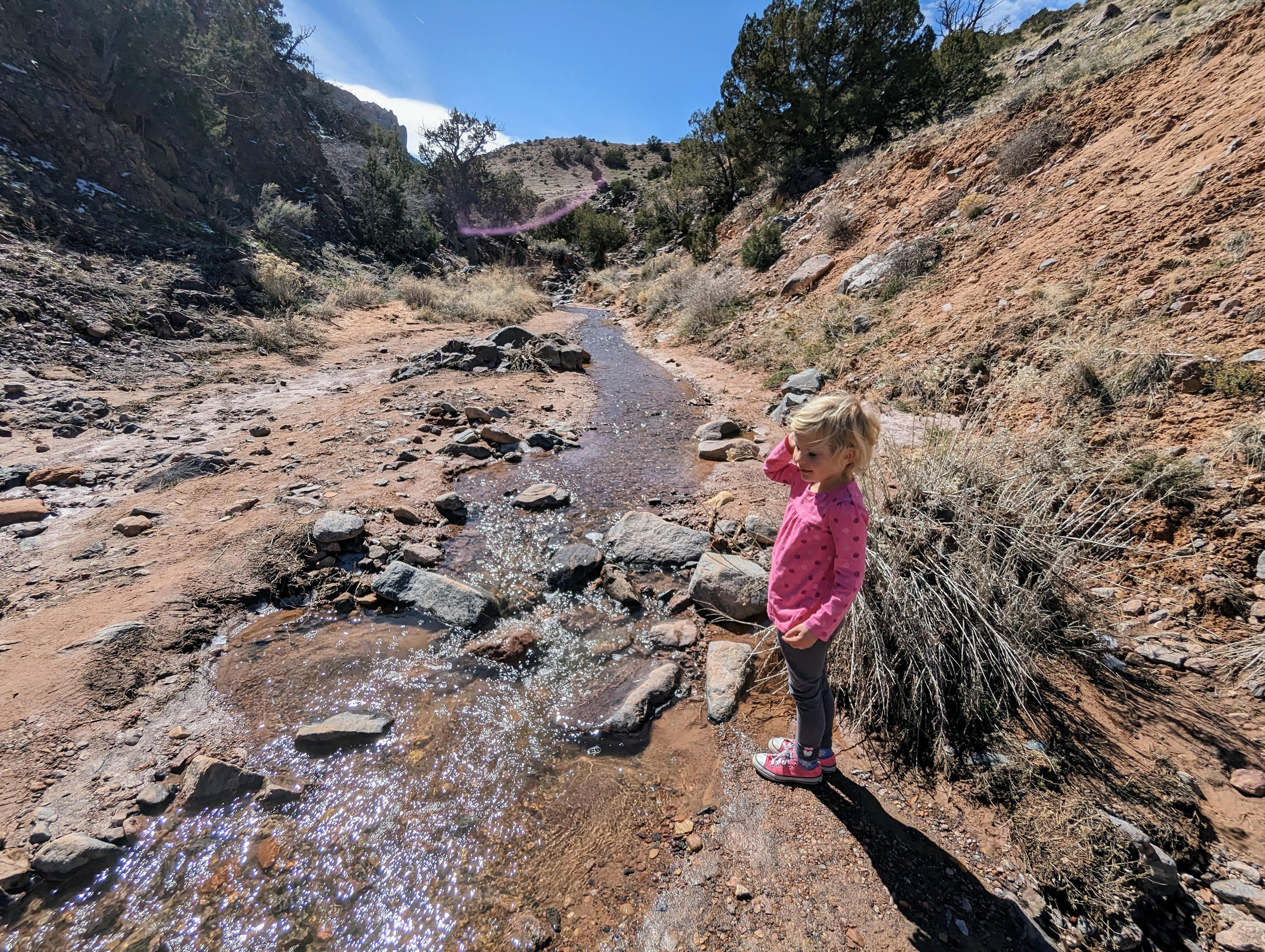
No Thoroughfare Canyon, combined with Devil's Kitchen, was our families favorite afternoon in Colorado National Monument. Lower No Thoroughfare Canyon, described here, is a lovely, easy, and scenic hike along a small stream. The canyon, in a black schist and migmatitic pegmatite rock, is in striking contrast to the reds and whites seen elsewhere in the monument. The water makes this reasonable on fairly warm days. Most hike at least to a large pool at the bottom of a small falls. Motivated hikers can continue just a bit further to a rather dramatic waterfall.
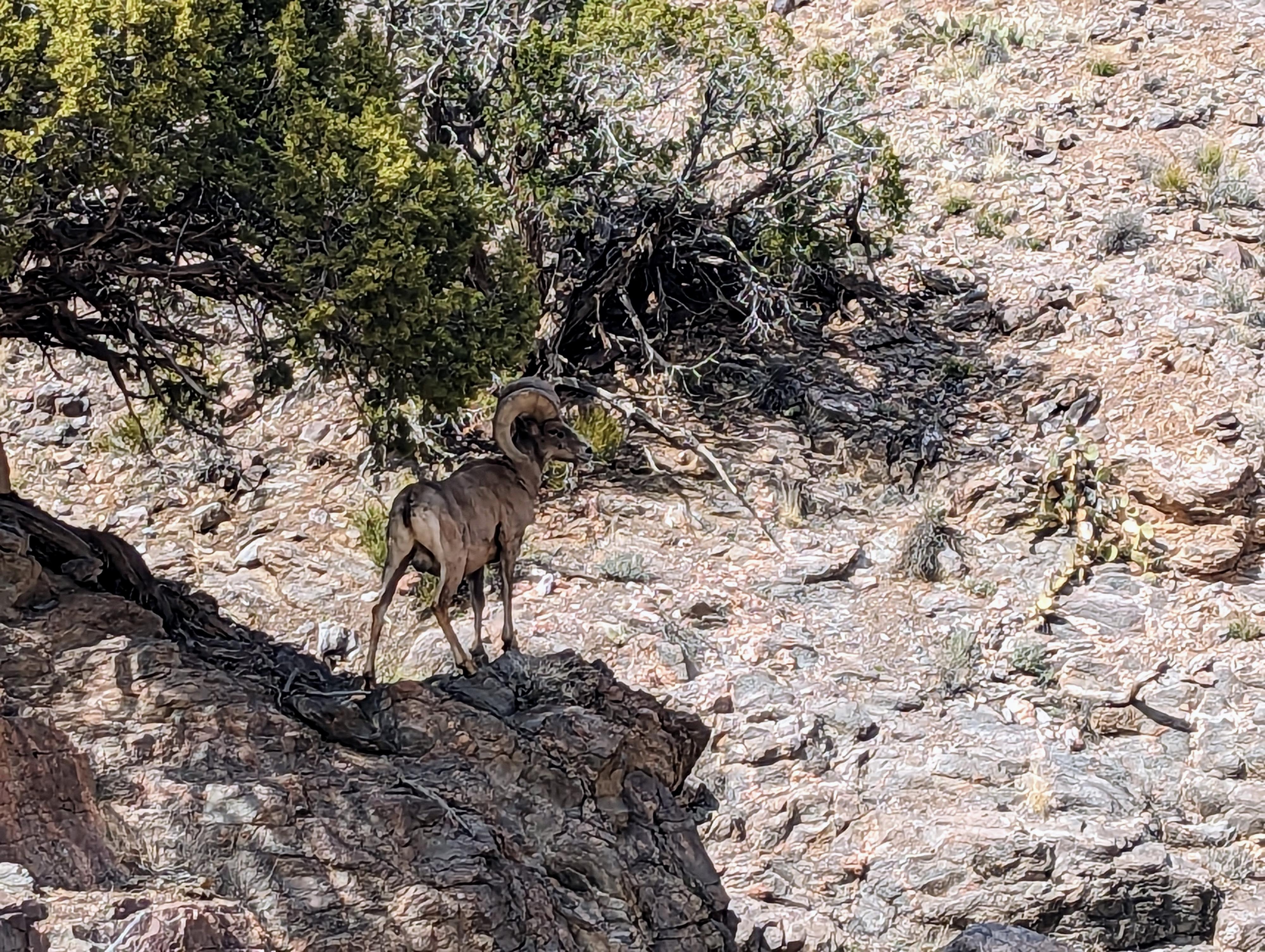
This canyon is home to numerous big horn sheep. Almost everyone we spoke to had seen them somewhere in the canyon. I saw a lone one just above the first pool. Keep an eye out, though, they can be easily missed if you're not looking for them.
Getting There
From the east side entrance to Colorado National Monument, drive 0.2 miles past the entrance fee station. The trailhead is on the left side of the road. There is somewhat limited parking. If full, there is overflow parking at the Devil's Kitchen Picnic area that is just across the road from the trailhead, where a paved road goes a short distance to a picnic area. There is a restroom at the picnic area.
Route Description
From the trailhead, follow the trail south. In just a couple of minutes is the junction with Echo Canyon/Old Gordon Trail, leaving on the left. Go right at this junction.
About a quarter of a mile from the trailhead is the second junction. Go right at this junction. Left goes to Devil's Kitchen.
The well-defined trail follows along the west side of the stream for just a few minutes before coming to the first crossing. Under most circumstances, it is easy to hop rocks and keep your feet dry during all the crossings.
From the first cross, several trails branch out and head east. Don't take them! Instead, stay along the stream from here on out, hiking either right next to, or only a stone's throw away from the stream on social trails and crossing as needed to stay on the easiest path.
The canyon soon begins to narrow a bit and becomes lined with dark volcanic rock. The many large cottonwoods and boulders beckon to laze in their shade by the water and take in the scenery.
From the trailhead, it is about 1.1 miles (40-60 minutes at a very leisurely pace) to the first pool. The pool, tucked next to a cliff with a small falls, is sublime and an excellent spot for a break.
To continue to the first waterfall, follow the trail as it climbs the hill on the west (right) side of the pool. The good trail climbs the hill, then descends back to the stream bottom.
The section between the pool and the waterfall is a bit rougher than below with more boulder hopping, but always a reasonable way can be found. It is about 0.75 miles from the pool to the falls one way.
Return the same way.
Photos
Maps
12S 705077E 4322979N
39°01'55"N 108°37'51"W
12S 705194E 4322798N
39°01'49"N 108°37'46"W
12S 705096E 4322619N
39°01'43"N 108°37'50"W
12S 704223E 4322018N
39°01'24"N 108°38'27"W
12S 703487E 4321332N
39°01'03"N 108°38'59"W