 Hiking
Hilgard Mountain
Hiking
Hilgard Mountain
Fish Lake
Overview
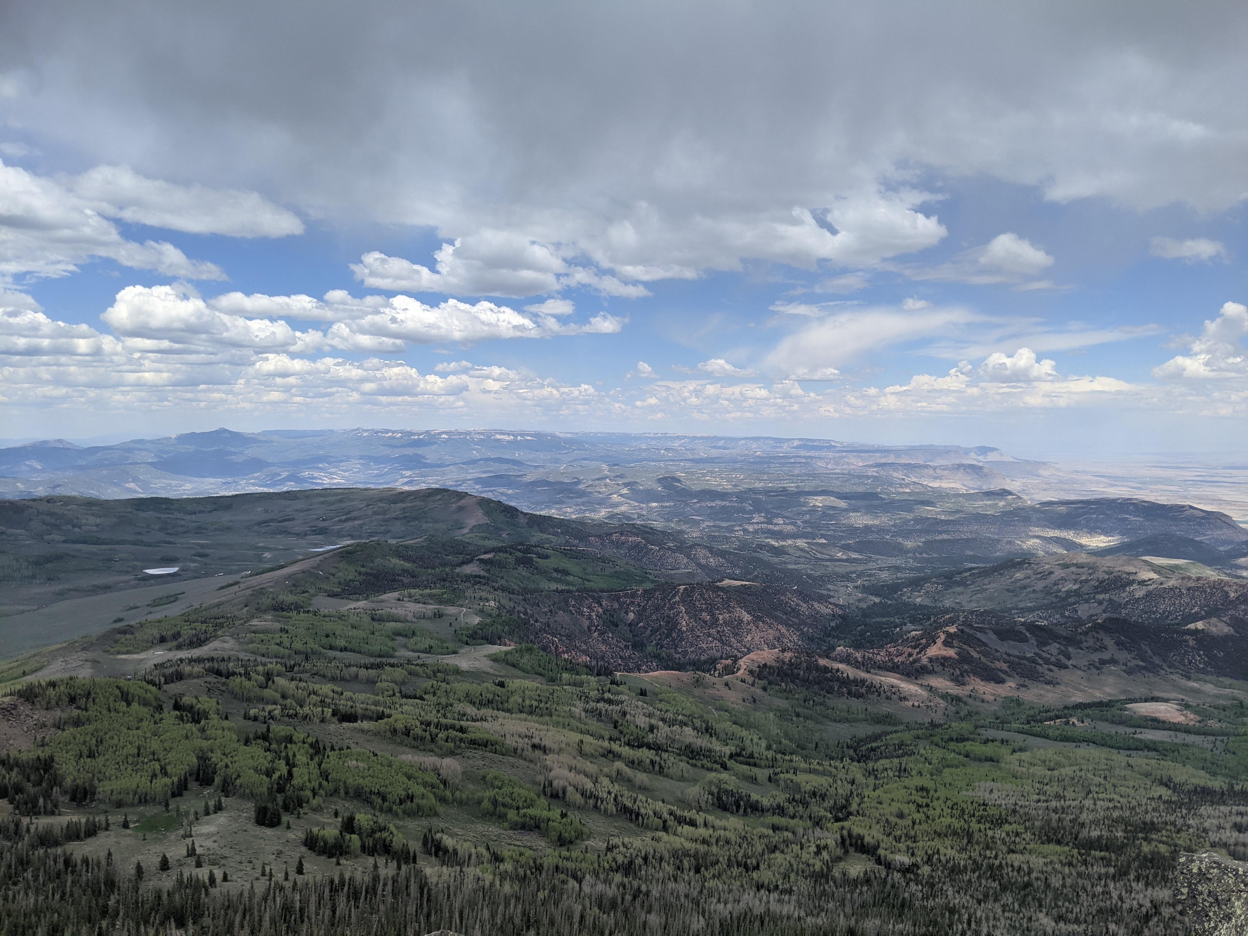
At 11,533, Hilgard Mountain is one of the higher peaks in the Fish Lake National Forest. The mountain is named after Julius Erasmus Hilgard. Hilgard had a prominent career in the Office of Coast Survey that did early survey work in the United States and much later became part of NOAA. The mountain, like other high peaks in the Fish Lake area has outstanding views of the forested and meadow dotted landscape surrounding it. It is one that seems to beckon to be climbed from a distance.
Though the USGS Quads show a trail to near the summit, the old trail appears to no longer exist. Old logging roads provide easy hiking access to near the peaks shoulder, where a little navigating through the trees to the ridge makes for easy passage to the summit. I would call this a moderate route because it does require a bit of route finding and intuition.
Getting There
Fish Lake is the prominent feature in the area, so driving directions start there. Head east on UT-25 from Fish Lake. After about 6-7 miles, you reach Johnson Reservoir and a junction with a paved road going north to I-70. Stay right for an additional 2.2 miles from the Johnson Reservoir junction to where Forest Road 015 leaves on the left. Reset your odometer here. The road from here is dirt with some washboard sections at the start, and rougher, rocky sections on the final climb to the trailhead. High clearance likely required in most conditions.
Route Description
There are two trailhead options. The first, road 2646, starts a bit before the road highpoint. The alternative is just up the road at the road highpoint. I went up from the alternate and came down to road 2646. It is pretty much six-to-one and half-dozen-to-the-other. I would lean toward road 2646 since it is a bit more used. That is described here, but the map shows the alternate for those inclined.
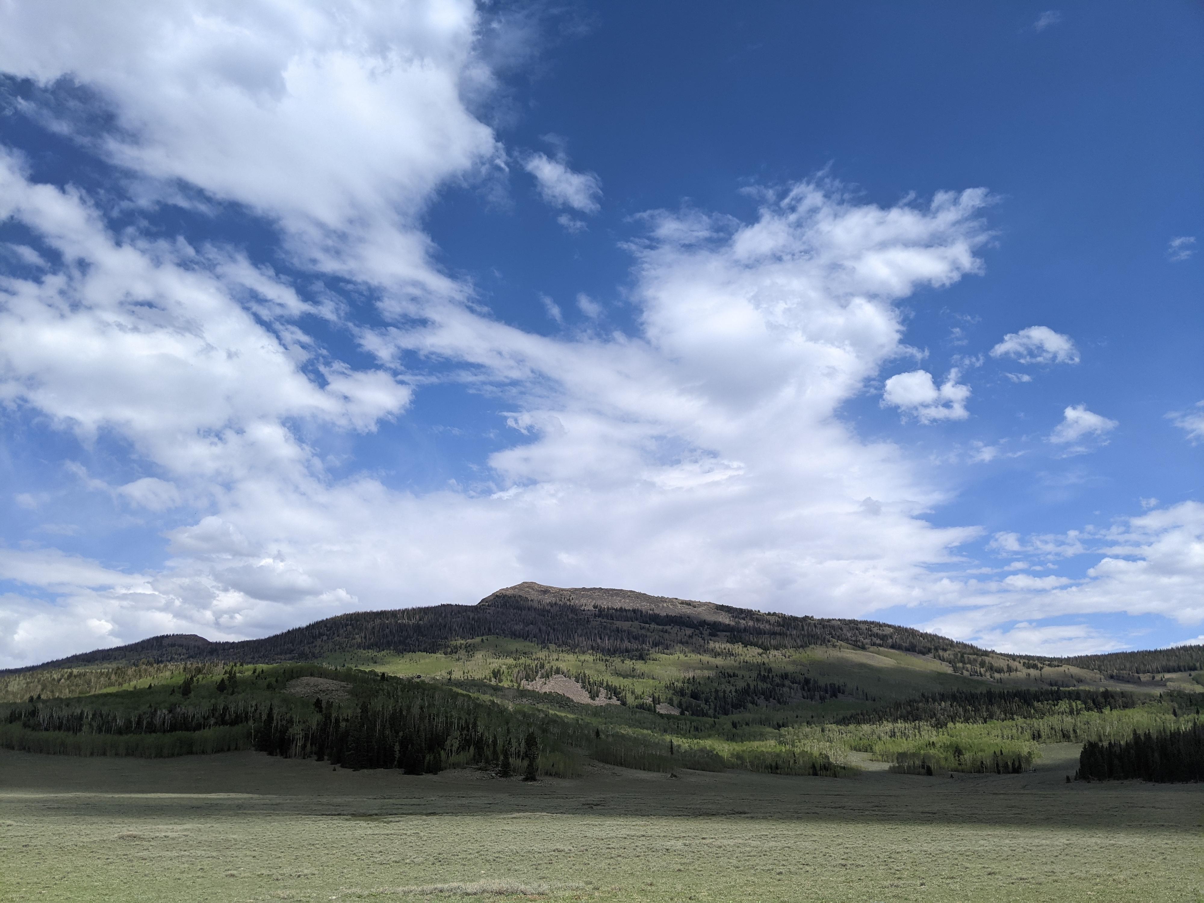
From the main road, follow the rough jeep road 2646 south as it climbs up a grassy area to a large trough. At the trough, look to the left (east) for an old logging road that is becoming overgrown but is still visible. Follow this old logging road as it heads east and climbs. The road turns south and then makes a switchback up the hill. This section is quite pretty, with Hilgard visible to the south.
The road passes through a section of trees before opening wide into a meadow like area with a marsh/small pond on the right. Just past this marsh/small pond the logging road begins to diverge into many small side roads. From here, head generally south toward the shoulder of the mountain. Stay generally due south. Heading too far east leads to boulder hopping, too far west and there becomes much deadfall to climb over. Due south, on my trip, had a minor social trail and very intermittent cairns.
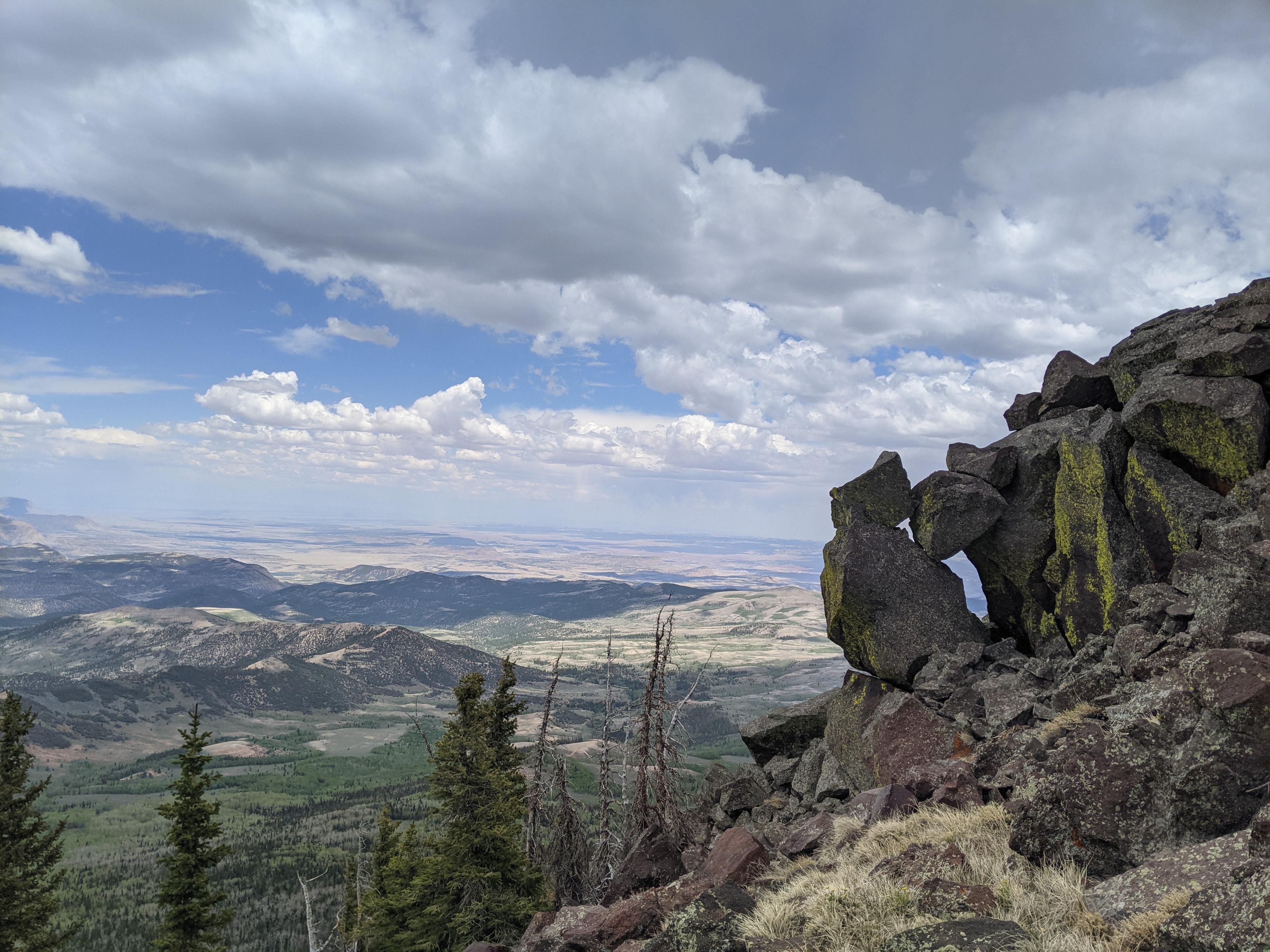
Once on the shoulder, it is an easy ridge walk to the summit. It seems easier to stay a bit south of the true ridge here, on an emerging social trail in spots. There is not much boulder hopping until near the top this way. The summit has excellent views over Fish Lake National Forest.
Return the same way.
Photos
Maps

12S 452354E 4283625N
38°41'60"N 111°32'53"W
12S 452562E 4283708N
38°42'03"N 111°32'44"W
12S 452612E 4282592N
38°41'26"N 111°32'42"W
12S 452440E 4282084N
38°41'10"N 111°32'49"W
12S 452700E 4281866N
38°41'03"N 111°32'38"W