Goosenecks State Park | Mexican Hat

Roadside Attraction Goosenecks State Park - Mexican Hat Roadside Attraction Goosenecks State Park

Mexican Hat

Overview

Wed Sunny, with a high near 75. West northwest wind 0 to 10 mph.
75° | 46°
Thu Mostly sunny, with a high near 75. Northwest wind 0 to 10 mph.
75° | 47°
Fri A slight chance of rain showers after noon. Mostly sunny, with a high near 74.
74° | 45°
Sat Sunny, with a high near 76.
76° | 44°
Sun Mostly sunny, with a high near 82.
82° | 46°
RATING: Roadside Attraction
LENGTH: 1+ hours
MAPS: None Needed.
SEASON: Any, although summers can be hot.
WATER: Bring all you need.
Wed Sunny, with a high near 75. West northwest wind 0 to 10 mph.
75° | 46°
Thu Mostly sunny, with a high near 75. Northwest wind 0 to 10 mph.
75° | 47°
Fri A slight chance of rain showers after noon. Mostly sunny, with a high near 74.
74° | 45°
Sat Sunny, with a high near 76.
76° | 44°
Sun Mostly sunny, with a high near 82.
82° | 46°
Goosenecks State Park

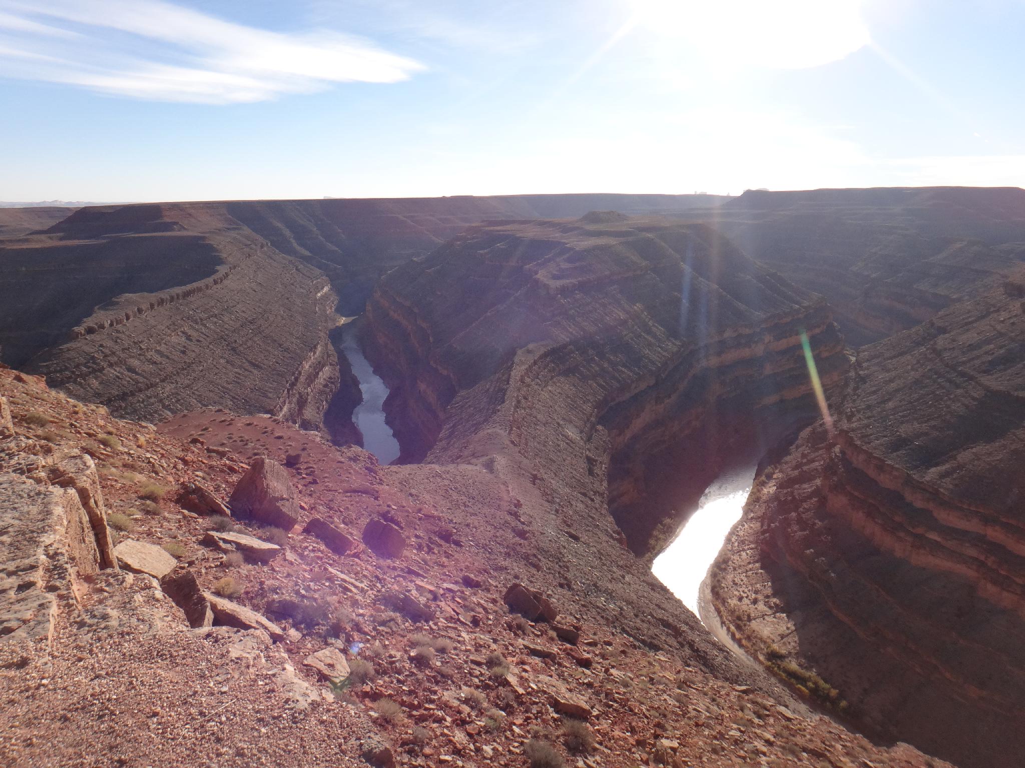
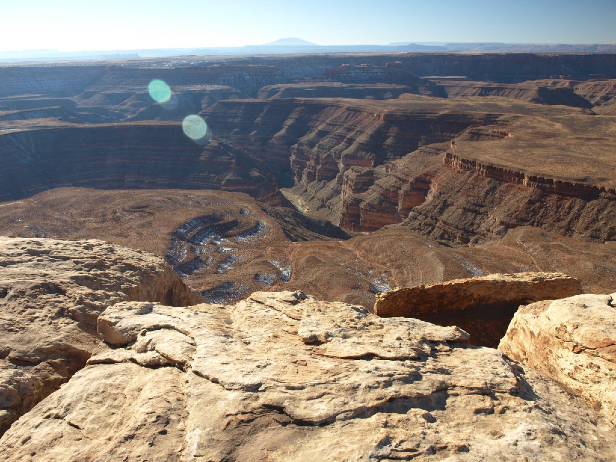
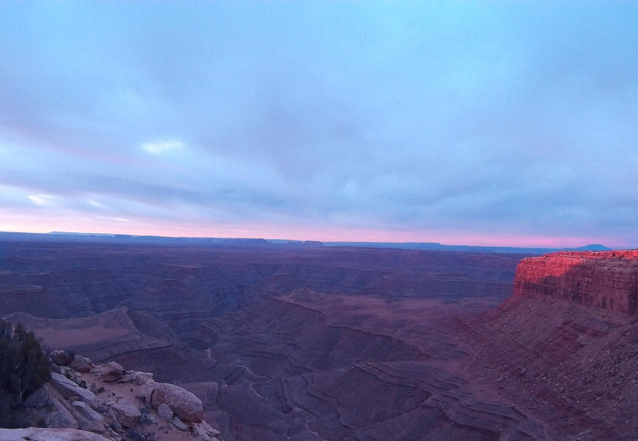
Goosenecks State Park is one of those places that really has to be experienced. I've seen some amazing pictures of the Goosenecks, but none have come close to actually standing on the rim and peering down 1000 feet to the San Juan River. This is a great family friendly attraction.

Note: There is camping at the park, and I recommend it, though it is primitive. No water is available. Fire rings, picnic tables, and vault toilets are the only amenities. Star gazing in this area is excellent, as there is little light pollution.
Looking into Goosenecks from Muley Point

Getting There

From Bluff, UT, travel west on US-163 about 16 miles to its junction with UT-261. If coming from Mexican Hat, this junction is about 4 miles east of Mexican Hat on US-163.

After 0.9 miles, turn left at the well signed junction to Goosenecks. The Goosenecks proper are 3.5 miles at the end of the road.

Sunrise over the Goosenecks from Muley Point

Route Description

The meanders are caused by forces millions of years go pushing up from below and raising the surrounding area with water, wind, frost and the San Juan River slowly creating the deeply incised meanders. Because of the upward forces, the erosion was focused downward and created the deep San Juan River channel.

Aside from wandering along the edge, there isn't much else to see in the park proper, though countless hiking opportunities abound nearby on Cedar Mesa proper.


Photos

Maps

Goosenecks State Park
12S 595240E 4114761N 37°10'28"N 109°55'38"W

Comments