Point Supreme |

Little Cottonwood Canyon

Hiking Point Supreme - Little Cottonwood Canyon Hiking Point Supreme

Little Cottonwood Canyon

Overview

RATING: Easy Hike

Wed

Sunny, with a high near 39. West northwest wind 10 to 14 mph.

39 | 25

Thu

A chance of snow showers. Partly sunny, with a high near 38. Chance of precipitation is 40%. New snow accumulation of less than half an inch possible.

38 | 26

Fri

A chance of snow showers after noon. Mostly sunny, with a high near 41.

41 | 26

Sat

Snow showers. Mostly cloudy, with a high near 39. New snow accumulation of 2 to 4 inches possible.

39 | 29

Sun

Snow showers. Cloudy, with a high near 26. New snow accumulation of 3 to 7 inches possible.

26 | 21

View Full Weather Details
SEASON: Summer, Fall
GEAR: Standard Hiking Gear
WATER: None

Wed

Sunny, with a high near 39. West northwest wind 10 to 14 mph.

39 | 25

Thu

A chance of snow showers. Partly sunny, with a high near 38. Chance of precipitation is 40%. New snow accumulation of less than half an inch possible.

38 | 26

Fri

A chance of snow showers after noon. Mostly sunny, with a high near 41.

41 | 26

Sat

Snow showers. Mostly cloudy, with a high near 39. New snow accumulation of 2 to 4 inches possible.

39 | 29

Sun

Snow showers. Cloudy, with a high near 26. New snow accumulation of 3 to 7 inches possible.

26 | 21

View Full Weather Details
Sugarloaf Mountain, Mount Baldy. and Alta Ski area from Point Supreme

Sugarloaf Mountain, Mount Baldy. and Alta Ski area from Point Supreme

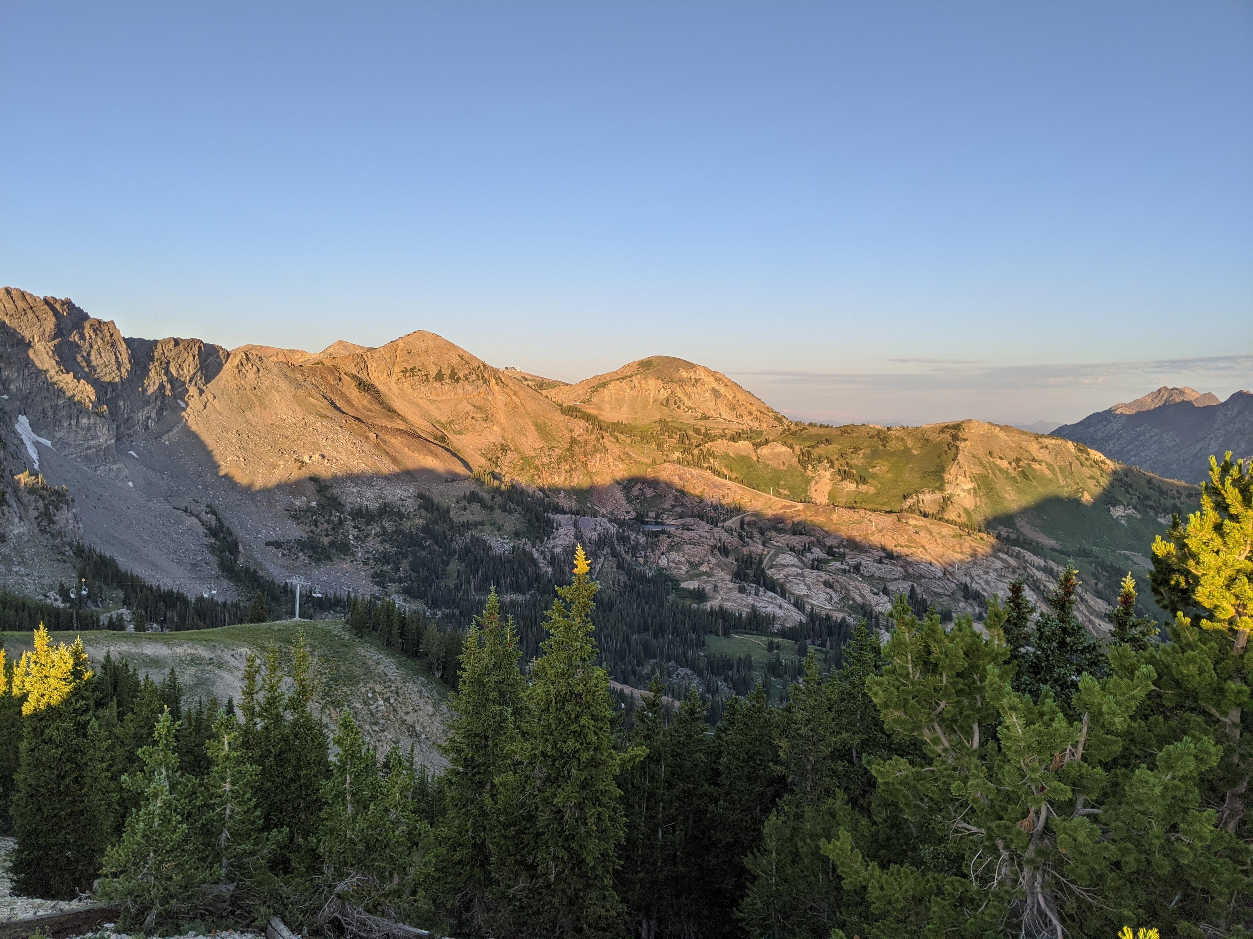
Point Supreme (10,595’) is part of Alta ski resort and see thousands of skiers nears its summit every winter. In the summer, the lift service road makes this an easy summit to reach. The 1.75-mile hike (one way) from the Albion Basin Campground is easy navigation, with a bit over 700’ of elevation gain. It makes for quick access to the ridge where motivated hikes can negotiate the ridge north to Catherine Pass on an easy and well used social trail. Heading south along the ridge is much rougher terrain, that crosses East Devils Castle before crossing Devils Castle proper.

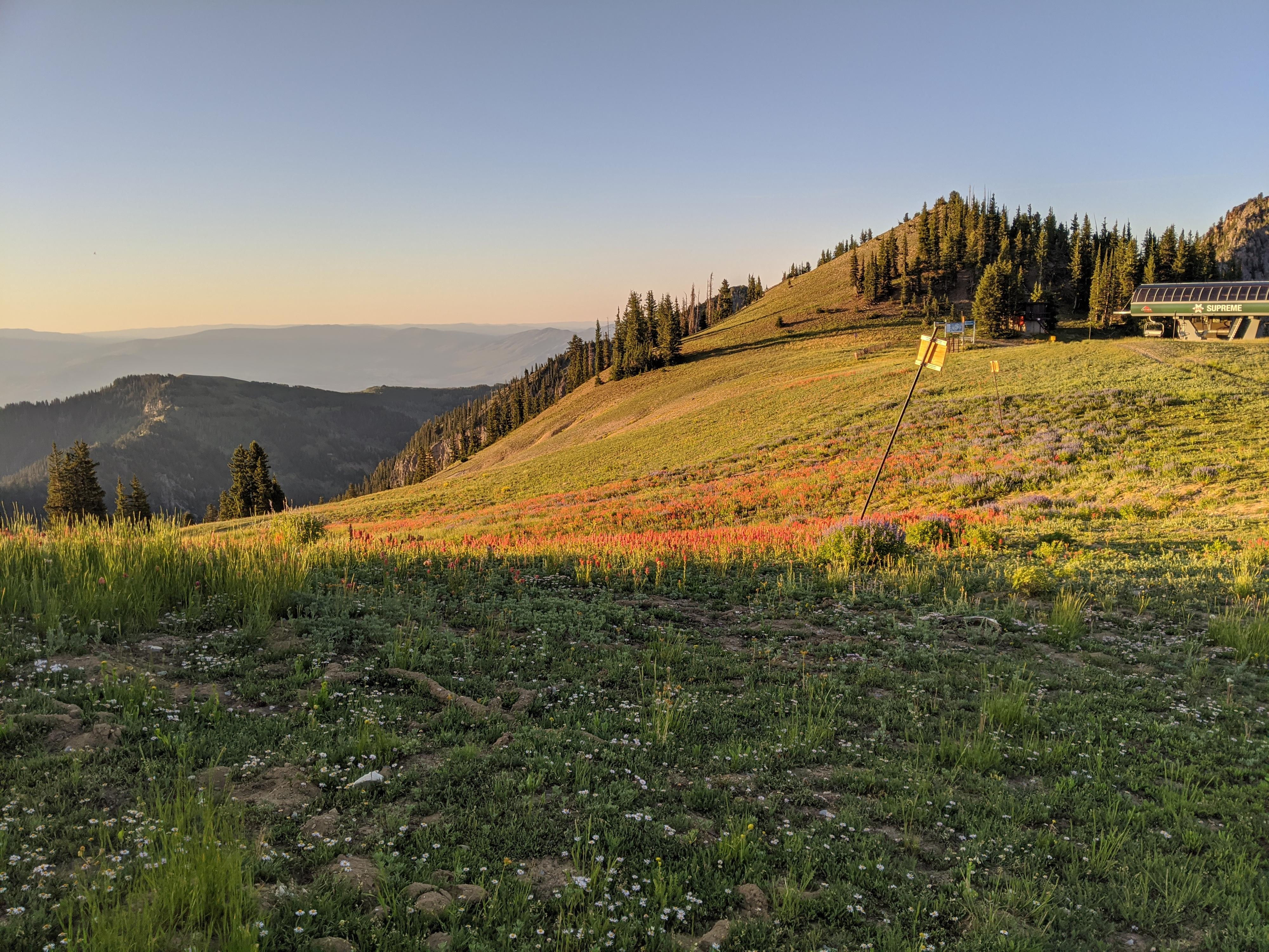
The service road is often flanked by wildflowers from mid-to-late summer, and wildlife abounds especially in the early mornings or late evenings.

A field of wildflowers near the ski lift.

A field of wildflowers near the ski lift.

Getting There

Little Cottonwood Canyon is on the east side of the Salt Lake City Valley. Get there by following I-215 to the east, taking exit 6 off the interstate and heading east toward the mountains.

Follow 6200 South which becomes Wasatch Blvd for 1.8 miles to the stop light and signs for Big Cottonwood Canyon. Continue south (straight) through the light an additional 2.3 miles to a junction and light. Stay left here, reaching the mouth of Little Cottonwood Canyon in an additional 1.6 miles.

From the mouth of Little Cottonwood, travel up the canyon 11.2 miles to the signed Secret Lake Trailhead parking, just before the Albion Basin Campground.

Note: The trailhead described here starts in Albion Basin. The area is incredibly popular, and the parking can fill up by 7AM on the weekends. Even during the week, I have seen it full by 8AM. You can alternatively start this hike from the base of Alta and use the Albion Meadows trail to reach the trailhead described here. This drops the parking issue but adds about 4 miles roundtrip to the hike. There is an $8 fee (2020) to drive the road to Albion Basin above the base of Alta.
Note: The Albion Basin road usually does not open until mid-to-late June due to snow. If in doubt, check with the Town of Alta.
The ski lift and Devils Castle beyond. Excellent wildflowers along the trail.

The ski lift and Devils Castle beyond. Excellent wildflowers along the trail.

Route

From the parking area, head into the campground, going right (counterclockwise) at the campground loop. The second gated road on the right is the Point Supreme road.

Follow the Point Supreme road as it climbs, passing several cabins. It soon leaves the cabins and begins a sweeping curve north then back south as it climbs. The rugged and stunning Devils Castle to the south dominates the view, as do wildflowers in the meadow areas in mid-to-late summer.

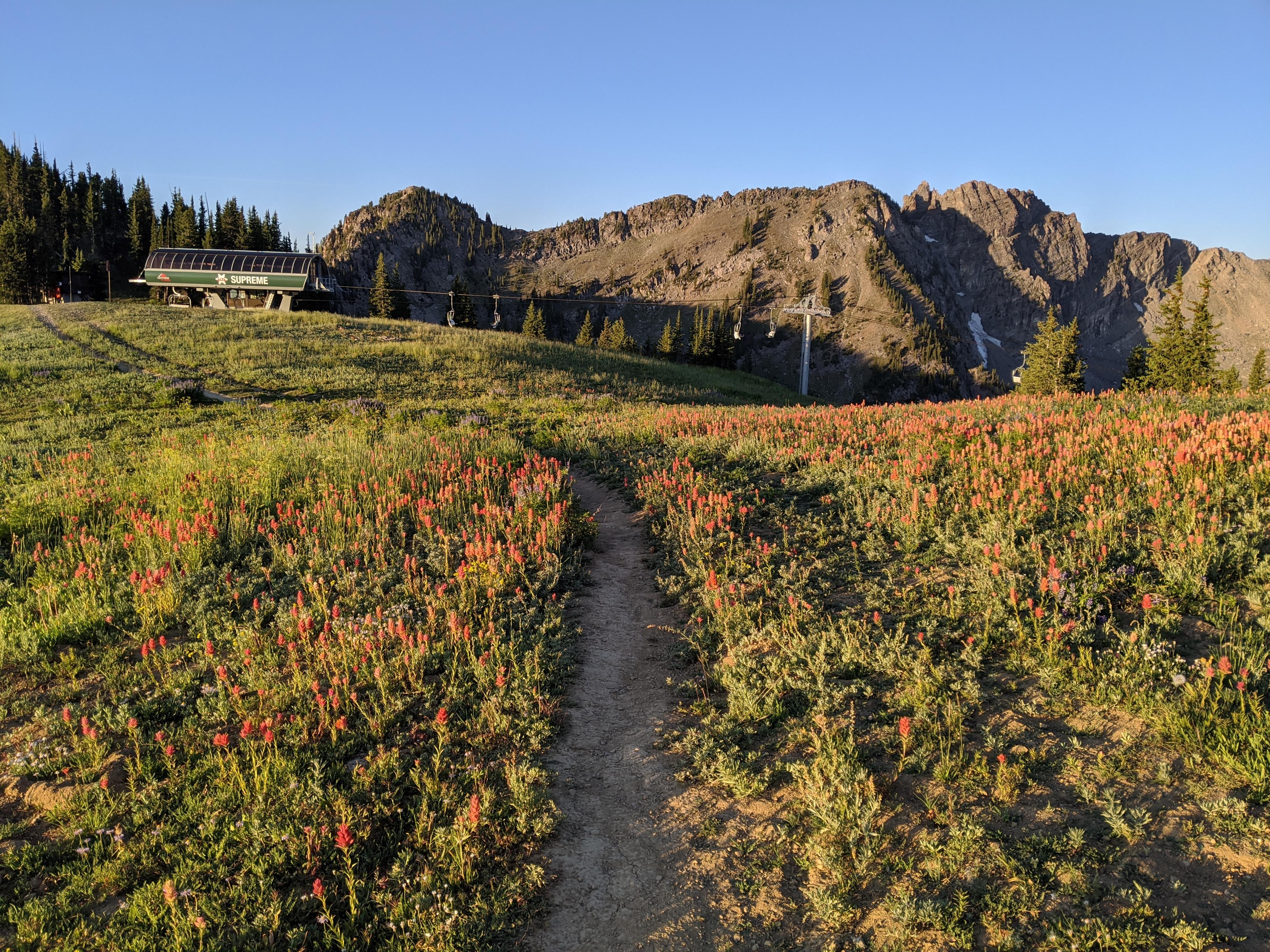
The road makes a couple of long switchbacks before a final climb north to the ridge proper and top of the ski lift. Views from this point are outstanding in all directions!

The lift is not the true summit. To reach the Point Supreme summit, go north along the ridge on a well-used single track to the top of the next highpoint. It is just a few minutes from the lift and a leisurely walk.


Maps

Route / 3.53 miles / Elevation Range 9,413 - 10,563 ft.
Printable Maps:
Cecret Lake Trailhead

12T 448112mE 4492097mN

N40° 34' 41" W111° 36' 47"

Campground Jct

12T 448179mE 4491765mN

N40° 34' 30" W111° 36' 44"

Devils Castle Loop / Road Jct

12T 448243mE 4491438mN

N40° 34' 20" W111° 36' 41"

Point Supreme

12T 449023mE 4491802mN

N40° 34' 32" W111° 36' 08"

Comments

Want to make a comment? Login and let yourself be heard.